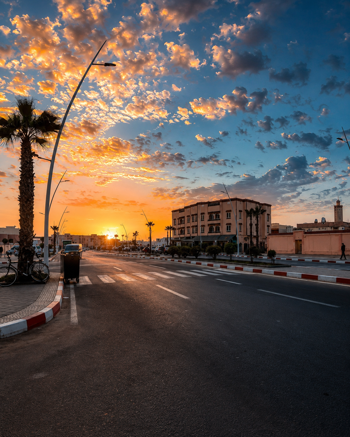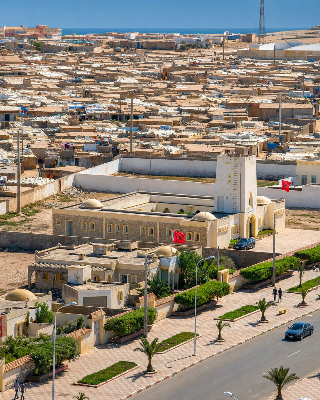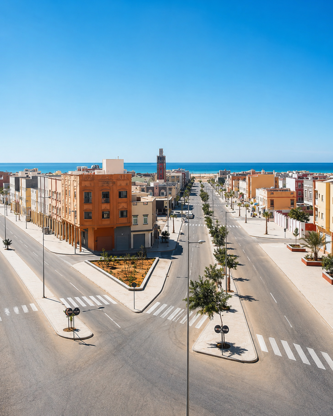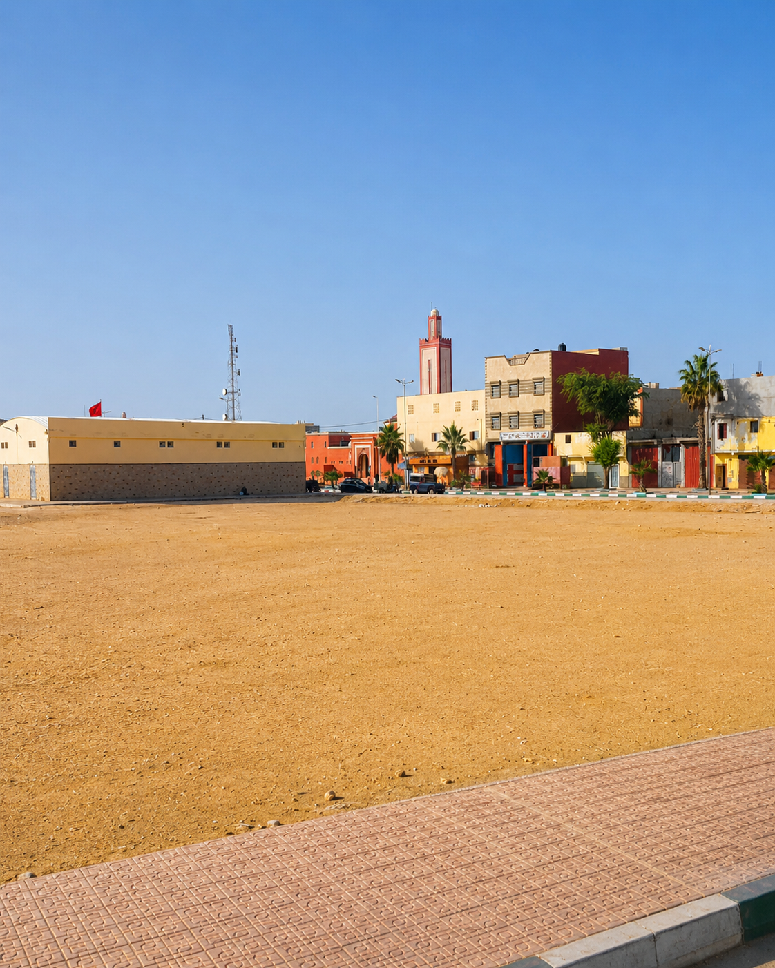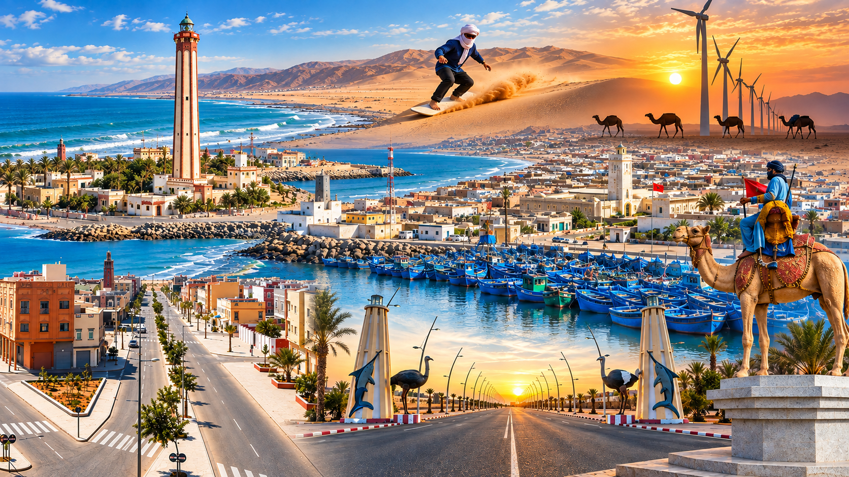
Editorial Boujdour collage combining the lighthouse, fishing harbour, city streets and Saharan travel imagery

Atlantic Sahara City

Boujdour Atlantic horizon, Saharan edge and lighthouse memory

Boujdour stands where the desert reaches the Atlantic: a practical southern city shaped by Cape Bojador, a working fishing port, lighthouse memory, open sea air and the long road between Laâyoune and Dakhla.

Why Boujdour matters

Where the Sahara meets the Atlantic

Boujdour is not a city of ornate medinas or imperial palaces. Its importance is quieter and more geographic: a coastal settlement beside Cape Bojador, a provincial capital in the Laâyoune-Sakia El Hamra region, and a working Atlantic place where fishing, administration and long-distance travel meet.

For visitors, Boujdour is best read through horizon, weather, port activity, lighthouse memory and the discipline of the southern road. The city gives the journey south a human scale between desert openness and ocean force.
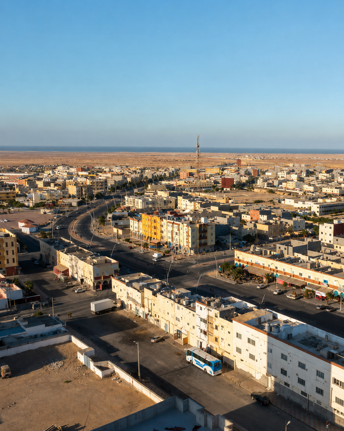
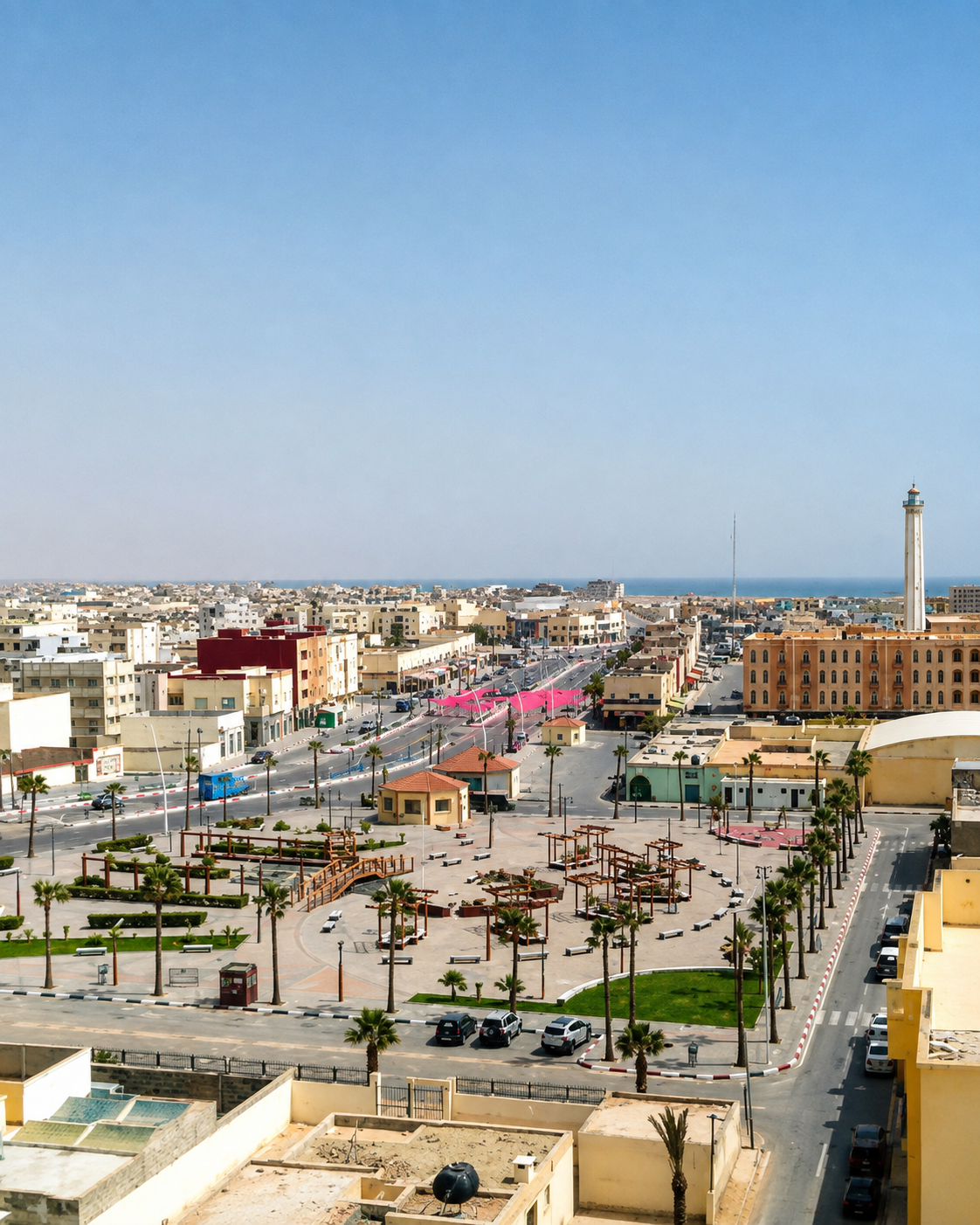
Boujdour streets and low-rise buildings with the lighthouse and Atlantic horizon

A city of edge and horizon

Boujdour's strength is not spectacle. It is the meeting of low urban forms, Atlantic wind, fishing work, desert light and the memory of Cape Bojador.

EXPLORE

Boujdour

Historical orientation

From cape and lighthouse to provincial capital

Boujdour's story is tied to the coast before it is tied to tourism. Cape Bojador long held maritime significance on the Atlantic edge of the Sahara; the lighthouse gave the shoreline a clearer marker; fishing anchored the settlement; and from the late twentieth century the city developed as the administrative centre of Boujdour Province.

01Maritime memory

Cape Bojador

The cape is a historic Atlantic reference point, known in European navigation as Cabo Bojador and in local geography as part of the Saharan coast.

02Coastal marker

The lighthouse

The lighthouse remains Boujdour's clearest vertical landmark, tying the city to navigation, sea conditions and the exposed Atlantic shoreline.

03Since 1976

Urban growth

After the province was created, Boujdour gained a stronger administrative role and expanded beyond the scale of a small fishing settlement.

04Contemporary city

Port and route

The fishing port, National Road 1 and regional services give Boujdour its practical identity between Laâyoune, the southern coast and Dakhla.

A visual bridge

Three glimpses between sea, cape and city

These images keep the reading honest: Boujdour is a place of ocean exposure, coastal navigation and restrained urban rhythm rather than a catalogue of decorative monuments.

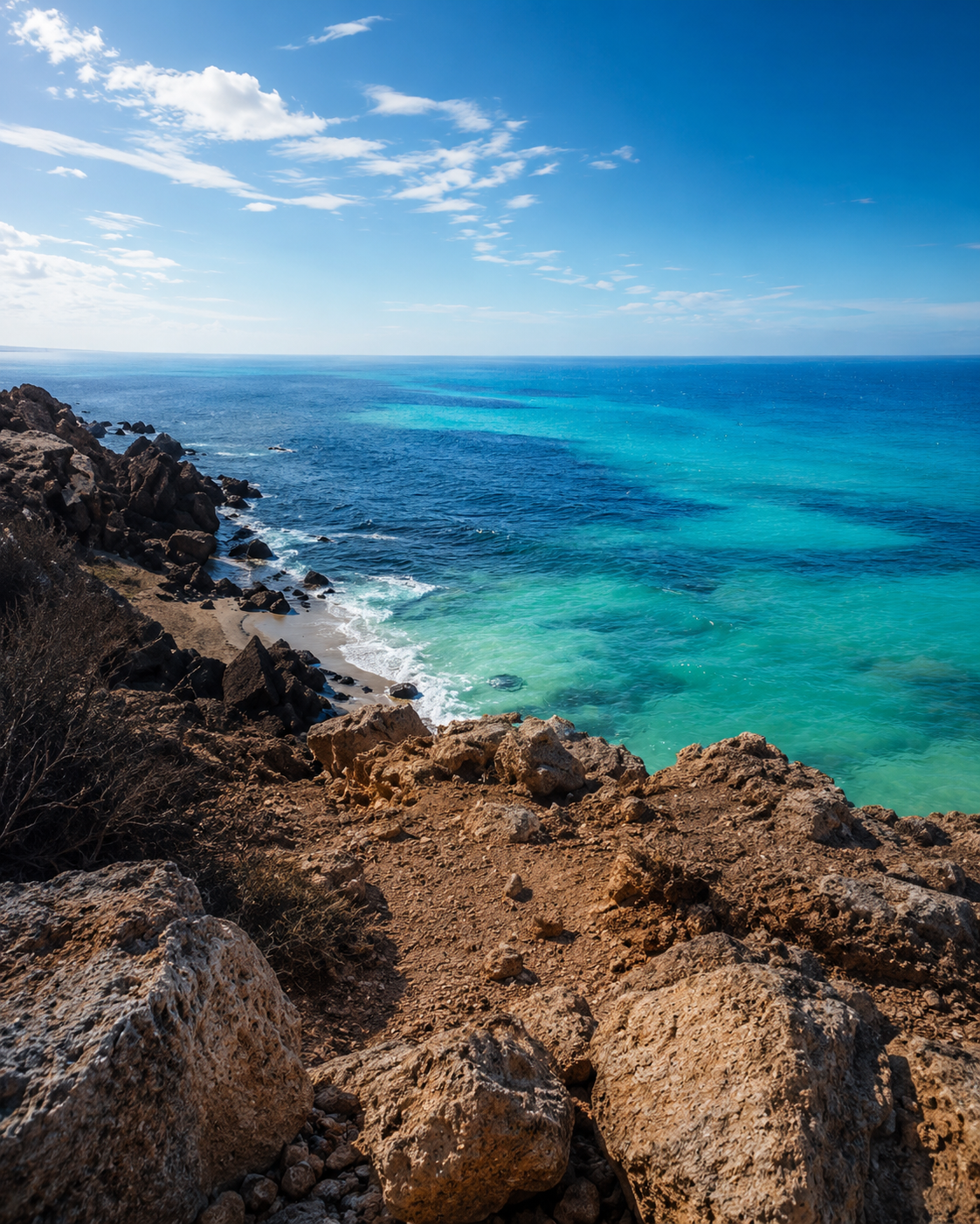
Rocky Atlantic shoreline in the supplied Boujdour collection

Atlantic threshold

The ocean is the city's first landscape: open, windy and powerful.

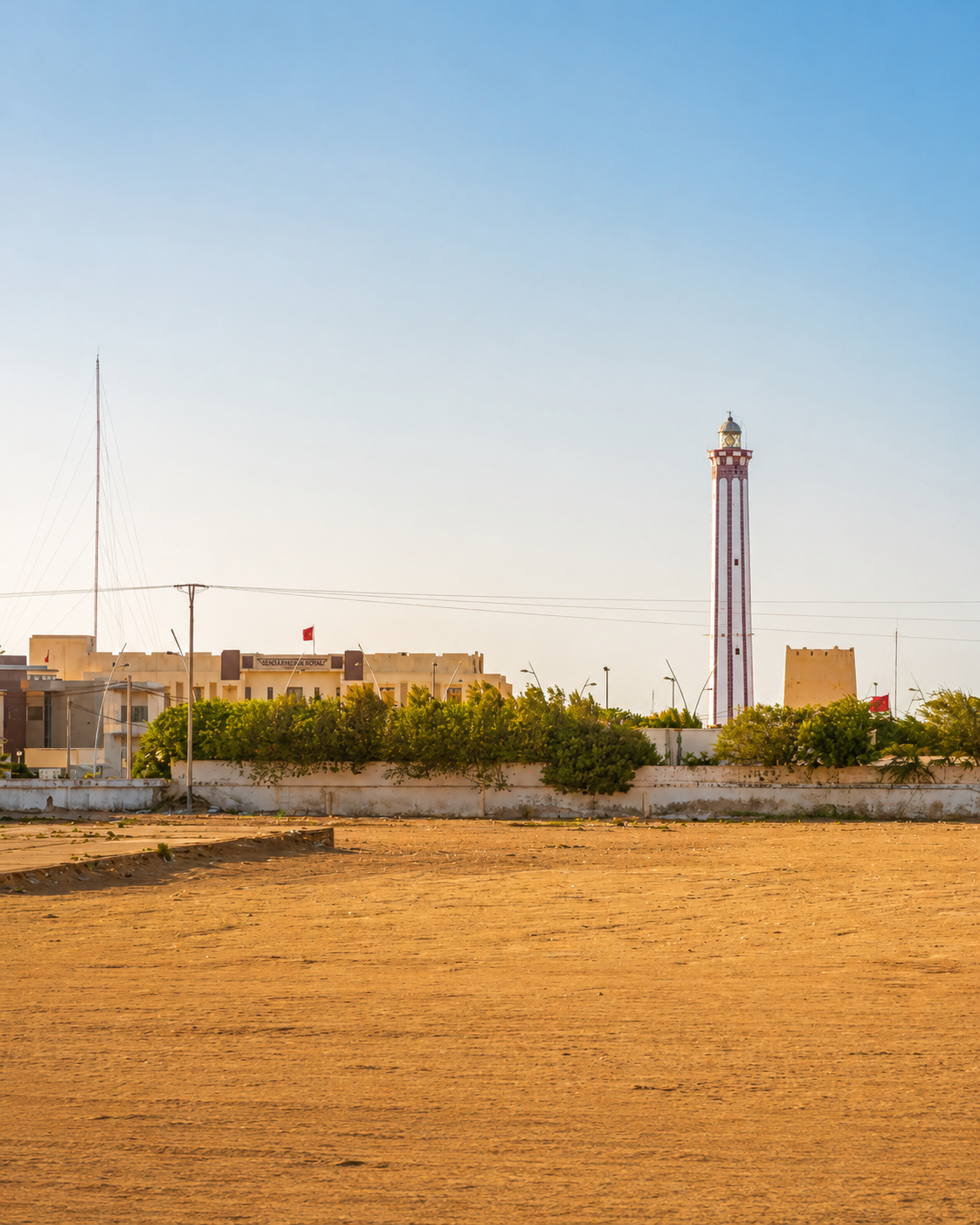
Boujdour lighthouse rising above low buildings and an open sandy foreground

Lighthouse memory

The lighthouse gives the low coast a visible point of orientation.

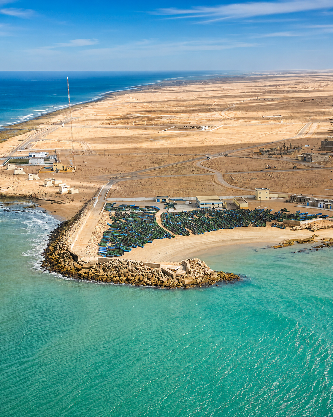
Aerial view of Boujdour fishing harbour, breakwater and Saharan coastline

Saharan shoreline

Sand, rock, wind and sea meet without the softness of a resort coast.

Boujdour at a glance

Atlantic Sahara city

Boujdour sits on Morocco's southern Atlantic route, close to Cape Bojador, where coastal weather, desert light and sea horizons shape the feeling of place.

Provincial capital

The city functions as the main urban and administrative centre of Boujdour Province within the Laâyoune-Sakia El Hamra region.

Fishing-port identity

Fishing remains central to the city's economy and daily rhythm. The port is a working place first, so visitors should treat it with respect and realism.

Route orientation

Boujdour is a useful point on the long Atlantic corridor between Laâyoune and Dakhla, especially for travellers reading the southern coast gradually.

A clearer reading of the city

A city shaped by cape, port and road

To understand Boujdour, avoid forcing it into the language of older imperial cities. Its layers are coastal and practical: a maritime cape, a lighthouse marker, a working harbour, low urban fabric and the long line of the southern Atlantic road.

Boujdour public square and low-rise cityscape with the lighthouse near the Atlantic horizon
Layer 1

Cape and lighthouse

The cape and lighthouse make Boujdour legible from the sea and from the road. They give the city its strongest geographic identity without needing grand architecture.

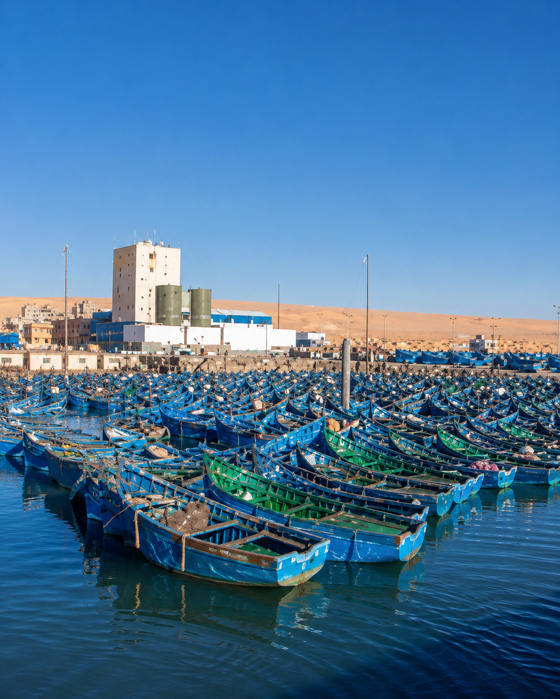
Blue and green fishing boats moored closely together in Boujdour harbour
Layer 2

Working coastal city

Port activity, services, neighbourhoods and everyday movement matter here. Boujdour is a lived city on a demanding coast, not a staged resort destination.

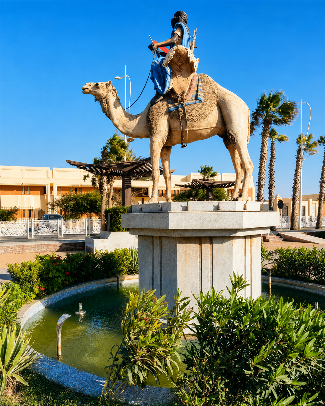
Camel-and-rider monument above a landscaped fountain in Boujdour
Layer 3

Sahrawi urban rhythm

The city belongs to a wider Saharan Atlantic world of family life, fishing work, wind, road travel, simple streets and a culture of practical hospitality.

Landmarks & orientation

Read Boujdour through six defining places

Boujdour's defining places are not a conventional monument trail. They are points of orientation that explain how the city works beside the Atlantic Sahara.

1
Cape Boujdour / Cabo Bojador

The coastal reference point that gives the city much of its maritime meaning and historic resonance.

2
Boujdour lighthouse

The clearest visual marker of the city, connected to navigation, coast memory and the open Atlantic horizon.

3
Fishing port

A working harbour that explains the city's economy and daily rhythm better than any staged attraction could.

4
Atlantic shoreline

The coast is exposed and beautiful in a serious way: surf, wind, rock, sand and long sea views.

5
National Road 1 approach

The road frames Boujdour as part of the long southern corridor linking Laâyoune, coastal settlements and Dakhla.

6
Aftissat and Lacraa context

Nearby fishing-coast references help place Boujdour within a broader maritime province rather than as an isolated stop.

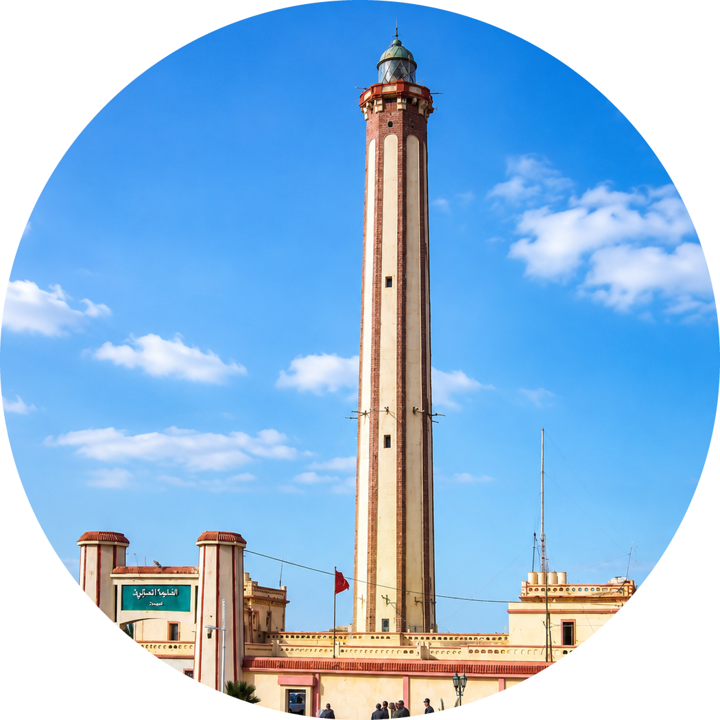
Boujdour lighthouse with its tall striped tower and entrance buildings
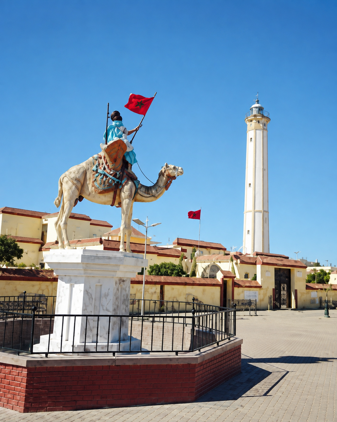
Camel-and-rider monument in Boujdour with the lighthouse behind it

The coastal marker

The lighthouse and cape — Boujdour's strongest orientation

Boujdour's most meaningful landmark is not decorative. The lighthouse and the cape belong to navigation, weather, distance and the hard clarity of the Atlantic Sahara. They help visitors understand why this city feels different from Morocco's older medina destinations: the story begins with coast, movement and survival at the edge of open water.

  • Use the lighthouse as a visual anchor when reading the city from the coast.
  • Notice how low urban forms meet the cliff, sand and ocean rather than dominating them.
  • Treat the exposed shoreline with care; this is Atlantic water, wind and rock, not a managed resort beach.

Architectural reading

Three languages to notice in Boujdour

Horizontal city form

Boujdour's architecture is restrained and low. The eye is drawn less to ornament than to horizon, wind, pale walls, road edges and the relationship between buildings and the coast.

Functional port logic

The port and fishing infrastructure express purpose: landing, repairing, storing, moving and selling. Read this area as a working system, not as a decorative waterfront.

Saharan practicality

Shade, simple volumes, wide streets and direct materials matter in a climate defined by sun, wind and distance. Boujdour's urban language is practical before it is picturesque.

Visual atmosphere

Ocean force, desert light and quiet transitions

Nearby highlights

Nearby coast, route and regional context

Boujdour connects to a wider Atlantic itinerary: Laâyoune to the north, Tarfaya farther along the northern coast, and Dakhla to the south. These are regional journey stages rather than quick trips from the city.

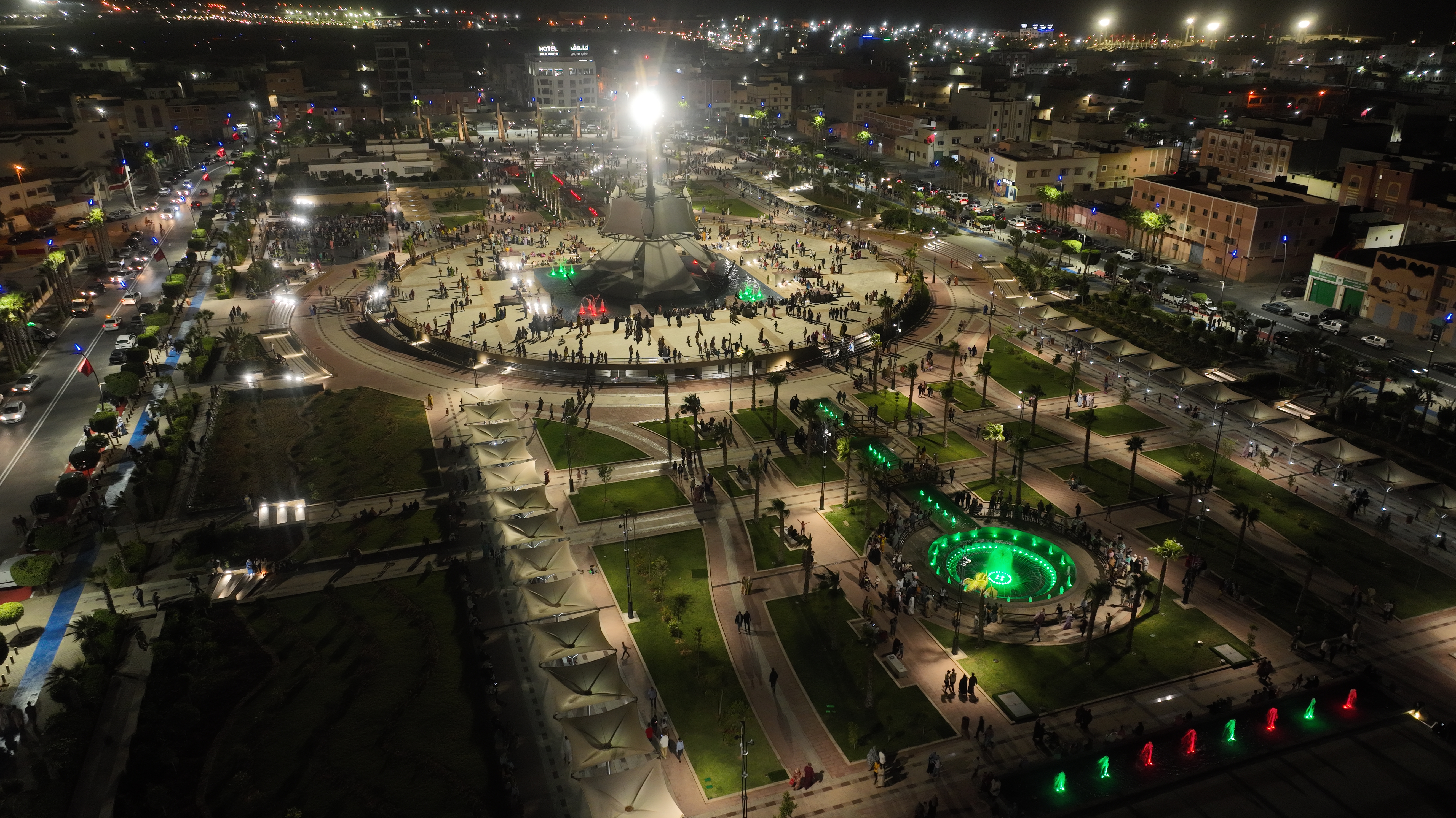
Laâyoune direction

North of Boujdour, Laâyoune gives the wider region its strongest urban base, with services, administration and onward travel connections.

Aerial photograph of Laâyoune's illuminated central square, fountains and surrounding city streets at night

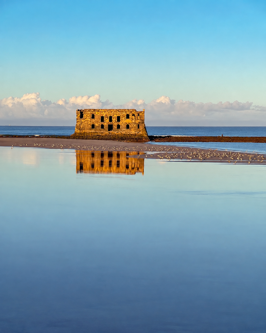
Tarfaya and Casa del Mar

Farther north, beyond Laâyoune, Tarfaya adds a different Atlantic chapter. The offshore Casa del Mar is its distinctive coastal landmark; allow for a separate travel leg.

Casa del Mar offshore at Tarfaya, reflected in calm shallow water

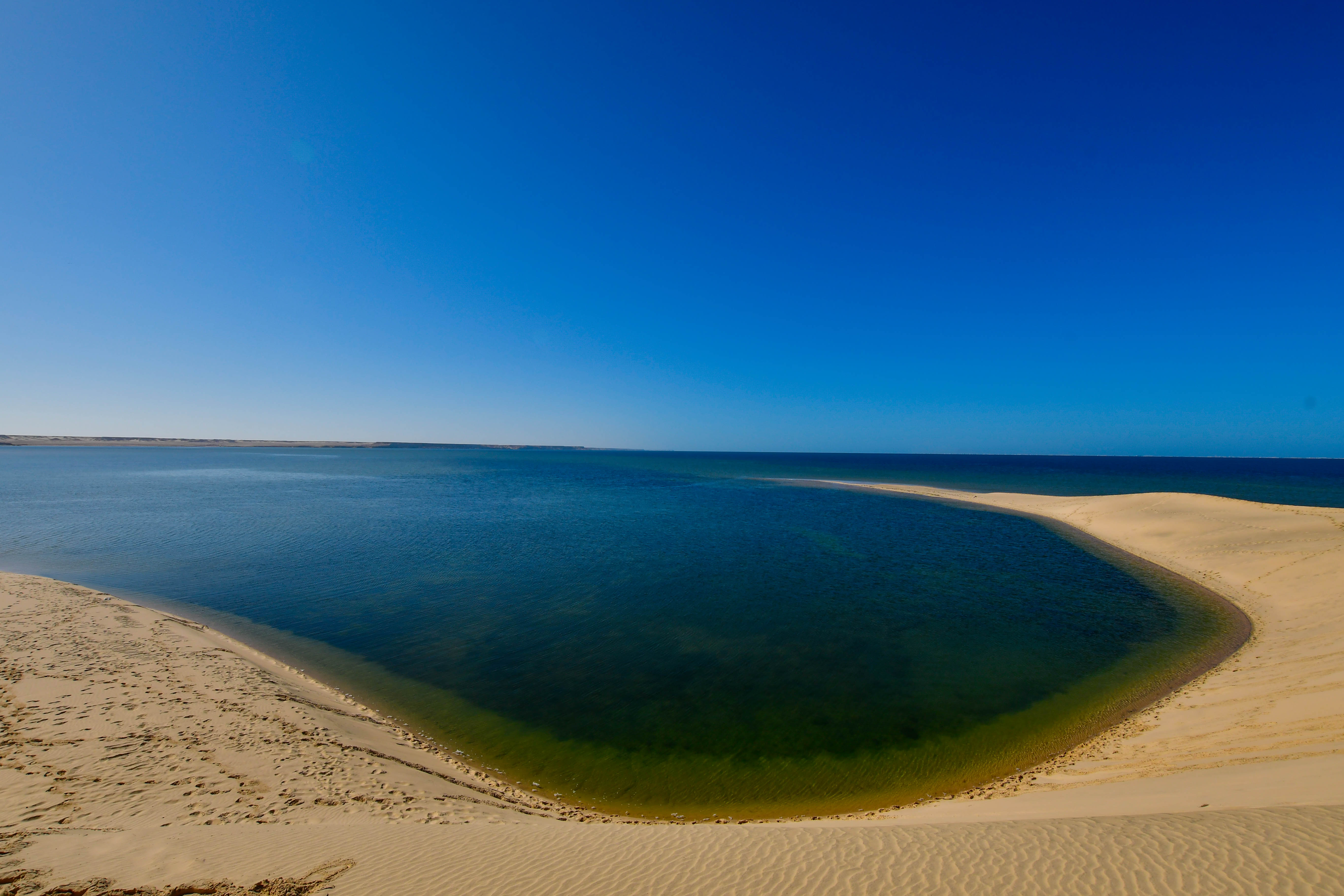
Dakhla and the lagoon

Continuing south toward Dakhla leads to a peninsula and sheltered lagoon with a different coastal character. Plan it as a substantial onward journey.

Pale sand dunes curving around the blue water of Dakhla Lagoon
Travel note: road conditions, coastal access, wind, port access and local visitor arrangements can change. Check current official or trusted local information before travelling.

Practical orientation

How to experience Boujdour well

  • Approach Boujdour as a serious coastal stop, not as a classic sightseeing city.
  • Give time to the lighthouse area, sea views and the working rhythm around the port.
  • Respect port activity, private workspaces and local routines; this is a working city first.
  • Plan fuel, water, daylight and rest carefully on the longer southern Atlantic route.
  • Expect wind and exposed ocean conditions, especially near the shoreline and cape.

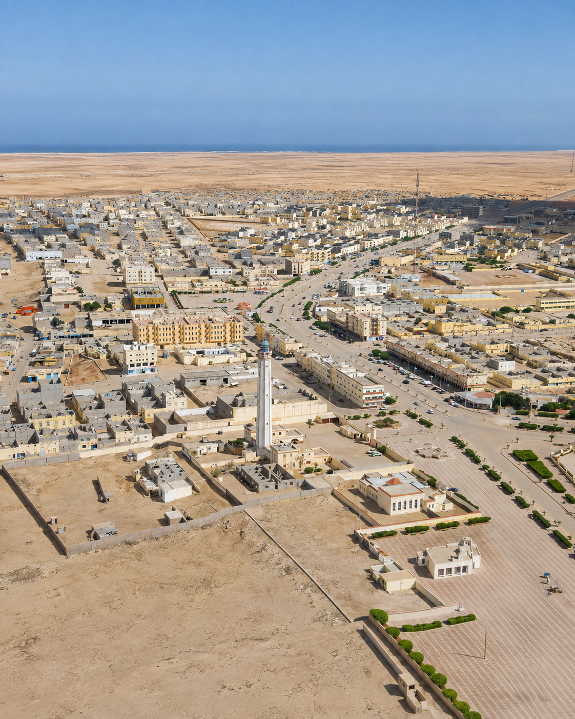
A strong first visit

Boujdour streets and a mosque at the transition from city blocks to open desert

Begin with the coastal edge and lighthouse orientation, then read the city through its port, streets and road setting. Boujdour is most rewarding when you let its Atlantic-Saharan scale set the pace.

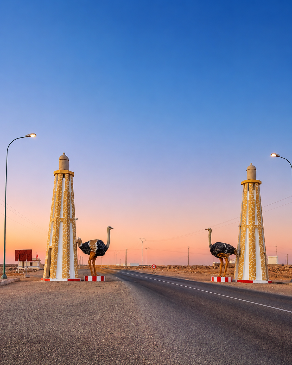
Boujdour entrance avenue between paired towers and ostrich sculptures at sunset

Go deeper with Exotic Morocco

Boujdour — Atlantic Sahara City Notes

Use this page as a careful orientation to Boujdour's coast, lighthouse memory, working port, route logic and regional context. For broader planning, continue through Exotic Morocco's city, region and guide collections.

✓ Coastal context✓ Real orientation points ✓ Port and route logic✓ Sahrawi Atlantic setting ✓ Practical travel guidance✓ Nearby coast context

Continue the journey

Continue the journey through Boujdour

Read the city through the Atlantic horizon, the lighthouse, fishing work, Saharan restraint and the long route south.