Moulay Idriss Zerhoun and the archaeological landscape of Volubilis

Sacred Hill Town of Morocco

Moulay Idriss Zerhoun sacred hill-town memory, Zerhoun views and Volubilis nearby

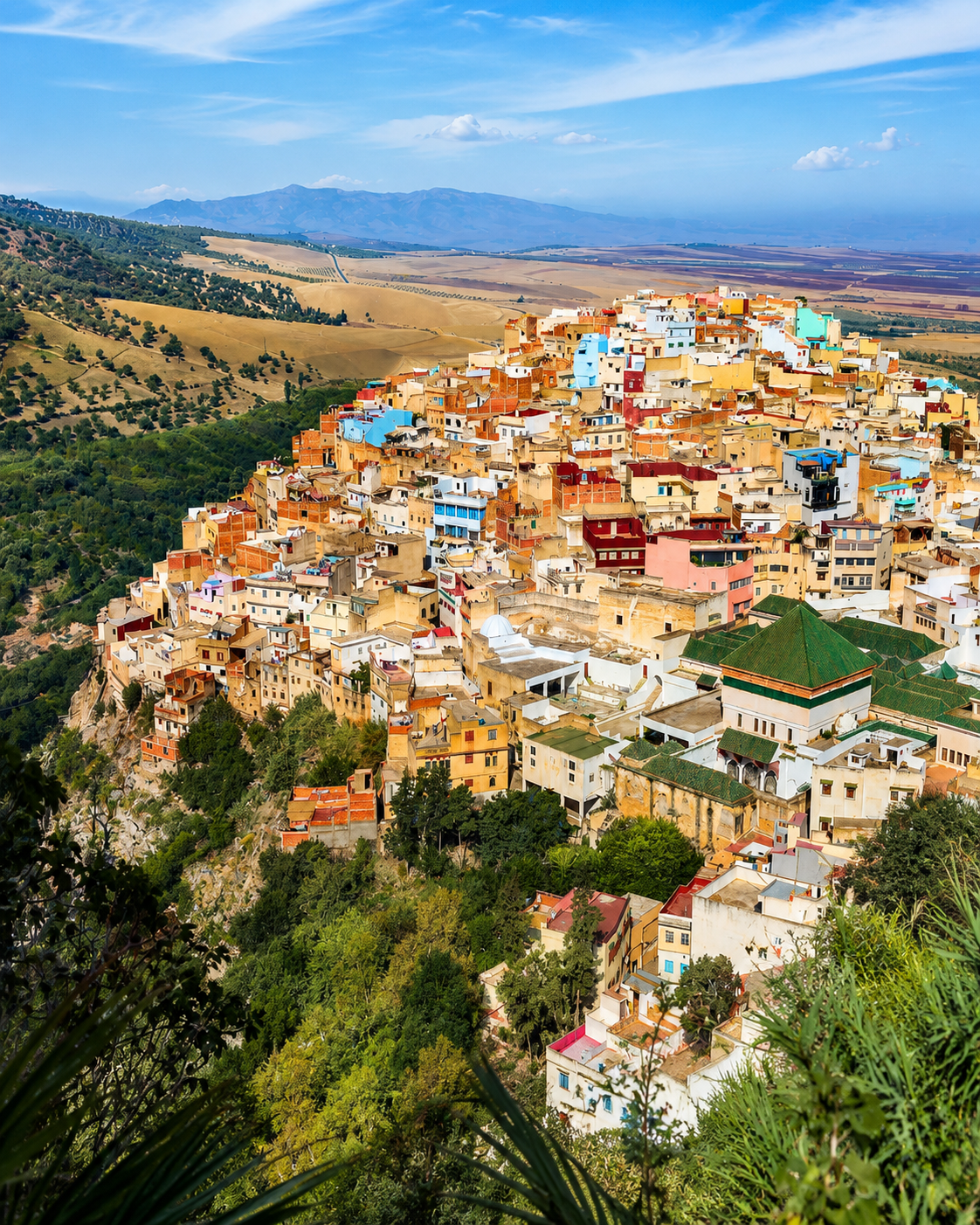
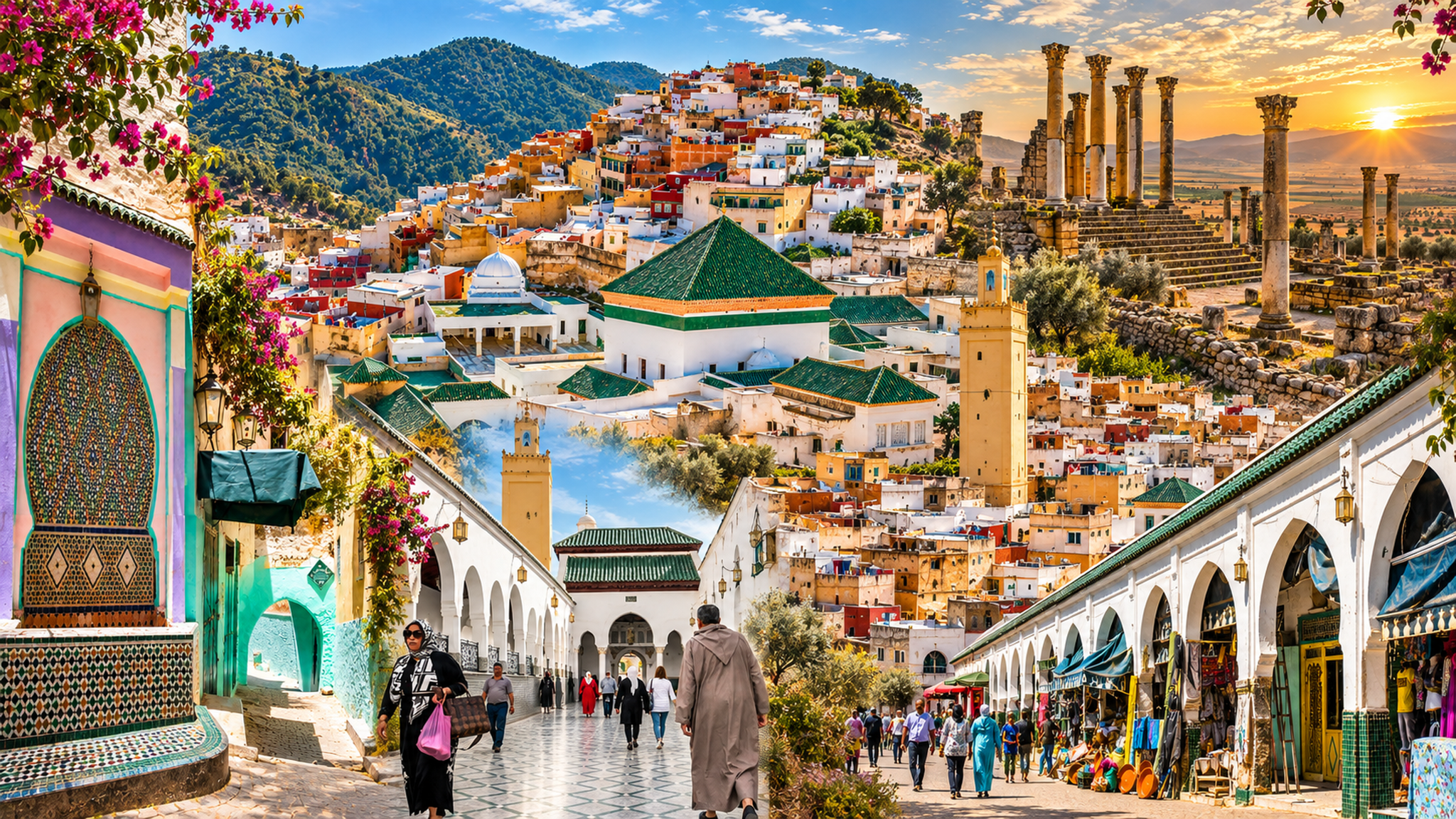
Moulay Idriss Zerhoun rises over two hills below Jbel Zerhoun, close to the archaeological site of Volubilis. Associated with Idris I and the early Idrisid state, it is best read as a sacred town, a viewpoint and a lived hillside settlement where dynastic memory, local devotion and rural landscape meet.

Why Moulay Idriss Zerhoun matters

Beyond a stop after Volubilis

Moulay Idriss Zerhoun is often folded into a Meknès and Volubilis route, but the town is not a footnote. Its importance comes from the tomb of Idris I, the memory of Morocco’s first Islamic dynasty and a hill setting that turns arrival into orientation.

The visit is physical and respectful: stairs, terraces, whitewashed houses, green-tiled roofs, local squares and long views over the plains around Zerhoun. It asks for slower walking than a ruins visit and more attention than a quick viewpoint.
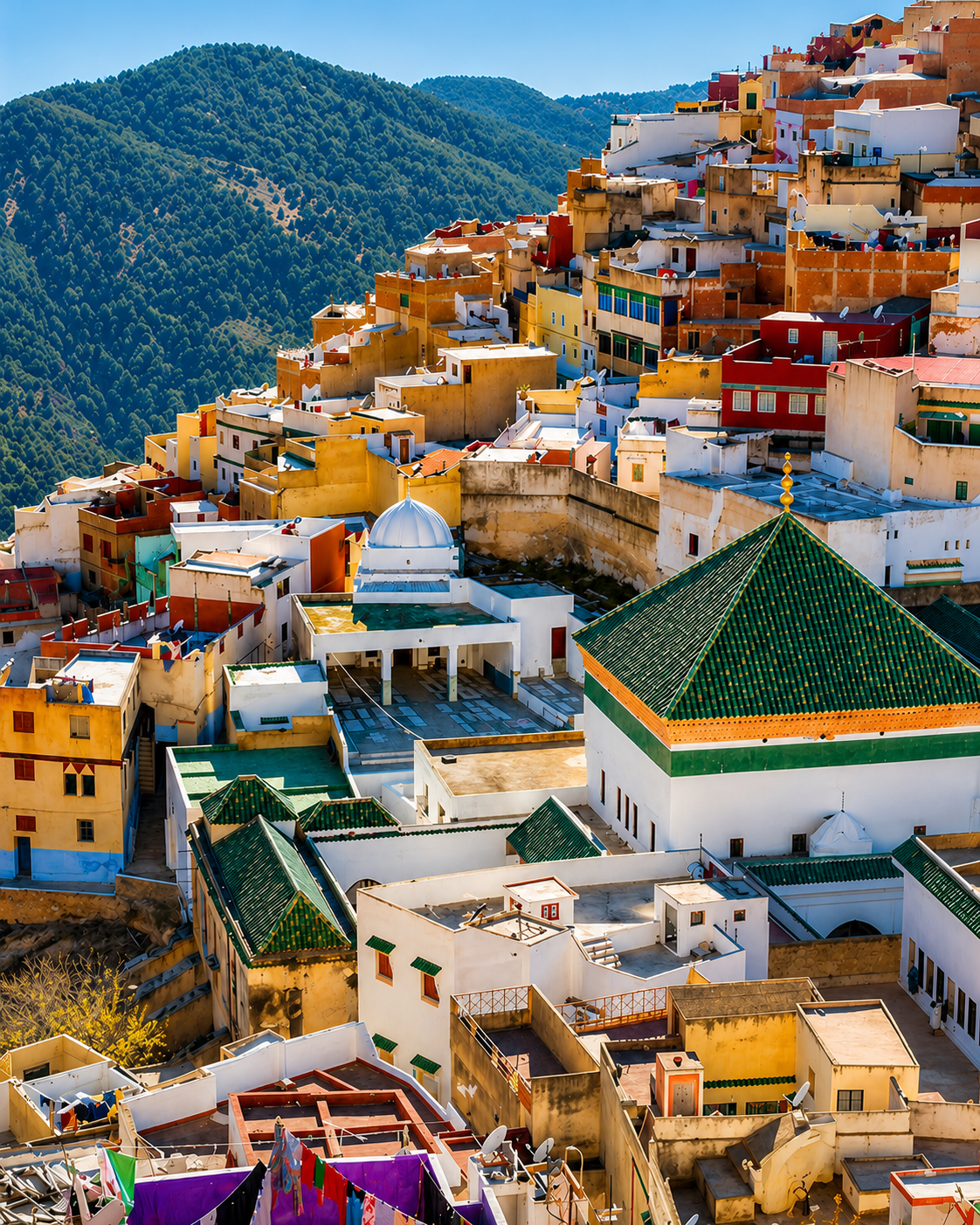
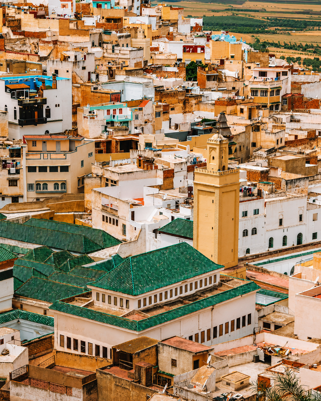
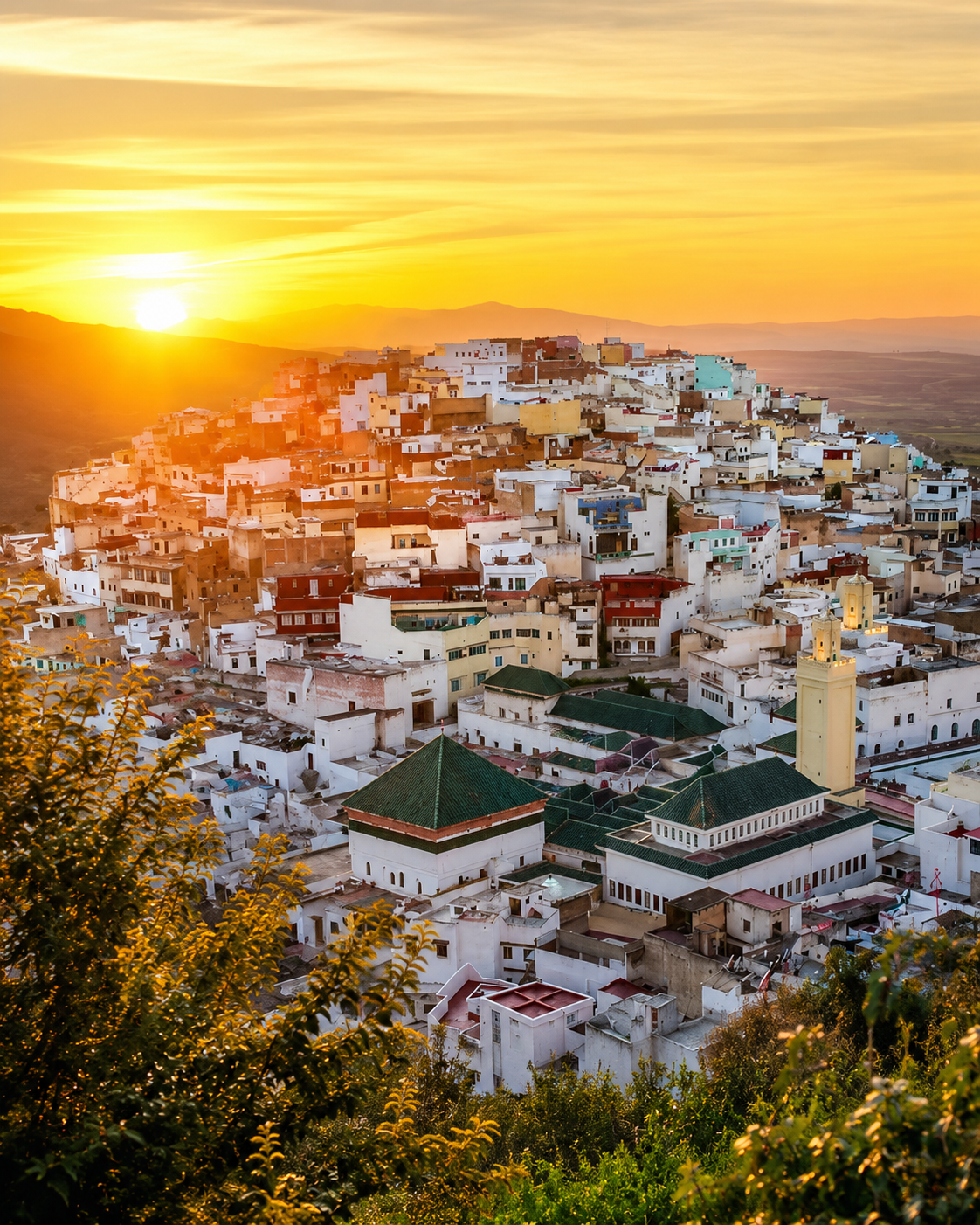
Moulay Idriss Zerhoun rising across the green slopes of Jbel Zerhoun

A sacred town on the slopes

Here the meaning sits in the whole setting: sanctuary roofs below, dense houses above, roads toward Volubilis and olive country opening around the town.

EXPLORE

Moulay Idriss Zerhoun

Historical orientation

From Idrisid memory to living pilgrimage

Moulay Idriss Zerhoun should be read through continuity rather than spectacle. Its story touches Volubilis and Walila, Idris I, the sanctuary town, annual pilgrimage and the rural Zerhoun landscape that still frames everyday life.

01Late 8th century

Idris I and Walila

Idris I is associated with the region of Walila, the later Volubilis area, and with the beginnings of the Idrisid state in Morocco.

02Sacred memory

The mausoleum town

The town’s central religious identity gathers around the sanctuary of Moulay Idriss I, making the urban centre a place of devotion as well as settlement.

03Annual rhythm

Pilgrimage and moussem

The annual moussem keeps the town connected to wider Moroccan pilgrimage traditions, with spiritual memory shaping local rhythm and civic identity.

04Nearby, since 1997

Volubilis recognised

The neighbouring archaeological site of Volubilis is a UNESCO World Heritage site; Moulay Idriss Zerhoun helps visitors read its later Idrisid and sacred landscape context.

These three views connect the town’s sacred centre, its steep hillside form and the archaeological plain below, showing how Moulay Idriss Zerhoun and Volubilis share one wider landscape.
Green-roofed sanctuary quarter among the houses of Moulay Idriss Zerhoun

Sanctuary roofs

Green-tiled roofs and clustered houses make the spiritual centre visible before any explanation.

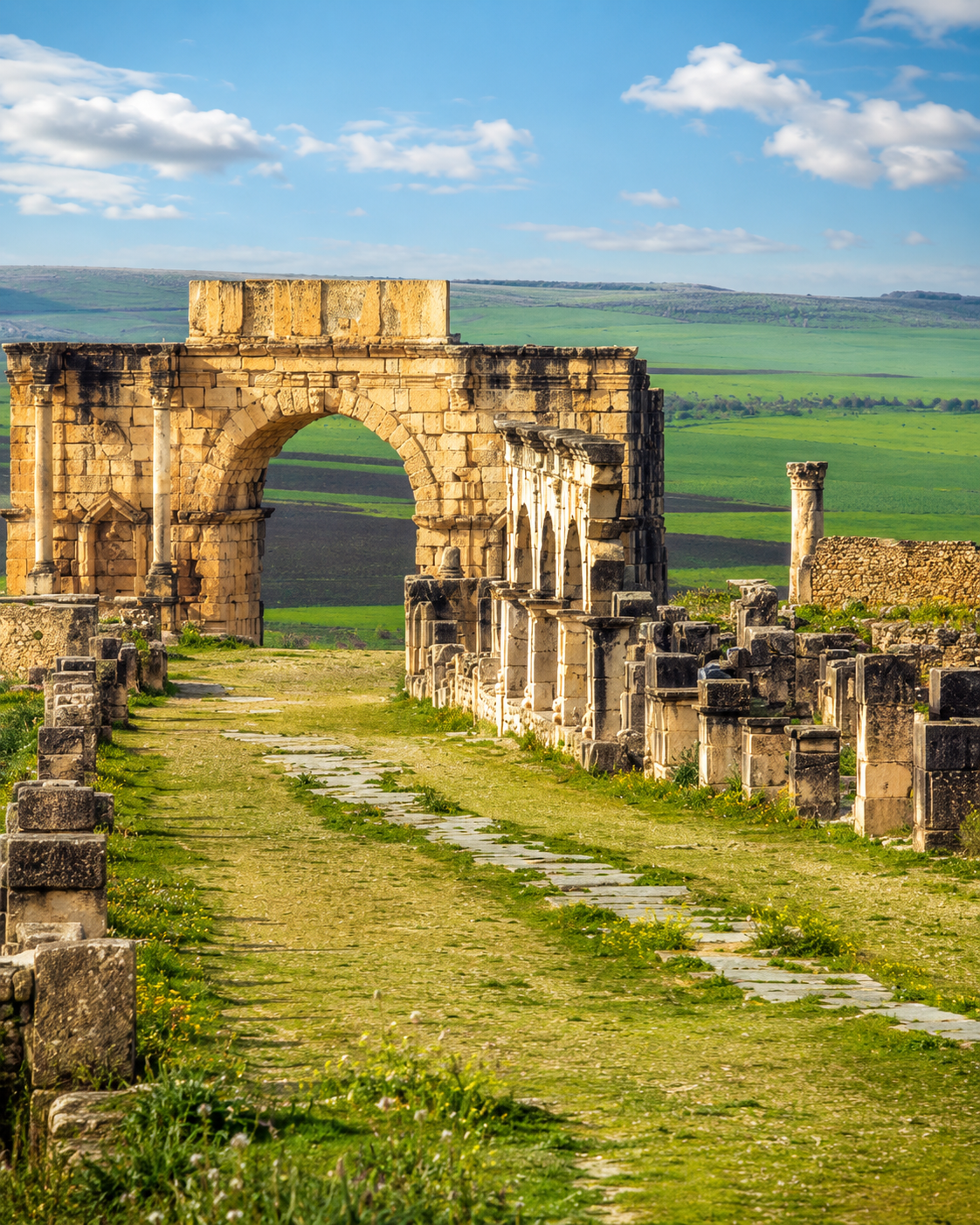
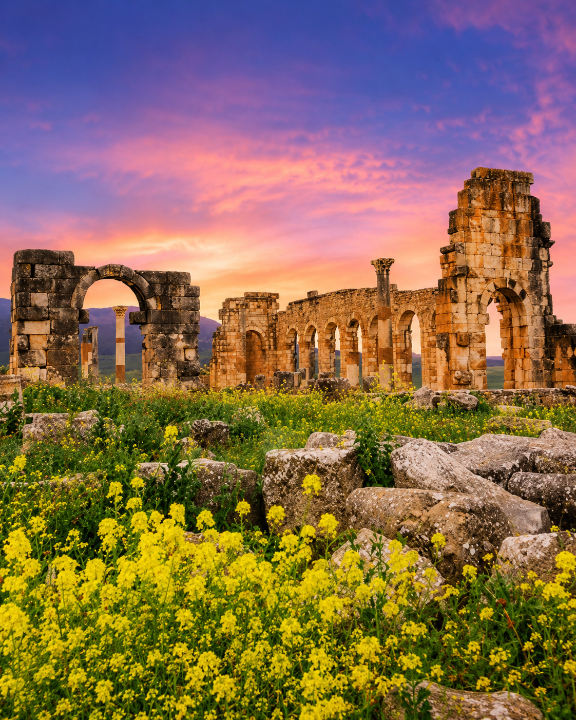
Roman arch and ruins at Volubilis in the Zerhoun landscape

Volubilis below

Roman ruins, Idrisid memory and the later sacred town belong to the same surrounding landscape.

Open Zerhoun landscape and archaeological plain near Moulay Idriss Zerhoun

Zerhoun horizon

Hills, olive country and broad plains keep the town tied to rural movement, not only pilgrimage.

Moulay Idriss Zerhoun at a glance

Sacred hill town

The town’s identity is anchored by the mausoleum of Moulay Idriss I and by a long pilgrimage tradition that still gives the centre its gravity.

Two-hill urban form

Houses, stairs, terraces and passageways climb across the slopes below Jbel Zerhoun, so orientation is as much vertical as horizontal.

Volubilis neighbour

Volubilis sits nearby in the same landscape, giving visitors a powerful route between Roman, late-antique, Idrisid and living sacred memory.

Careful visitor rhythm

The best visit is measured: pause at viewpoints, respect religious boundaries, ask before photographing people and let the town’s everyday rhythm stay intact.

A clearer reading of the town

A town shaped by faith, slope and everyday life

To understand Moulay Idriss Zerhoun, do not separate shrine, street and landscape. The town’s meaning comes from how pilgrimage, hillside architecture, local food, olives and the Volubilis route meet in a compact place.

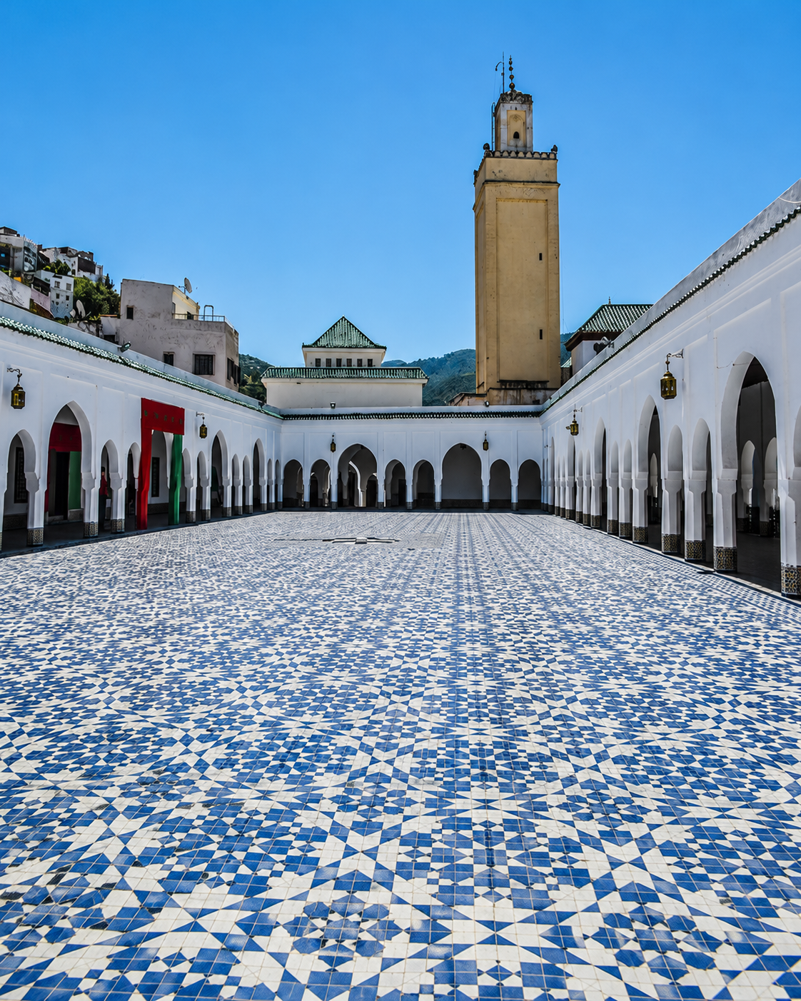
Tiled courtyard and minaret in Moulay Idriss Zerhoun
Layer 1

Sanctuary memory

The mausoleum and zawiya form the spiritual centre. Even when interiors are restricted, the surrounding roofs, entries and street movement explain the town’s devotional role.

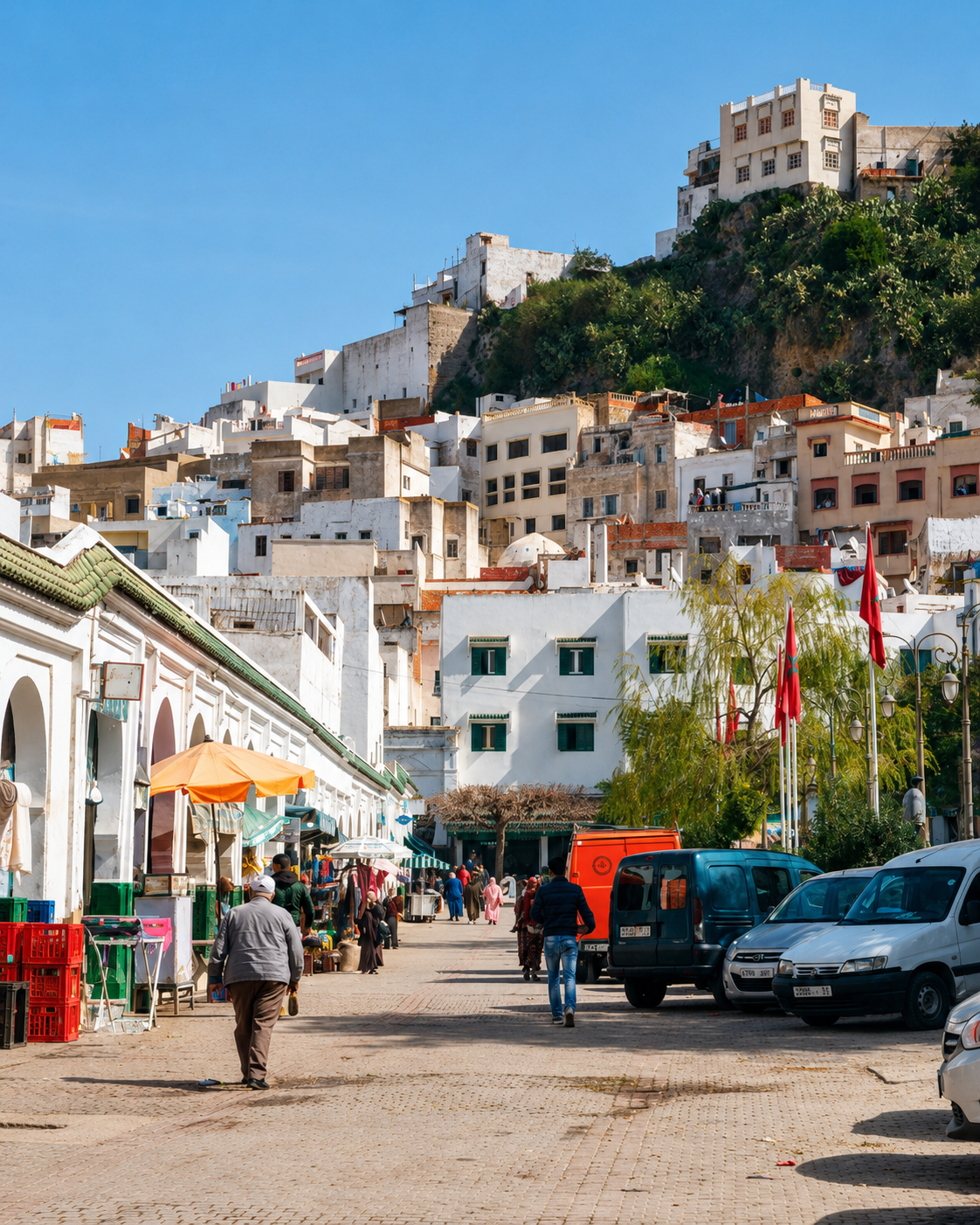
Hillside street and clustered houses in Moulay Idriss Zerhoun
Layer 2

Hill-town movement

Stairs, arched passages and terraces shape the visitor’s pace. Each climb reveals a different reading of houses, minarets, fields and the plains beyond.

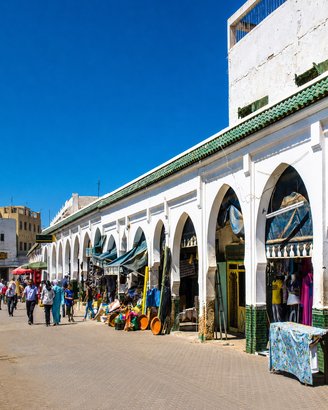
Arcaded market street and everyday life in Moulay Idriss Zerhoun
Layer 3

Local life and olives

Markets, simple restaurants, olive-country routes and local hospitality keep the town lived-in. Moulay Idriss Zerhoun is heritage, but it is also an everyday community.

Landmarks & orientation

Read Moulay Idriss Zerhoun through six defining places

The important places are quiet rather than oversized. Read them as orientation points: a sanctuary, visible roofs, a rare minaret, terraces, lanes and the nearby archaeological landscape.

1
Mausoleum of Moulay Idriss I

The spiritual centre of the town and the place most closely connected with its sacred memory and pilgrimage identity.

2
Zawiya quarter and main square

The urban heart around the shrine, where routes, local movement and visitor orientation naturally converge.

3
Cylindrical minaret

A distinctive round minaret associated with the Al-Santisi Mosque, visible as one of the town’s most unusual architectural markers.

4
Terraces and viewpoints

Lookouts over green roofs, white houses and the surrounding plains help the town become readable without rushing it.

5
Old lanes and hillside stairs

The compact lanes and stairways reveal the real rhythm of the town: steep, domestic, social and best approached slowly.

6
Volubilis route

The nearby archaeological site completes the broader reading of Roman, late-antique, Idrisid and sacred landscape history.

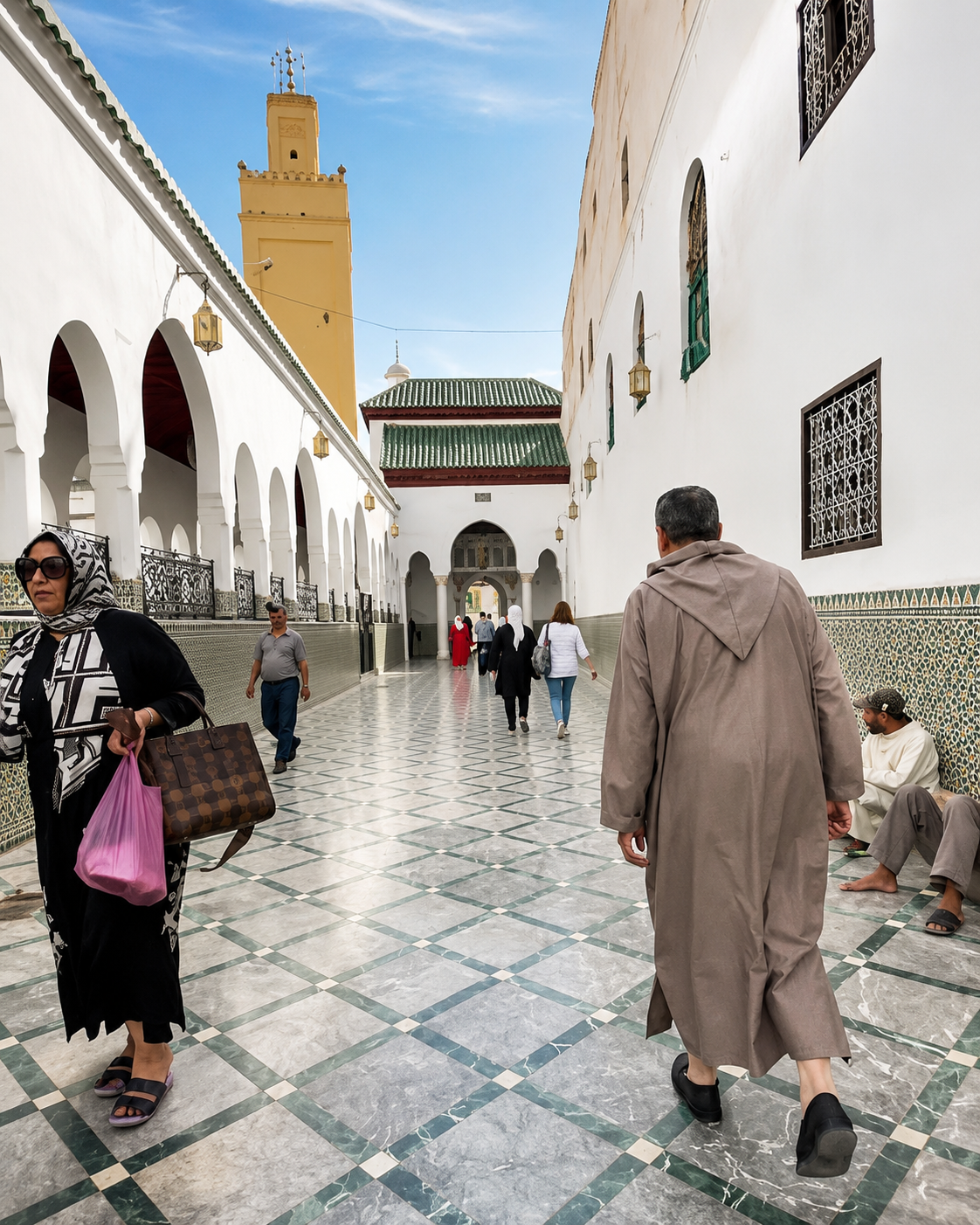
Arcaded sanctuary area and minaret in Moulay Idriss Zerhoun
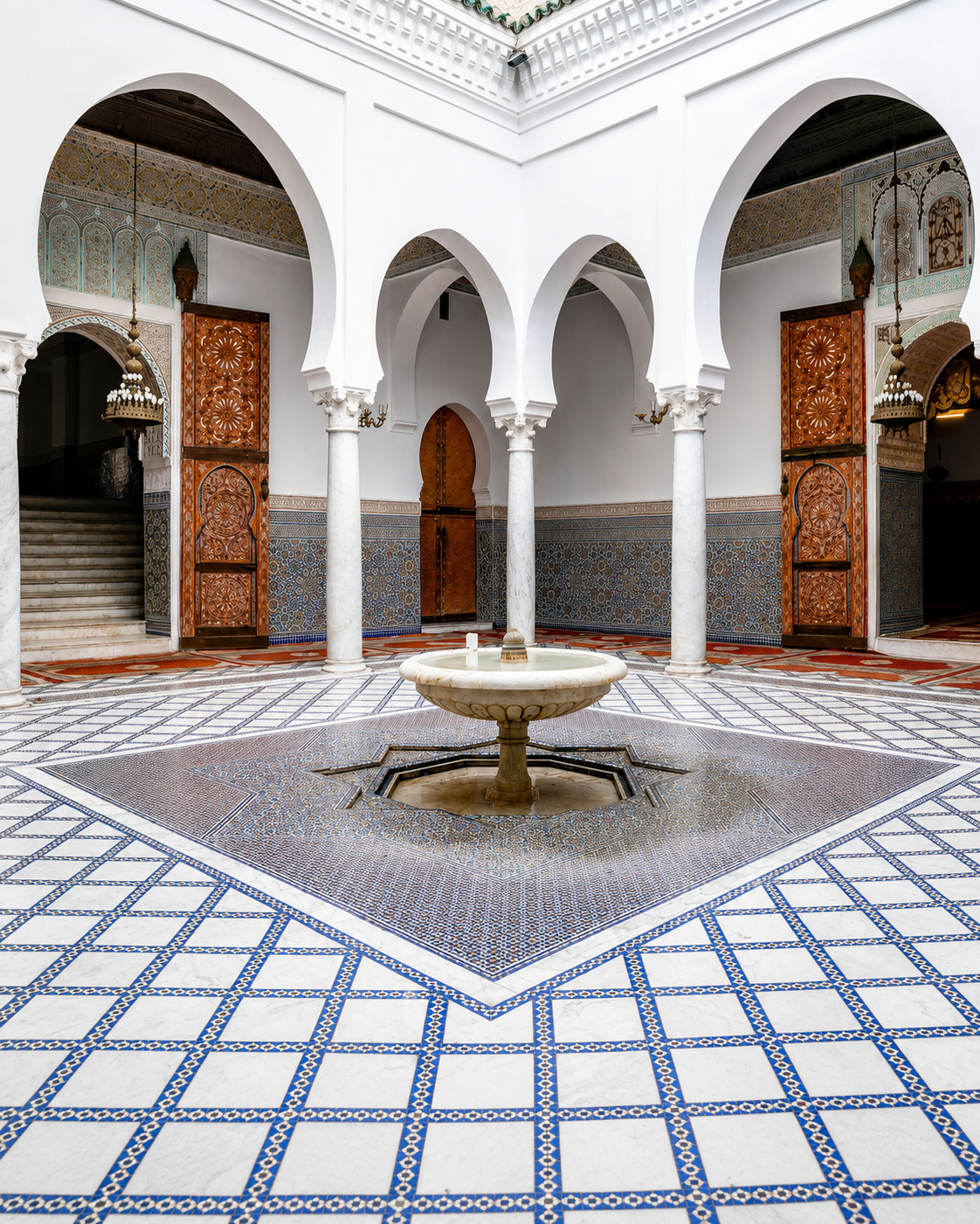
White arcaded courtyard with fountain and carved doors in Moulay Idriss Zerhoun

Moulay Idriss Zerhoun is not a city of large museum interiors. Its strongest interior feeling is produced by thresholds: lanes tightening near the shrine, views opening from terraces, worshippers and residents moving through the centre, and the visible green roofs that mark sacred memory.

The sanctuary town — devotion shaped by slope and restraint

For visitors, respect matters. Some religious spaces may be restricted, and the town should not be treated as a stage. Its beauty is strongest when observed with patience: a doorway, a tile detail, a view over rooftops, a pause in the main square.

  • Read the sanctuary quarter from outside with respect.
  • Use terraces to understand the town’s form.
  • Pair Volubilis with enough time for the hill town.

Architectural reading

Three architectural languages to notice

Hillside compression

Architecture here climbs rather than spreads. Houses, stairs and terraces respond to slope, making movement part of the town’s design.

Sacred markers

Green roofs, shrine approaches and the cylindrical minaret give the town a recognisable visual vocabulary without needing monumental scale.

Landscape connection

The built form is inseparable from Jbel Zerhoun, olive country and Volubilis below. The view is not decoration; it explains why the town matters.

Visual atmosphere

Hill-town light, stone ruins and a wide horizon

Nearby highlights

Nearby heritage and landscape

Moulay Idriss Zerhoun works beautifully as a focused stop, but its meaning expands when paired with the archaeological and regional landscape around it.

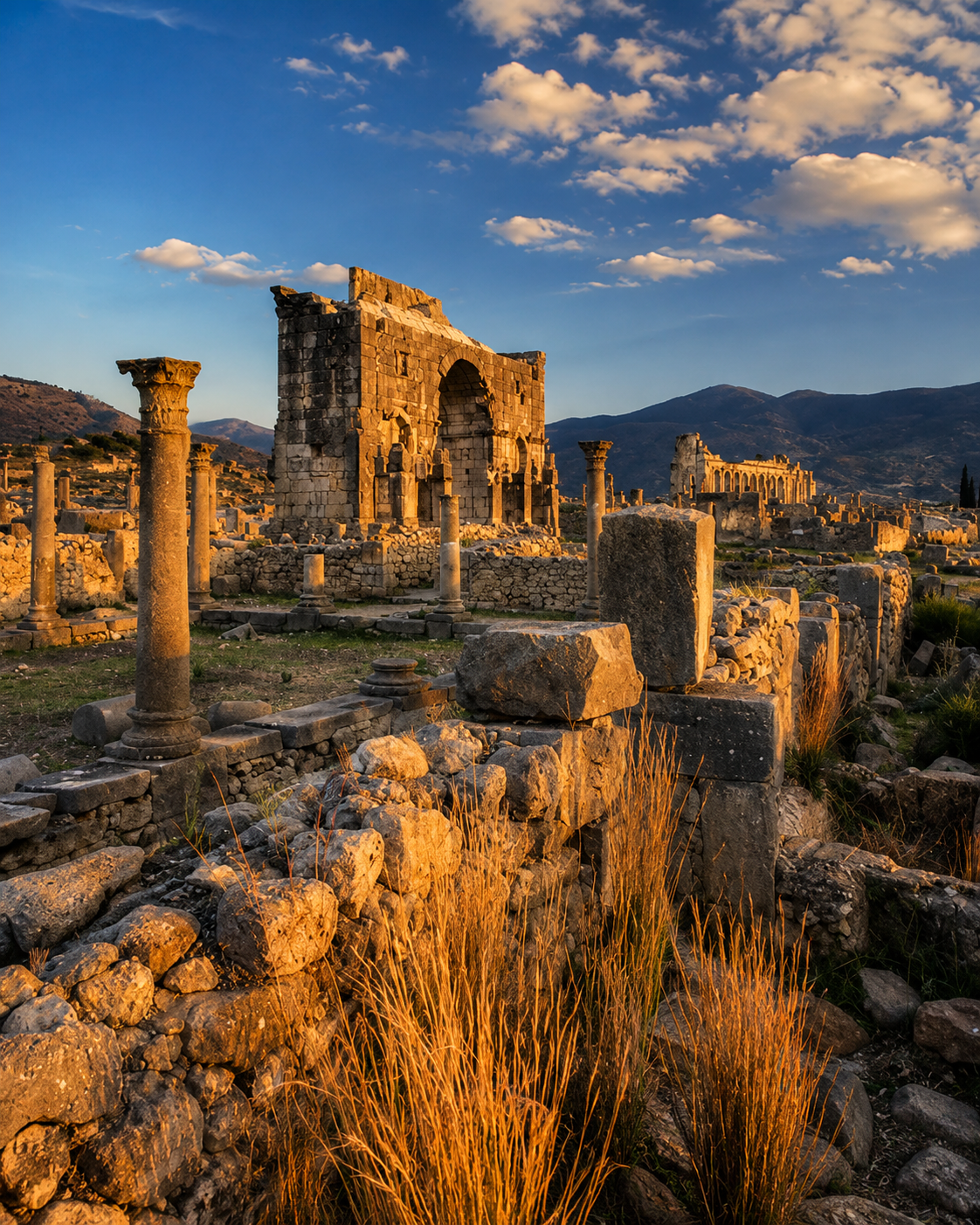
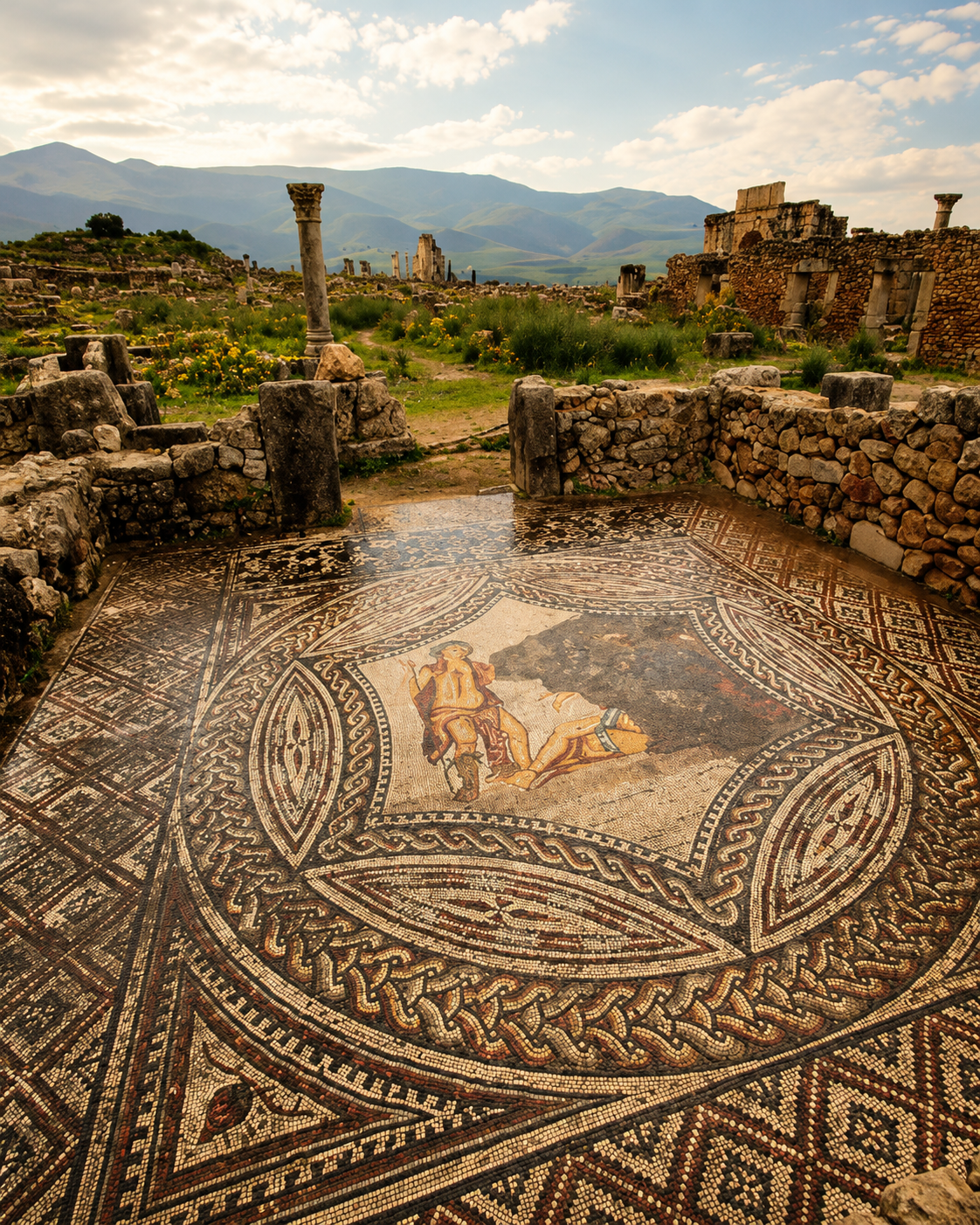
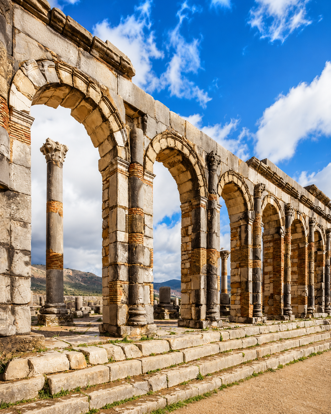
Volubilis

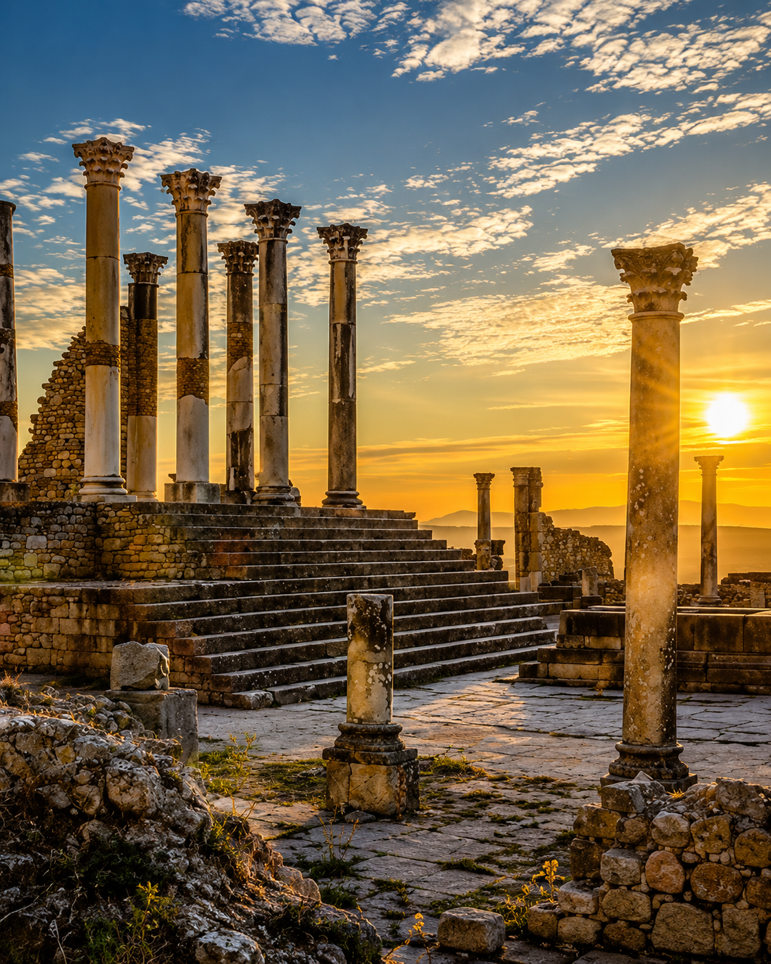
A major archaeological site close to town, with Roman streets, columns, mosaics, oil presses and later Idrisid resonance. Give it time before returning uphill.

Ancient columns at Volubilis in warm evening light

Meknès

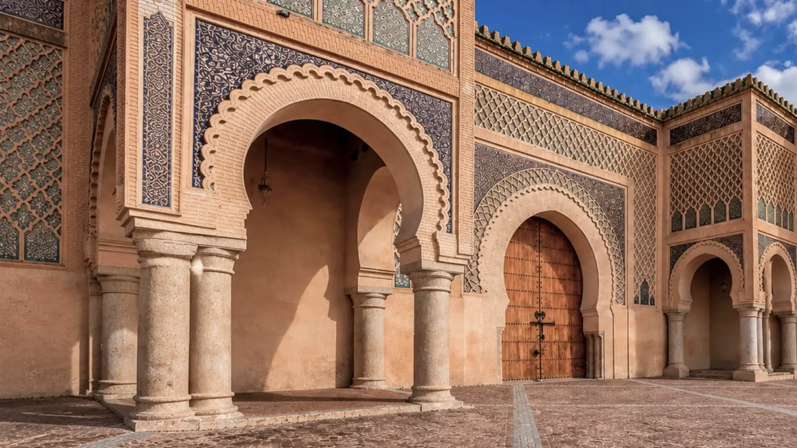
The imperial city nearby adds a different scale: walls, gates, squares, medina life and a strong base for understanding the wider heritage route.

Bab Mansour and imperial architecture in nearby Meknès

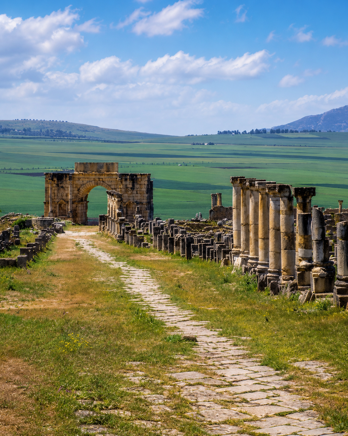
Zerhoun countryside

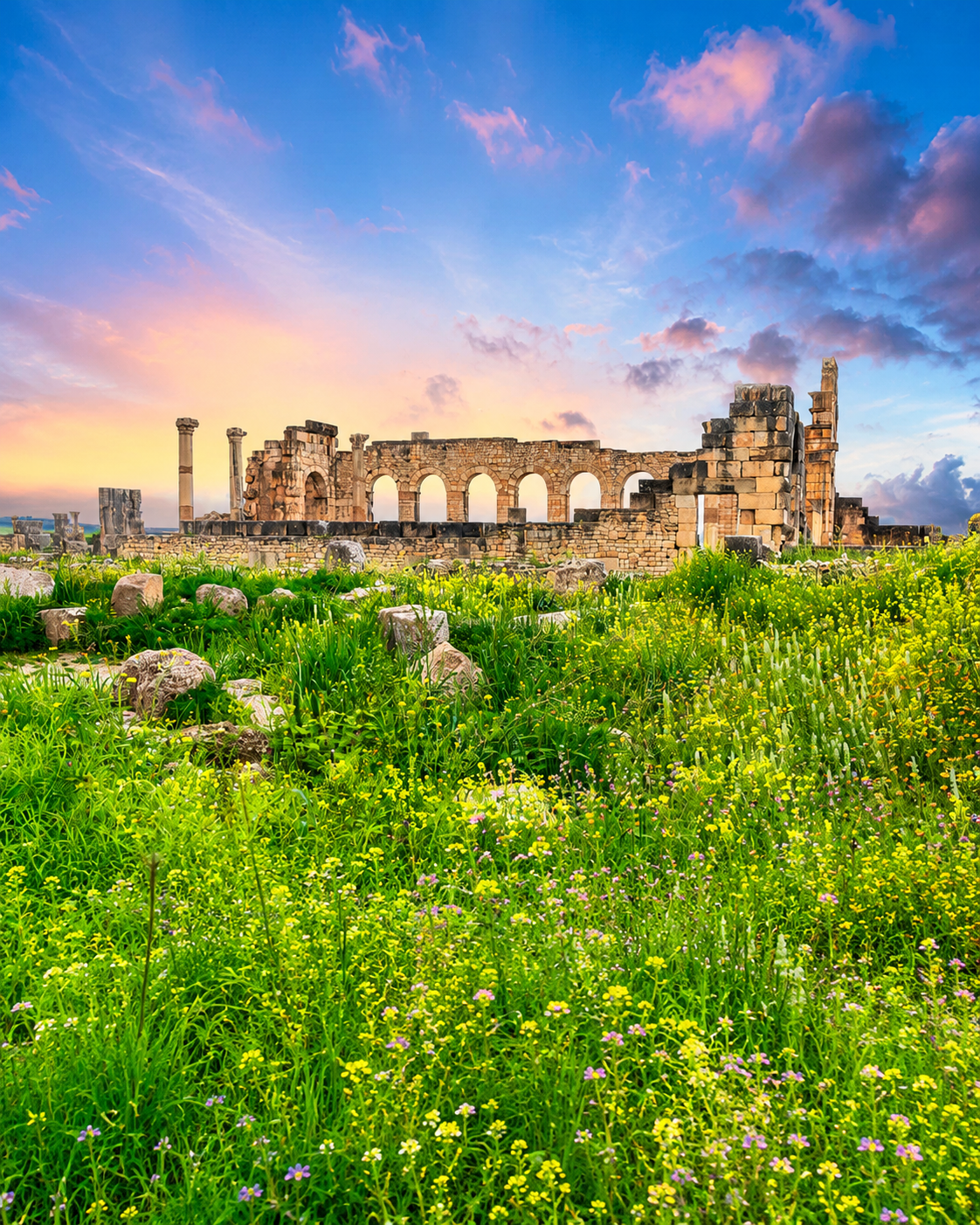
Green fields, olive country and the archaeological plain connect Volubilis to the wider slopes of Jbel Zerhoun. Read the landscape as part of the route, not only the road between sites.

Green fields and ruins across the wider Zerhoun landscape near Volubilis
Travel note: access rules, restoration work, transport conditions and local visitor arrangements can change. Check current official or trusted local information before travelling.

Practical orientation

How to experience Moulay Idriss Zerhoun well

  • Give the town its own time rather than treating it only as the climb after Volubilis.
  • Start with a gentle orientation from the main square and terrace views.
  • Walk the lanes slowly and watch how the shrine, houses and landscape fit together.
  • Use comfortable shoes, water, sun awareness and a respectful pace.
  • Follow local signage and guidance around religious interiors and shrine thresholds.

A strong first visit

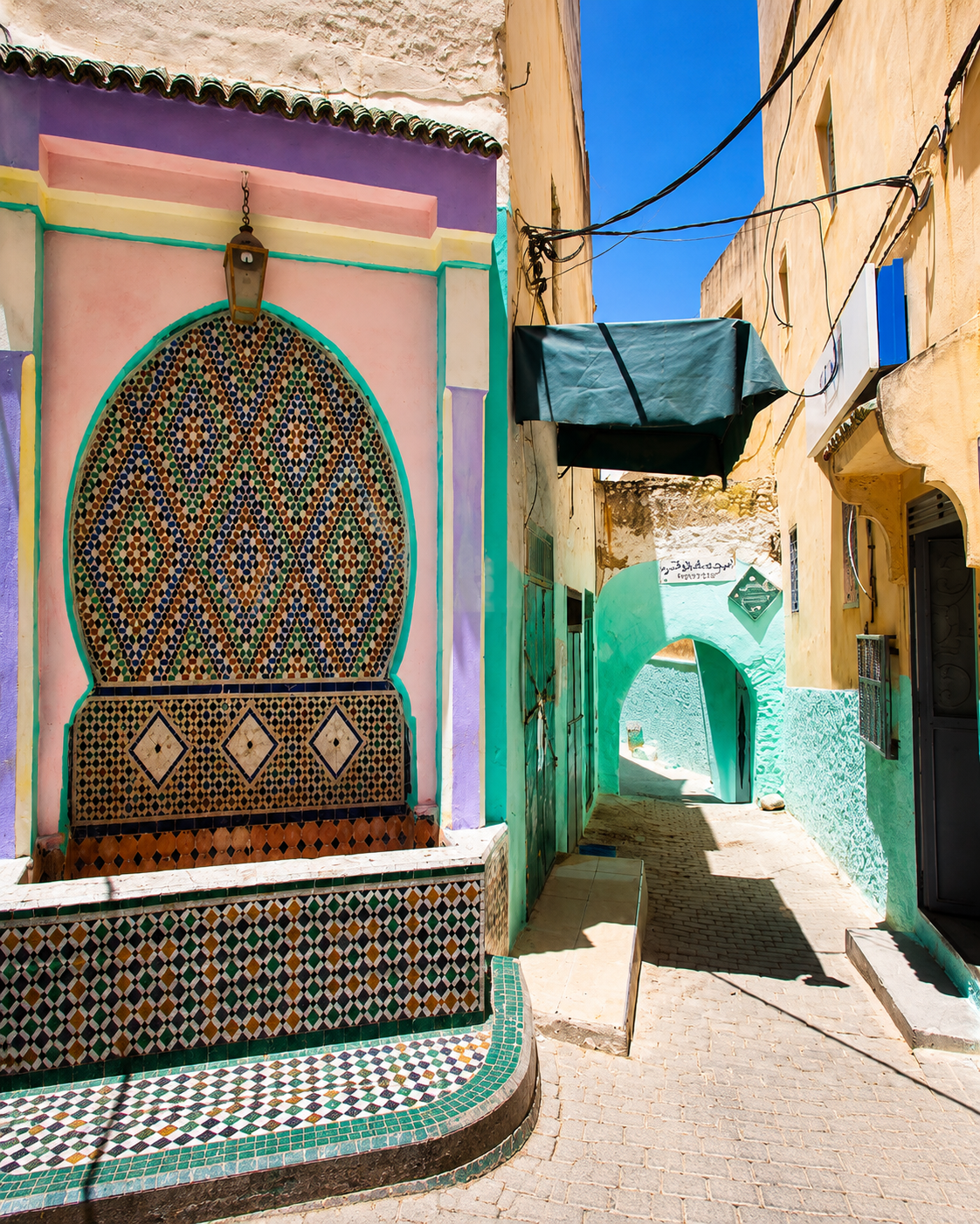
Decorative zellige façade and narrow lane in Moulay Idriss Zerhoun

Arrive early or late in the day, begin with the viewpoints, keep the sanctuary area quiet, then pair the town with Volubilis when temperatures and light make the ruins easier to read.

Moulay Idriss Zerhoun rising across the green slopes below Jbel Zerhoun

Go deeper with Exotic Morocco

Moulay Idriss Zerhoun — Editorial City Guide

A careful orientation for reading the town through shrine memory, hillside movement, Volubilis context, Zerhoun landscape and respectful visitor behaviour.

Sacred town orientationTerrace viewpoints Volubilis contextZerhoun landscape Practical visiting rhythmNearby Meknès route

Continue the journey

Continue the journey through Moulay Idriss Zerhoun

Move from the sanctuary quarter to terraces, from lanes to olive country, from Volubilis back toward Meknès and Fès. The town rewards the visitor who looks carefully before moving on.