
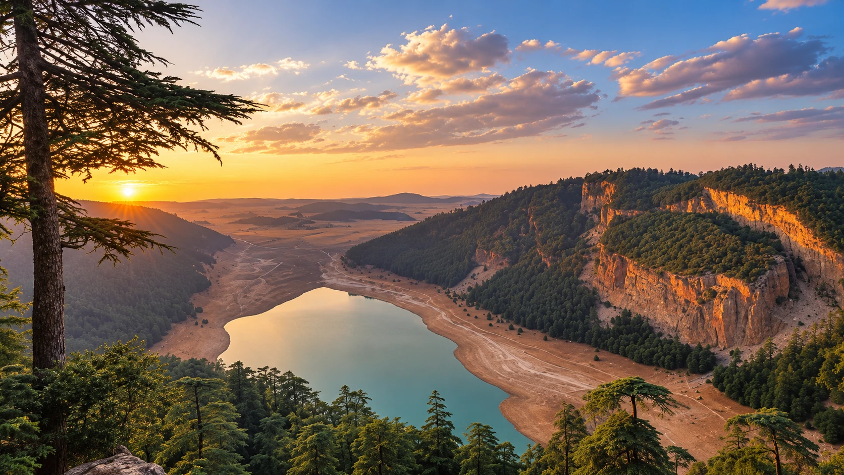
Aguelmame Azegza lake basin ringed by cedar forest and limestone cliffs at sunset

Visit / Place · Middle Atlas · Khénifra province

Aguelmame Azegza A green Middle Atlas lake between cedar forest, limestone slopes and quiet water

Aguelmame Azegza is a natural lake near Khénifra where water, cedar forest and limestone relief turn the Middle Atlas into a slow, careful landscape.

Begin with the wider basin before moving toward the shore. The lake is most rewarding when it is read as a complete natural setting: forest edge, pale rock, changing waterline and mountain air held in one quiet frame.

Why Aguelmame Azegza matters

A lake before it is a view.

Aguelmame Azegza is often admired for its colour, but its importance begins with the way water sits inside the Middle Atlas. The lake occupies a mountain basin shaped by limestone, forest and seasonal water movement, which makes it more than a scenic stop beside the road.

The place matters because it makes a protected Atlas landscape legible at human scale. Visitors can see cedar and holm oak approaching the water, pale slopes enclosing the basin, and a shoreline that changes with weather and season. Those details reveal a fragile system rather than a fixed postcard.

Aguelmame Azegza also belongs to the Khénifra National Park context. Protected-area profiles identify the park as a nationally designated landscape created in 2008, with Middle Atlas forests, water systems and biodiversity forming part of its value. The lake should therefore be approached as a natural site under care, not simply as open scenery.

Its quieter power is educational. In one compact setting, visitors can read water, rock, forest, shade, grazing pressure, local recreation and the need for restraint. The best visit does not rush to consume the view; it watches how the basin works.

For travellers, Aguelmame Azegza gives the Middle Atlas a clear shape. It links Khénifra, cedar country, mountain weather and upland water into a place that feels calm at first, then increasingly complex when viewed slowly.

Core natural-site facts are grounded in the Protected Planet profile for Parc National de Khénifra, Morocco's CBD protected-area profile, and regional geomorphology research on Aguelmam Azigza. Road condition, access and visitor facilities should be checked locally before travel.
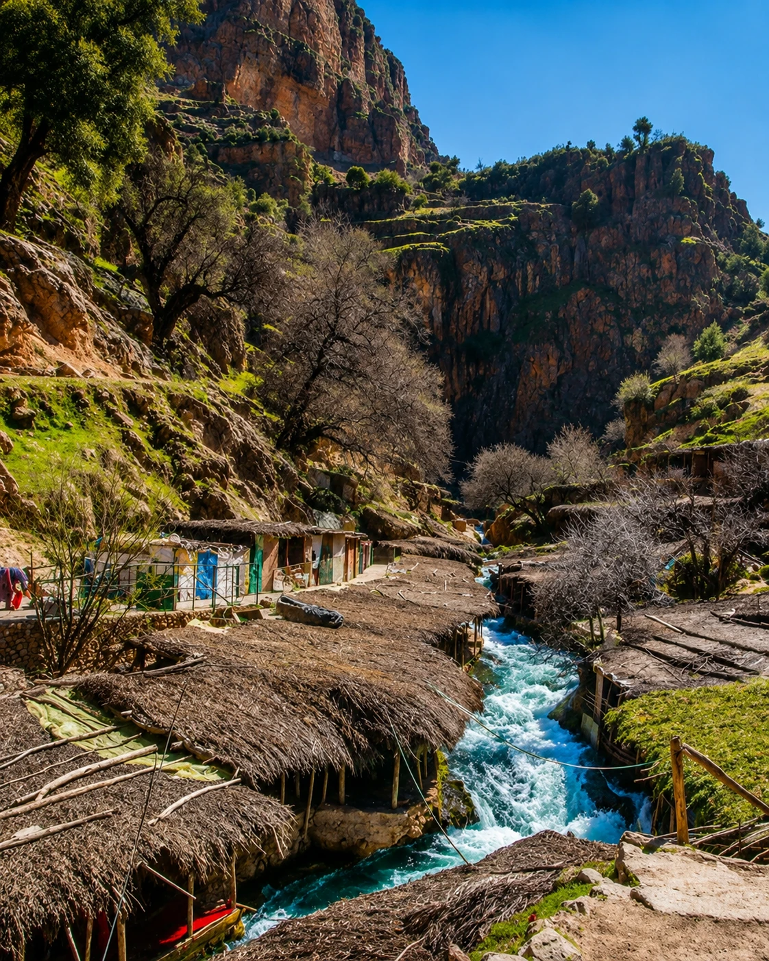
Rocky stream, cliffs and green mountain slopes selected as the circular contextual image

Map orientation

Use the map to place the lake within the forested uplands east of Khénifra and the broader Middle Atlas landscape.

Editorial reading

Its beauty is hydrological, not decorative.

The first impression is colour: green water, dark trees, dry rock and open sky. Look longer and the lake becomes a lesson in balance. The same calm surface depends on rainfall, snowmelt, groundwater, shade, soil, visitor pressure and the health of the surrounding forest.

That is why Aguelmame Azegza rewards a slower visit. The stronger experience comes from seeing the water and its edge together: the changing line of the shore, the forest descending toward the basin, and the way limestone gives the landscape its bowl-like force.

Read the lake in layers. The water gives the first point of orientation. The trees provide shade, scent and scale. The slopes explain enclosure. The exposed banks remind visitors that mountain lakes are sensitive, not ornamental.

The best reading also includes restraint. Stay on durable ground, keep noise low, avoid litter and give local use of the site room to continue. A lake can look empty and still be socially and ecologically active.

Leave with more than one photograph. Notice how the basin changes when the light moves, how the forest controls the mood, and how the shore asks visitors to be careful with every step.

Natural and heritage orientation

Read the site through water, forest and limestone.

Aguelmame Azegza is best understood as a Middle Atlas natural landscape rather than a simple picnic lake. Its identity comes from the meeting of a mountain water body, limestone relief, cedar and holm-oak cover, nearby rural use and the wider conservation context of Khénifra National Park.

01Place type

A mountain lake

The site is a natural lake landscape in Khénifra province, commonly associated with the Middle Atlas cedar country and known for the green tone that gives the place its name.

02Geology

A karst basin

Regional geomorphology research describes Aguelmam Azigza as a karst lake set within limestone relief. That geology explains the enclosed feeling and the importance of water moving through rock.

03Protection

National park context

Khénifra National Park is listed by protected-area sources as nationally designated in 2008. Aguelmame Azegza should be read within that larger forest and upland-water conservation landscape.

04Care

A sensitive shore

The lake edge, waterline and forest approaches can be affected by season, weather and visitor use. Responsible travel here begins with staying light on the ground and leaving no trace.

A visual bridge

Three readings between water, forest and rock

Before Aguelmame Azegza becomes a photograph, it is a relationship between a lake basin, cedar shade, limestone slopes and visitor movement. These three readings help the place feel precise rather than generic.

01

Water

The lake as a living surface

The water is not a flat scenic mirror. Its colour, edge and mood change with light, wind, season and level, so the shoreline should be read as evidence of a living system.

  • Watch the waterline before choosing where to walk.
  • Notice how colour shifts from green to blue.
  • Treat exposed banks as sensitive ground.
02

Forest

Cedar shade around the basin

The forest is part of the lake's character, not a background decoration. Cedar and holm oak give scale, protection, scent and seasonal contrast to the upland water.

  • Read tree cover as part of the lake experience.
  • Keep distance from wildlife and nesting areas.
  • Use existing paths where they are clear.
03

Looking

Basin before shoreline

The strongest visit begins with the whole hollow. Distance reveals the form; walking reveals texture, shade, banks and quiet; higher ground reconnects the water to the forest and rock around it.

  • Start with the full basin.
  • Move slowly along durable ground.
  • Use viewpoints to understand scale.

Quick orientation

Type of place

A natural Middle Atlas lake near Khénifra, best understood as a mountain water landscape shaped by limestone, forest cover and seasonal change.

Landscape context

The site belongs to cedar and holm-oak country in the Khénifra National Park area, where upland water, forest and limestone relief meet closely.

Best for

Slow nature reading, careful photography, quiet walking, forest shade, lake views and a calmer understanding of Morocco's central mountain landscapes.

Closest city context

Khénifra is the natural travel base for placing Aguelmame Azegza within the Middle Atlas, forest routes and regional planning.

What visitors experience here

A lake that changes as you approach it.

Aguelmame Azegza works in stages. First comes the wider Middle Atlas setting: slopes, trees, road, sky and the sense of entering cooler upland air. Then comes the basin, where the lake gathers colour and the forest makes the water feel held.

Arrival

The basin opening

The approach is strongest when the view widens gradually. Trees frame the descent, limestone gives the basin its pale edges, and the water appears as a cool centre rather than a separate attraction.

Light

Green water, hard sky

The lake can shift from muted green to cooler blue depending on angle and cloud. In clear light, the contrast between water, forest and dry banks makes the whole basin easier to read.

Movement

Shoreline rhythm

The rewarding pace is unhurried. Move only where the ground is stable, pause before entering soft edges, and let the curve of the shore set the rhythm instead of forcing a fast circuit.

Forest

Cedar shade and scent

The surrounding trees soften the lake. They bring shade, resin scent, dark vertical forms and a feeling of enclosure that makes the water feel protected even when the site is busy.

Texture

Rock, bank and waterline

The smaller details matter: exposed limestone, damp edges, dry grasses, roots, tracks and the thin line where the lake has recently touched the shore. These textures prevent the place from becoming a simple panorama.

Pace

A quieter mountain visit

The lake loses meaning when treated only as a quick photo stop. The better visit gives time to light, silence, local use, water level, forest cover and the care required by a sensitive natural site.

Place details and orientation

Read Aguelmame Azegza through six defining elements

No single detail explains the lake. Its meaning comes from the relationship between basin form, water level, limestone, forest cover, visitor rhythm and the wider protected landscape.

1
Lake basin

The basin gives the place its form. Read the water in relation to the hollow around it, not as a flat object detached from the land.

2
Limestone slopes

Pale rock and steep relief help explain the enclosed feeling of the site and the karst logic behind the lake landscape.

3
Cedar and holm oak

The forest is part of the lake's identity. Its shade, colour and edge condition shape both the view and the visitor experience.

4
Changing waterline

Mountain water bodies are not static. The visible shore can shift with season and weather, so exposed edges should be treated carefully.

5
Visitor shore

The accessible edge is where most people experience the lake. Staying on durable ground protects the bank and keeps the visit calm for others.

6
Park context

Aguelmame Azegza belongs to a wider Khénifra National Park landscape of forests, wetlands and upland ecological value.

Lake, not backdrop

The place asks for a lighter step.

Stand back before going to the edge. The first lesson is spatial: a lake held inside slopes and trees, shaped by water movement, geology, weather and the pressure of human use. The view is beautiful because the system is complete.

Then move closer. Texture replaces panorama: stones, damp ground, tree roots, exposed banks, shadow and the thin traces of earlier water levels. This is where the visit becomes more than a view and starts to reveal the lake's sensitivity.

Look for the relationship between shore and forest. The lake reads best when the trees, slopes and water are kept in the same frame, reminding visitors that natural beauty here depends on care beyond the photograph.

Landscape and water intelligence

A mountain lake is not a fixed scene.

The character of Aguelmame Azegza is not just visual atmosphere. Water level, forest cover, limestone relief, weather and visitor use all influence how the lake looks and how it should be approached.

The lake's beauty depends on relationships: shade and exposure, hard rock and soft shore, open water and tree cover, recreation and protection. A careful visitor reads those relationships before choosing where to sit, walk or photograph.

What to notice slowly

  • Look at the whole basin before focusing on the shoreline.
  • Notice where the waterline is damp, exposed, trampled or recovering.
  • Read cedar and holm oak as part of the lake's protection and mood.
  • Watch how limestone slopes control the sense of enclosure.
  • Keep Khénifra National Park in mind; the lake belongs to a larger protected landscape.
  • Respect soft banks, quiet areas, wildlife and local use of the shore.

Visual reading

Three natural languages to notice

Basin and enclosure

Aguelmame Azegza speaks first through form: water gathered inside a hollow, with forest and rock creating a natural room before the eye separates shore, slope and tree line.

Forest and threshold

The strongest visual threshold is where cedar shade meets open water. That edge gives the lake depth, keeps the scene from feeling empty and reminds visitors to move carefully.

Surface and pressure

Water and shore record wind, season, trampling and dryness. Their beauty depends on restraint, which is why the respectful visitor avoids fragile edges and leaves no trace.

Visual atmosphere

Water, shade and quiet transitions

From height to waterline

Start with the full basin, then move closer to read the edge: stone, bank, roots, grasses and the changing mark left by water. The shift from wide view to shore detail turns the lake into a place with structure.

From green to shadow

The strongest contrast is not artificial colour, but the meeting of green water, cedar darkness, pale rock and open mountain light. Look for how the same surface can feel clear, deep, cold or quiet depending on angle.

From photo to memory

The image is powerful, but the deeper memory comes from walking slowly enough to connect water with forest, climate, local use and responsibility. A careful visitor leaves with the sound of wind, the smell of trees and the sense of a lake that should remain whole.

Nearby places and onward links

Connect the lake to the wider Middle Atlas map

Aguelmame Azegza belongs to a broader Khénifra and Middle Atlas itinerary. Use it as a quiet natural anchor, then widen the journey through forest landscapes, regional routes and responsible planning.

Khénifra

The closest city context for Aguelmame Azegza. Use Khénifra to understand the lake within Middle Atlas routes, cedar landscapes and upland travel planning.

Browse city guides

Béni Mellal-Khénifra

The wider regional frame connects mountain lakes, rivers, forest areas and inland travel between central Morocco and the Middle Atlas.

Explore regions

Nature and landscapes

Aguelmame Azegza is a strong entry point into Morocco's quieter natural places, where water, forest and responsible visitor behaviour matter.

Browse themes

Visit Morocco places

Continue through valleys, waterfalls, lagoons, caves, national parks, monuments and natural heritage places beyond city guides.

Browse Visit places

Plan your journey

Treat Aguelmame Azegza as a natural route anchor. Check current road conditions, local advice and seasonal context before travelling.

Plan your journey

Stories from Morocco

Use the Stories section for richer cultural and landscape reading around water, forest, memory and the human rhythm behind travel.

Read stories

How to visit respectfully

Good behaviour protects the lake.

Aguelmame Azegza invites a relaxed visit, but relaxation should not become carelessness. Keep to durable ground, avoid driving or walking onto soft banks, take every piece of waste back out, and leave quiet areas quiet.

Respect also means caring for how local people use the place. Give families, guides, small vendors and rural movement room. Ask before photographing people, avoid intrusive drone use unless clearly permitted, and do not treat the shore as private space just because you found a view.

  • Stay on stable paths and avoid fragile wet or recovering shorelines.
  • Carry out litter, food packaging and anything that could reach the water.
  • Keep music and noise low so the lake remains a shared natural space.
  • Respect wildlife from a distance and never feed animals.
  • Check current road, weather and access conditions close to travel.

A strong first visit

Begin above or back from the edge, where the whole basin can be understood. This first view gives the visit its structure: forest, limestone, water and sky can be read together before the shoreline details compete for attention.

Move slowly enough to notice the difference between stable ground and soft bank. Pause in shade, watch the colour of the water change, and let the forest edge frame the lake rather than pushing into sensitive areas for a closer photograph.

If local guidance is available, use it to understand seasonal access, safe paths and the wider Khénifra National Park context. The lake is more meaningful when it is connected to forests, wetlands and rural life around it.

Afterward, connect the visit to Khénifra and the wider Middle Atlas. That context helps Aguelmame Azegza feel less like an isolated lake and more like part of a regional landscape of water, cedar, weather and careful travel.

  • Start with the whole basin before approaching the water.
  • Choose durable ground and avoid trampling fragile banks.
  • Use viewpoints to understand the lake, not only to photograph it.
  • Leave space for local visitors, guides and small businesses around the site.
  • Finish by connecting the lake back to Khénifra and the Middle Atlas.

Careful planning note: road condition, weather, access and facilities can change. Verify practical arrangements locally before travelling.

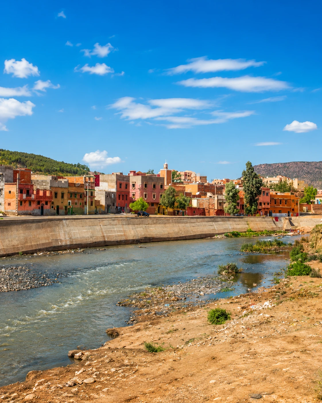
Riverside city scene selected as the final guide cover image

Go deeper through the nearest city context

Khénifra: the city gateway to Aguelmame Azegza

Aguelmame Azegza belongs naturally inside a wider Khénifra journey. The city gives visitors a stronger base for reading Middle Atlas routes: cedar forests, rivers, lake landscapes, rural roads and the quieter geography of central Morocco.

Use Khénifra to widen the context after the lake itself. Nearby uplands, forest approaches and practical regional planning become easier to understand when Aguelmame Azegza is treated as part of a larger mountain landscape rather than a detached excursion.

Middle Atlas contextKhénifra city orientation Cedar and lake routesWater and forest reading Practical travel structureNearby natural highlights

Continue the journey

Continue from Aguelmame Azegza into the Middle Atlas.

Read the lake slowly, then connect it to Khénifra, cedar forest, upland water, regional routes and the wider natural map of Morocco.