
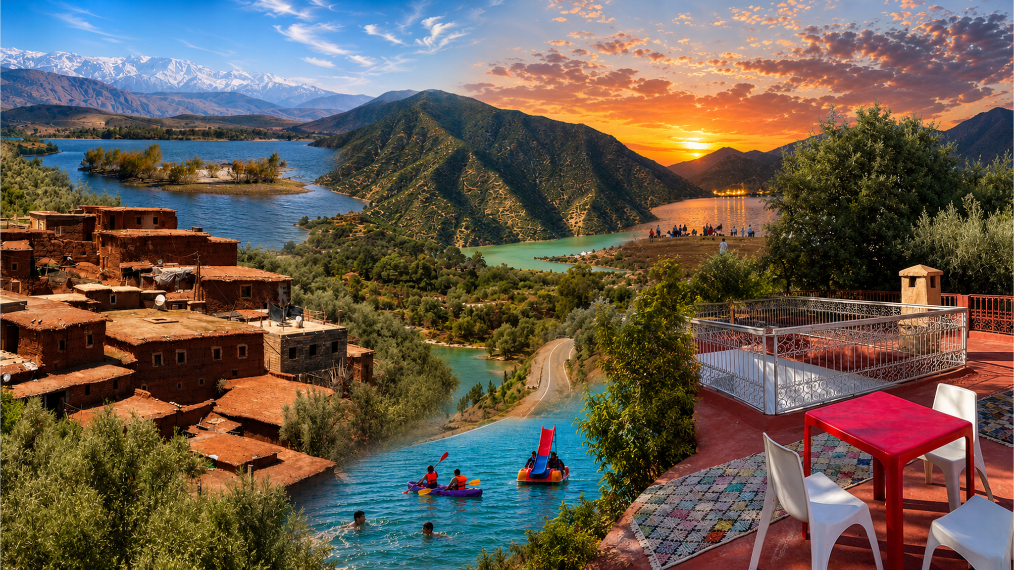
Panoramic composition of Ouirgane Valley scenes with mountain villages, reservoir views and terraces

Visit / Place · High Atlas · Al Haouz

Ouirgane Valley Water, cultivated hillsides and the open horizons of the High Atlas

South of Marrakech, Ouirgane brings mountain villages, orchards and a broad reservoir into one landscape shaped by water and everyday work.

Make room for a walk and a long pause. The valley rewards time on the ground, where field paths and village lanes bring the mountain panorama into focus.

Why Ouirgane Valley matters

A mountain landscape sustained by water.

Ouirgane lies in Al Haouz, on the northern side of the High Atlas. The name refers to a village and the surrounding valley landscape: cultivated ground, smaller settlements, mountain slopes and the reservoir beside the village. Understanding that wider setting gives a visit more substance than a single lakeside stop.

The landscape holds two different stories of water. Orchards, terraced gardens and fields belong to a working rural environment. The broad water surface is the reservoir associated with the Yacoub El Mansour dam on the N'Fis, a modern addition to the valley. Its scale connects local scenery with the larger question of how water is stored and managed around Marrakech.

Ouirgane also offers a way into the High Atlas at village scale. Paths connect homes, cultivated land and neighbouring valleys; a walk can move between open views and the small spaces where daily life takes place. The countryside is inhabited and maintained, and its character comes as much from that use as from the mountain backdrop.

For travellers based in Marrakech, this makes the valley a rewarding change of pace. The most useful question is what kind of day you want here: a village visit and lunch, a modest walk, or a longer outing with a local mountain guide. Each reveals a different part of the place.

For regional context, see Marrakech Tourism's Ouirgane profile. The reservoir's water-management role is outlined in SYGEO's Yacoub El Mansour dam profile.
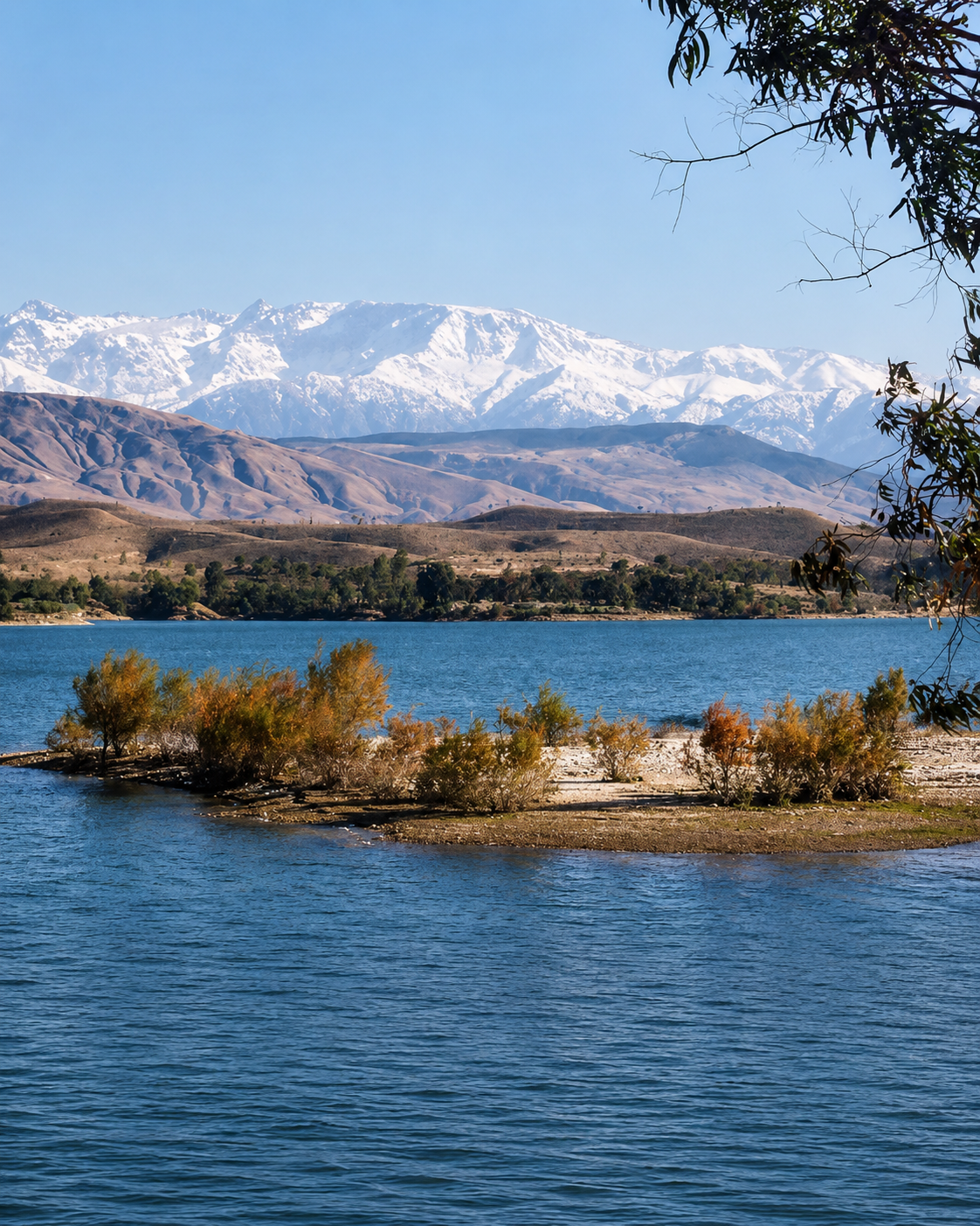
Blue water and wooded shoreline beneath a snow-covered Atlas mountain backdrop

Map orientation

Centered on Ouirgane village. The reservoir and surrounding slopes give the valley its wider setting.

Open Ouirgane in Google Maps ↗

Editorial reading

The valley has several centres of attention.

The water naturally draws the eye, but a reservoir view explains only one part of Ouirgane. Turn towards the slopes and the composition changes: houses gather in smaller groups, cultivated ground interrupts the hillsides, and tracks describe routes that a photograph can easily hide.

Look at where these elements meet. A field edge, a retaining wall or a path above a settlement can be more revealing than a distant peak. These junctions show how a broad mountain environment becomes usable ground, divided into places to live, grow, travel and rest.

It helps to separate observation from assumption. A green patch does not reveal its crop or water source at a glance. A visible track does not establish public access. Ask a local guide about the details that interest you; specific explanations are more useful than a general story about timeless village life.

Give the inhabited foreground as much attention as the skyline. Shops, gardens and ordinary journeys belong to the valley's present. They make Ouirgane a place with its own purposes, beyond the brief interval in which a visitor is looking at it.

Landscape and cultural orientation

Village life and a changing waterscape.

Ouirgane's context brings together Amazigh communities, cultivated hillsides and modern infrastructure. These layers help explain the place without attaching an invented origin story to every view.

01Settlement

An inhabited valley

The village belongs to a wider network of mountain communities. Homes, fields and local services give this landscape its everyday organisation.

02Cultivation

Ground shaped for growing

Orchards, terraces and cultivated plots are a defining part of Ouirgane's setting. Their varied sizes and boundaries reward attention on a walk.

03Water management

A modern reservoir

The Yacoub El Mansour dam entered service in 2008. The reservoir is part of the N'Fis water system, with a role in regulation and Marrakech's water supply.

04Regional connections

The approach through Asni

From Marrakech, the approach runs through the Tahanaout and Asni area, as described by Ouirgane Eco Domaine. Ouirgane makes sense within that mountain route, with time allowed for the return journey.

A visual bridge

Three ways to find your bearings

Use the shape of the ground to organise the view. A few deliberate observations can turn an expansive panorama into a landscape you can follow.

01

Horizons

Separate the ridgelines

Follow one ridge at a time. Nearer slopes usually carry more visible texture, while distant relief becomes softer. This gives the valley depth without needing to identify every summit.

  • Find the nearest continuous ridge.
  • Trace the overlap with the hills beyond.
  • Notice where a side valley opens.
02

Edges

Follow the shoreline

The meeting of land and water makes the valley's folds easier to see. Projecting ground and recessed bays produce a more intricate outline than the water surface first suggests.

  • Notice curves before looking for reflections.
  • Compare opposite banks from one position.
  • Keep the landform in the photograph.
03

Scale

Let a building measure the view

A house, terrace or roadside tree gives the eye a familiar size. Use one as a reference, then look again at the slope behind it to appreciate the distance involved.

  • Choose a clear foreground reference.
  • Compare its size with the hillside.
  • Leave breathing room around the subject.

Quick orientation

Type of place

A mountain valley, village and reservoir setting. Best approached as a landscape to spend time in, with individual walks or visits arranged to suit your interests.

Landscape context

Al Haouz in the Marrakech-Safi region, within the High Atlas setting south of Marrakech. Explore the broader mountain context through our regional guides.

Best for

Village walks, landscape photography and a slower day outdoors. Choose the length and ascent of a walking route deliberately; nearby hills can demand more effort than they appear to.

City base

Marrakech is the relevant city base. A day trip suits a focused visit; a local overnight stay gives more flexibility for walking and quiet time.

What visitors experience here

Open views, then a closer rhythm.

The experience changes when you leave the vehicle. Broad stretches of scenery give way to the height of a wall, the surface beneath your shoes and the turns of a village path.

Arrival

The view opens

Where the approach reveals the water, the eye moves away from the road towards the opposite slopes. Stop only at a suitable pull-in; the best pause allows you to look without watching for traffic.

Light

A surface in motion

Ripples break the water into small changes of brightness. The same view can become reflective or textured as the breeze shifts, even while the surrounding hills remain still.

Walking

Turns that change the scene

A bend can replace an open view with trees, houses or a close hillside. These interruptions give a walk its rhythm and make each return to the panorama feel different.

Texture

Rough ground, smaller details

At walking distance, stone, soil and leaf shapes take over from broad colour. Notice these details where you naturally pause, keeping clear of crops and the edges of narrow paths.

Village

Everyday activity

Close to homes and businesses, conversation and passing traffic bring a different atmosphere. Let local movement set the pace when a lane is busy, particularly around doorways and shopfronts.

Rest

A seated perspective

Lunch or tea on an accessible terrace can become part of the visit itself. Staying in one position gives time to notice clouds, changes in visibility and shadows moving across the ground.

Place details and orientation

Six elements to recognise on the ground

Use these as points of orientation when choosing an outing. They describe the wider area; reaching them all is neither necessary nor a suggested single walking circuit.

1
Ouirgane village

The named centre around which to arrange a meeting point, meal or local introduction before setting out.

2
Yacoub El Mansour reservoir

The broad waterbody beside Ouirgane. Reservoir views can be enjoyed without approaching the dam infrastructure.

3
The N'Fis connection

The river system links this reservoir with downstream water management, giving the lake a role beyond recreation.

4
Terraces and field boundaries

These show how growing spaces are divided and fitted to the terrain. Observe them from established paths.

5
Marigha and Tassa Ouirgane

Names you may encounter when arranging accommodation or a walk nearby. Confirm the exact meeting point rather than relying on “Ouirgane” alone.

6
The Azzaden Valley connection

Local guided outings can link neighbouring villages and valley scenery. A longer traverse needs its own route plan and a suitable level of fitness.

A closer look

Ask what a small feature does.

A narrow channel, low wall or gate may have a specific practical purpose. Ask how it is used before assigning it a story. Even a short explanation can make an apparently ordinary detail the most memorable part of a walk.

A guide can also distinguish a route connecting villages from a path serving private land. That knowledge matters when the visible landscape seems inviting but its boundaries are unfamiliar.

Kasbah Africa's local walking description provides an example of the area's connections between Ouirgane, Marigha and Azzaden. Choose an itinerary around current conditions and your own walking ability.

Water and landscape intelligence

A reservoir belongs to a larger system.

The Yacoub El Mansour dam helps regulate water in the N'Fis basin upstream of Lalla Takerkoust. Its connection to Marrakech's supply adds another dimension to a familiar travel scene: the water has uses and responsibilities beyond the view.

Water level, weather and visibility affect what a visitor encounters. Treat photographs as records of particular conditions. Plan around the place as it is on the day, rather than expecting a fixed shoreline or a particular shade of blue.

What to notice slowly

  • Where cultivated ground follows a slope and where it levels out.
  • How channels and boundaries organise smaller plots.
  • The difference between a river course and a reservoir edge.
  • Where exposed ground meets trees or planted land.
  • How access roads relate to the shape of the hillside.
  • Which details need a local explanation before they make sense.

Landscape reading

Contour, connection and use

Contour

Trace the flatter lines across a hillside. Terraces, tracks and building platforms introduce horizontal surfaces into sloping ground, making its gradient easier to understand.

Connection

Follow a visible route with your eye. Where does it turn, narrow or disappear? That exercise reveals why two places that look close across a valley may require a longer journey between them.

Use

Look for entrances, planted rows and boundaries. They distinguish spaces with different purposes and help explain why open countryside still has rules of access.

Visual atmosphere

Colour with room to breathe

A quieter palette

Between brighter areas of water and vegetation, pay attention to subdued tones: dry ground, grey stone and the shadowed side of a building. These quieter colours give the scene balance.

The shape of a shadow

Side light can reveal a small change in level that is difficult to see at midday. Look across the terrain and watch how an edge gains definition when one side falls into shade.

More than the widest frame

Alongside a panorama, remember a small detail you actually encountered: a bend in a lane, a leaf against water or the view from your lunch table. It will recall the visit in a different way.

Nearby places and onward links

Place Ouirgane within a Marrakech journey

Marrakech supplies the city context; Asni, Marigha and neighbouring valleys help orient the local route. Use the wider guides to choose what belongs in the same trip.

Marrakech

Continue with gardens, medina streets and the city's cultural landmarks. Allow separate time for the city and the valley so each visit has space.

Open Marrakech city guide

High Atlas context

Compare Morocco's mountain settings through the regional overview before choosing another base or adding an onward stage.

Explore Morocco's regions

Asni and nearby valleys

Asni is part of the approach; Marigha and Azzaden offer further local context. Explore the Visit collection for your next mountain outing.

Browse places to visit

Landscape and culture

Connect observations from the valley with wider themes in Moroccan settlement, materials, food and the use of land.

Explore the themes

Plan the return

Agree pickup arrangements, walking distance and meal stops in advance. A simple route often makes a more satisfying day than several rushed detours.

Plan your journey

Continue learning

Build context for the places you encounter through the Learn collection, then return to the landscape with more informed questions.

Explore Learn Morocco

How to visit respectfully

Give local life the space it needs.

Stay on agreed paths through inhabited and cultivated areas. Ask before entering a garden or photographing people, and leave room for residents, working animals and vehicles to pass.

Arrange unfamiliar walks with a local mountain guide. Clarify distance, ascent, return transport and what is included. The valley's relaxed atmosphere should not replace a practical assessment of the route.

  • Use walking shoes and carry water, sun protection and an appropriate extra layer.
  • Follow current local advice on paths, weather and access.
  • Leave crops, channels, gates and field walls undisturbed.
  • Take litter away and use designated places to stop.
  • Keep clear of dam installations and restricted areas.
  • Before any water activity, confirm permission, conditions and suitable supervision locally.

A strong first visit

Choose one main activity before leaving Marrakech. A short village walk and lunch suit a different day from a route linking several settlements. Give your host or guide a clear idea of your walking ability and interests.

Start at an agreed meeting point in or near Ouirgane. Take a first view of the valley, then follow a locally confirmed route that brings you closer to its cultivated ground and village setting.

Keep lunch and the return journey in the plan. If the route or weather proves unsuitable, a shorter walk and a quiet stop can still make a complete visit.

  • Confirm the meeting point and return arrangements.
  • Allow time for one walk you can comfortably complete.
  • Choose a meal stop that fits the route.
  • Ask about the details that catch your attention.
  • Return with time in hand for changing conditions.

Before setting out: confirm road and trail conditions with your accommodation or guide. Check any activity's availability and price directly; there is no single opening timetable for the whole valley.

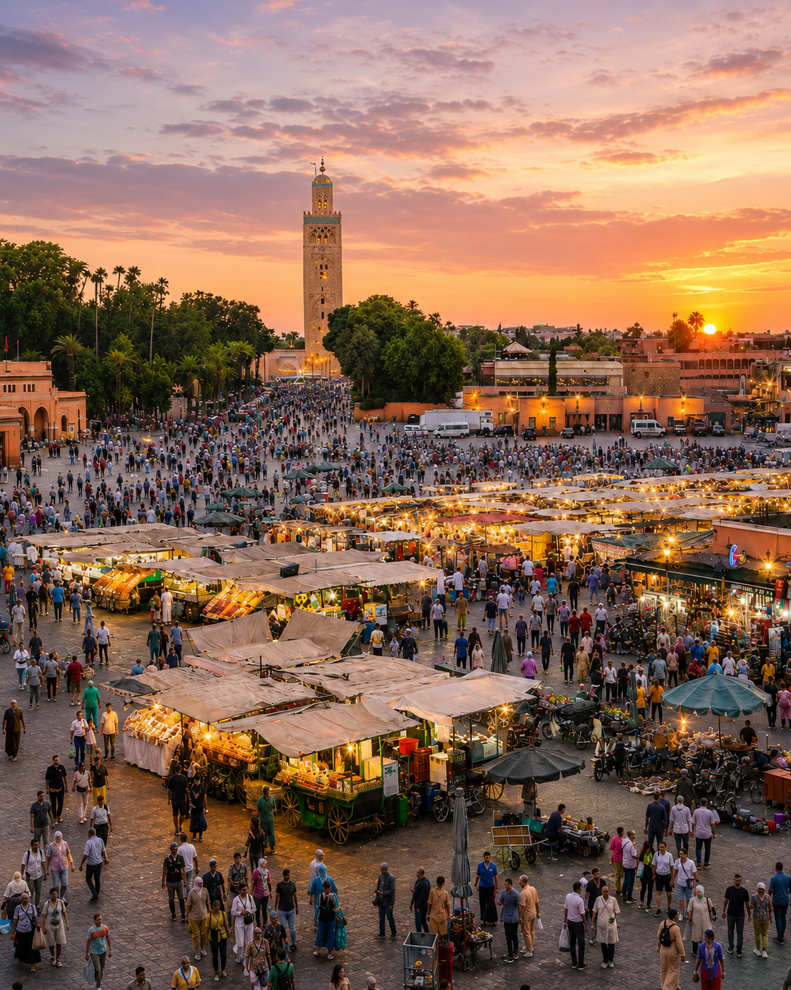
Evening crowds and illuminated stalls in Marrakech with the Koutoubia minaret in the background

The city base for your valley visit

Marrakech — from the medina to the mountains

A Marrakech stay can hold both the concentration of the city and the open space of Ouirgane. Give each its own rhythm: time for streets, gardens and cultural landmarks in the city, and a separate day for the valley.

Use the Marrakech guide to organise the urban part of your journey, then agree the mountain arrangements with your host or guide. An overnight stay near Ouirgane is another option when walking is the priority.

Marrakech city orientationMedina and garden visits A dedicated mountain dayLocal walking arrangements Time for lunch and pausesA clear return plan

Continue the journey

Connect Ouirgane with your Marrakech stay.

Bring the valley's open horizons into a journey through the city, then choose your next place with time to explore it well.