
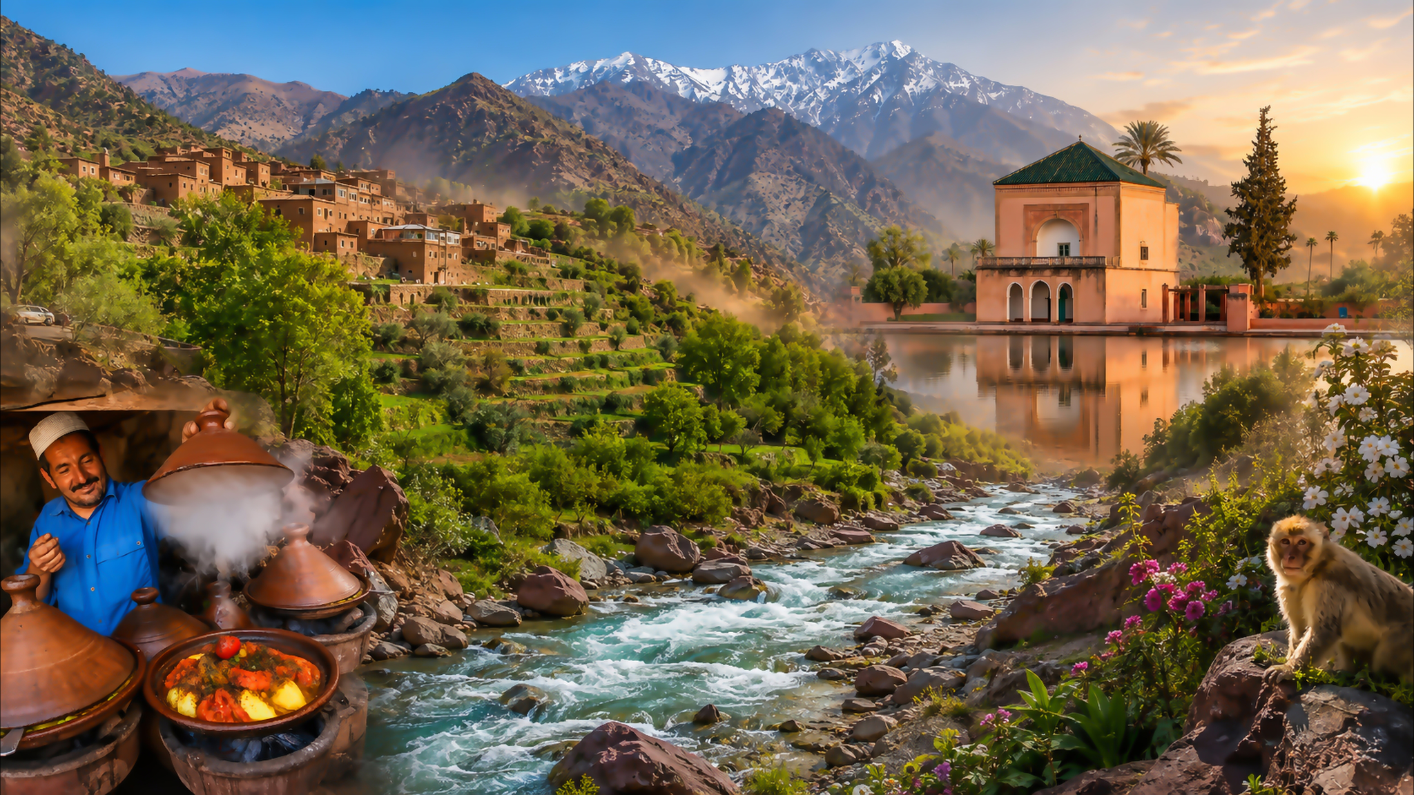
Ourika Valley river landscape with High Atlas peaks, mountain villages and Marrakech cultural details

Visit / Place · High Atlas · Al Haouz

Ourika Valley A living river corridor between orchards, villages and mountain walls

Ourika Valley follows the Ourika River from the Haouz plain into the High Atlas, bringing water, cultivated land and settlement into a single mountain landscape.

Read it as a route, not a single stop. Open foothills give way to terraces, tighter slopes, riverside settlements and the upper-valley walking country around Setti Fatma.

Why Ourika Valley matters

The river explains the valley.

Ourika Valley is not one viewpoint or waterfall. It is a long mountain corridor whose identity comes from the relationship between river, cultivated ground, road, villages and steepening relief. Understanding that connected geography is the difference between merely passing through and actually reading the place.

Water is the organising line. The river gives the valley floor movement and sound, while greener cultivated areas stand out against rockier slopes. Fruit and nut trees, fields and planted terraces make clear that this is not untouched wilderness but a worked landscape shaped by daily use.

The settlements are equally important. Amazigh communities live along the valley, and homes, paths, shops and agricultural plots belong to an inhabited region rather than a scenic backdrop. Visitors should notice how buildings occupy limited ground between water, road and mountain.

The valley also clarifies Marrakech's geography. Leaving the city to the southeast, the route crosses the Haouz plain before the High Atlas begins to close around the river. In a relatively short distance, urban scale gives way to a landscape where water and slope determine movement.

Setti Fatma is the best-known upper-valley reference and a starting point for walks toward cascades, but it should not stand in for the whole valley. The changing route through Tnine Ourika, Oualmas and smaller settlements is part of the experience.

Geographic and visitor context is grounded in the Moroccan National Tourist Office and the official Marrakech-Safi tourism guide. Check weather, water, road and trail conditions locally before setting out.
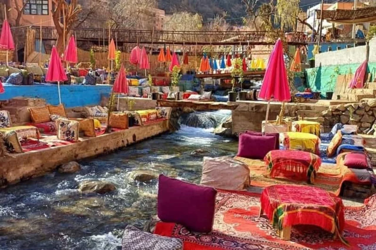
Riverside seating beside flowing water in Ourika Valley

Map orientation

The map centres the upper Ourika corridor, where the road, river and settlements draw together before Setti Fatma.

Editorial reading

Its beauty is spatial, not singular.

The memorable image may be a river bend, a planted terrace or a village against the slope, yet the valley's real strength lies in the sequence between them. Every turn changes the balance of water, vegetation, stone and settlement.

The river is central without being the whole story. Look away from the water and the slopes reveal retaining walls, paths, houses and patches of cultivation fitted to limited ground. These details show how the valley is inhabited.

Season changes the reading. Water volume, foliage, light and visibility are never fixed, so no single photograph can represent every visit. Treat the landscape in front of you as the reality, not as a failed copy of an online image.

The road provides the main visual sequence, but stopping carefully is what turns movement into understanding. A useful pause includes the river below, the slope above and the settlement pattern between them.

Setti Fatma concentrates visitors, riverside activity and access to mountain paths. It is an important upper-valley node, yet quieter stretches lower down may explain cultivation and village spacing more clearly.

The human landscape deserves restraint. Agricultural plots are not public gardens, homes are not displays and local people are not scenery. Ask before photographing, keep access clear and support local services without turning every encounter into a transaction.

Leave with the full corridor in mind: Marrakech behind, the Haouz plain opening the journey, the river guiding the road and the High Atlas steadily narrowing the frame.

Landscape and cultural orientation

Read the valley through water, cultivation and settlement.

Ourika Valley is best understood as a lived geography. High Atlas runoff has shaped the river corridor over long periods; people have worked the usable ground beside it, and settlements follow the narrow opportunities created by water, slope and access.

01Geography

A river corridor

The Ourika River creates the continuous line through the valley. Its course helps explain the road, the cultivated floor and the way the landscape tightens toward the upper valley.

02Cultivation

Productive ground

Official tourism sources note fruit and nut trees across the fertile valley. Planted ground is therefore part of the valley's identity, not a decorative edge to the mountain view.

03Communities

Amazigh settlements

Villages on the floor and hillsides make Ourika a living cultural landscape. Domestic space, farming, local commerce and visitor activity share the same narrow corridor.

04Upper valley

Setti Fatma

The village is the best-known base for riverside pauses and walks toward nearby cascades. It is a gateway to steeper terrain, not the definition of the entire valley.

A visual bridge

Three readings between water, slope and route

Ourika becomes clearer when the river is read together with the land beside it and the road moving through it. These three readings reveal a connected valley rather than a collection of scenic stops.

01

Water

The moving centre

The river gives the valley continuity. Follow its bends to understand where cultivation gathers, where the road draws close and where settlements occupy the available ground.

  • Notice changes in width, sound and speed.
  • Read planted land in relation to water.
  • Keep a safe distance when conditions are uncertain.
02

Slope

Limited ground, careful placement

As the valley narrows, flat ground becomes scarce. Terraces, buildings, footpaths and vegetation reveal how life is fitted between rock, river and road.

  • Look across the river to hillside villages.
  • Notice retaining lines and planted terraces.
  • Respect paths serving homes and fields.
03

Route

A landscape in sequence

The route from the Haouz plain toward Setti Fatma is a gradual transition. Wider horizons, cultivated foothills and enclosed mountain sections belong to one unfolding geography.

  • Read the change before seeking a destination.
  • Pause only where stopping is safe and appropriate.
  • Let the return journey complete the comparison.

Quick orientation

Type of place

A High Atlas river valley: a broad travel corridor rather than one enclosed attraction, with villages, cultivated land, roadside stops and upper-valley paths.

Area

Al Haouz, southeast of Marrakech. The route leaves the Haouz plain and follows the Ourika River toward steeper mountain country.

Best for

Landscape reading, mountain-road scenery, short walks, riverside pauses, cultivated-valley details and understanding the relationship between Marrakech and the High Atlas.

Closest city context

Marrakech is the principal city gateway. It provides the clearest base for placing Ourika within a wider journey through the Marrakech-Safi region.

What visitors experience here

The valley changes with every narrowing turn.

Ourika is experienced in motion. The wide light of the plain gives way to river bends, planted banks and slopes that rise closer to the road. The landscape becomes more enclosed without losing its human scale.

Arrival

Plain becoming foothill

South-east of Marrakech, long horizons begin to gather into a defined river route. The transition is gradual enough to show how the city, plain and mountains connect.

Sound

The river moving in and out

Water may be close and insistent beside one stop, then partly hidden by trees, walls or the road. Listening reveals the river even where the view does not.

Scale

Slopes closing the frame

The upper valley feels increasingly vertical. Rock faces, cultivated edges and hillside buildings compress the view and direct attention along the river.

Cultivation

Green is evidence of work

Orchards and planted terraces should be read as productive ground. Their lines, shade and seasonal colour record care within a demanding mountain setting.

Upper valley

Setti Fatma's active edge

Riverside dining, small businesses and trail activity give the village a lively visitor rhythm. Beyond that activity, the surrounding slopes return attention to mountain scale.

Pace

Road, pause, short walk

A balanced visit alternates movement with observation. A few well-chosen stops reveal more than constant photography through a vehicle window.

Place details and orientation

Read Ourika Valley through six defining elements

No single stop explains the valley. Its character comes from the continuing relationship between moving water, productive ground, settlements, road access and steep mountain relief.

1
Ourika River

The continuous natural line through the valley, shaping views, pauses and the position of cultivated ground.

2
Orchards and plots

Fruit and nut trees, fields and planted terraces mark the usable land beside the river and along gentler slopes.

3
Hillside settlements

Villages reveal how homes and paths occupy narrow bands of ground above the water and road.

4
Riverside life

Seating terraces, food stops and small businesses create an active social edge where the route meets the water.

5
Setti Fatma

The best-known upper-valley village and a practical reference for walks toward the cascades above the river corridor.

6
Mountain paths

Footpaths extend the experience beyond the road, but surfaces, exposure and conditions require realistic judgment.

Valley, not viewpoint

The place rewards connected looking.

Begin with the widest relationship: river below, road beside it and slopes rising on both sides. This first reading prevents water, village and mountain from becoming separate postcard subjects.

Then look for the narrow decisions. A planted shelf, a footbridge, a retaining wall or a cluster of houses can explain how people use ground that changes quickly in width and height.

Finally, compare different stretches of the route. Lower-valley cultivation, roadside activity and upper-valley walking each reveal a distinct layer without cancelling the others.

Landscape and water intelligence

Water makes the valley legible.

The Ourika River is more than a visual feature. It explains the greener valley floor, the placement of cultivated land and the route's repeated return to the water. Where the river, road and slopes draw close, the landscape's structure becomes especially clear.

This system is dynamic rather than fixed. Water level, shade, foliage and trail conditions change with season and weather. Good observation therefore includes caution: the river's beauty does not remove the need to respect current conditions and local advice.

What to notice slowly

  • Follow the river visually, including where trees or buildings partly conceal it.
  • Notice how cultivated ground occupies flatter shelves and gentler banks.
  • Compare exposed rock with shaded, planted and inhabited areas.
  • Read villages as part of the slope rather than isolated scenic objects.
  • Watch how the road changes its relationship to the water.
  • Check local conditions before approaching cascades or uneven mountain paths.

Visual reading

Three landscape languages to notice

The horizontal ribbon

River, road and cultivated floor pull the eye along the valley. This horizontal movement makes every bridge, bend and planted bank part of a larger sequence.

Vertical compression

Slopes rise closer in the upper valley, stacking rock, vegetation, houses and paths above the water. The view becomes deeper precisely because the usable ground becomes narrower.

Season on the surface

Foliage, exposed stone, water and distant ridges respond differently to light and weather. The same stop can feel generous, austere, cool or exposed at another time.

Visual atmosphere

Light, water and mountain transitions

From plain to enclosure

The route begins with a broad horizon and gradually accepts the direction of the mountains. By the upper valley, the view is channelled between slopes and along the water.

From water to stone

Reflections and green banks draw the eye downward, while exposed rock pulls it back toward height and scale. The contrast gives Ourika its visual tension without needing exaggerated colour.

From image to route memory

The lasting impression is often sequential: a cool riverside pause, a village across the slope, a tight bend, a planted terrace and the return toward Marrakech under a widening sky.

Nearby places and onward links

Connect the valley to Marrakech and the High Atlas

Ourika belongs to a wider Marrakech-Safi journey. Marrakech provides the city context, while the region opens toward mountain landscapes, rural routes and other Visit places.

Marrakech

The principal city gateway for Ourika. Use the city guide to connect the valley with a broader stay, cultural context and onward planning.

Open Marrakech city guide

Morocco's regions

Place Al Haouz and the High Atlas within the country's wider geography of coasts, plains, mountains, oases and southern landscapes.

Explore the regions

Landscape themes

Continue with editorial collections that connect water, mountains, rural places and the visual character of Morocco.

Browse themes

Visit Morocco places

Continue through kasbahs, valleys, waterfalls, lagoons, caves, monuments and natural heritage places beyond the city guides.

Browse Visit places

Plan your journey

Build Ourika into a realistic day or longer mountain itinerary, leaving room for changing weather, traffic and local conditions.

Plan your journey

Stories from Morocco

Read deeper accounts of place, food, craft, landscape and community before reducing the valley to a single excursion.

Read stories

How to visit respectfully

Travel gently through a lived valley.

Ourika combines homes, cultivated land, road traffic, riverside businesses and mountain paths. Respect begins by recognising that visitor space and everyday local space overlap. Keep roads, doorways and agricultural access clear, and ask before photographing people or private property.

Nature requires the same attention. Do not leave litter, damage planted ground or approach the river as though conditions were guaranteed. Water and mountain weather can change; follow local warnings and turn back when a path, crossing or slope feels unsafe.

  • Ask clearly before photographing residents, workers, vendors or domestic spaces.
  • Stay off planted terraces and use recognised paths where available.
  • Keep music and noise low beside homes and quieter river sections.
  • Use local guides for unfamiliar or exposed routes when that adds safety and context.
  • Check weather, water, road and trail conditions close to travel.

A strong first visit

Decide first whether your priority is the valley route, a calm riverside pause or a more demanding walk near Setti Fatma. Trying to compress every possibility into one hurried schedule usually weakens the experience.

On the outward journey, watch the transition from the Haouz plain into the foothills before making the first stop. Farther in, choose a safe viewpoint that includes water, cultivated ground and settlement in the same frame.

If walking toward the cascades, judge the route by current conditions rather than reputation. Wear secure footwear, keep both hands available on uneven sections and seek local guidance when the path is unfamiliar.

Use the return to Marrakech as part of the reading. The mountains open back toward the plain, making the valley's narrow structure easier to understand in reverse.

  • Begin with the full river corridor rather than rushing to the final stop.
  • Choose pauses where parking or stopping does not obstruct local movement.
  • Balance riverside activity with a quieter landscape observation.
  • Leave room for weather, traffic and trail conditions to change the plan.
  • Finish by connecting the valley back to Marrakech and the Haouz plain.

Careful planning note: access, weather, water levels, transport arrangements and trail conditions can change. Verify them locally before travelling.

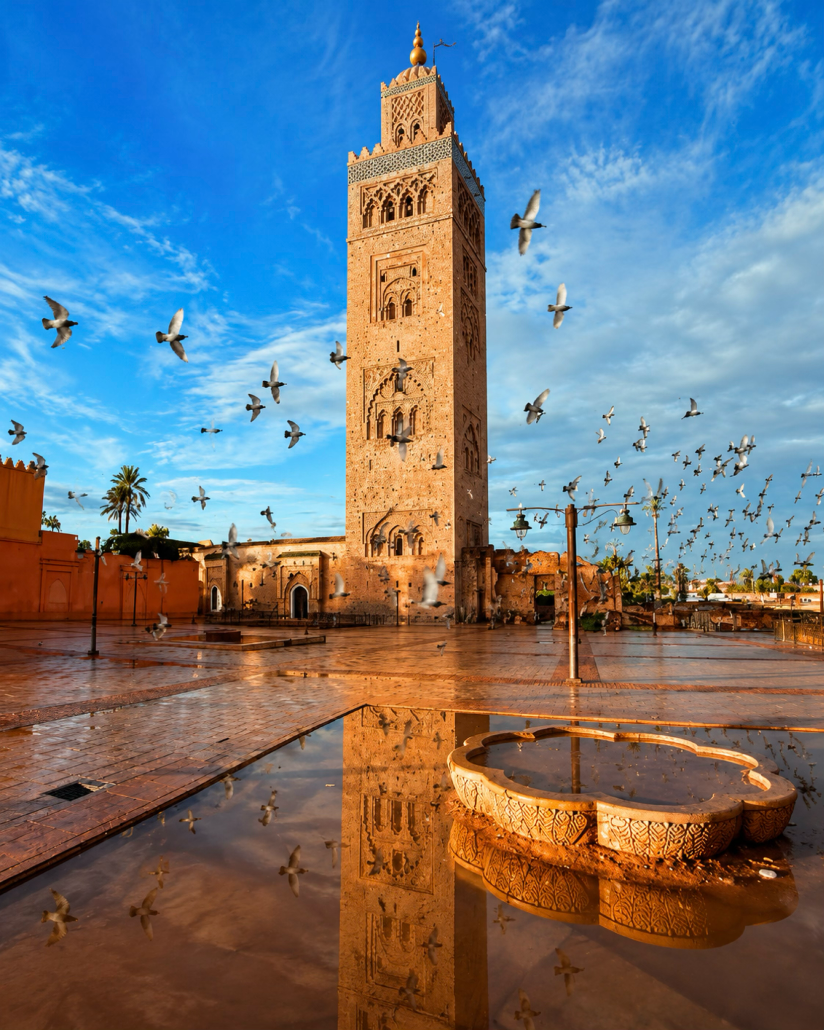
Koutoubia Mosque minaret and city square in Marrakech

Go deeper through the nearest city context

Marrakech — the city gateway to Ourika Valley

Ourika belongs naturally inside a wider Marrakech journey. The city provides the clearest base for understanding the shift from the Haouz plain toward the High Atlas, while its markets, gardens, architecture and food culture offer a distinct urban counterpoint.

Use Marrakech to give the valley scale before and after the visit. The contrast makes both places more legible: one organised through dense urban history, the other through river, cultivation, settlement and mountain relief.

Marrakech city orientationHaouz plain context High Atlas gatewaysCulture and architecture Practical travel structureWider regional routes

Continue the journey

Continue from Ourika Valley into Marrakech.

Carry the river, terraces and mountain scale back toward the city, then use Marrakech to open the wider cultural and geographic map of Morocco.