
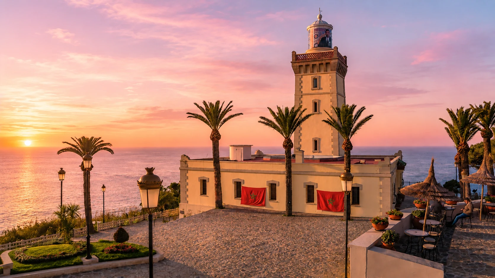
Cap Spartel lighthouse at sunset above the Atlantic near Tangier, Morocco

Visit / Place · Tangier coast · Strait of Gibraltar edge

Cap Spartel A lighthouse cape where Tangier turns toward the Atlantic horizon

Cap Spartel is one of Tangier's defining sea-edge places: a headland, a working maritime symbol and a viewpoint where lighthouse, forest, cliffs and open water shape the visit.

Arrive with the map in mind before chasing the view. The experience is strongest when the lighthouse, coastal road, forested slope and Atlantic-Mediterranean transition are read as one northern Moroccan landscape.

Why Cap Spartel matters

A cape before it is a viewpoint.

Cap Spartel matters because it gives Tangier a precise edge. The city is often described through medina streets, port history and international memory, but this cape turns that story outward toward wind, navigation, forest, cliff and the traffic of the Strait of Gibraltar.

The place is widely known for the meeting of Atlantic and Mediterranean waters. That phrase is useful as a visitor image, but the richer reading is geographical: Cap Spartel looks across a transition zone where ocean approaches, strait passage and Tangier's western coastline come into one field of vision.

The lighthouse gives the cape its vertical signature. IALA Heritage identifies Cap Spartel Lighthouse as Morocco's oldest lighthouse and notes that it has been in operation since 15 October 1864. That makes the site more than a scenic stop; it is a maritime heritage marker tied to safety, route memory and international navigation.

Cap Spartel also matters as a landscape threshold. Behind the viewpoint are trees, road curves and the green edge of Tangier's western outskirts. Ahead are water, horizon and ships. The power of the place comes from that compression: land ending, sea opening, and a lighthouse holding the line between them.

For visitors, the best experience is not only the photograph. It is the sequence of arrival, wind, light, lighthouse form, sea horizon and onward movement toward Achakkar, the Caves of Hercules or back into Tangier. Read the cape as a coastal system and it becomes much more memorable.

Core facts are grounded in IALA Heritage, the official Cap Spartel site and Moroccan National Tourist Office Tangier nature guidance. Practical details such as access, prices and opening hours should be checked close to travel.
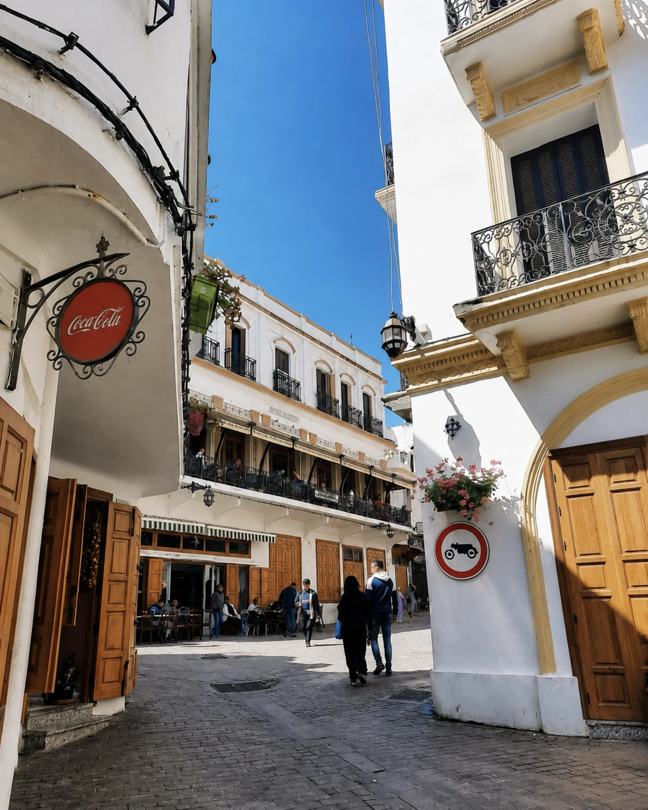
Tangier street with white buildings, balconies and a blue sky near the Cap Spartel city context

Map orientation

Use the map to place the lighthouse cape on Tangier's western edge, close to Achakkar, the Caves of Hercules and the Atlantic entrance to the Strait of Gibraltar.

Editorial reading

Its beauty comes from position, signal and restraint.

Cap Spartel is powerful because it does not need many objects to explain itself. A lighthouse, a headland, a line of water and a road from Tangier are enough. The visitor's task is to read how those elements work together.

The lighthouse is the visible sign, but the cape is the larger structure. It gathers sea weather, forest shade, exposed viewpoints and maritime history into one compact experience. That is why a short visit can still feel complete when approached carefully.

Look first for orientation rather than spectacle. Which way does the land fall? Where does the horizon open? How does the lighthouse sit between road, cliff and water? These simple questions turn the viewpoint into a place with logic.

The most rewarding photographs usually come after that reading. Instead of treating the cape as a quick stop, allow the light to change across white walls, trees, sea surface and the distant line of ships. The image then carries context, not just colour.

Respect matters here because coastal viewpoints are easy to overuse. Stay back from unsafe edges, avoid blocking paths, keep litter out of the landscape and give other visitors space to experience the horizon without noise or hurry.

When you leave, connect the cape back to Tangier. Cap Spartel explains why the city feels both Moroccan and maritime, local and outward-facing: the road returns from wind and horizon into a place shaped for centuries by passage.

Historical and heritage orientation

Read the cape through navigation, coastline and continuity.

Cap Spartel is best understood as a maritime landscape rather than a single photo point. The headland, lighthouse, forested approach and Strait horizon together explain why this edge west of Tangier has carried practical, symbolic and visitor meaning.

01Place type

A coastal headland

The site is a cape and viewpoint on Tangier's western side. Its identity comes from the meeting of landform, sea exposure, road access and the lighthouse that marks the maritime edge.

021861-1864

Lighthouse construction

IALA Heritage records that construction began in 1861 and that the light entered service on 15 October 1864, placing Cap Spartel in Morocco's modern lighthouse history.

03Navigation

A signal at the Strait

The lighthouse is tied to the Atlantic approach to the Strait of Gibraltar. Its significance is therefore practical as well as visual: it belongs to routes, ships and coastal safety.

04Today

A cared-for visitor site

The contemporary site includes heritage interpretation around the lighthouse. Details of access, tickets and visiting hours should always be checked with the official site before travel.

A visual bridge

Three readings between sea, signal and forest

Before Cap Spartel becomes a sunset image, it is a relationship between moving water, a fixed lighthouse and the land that carries Tangier toward the Atlantic. These readings help visitors slow down and see why the cape feels larger than its footprint.

01

Sea edge

Water as orientation

The view is not only blue distance. The water explains direction, exposure and passage. Read the horizon as a working maritime space as well as a place of beauty.

  • Start with the line between land and sea.
  • Notice ships, haze, wind and changing light.
  • Think of the Strait as movement, not only scenery.
02

Signal

The lighthouse as marker

The lighthouse gives the cape a readable centre. Its form turns a wide coastal panorama into a specific place with history, purpose and a clear visual anchor.

  • Read the tower against sky and water.
  • Connect the building to navigation and safety.
  • Let the architecture organise the viewpoint.
03

Approach

Forest before open horizon

The road from Tangier is part of the experience. Trees, curves and glimpses of water prepare the eye before the cape opens outward to the Atlantic and the Strait.

  • Notice the shift from city to coastal green.
  • Pause before the main viewpoint becomes crowded.
  • Use the return to Tangier as part of the reading.

Quick orientation

Type of place

A coastal headland and lighthouse site west of Tangier, best understood as a maritime viewpoint with heritage, landscape and route meaning.

Landscape context

The cape overlooks the Atlantic entrance to the Strait of Gibraltar, with forested slopes, exposed sea light and Tangier's western coastal road nearby.

Best for

Lighthouse heritage, sea views, sunset atmosphere, coastal photography, Tangier day planning and a wider reading of Morocco's northern maritime edge.

Closest city context

Tangier is the natural base for Cap Spartel, linking the cape with the medina, Kasbah, port story, Achakkar coast and nearby caves.

What visitors experience here

A place that opens from road to horizon.

Cap Spartel works in stages. First comes the road out of Tangier, then the green edge, then the lighthouse and the sudden spread of water. The visit is simple, but the setting keeps changing as light, wind and distance alter the cape.

Arrival

The turn out of Tangier

The approach matters. Leaving the city for the western coast shifts the mood from streets and port energy to trees, bends, sea air and the expectation of a viewpoint.

Light

Sea brightness and haze

The cape can feel crisp or softened depending on wind and visibility. Watch how light changes the water surface, the lighthouse walls and the distant horizon line.

Marker

The lighthouse profile

The lighthouse turns the headland into a landmark. Its value is not decoration alone; it makes the site readable as maritime heritage and a working edge of orientation.

Coast

Cliffs, road and open water

The strongest view comes from seeing the landform and the sea together. Edges, slopes, rocks and roads show that the cape is a place of exposure as much as beauty.

Forest

A green threshold

The western side of Tangier is not only coast. Forested pockets and shaded approaches give the visit contrast before the open viewpoint, especially when the sun is strong.

Pace

A short visit that rewards patience

Cap Spartel can be seen quickly, but it reads better slowly. Give time to the map, the lighthouse, the wind direction and the way Tangier sits behind the cape.

Place details and orientation

Read Cap Spartel through six defining elements

No single view explains the cape. Its meaning comes from the relationship between lighthouse, headland, water, road, vegetation and nearby Tangier coastal places.

1
The lighthouse

The tower is the site's main heritage marker and the clearest visual sign that Cap Spartel belongs to navigation as well as tourism.

2
The sea junction reading

Visitors often come for the Atlantic-Mediterranean meeting point. Treat it as a geographical transition and a Strait viewpoint, not only a slogan.

3
The headland edge

The cape's form creates drama: land drops away, water opens, wind strengthens and the horizon becomes the main spatial reference.

4
The forested approach

Trees and green slopes soften the arrival and make the final exposure to sea and sky feel sharper.

5
Heritage interpretation

The lighthouse site includes maritime interpretation. Check current official access before planning the interior, garden or museum part of the visit.

6
Nearby coastal rhythm

Cap Spartel pairs naturally with Achakkar and the Caves of Hercules, giving Tangier's western coast a clear half-day structure.

Cape, not backdrop

The place asks for orientation.

Stand back before focusing on details. The first lesson is directional: Tangier behind you, open water ahead, the lighthouse marking the edge and the coast bending toward Achakkar. This geography is what gives the cape its authority.

Then read the human layer. A lighthouse is built for attention, but not for display alone. It belongs to warnings, routes, maintenance and the patient work of maritime safety. That purpose gives the architecture more weight than a simple viewpoint would have.

Finally, return to the landscape. Wind, trees, cliff lines and traffic on the water keep the place active. Cap Spartel is memorable because it lets a visitor feel both stillness and movement at the same time.

Landscape and maritime intelligence

A lighthouse cape is a working landscape.

Cap Spartel's beauty is inseparable from use. The lighthouse is placed where geography demands attention: an exposed headland, changing weather, moving vessels and a coastline that helps define the approach to the Strait of Gibraltar.

This makes the visit richer than a scenic pause. The same elements that make the cape beautiful also explain its function: height, visibility, clear horizons, durable architecture and a position that turns local coastline into international passage.

What to notice slowly

  • Look at how the lighthouse holds the eye before the wider sea view takes over.
  • Notice wind, haze and visibility; they change the mood and the reading of the horizon.
  • Read the cape as part of Tangier, not as an isolated roadside attraction.
  • Keep the nearby caves and Achakkar coast in mind as part of the same western route.
  • Stay away from unsafe cliff edges and respect closed or managed areas.
  • Check official access details close to travel if you want to enter the lighthouse complex.

Visual reading

Three coastal languages to notice

Line and horizon

Cap Spartel is organised by long lines: the sea horizon, the road edge, the slope of land and the vertical lighthouse. These lines make the place feel calm even when the wind is strong.

Signal and shelter

The lighthouse signals outward, while the forested approach shelters the arrival. Moving between those two feelings gives the visit its rhythm.

City and open water

Tangier remains close, but the cape points away from the city. That tension between urban memory and open sea is one of Cap Spartel's most distinctive qualities.

Visual atmosphere

Light, wind and quiet transitions

From road to edge

The visit begins before the main viewpoint. Trees, curves and glimpses of water prepare the eye, then the cape opens suddenly into sea light and the clear presence of the lighthouse.

From wall to water

Read the lighthouse surfaces against the water behind them. The contrast between built form and moving sea is what gives Cap Spartel its clean visual force.

From photo to memory

The image is easy to collect, but the stronger memory comes from orientation: where you stood, which way the wind moved, how the horizon changed, and how Tangier returned behind you.

Nearby places and onward links

Connect the cape to Tangier and the northern coast

Cap Spartel belongs naturally inside a Tangier journey. Use it to connect the medina and port story with forest walks, Atlantic-facing viewpoints, coastal caves and the wider northern Morocco map.

Tangier

The closest city context for Cap Spartel. Return to Tangier to connect the cape with the Kasbah, medina, port history and Strait-facing viewpoints.

Open Tangier city guide

Northern Morocco

The broader regional frame for Tangier, Strait landscapes, Atlantic-Mediterranean crossings, Rif approaches and coastal routes.

Explore regions

Architecture & Heritage

The lighthouse gives Cap Spartel a strong heritage layer, linking architecture with navigation, preservation and maritime identity.

Read the theme

Visit Morocco places

Continue through capes, caves, beaches, valleys, waterfalls, monuments, gardens and natural places beyond the city guides.

Browse Visit places

Plan your journey

Treat Cap Spartel as a western Tangier anchor. It works well when planned with the coastal road, Achakkar and a return into the city.

Plan your journey

Stories from Morocco

Use the Stories section for richer cultural reading around place, coast, memory, architecture and the human rhythm behind landscapes.

Read stories

How to visit respectfully

Good behaviour protects the coastal experience.

Cap Spartel is easy to visit, which makes care more important. Viewpoints, road edges and managed heritage spaces can feel casual, but they still need patience, safety and respect for staff, local visitors and the landscape.

Respect here is practical. Do not cross barriers, stand too close to exposed edges, leave litter, block paths for photographs or treat managed areas as open access. If the lighthouse complex is part of your plan, verify current access through official channels before travelling.

  • Give other visitors space at the viewpoint, especially around sunset or busy periods.
  • Stay behind barriers and avoid unsafe cliff edges, even when the view is tempting.
  • Ask before photographing people, staff or private moments around the site.
  • Carry out litter and keep food packaging away from the coastal and forested areas.
  • Check current access, ticketing and opening details close to travel if entering the complex matters to your visit.

A strong first visit

Begin by locating Cap Spartel in relation to Tangier. The visit becomes clearer when you know that the city is close behind you while the cape faces the Atlantic approach to the Strait. That simple orientation makes the lighthouse more meaningful.

Arrive with enough time to look slowly rather than rushing straight to the most obvious photo. Notice the road, trees, slope and lighthouse before focusing on the horizon. If visibility is soft, let the haze become part of the experience instead of treating it as a problem.

Use the viewpoint with care. Stay within safe areas, keep the path open and avoid turning the lighthouse into only a background prop. Its importance comes from purpose: navigation, weather, maintenance and the long relationship between Tangier and maritime passage.

After the cape, continue the reading rather than ending it abruptly. The nearby western coast, Achakkar area and Caves of Hercules can help frame Cap Spartel as part of a wider coastal sequence before returning to Tangier.

  • Read the map first so the cape's position makes sense.
  • Pause for the lighthouse, then widen the view to the water and road.
  • Let weather and visibility shape the visit instead of forcing one perfect image.
  • Keep the landscape clean and avoid pressure on unsafe or managed edges.
  • Finish by connecting the cape back to Tangier and the western coast.

Careful planning note: access arrangements, prices and exact opening hours can change. Verify practical details with the official site or locally before travelling.

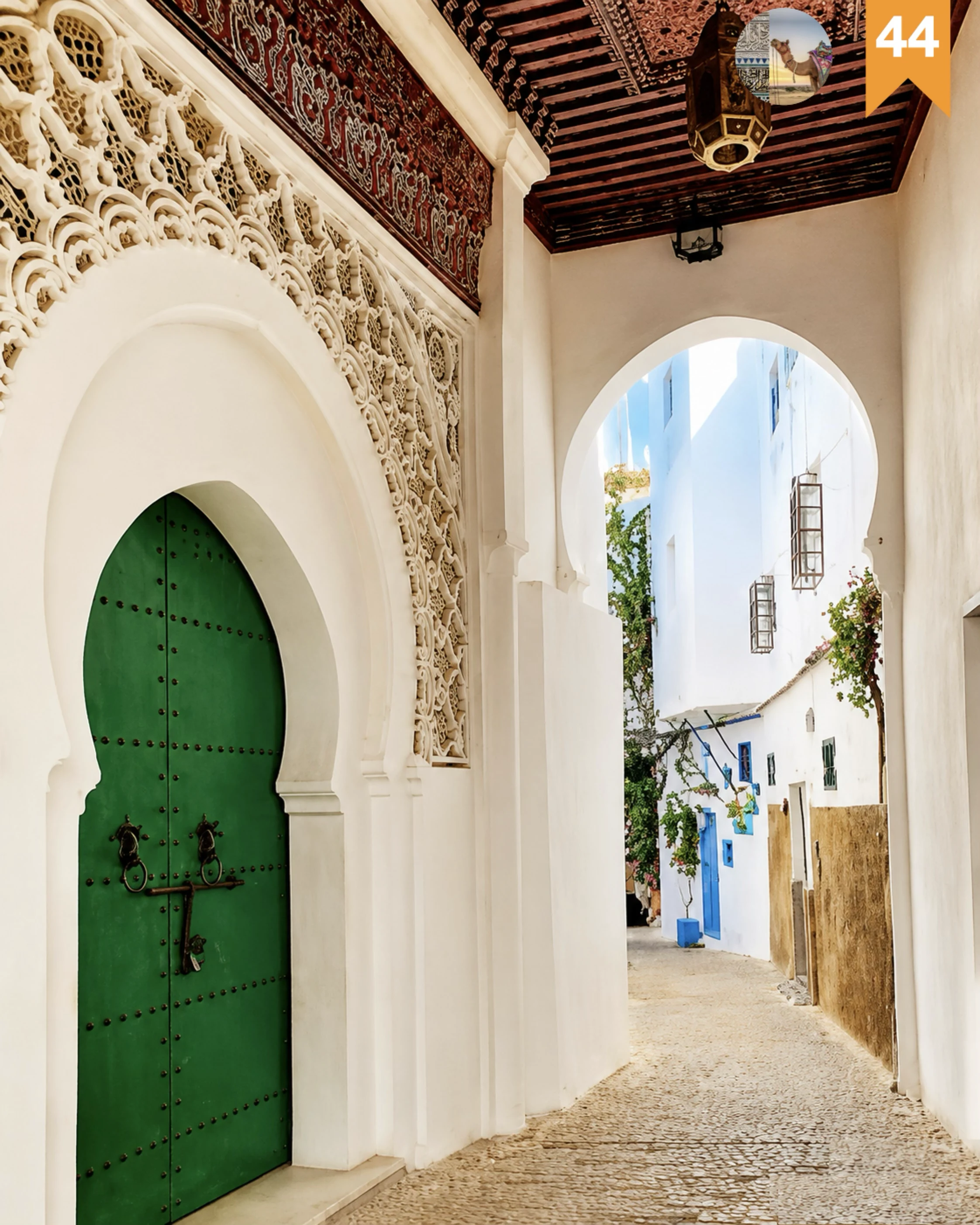
Tangier architectural passage with carved plaster, a green door and whitewashed lanes

Go deeper through the nearest city context

Tangier, the city gateway to Cap Spartel

Cap Spartel belongs naturally inside a wider Tangier journey. The city gives the cape its cultural and geographic frame: medina streets, Kasbah viewpoints, port memory, Strait-facing terraces and the coastal road that leads west toward forest and open water.

Use Tangier to widen the context after the cape itself. The return from Cap Spartel helps visitors understand the city as a place shaped by approach, departure, trade, sea air and the constant presence of horizons.

Tangier city orientationStrait viewpoints Atlantic coast routeLighthouse heritage Practical travel structureNearby coastal places

Continue the journey

Continue from Cap Spartel into Tangier and Morocco's northern coast.

Read the cape slowly, then connect it to Tangier, the Strait of Gibraltar, Atlantic-facing viewpoints, lighthouse heritage and the wider coastal map of Morocco.