
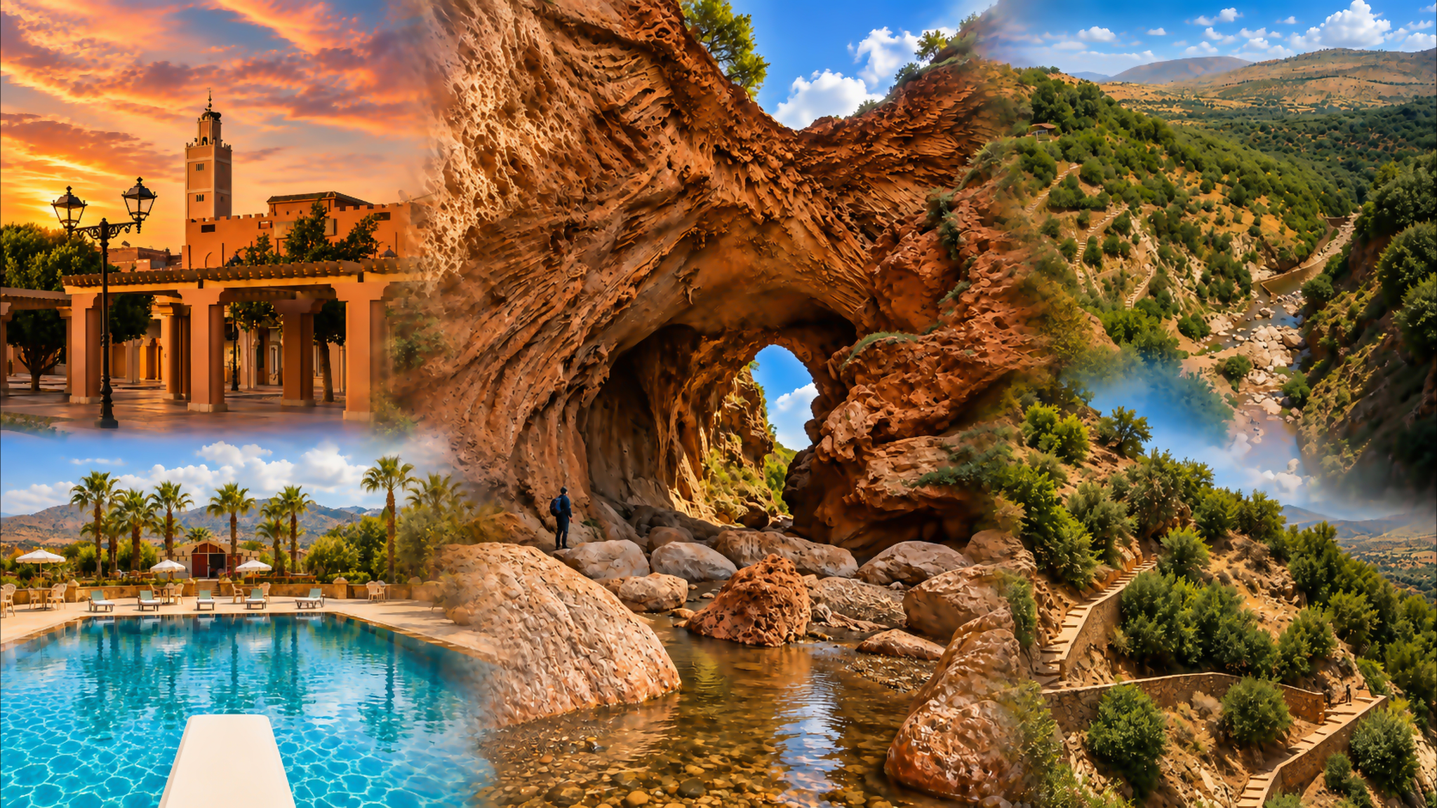
Visual composition centred on Imi n’Ifri Natural Bridge, with Moroccan town and mountain scenes

Visit / Place · Near Demnate · Central High Atlas

Imi n’Ifri Natural Bridge · A passage through water-shaped stone

Near Demnate, a vast natural arch shelters a rocky watercourse. Imi n’Ifri brings the High Atlas into close view: an open gorge, a deep stone canopy and daylight framed by the rock.

Begin above the gorge, then consider the descent. The view from below reveals the span, but the route under it depends on footing, water and conditions on the day.

Why Imi n’Ifri matters

Water has built as well as worn away.

Imi n’Ifri is a natural bridge near Demnate, in Azilal province. Its broad span crosses a gorge in the Central High Atlas, giving visitors an unusually direct encounter with a landscape shaped by water. The stone overhead, the irregular walls and the channel below belong to the same geological story.

The bridge is associated with travertine, a carbonate rock deposited by mineral-rich water. This matters because erosion alone does not explain what you see. Water can remove material, carry it in solution and deposit it elsewhere. A natural arch that looks like a single act of carving can therefore preserve a more complex history of accumulation and change.

The site is also a meeting of scales. Above, the surrounding slopes establish the mountain setting. Below, the span becomes an enclosing roof, while boulders and the stream bring attention down to individual steps. Few viewpoints communicate both experiences at once; moving between them is part of understanding the place.

Demnate gives that experience its local context. The bridge is a visit in the town’s surroundings, connected to the everyday roads and communities of this part of the Atlas. Beni Mellal belongs to a wider regional itinerary; it should not be mistaken for the town immediately beside the arch.

For a thoughtful visitor, the value lies in looking beyond the opening. Notice the stone that supports it, the water that passes underneath and the difference between exposed slopes and sheltered recesses. These relationships give the site meaning even when the light or water level differs from a familiar photograph.

Place context: Moroccan National Tourist Office. Geological reading: Geoheritage of a Mountain Tourist Route and the M’Goun Geopark geosite directory.
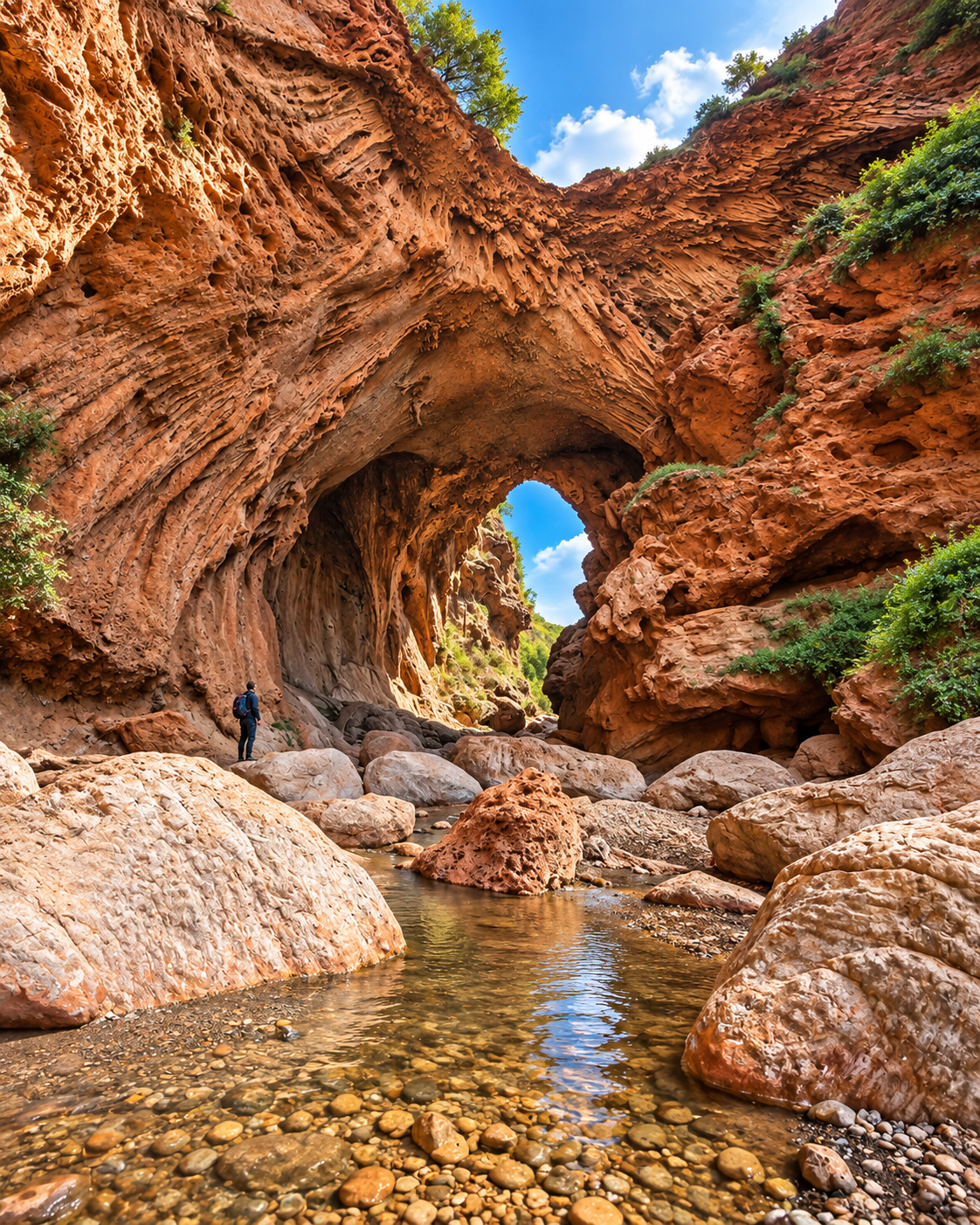
Imi n’Ifri’s natural arch above a rocky stream, with a walker showing its scale

Map orientation

The map centres on the bridge near Demnate. Open directions; confirm the walking approach locally.

Editorial reading

The opening changes everything around it.

The first impression is often the bright gap beneath the arch. Let your eye move away from that centre for a moment. The surrounding stone gives the opening its shape: uneven edges, deep hollows and projecting surfaces make the light feel sharply bounded.

Then look at the near ground. A boulder in front of the opening can seem almost as large as a distant wall. This compression is one reason a photograph can mislead about the size of the passage. A person on the established route offers a more useful reference.

The view is not symmetrical. One side may reveal more sky, another more rock; a small shift of position changes how much of the gorge appears beyond. There is no need to search for a single perfect centre. The uneven frame is part of the character of Imi n’Ifri.

Keep the upper edge in the composition when it is visible. It shows where the sheltered space meets the open hillside and helps explain how a bridge can feel like a cave from underneath. The transition is more revealing than a close photograph of the opening alone.

Finally, compare surfaces in the same light. Rough stone breaks a shadow into small marks; smoother patches return a broader glow. These differences give depth to a view that can otherwise flatten into one warm colour.

A good reading does not require reaching every recess. Choose a stable place to stop, allow other walkers to pass, and look across the space rather than moving towards an edge for a cleaner frame. The strongest observation often comes from staying still.

Natural and regional orientation

A geological landmark in Demnate’s surroundings.

Place the bridge within a landscape of rock, springs and mountain routes. Its significance is geological, while its setting connects it to the towns and communities of the Central High Atlas.

01Place type

A natural span

The arch crosses a gorge without constructed piers or masonry. The walking experience takes you towards the space beneath it, where the scale of the rock becomes much clearer.

02Water and stone

A carbonate landscape

Travertine connects the bridge to water carrying dissolved minerals. The present channel and the stone above it record different aspects of a landscape shaped over time.

03Regional context

The M’Goun geosites

The M’Goun Geopark directory presents Demnate and Imi n’Ifri together. This places the bridge within a broader approach to discovering the region’s geological heritage.

04Local reference

Demnate first

Use Demnate to orient the immediate visit. Azilal and Beni Mellal help frame the wider journey, but each requires its own route planning beyond the bridge.

A visual bridge

Three ways to bring the landscape into focus

A wide view, a middle distance and a close detail reveal different things. Give each its own attention so that the arch remains connected to the gorge around it.

01

Wide view

Keep the slopes in sight

The surrounding ground explains where the bridge sits. A composition that includes both the hillside and the gorge gives the span a setting and avoids making it appear detached from the mountain.

  • Find the line where the gorge opens.
  • Include the upper ground when the viewpoint allows.
  • Notice how vegetation marks parts of the slope.
02

Middle distance

Separate the planes

Read the foreground boulders, the arch and the far opening as three distinct layers. Their overlap creates depth, especially where shadow makes two separate rock faces appear to merge.

  • Follow the channel into the view.
  • Compare near edges with distant silhouettes.
  • Let open sky separate overlapping rock.
03

Close detail

Read the small relief

Hollows, ledges and small changes in surface texture become visible when you stop looking only at the outline. Side lighting can reveal these details without needing to touch the rock.

  • Compare smooth and irregular patches.
  • Watch how tiny shadows describe the surface.
  • Observe delicate projections from the path.

Quick orientation

Type of place

A natural rock bridge over a gorge. Best approached as a geological landscape, with a descent and uneven terrain to consider before walking below the span.

Landscape context

Near Demnate, in Azilal province and the Béni Mellal-Khénifra region. Explore the Central High Atlas within our regional guides.

Best for

Rock formations, landscape photography and an attentive walk. The mood is exploratory: allow time to pause and choose the length of the visit around conditions.

Town and city context

Demnate is the immediate town reference. The Beni Mellal guide supports a broader regional journey beyond this individual stop.

What visitors experience here

Open hillside, enclosed rock, daylight again.

The visit has a changing sense of space. What begins as a look into a gorge can become a close encounter with a high stone canopy. Let the route reveal that transition at a comfortable pace.

Arrival

The depth below the road

The first view downwards establishes the drop into the gorge. Before descending, locate the walking approach and the return route; an upper viewpoint and a walk beneath the arch are different commitments.

Enclosure

A canopy of rock

Below the span, attention moves overhead. The opening becomes a roofed passage, and the apparent weight of the stone changes the feeling of the space even while daylight remains visible ahead.

Light

Eyes adjusting to shade

The bright exterior and darker interior ask your eyes to adjust. Pause before photographing: details that look lost in shadow at first can become legible when you give them a moment.

Ground

A route that asks attention

Steps and rougher ground bring the walking pace down. Keep your hands available for balance and stop before looking through a camera; the surface underfoot deserves as much attention as the arch.

Sound

Listening inside the gorge

When water is audible, compare its sound with your footsteps and voices nearby. The sheltered space can make these small sounds more noticeable than they are on the open approach.

Return

The climb back into daylight

The return brings open air and a wider horizon back into the visit. Leave energy for the ascent and a final pause; looking back from a suitable stopping point helps settle the sequence of spaces.

Place details and orientation

Six elements that organise the view

Use these features to describe what you see. Each belongs to a different part of the bridge and its immediate surroundings.

1
The span

The body of rock overhead connects the sides of the gorge and defines the bridge’s overall form.

2
The openings

Daylight at the ends reveals the passage through the rock and sets its irregular edges in relief.

3
The watercourse

The channel gives the gorge a direction; its visible flow and accessible edges depend on conditions.

4
The boulder field

Large rocks interrupt the near view and help explain why the lower approach needs careful footing.

5
The rock surfaces

Hollows and projecting textures give the walls a different character from the loose material on the ground.

6
The gorge rim

The upper edge connects the enclosed space below to the surrounding hillside and road-level setting.

A careful eye

Look without forcing a story onto the stone.

Natural openings invite comparisons. From some angles, visitors see a map-like silhouette in the daylight beyond the bridge. Treat that resemblance as a feature of the viewpoint: a change in position changes the outline.

It is just as rewarding to observe what remains recognisable from every angle: the relationship between overhead rock, open space and the watercourse. That reading does not depend on reproducing someone else’s photograph.

Avoid assigning a precise age or origin to every visible mark. A field of hollows is something you can describe; the process that made each hollow requires closer geological investigation. Observation and explanation complement each other when their limits are kept clear.

Geology and water

From dissolved mineral to solid rock.

Water moving through carbonate terrain can dissolve minerals and transport them underground. Where mineral-rich water emerges and conditions change, calcium carbonate can precipitate as a deposit. Travertine is one expression of that process.

The geological study of Imi n’Ifri distinguishes the travertine of the bridge from the older carbonate rocks in its surroundings. This is a useful distinction: the age of the regional bedrock does not automatically give the age of the arch. The bridge belongs to a sequence of processes, rather than one simple date.

What to notice slowly

  • Distinguish the continuous rock overhead from separate boulders below.
  • Look for porous surfaces without breaking or removing fragments.
  • Compare visibly damp patches with dry, exposed stone.
  • Notice where water emerges or changes direction, if visible from the route.
  • Observe vegetation in sheltered recesses without entering them.
  • Ask a knowledgeable guide to explain the features you can actually see.

Landscape reading

Three distinctions worth keeping

Bridge and passage

“Bridge” describes the span across the gorge; from underneath, the experience is a passage through enclosed rock. Both readings are useful, because each makes a different part of the same landform visible.

Shape and viewpoint

The rock has a physical form, but the outline you see depends on where you stand. A photograph records one alignment of edges; it cannot show the full depth and changing geometry of the space.

Landscape and conditions

The bridge may be the reason for travelling here, but the day’s water, weather and route condition determine the visit. Plan around what is accessible on arrival, rather than assuming a photograph describes the current path.

Visual atmosphere

Colour held between shade and sky

Warm stone, cool shadows

Compare a sunlit surface with one facing into the passage. The contrast can make the same family of colours feel warm in one place and subdued in another. Let that range remain in a photograph instead of pushing every surface towards the same orange.

Reflections at ground level

Where still water is visible, it can reflect the opening or a small piece of sky. These fragments offer a quieter subject than the full arch. Photograph them from stable ground without stepping into the channel or blocking the walking line.

A sequence to remember

Choose a few different impressions: the first downward view, the weight of the canopy, a small texture and the return to the hillside. Together they recall the visit more fully than many versions of the same central opening.

Nearby places and onward links

Connect Demnate with the wider Atlas journey

Keep the immediate visit centred on Demnate. For a longer itinerary, use the city, region and planning guides to organise separate stops across the Atlas and its foothills.

Beni Mellal

Add a city chapter to a journey through the region. The guide gives Beni Mellal its own place in the itinerary, with space to explore beyond a single natural landmark.

Open Beni Mellal city guide

Atlas and interior Morocco

Place the Demnate area within a broader mountain itinerary. The regional collection helps organise the relationship between valleys, towns and landscapes.

Explore regional guides

Ouzoud and Azilal

Ouzoud’s waterfalls add a different water landscape to an Azilal itinerary. Plan the connection separately and leave enough time for both sites.

Browse natural places

Demnate and town life

Leave room around the bridge visit for Demnate itself. Use the wider city collection to connect natural stops with Morocco’s urban and regional contexts.

Browse city guides

Plan your journey

Build a day around the chosen walking route, local conditions and the return drive. Avoid combining several mountain stops on the strength of a map distance alone.

Plan your journey

Stories from Morocco

Continue with editorial reading that connects places to people, regional life and landscape. A broader perspective adds context after a visually focused visit.

Read stories

How to visit respectfully

Choose a route that suits the day.

Ask locally about access before committing to the descent. The lower route involves steps and uneven rock; it should not be assumed suitable for wheelchairs, pushchairs or anyone uncomfortable with exposed footing. If the descent is unsuitable, ask about an appropriate upper viewing option.

Wear shoes with reliable grip and keep hands free when moving over rough ground. Avoid entering the gorge during heavy rain, rising water or uncertain conditions. Turn back if the route requires a crossing or manoeuvre beyond your confidence; completing a loop is not the purpose of the visit.

  • Agree the route and fee before setting out with a local guide.
  • Carry drinking water and allow energy for the climb back.
  • Supervise children closely near steps, drops and the channel.
  • Leave rock, plants and any wildlife undisturbed; take all litter away.
  • Ask before photographing people and keep stopping points clear.

A strong first visit

On arrival, establish where the walk starts, how you will return and whether the lower passage is suitable that day. Tell your guide about mobility concerns or discomfort with heights before choosing the route.

At the first suitable viewpoint, take in the gorge before reaching for a camera. During the descent, separate walking from looking: pause somewhere stable to examine the span and keep moving sections free for other visitors.

Below the arch, choose a few observations rather than a list of positions to reach. The opening, an overhead surface and the watercourse give you three different subjects without requiring access to every corner.

Finish with time to recover at the top before continuing. Demnate is the immediate reference for the visit; a journey onwards to Ouzoud, Azilal or Beni Mellal needs separate road and timing decisions.

  • Confirm the approach and return before descending.
  • Choose stopping places with secure footing.
  • Give narrow sections to walkers who are passing.
  • Leave enough daylight and energy for the return.
  • Reassess the onward plan if the visit takes longer than expected.

Before travelling: confirm current access and weather locally. No fixed opening hours, admission price or guaranteed walking circuit is assumed here.

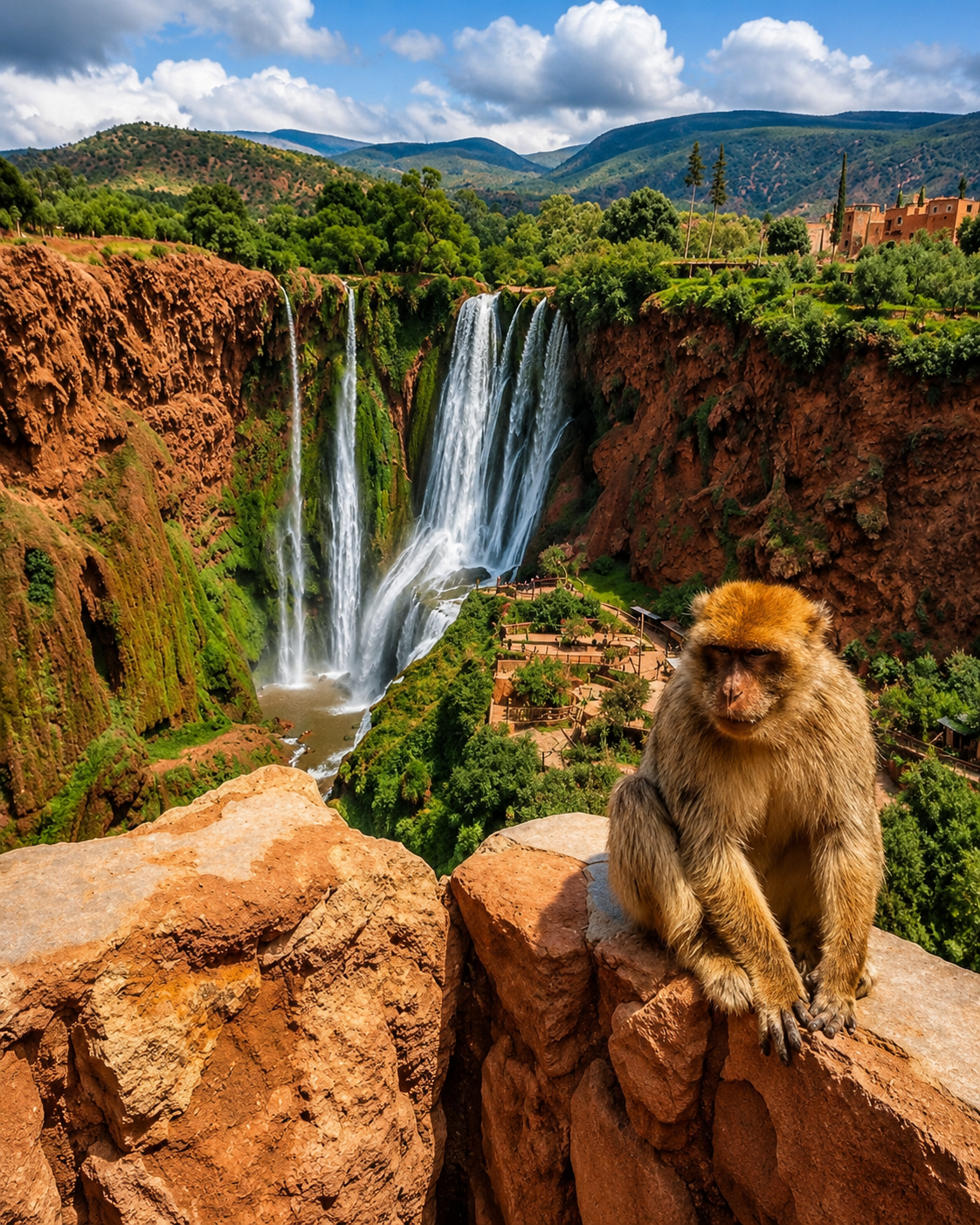
Ouzoud Falls with a macaque in the foreground, illustrating the wider Béni Mellal-Khénifra region

Go deeper through the wider regional context

Beni Mellal — continue the regional journey

Use the Beni Mellal guide to extend your travels beyond Demnate and the natural bridge. It provides a city chapter within a wider journey through the Béni Mellal-Khénifra region, with time for towns as well as mountain landscapes.

Ouzoud Falls, pictured here, offers another perspective on water in the Atlas foothills. Combine that wider landscape with a visit to Beni Mellal, allowing each stop enough time instead of treating the region as a series of viewpoints.

Beni Mellal city orientationDemnate visit contextCentral High Atlas landscapesAzilal and Ouzoud connectionsSeparate onward stopsPractical regional planning

Continue the journey

From Imi n’Ifri to the wider Atlas region.

Give the bridge time, then continue with a city chapter: Beni Mellal and a broader view of the region.