
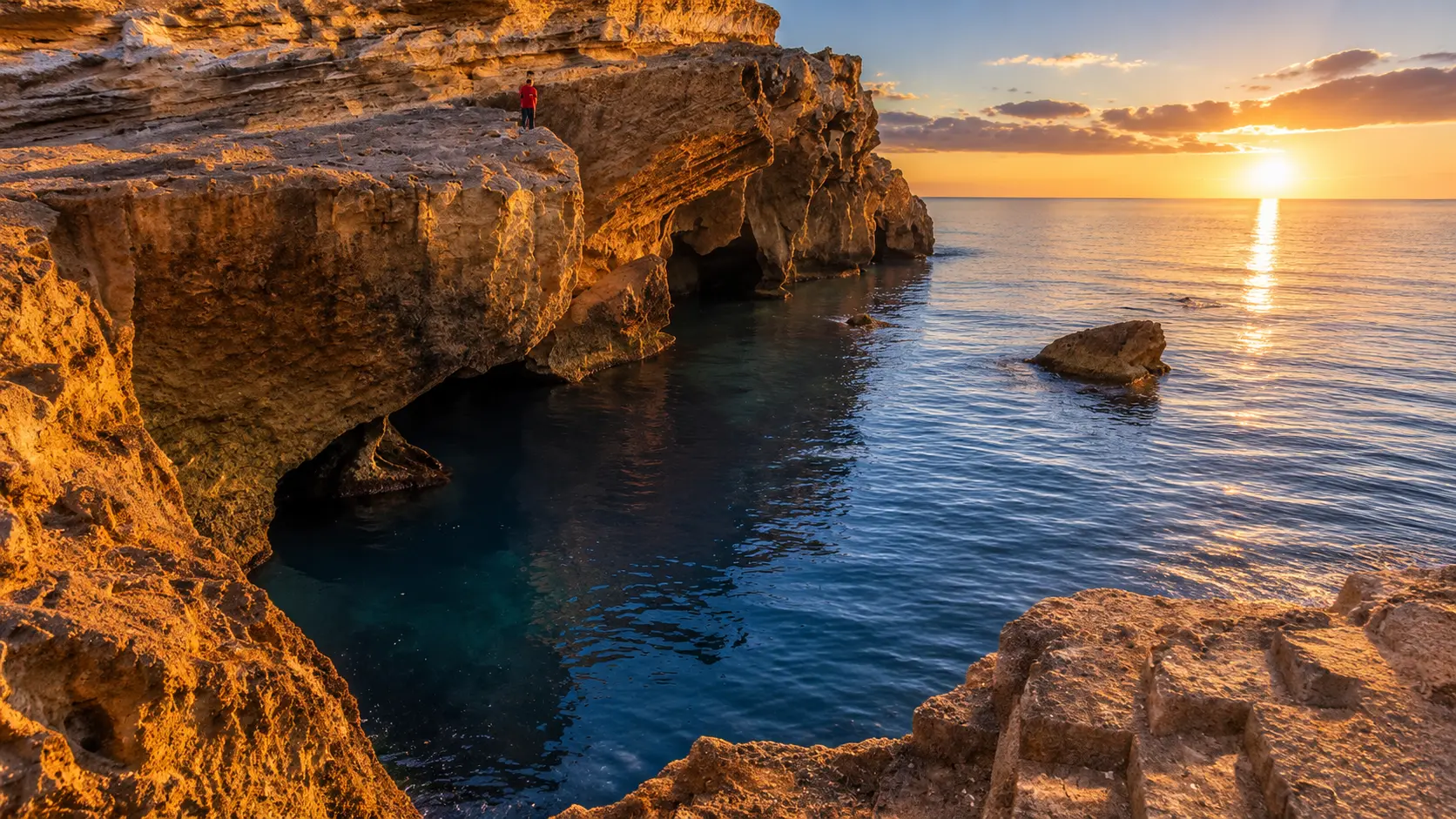
Ras El Ma beach and Mediterranean shore in Nador province, Morocco

Visit / Place · Nador province · Mediterranean coast

Ras El Ma A quiet Mediterranean edge of beach, cliffs, fishing port and Nador light

Ras El Ma is a coastal place in Nador province where a broad beach, rocky edges, working port life and the nearby Moulouya landscape meet the Mediterranean.

Read it slowly from the waterline outward: sand, cliff, harbor, horizon and the softer rhythm of a seaside town that still feels connected to local use, not only to summer escape.

Why Ras El Ma matters

A coast before it is a beach stop.

Ras El Ma is one of those Moroccan coastal places whose meaning comes from position. Also known in French as Cap de l'Eau and often linked with the Ras Kebdana name, it sits in Nador province on the Mediterranean shore of the Oriental region.

The place matters because it joins several coastal readings in one compact scene. There is the open beach, the rocky side of the shoreline, the working rhythm of a small fishing port and the wider eastward context of the Moulouya mouth near Saidia.

That combination gives Ras El Ma a different register from a resort-only beach. It can be relaxed and family-oriented in summer, but it also carries the texture of a lived coast: boats, fish restaurants, morning movement, cliff paths, sea air and local visitors using the shore in ordinary ways.

The landscape asks for a careful eye. Mediterranean water can make the first impression, but the stronger reading comes from how blue water, pale rock, sand, harbor edges and inland dryness sit beside one another without needing dramatic staging.

For visitors, Ras El Ma works best as a slow coastal pause within the Nador and Oriental Morocco map. It rewards people who look beyond the swim-and-leave rhythm, respect local space, and notice how a beach can also be a working shore.

Core orientation is grounded in the Moroccan official portal article on Ras El Ma in Nador province. Practical details such as sea conditions, services, access and seasonal crowding should be checked close to travel.
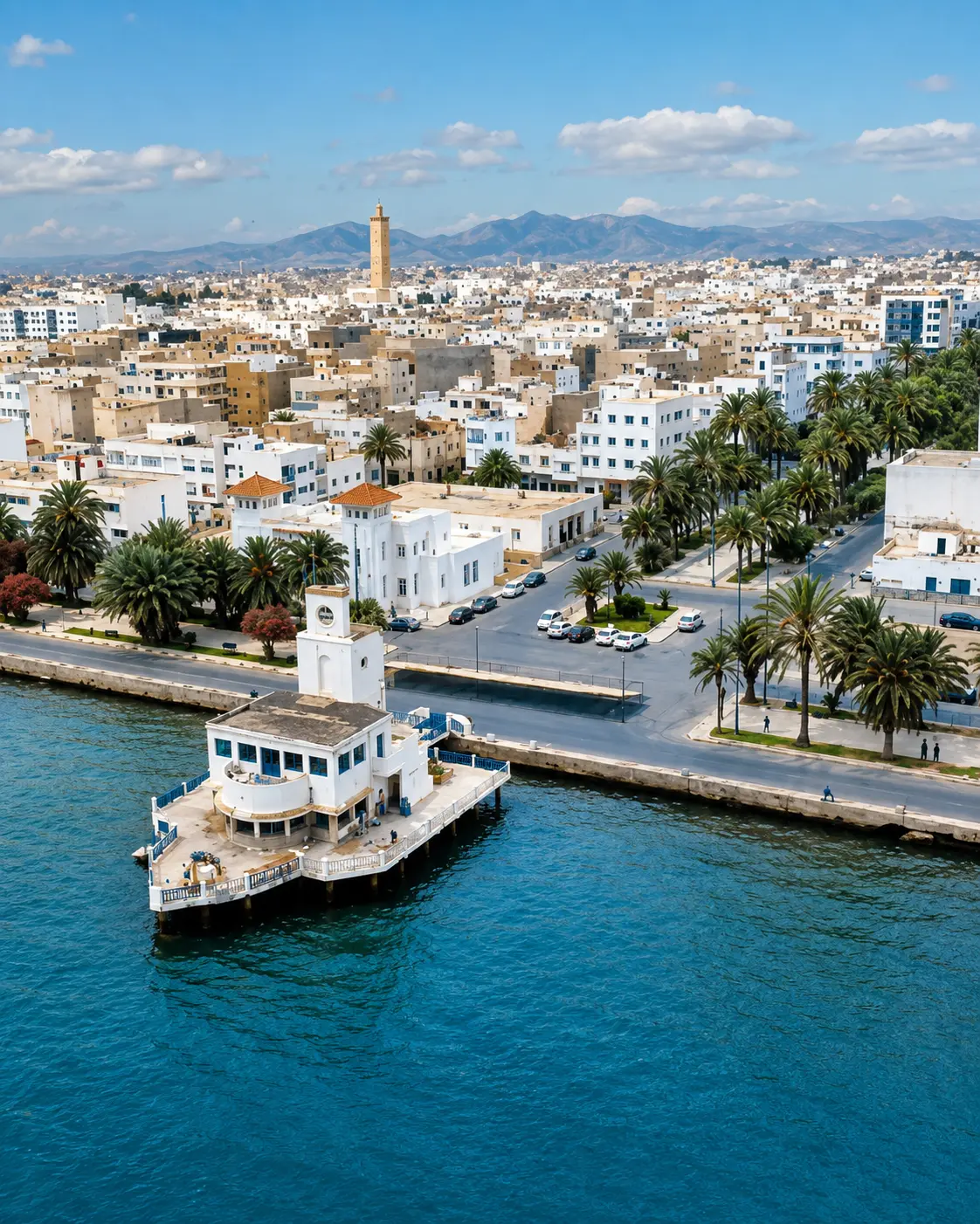
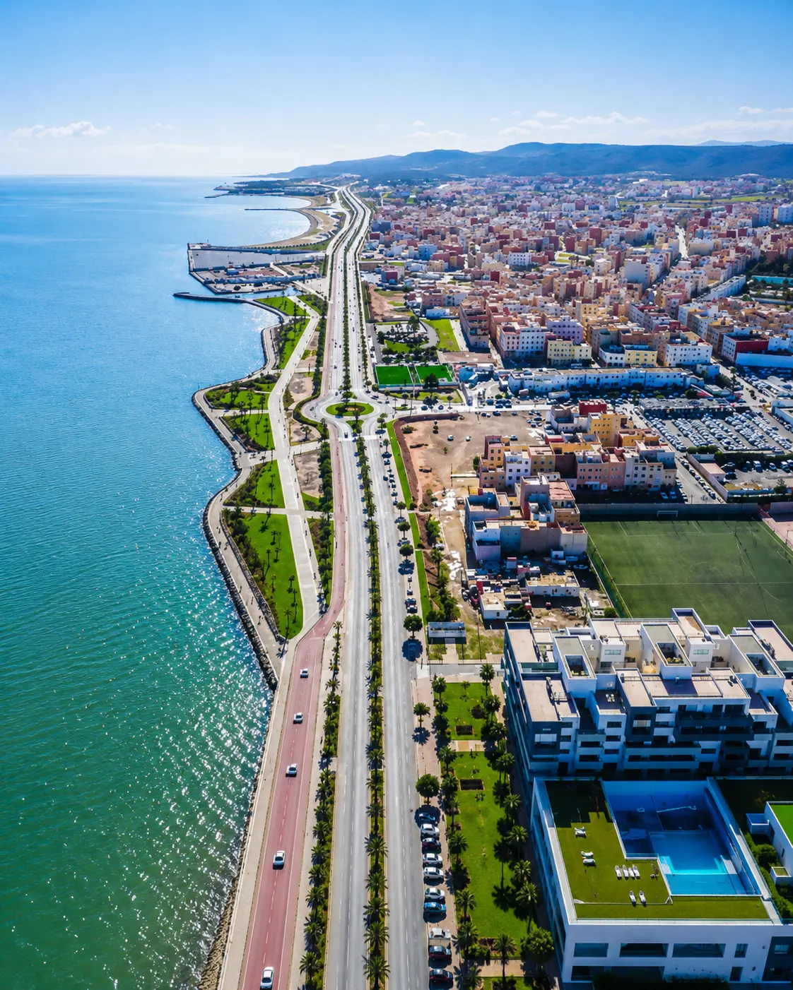
Nador city and Mediterranean coast context for Ras El Ma

Map orientation

Use the map first to place Ras El Ma on the Nador province coast, between the Mediterranean shore, Saidia direction and the Moulouya-edge landscape.

Editorial reading

Its beauty is coastal, practical and unforced.

The first image is simple: sea, shore, light. Stay longer and Ras El Ma becomes more layered. The beach opens the view, the rocks give it edge, and the port keeps the place connected to work rather than only leisure.

This is why the best visit avoids treating the coast as a flat backdrop. Look for where the beach changes into stone, where small boats and harbor structures interrupt the horizon, and where the town meets the water without becoming a staged resort scene.

The official Moroccan portal describes Ras El Ma through beach, cliffs, fishing port, seafood restaurants and its position near Saidia and the Moulouya mouth. Those details matter because they keep the place grounded in a real coastal geography.

Read the shore in layers. The water gives calm, the cliffs give drama, the fishing port gives rhythm, and the nearby Moulouya context reminds visitors that this coast is also environmentally sensitive.

Ras El Ma is strongest when seen without exaggeration. Its appeal lies in clear water, open air, family beach life, rock texture and the feeling of an eastern Mediterranean Morocco that is quieter than the country's most familiar postcard routes.

A respectful visitor keeps that balance intact: enjoy the view, but do not crowd working areas, photograph people intrusively, leave litter, climb unsafe rock edges or treat the shoreline as disposable scenery.

Coastal and regional orientation

Read Ras El Ma through shore, port and Moulouya context.

Ras El Ma is not a single monument with one date to memorize. It is a coastal place whose identity comes from names, geography and use: Mediterranean beach, rocky cliff edge, fishing activity, Nador province and the wider Oriental coast near the Moulouya mouth.

01Place type

Mediterranean beach town

Ras El Ma is best understood as a seaside town and beach area in Nador province, where recreation, local settlement and fishing-port activity sit close together.

02Names

Cap de l'Eau and Ras Kebdana

The place appears under several names in visitor and regional references, including Cap de l'Eau and Ras Kebdana. Keeping the names together helps travellers recognise the same coastal area across maps and local usage.

03Setting

Between sea and river mouth

The Moroccan official portal places Ras El Ma on the Mediterranean shore between the Saidia resort direction and the Moulouya mouth, a nearby ecological context described as Ramsar and SIBE classified.

04Local use

Fishing-port rhythm

Beyond the beach, the town has a traditional fishing port and nearby seafood-oriented restaurants. That working edge gives the visit a local rhythm that should be respected, especially around boats and people at work.

A visual bridge

Three readings between water, rock and working coast

Before Ras El Ma becomes a beach photograph, it is a relationship between sea, cliff, harbor, town and the wider Nador coastline. These readings help visitors slow down and see more than blue water.

01

Water

The horizon as orientation

The sea gives Ras El Ma its first grammar. It opens the eye, sets the pace and turns the beach into a horizontal landscape where small changes in wind, light and water colour matter.

  • Start with the full line of sea and shore.
  • Notice where calm water changes with wind.
  • Let the horizon frame the rest of the visit.
02

Edge

Cliffs, sand and scale

The rocky side of Ras El Ma gives the beach its contrast. Stone, cliff lines and pale ground prevent the coast from feeling flat, while the open sand keeps the experience accessible and generous.

  • Read the meeting of sand and rock.
  • Keep distance from unsafe edges.
  • Use height for orientation, not risk.
03

Rhythm

Port life beside leisure

The fishing-port edge is part of the place's intelligence. It keeps Ras El Ma from becoming only a beach image and reminds visitors that coastal beauty can also belong to everyday work.

  • Leave space around working areas.
  • Observe boats and harbor movement quietly.
  • Connect food, port and coast with respect.

Quick orientation

Type of place

A Mediterranean beach and coastal town in Nador province, with a shoreline experience shaped by sand, rocks, port activity and seasonal seaside life.

Landscape context

The setting belongs to Morocco's Oriental coast, close to the Saidia direction and the Moulouya mouth, where beach, cliff and ecological caution meet.

Best for

Clear-water beach time, coastal photography, cliff-and-horizon views, seafood stops, quiet walking and a slower reading of Nador province's Mediterranean edge.

Closest city context

Nador gives the strongest city context for travellers connecting Ras El Ma with the wider Oriental coastline, Marchica lagoon, regional routes and seaside towns.

What visitors experience here

A coast that changes from horizon to harbor.

Ras El Ma works in stages. First comes the Mediterranean openness: water, sky and the long visual calm of the beach. Then the details become clearer: rock, harbor edges, family movement, fishing rhythm and the dry inland tone behind the shore.

Arrival

The wide blue opening

Arrival is often defined by space. The beach and sea open quickly, giving the place a calm first impression before the visitor starts noticing port activity, cliff texture and the settlement behind the water.

Light

Mediterranean brightness

The light can be clean and direct, especially around open sand and water. It sharpens the colour of the sea, flattens distant haze and makes the pale rock edges read more clearly against the blue.

Movement

From beach to harbor

The most useful walking rhythm is lateral. Move along the shore, then toward the port edge where the visit shifts from leisure into a more local reading of boats, work, food and coastal routine.

Texture

Sand, stone and salt

Ras El Ma is not visually complicated, and that is part of its strength. Sand, wet rock, harbor surfaces, dry ground and salt air create a modest texture that feels honest rather than polished.

Local rhythm

A working seaside edge

The fishing-port context gives the place a rhythm beyond beach use. Visitors should observe without blocking movement, especially near boats, working areas and people handling the practical life of the shore.

Pace

A slower coastal pause

The coast rewards a slower visit: a swim or walk, a look toward the cliffs, a pause near the port, and enough time to understand why the place belongs to the wider Oriental shoreline.

Place details and orientation

Read Ras El Ma through six defining elements

No single detail explains the place. Its identity comes from the relationship between beach, rock, fishing port, Nador province, Moulouya-edge context and the changing rhythm of the seasons.

1
Mediterranean beach

The broad beach gives Ras El Ma its easiest entry point: open water, sand, swimming atmosphere and a relaxed seaside frame.

2
Rocky cliff edge

Natural rock and cliff sections add scale and contrast, but they also require caution, distance and good judgement around unstable or exposed areas.

3
Fishing port

The port keeps the coast connected to work, boats and seafood culture. It should be approached as a working place, not only a photo subject.

4
Moulouya context

The nearby Moulouya mouth gives the wider area ecological importance. Visitors should treat beach edges, water and litter with real care.

5
Nador province route

Ras El Ma belongs naturally to an Oriental coast itinerary connected with Nador, Saidia direction and Mediterranean route planning.

6
Seasonal rhythm

The atmosphere can shift between lively summer beach use and quieter coastal pauses. Plan flexibly and check local conditions close to travel.

Coast, not backdrop

The place asks for a careful eye.

Begin with the whole shoreline. The beach, harbor and cliffs make more sense when read together than when separated into quick snapshots. Ras El Ma is not only a place to face the sea; it is a place to understand a working Mediterranean edge.

Then move closer. The details are modest but valuable: rope, boats, wet stone, sand texture, restaurant life, cliff shadow and the way local families use the shore. These ordinary elements give the place its authenticity.

Finally, connect the visit back to Nador province. The coast here belongs to a wider eastern Moroccan geography of beaches, lagoons, river mouth, fishing activity and seaside towns rather than to one isolated viewpoint.

Landscape and coastal intelligence

Water is not just scenery here.

The coastal character of Ras El Ma is not only visual atmosphere. Sea, sand, cliff, port and the nearby Moulouya landscape shape how the place is used, photographed, protected and remembered.

That is why the strongest reading is practical as well as beautiful. Clear water invites leisure, but working-port edges need space; cliffs invite viewpoints, but also caution; nearby ecological context asks visitors to keep the shore clean and light in their footprint.

What to notice slowly

  • Look at the whole beach before focusing on one viewpoint or photograph.
  • Notice how the water colour changes with wind, depth and light.
  • Read the cliff edge as a natural boundary, not as a playground.
  • Keep working-port areas clear for local movement and fishing activity.
  • Connect Ras El Ma to Nador, Saidia direction and the Moulouya-edge landscape.
  • Leave no litter and avoid disturbing sensitive shore or river-mouth environments nearby.

Visual reading

Three coastal languages to notice

Open water and horizon

Ras El Ma speaks first through openness. The horizon gives the place calm, while the changing water surface makes the coast feel alive without needing heavy visual drama.

Cliff edge and beach scale

The meeting of rock and sand gives the place its physical contrast. Read the cliff as structure and boundary, then return to the beach to understand the full scale of the shore.

Working coast and visitor care

Boats, port edges and seafood activity keep the place connected to local livelihood. The most respectful visitor gives working areas space and photographs the scene without intruding.

Visual atmosphere

Blue water, pale rock and quiet transitions

From distance to detail

Start with the wide sea and beach line, then move closer to read the port edge, cliff texture, wet stone, sand marks and small signs of everyday use. The place becomes richer when the eye leaves the horizon and returns to ground level.

From blue to gold

The strongest visual contrast is simple: Mediterranean blue against pale sand, rock and warm coastal light. Avoid forcing the scene into artificial colour; its beauty comes from clarity, air and honest texture.

From photo to memory

The image is easy to collect, but the deeper memory comes from time: wind on the water, footsteps near the shore, boats shifting near the port and the calm of a coast that still feels locally used.

Nearby places and onward links

Connect Ras El Ma to the wider Oriental coast

Ras El Ma belongs to a broader eastern Mediterranean itinerary. Nador gives the clearest city context, while Saidia direction, the regional coast and Morocco's Visit pages widen the route.

Nador

The strongest city context for Ras El Ma. Use Nador to frame Marchica lagoon, the wider province, port culture and eastern Mediterranean travel planning.

Open Nador city guide

Saidia

Saidia gives useful coastal contrast: a better-known resort direction near the same northeastern shore, helpful for reading Ras El Ma as quieter and more local.

Open Saidia city guide

Regions of Morocco

Use the region hub to connect the Oriental coast with Morocco's broader Mediterranean, Rif, Atlantic, Atlas and southern landscapes.

Explore regions

Visit Morocco places

Continue through beaches, lagoons, caves, mountains, parks, monuments and natural sites beyond the city guides.

Browse Visit places

Plan your journey

Treat Ras El Ma as a coastal pause within a wider route, not only a beach stop. Connect it carefully with Nador and eastern Morocco planning.

Plan your journey

Stories from Morocco

Use the Stories section for deeper reading around coast, memory, local life and the slower details behind Moroccan landscapes.

Read stories

How to visit respectfully

Good behaviour protects the coast.

Ras El Ma is a beach, a town edge and a working shore. Respect means leaving space for local families, fishers, restaurant workers and people using the coast in ordinary ways. Ask before photographing people and avoid turning private or working moments into content.

Respect also means caring for the shoreline. Do not leave litter, drive or walk carelessly over sensitive edges, crowd boats, climb risky cliffs, damage rock surfaces or ignore changing sea conditions. A slower visitor sees more and leaves less pressure behind.

  • Ask clearly before photographing local people, fishers, families or restaurant workers.
  • Keep port movement clear and avoid blocking boats, ropes, equipment or service areas.
  • Carry out your rubbish and be especially careful near water, rocks and beach edges.
  • Use caution around cliffs, waves and exposed sun; conditions can change quickly.
  • Check current sea, access, parking and local service conditions close to travel.

A strong first visit

Begin with the full shoreline so the place reads as one coastal scene: beach, water, port, cliff and town edge. This first view gives the visit structure before the details start competing for attention.

Then walk slowly along the beach or toward the harbor edge, keeping enough distance from working areas. Notice where the atmosphere shifts from leisure to local routine: boats, fish, restaurants, family movement and the practical use of the shore.

If you climb or seek a higher view, keep it safe and respectful. The cliffs are part of the visual identity, but the point is orientation, not risk. The better view is the one that helps you understand sea, rock and settlement together.

Afterward, connect the visit to Nador and the wider Oriental coast. Ras El Ma feels stronger when it is not isolated from Marchica, Saidia direction, the Moulouya landscape and the Mediterranean route structure around Nador province.

  • Start with the full beach and horizon before focusing on one photo angle.
  • Move from open shore to harbor edge without blocking local work.
  • Use cliff viewpoints cautiously and stay away from unstable or exposed edges.
  • Support local services with courtesy, patience and fair-minded interaction.
  • Finish by connecting Ras El Ma back to Nador and the Oriental coast.

Careful planning note: sea conditions, access, services, seasonal crowding and exact travel times can change. Verify practical arrangements locally before travelling.

Nador city and Mediterranean coast, the gateway context for Ras El Ma

Go deeper through the nearest city context

Nador - the city gateway to Ras El Ma

Ras El Ma belongs naturally inside a wider Nador province journey. The city context helps visitors connect the beach with eastern Mediterranean routes, Marchica lagoon, port culture, coastal towns and the quieter landscapes around the Oriental shore.

Use Nador to widen the context after the beach itself: the visit becomes stronger when Ras El Ma is treated as part of a regional coast shaped by water, fishing, family travel, river-mouth ecology and local seaside rhythm.

Nador city orientationOriental coast context Marchica lagoon readingFishing-port rhythm Practical travel structureNearby seaside highlights

Continue the journey

Continue from Ras El Ma along the Oriental coast.

Read the beach slowly, then connect it to Nador, Saidia direction, Marchica lagoon, the Moulouya-edge landscape and Morocco's wider Mediterranean map.