

Oued Laou Coast at sunset with Mediterranean water, white town buildings and Rif mountain slopes

CITY / DESTINATION · Rif coast · Tétouan province

Oued Laou

Oued Laou is where the Laou river reaches the Mediterranean, creating a coastal place shaped by beach, harbour, valley agriculture, summer family rhythm and the steep edges of the Rif.

Begin with the full bay before moving closer. The strongest reading is not only the beach: it is the meeting of river, sea, town, fishing harbour, coastal road and mountains.

Why Oued Laou Coast matters

A coast where the river explains the place.

Oued Laou matters because it is not only a beach name. The place takes its identity from water moving in two directions: the Laou river descending from the Rif landscape and the Mediterranean opening outward in a long blue curve. That meeting gives the coast its shape, its working rhythm and much of its visual character.

The town is often approached from Tétouan along the Rif coastal road, where cliffs, coves and sea views make the arrival part of the experience. This matters for visitors because Oued Laou is best understood as a route place: a coastal pause between Tétouan, the mountain valleys and the wider northern Morocco shoreline.

Its beauty is direct rather than polished. White buildings gather near the waterfront, fishing boats and small harbour activity keep the coast practical, and the beach carries a strongly Moroccan family rhythm in high summer. Outside the busiest weeks, the same waterfront can feel quieter, more local and more spacious.

The Laou river mouth adds a second layer. It links the visible coast to the inland valley behind it, where water, gardens, settlements and mountain roads explain why this is more than a strip of sand. Looking carefully means keeping both landscapes in view: the open sea in front and the Rif hinterland behind.

For Exotic Morocco, Oued Laou belongs in the Visit section because it is a place of landscape reading. It teaches visitors to notice scale, wind, working life, seasonal pressure, water quality, road edges and the difference between a quick beach stop and a coastal place with a real geography.

Place context is cross-checked with Visit Tetouan's Oued Laou overview and Tétouan background from the Moroccan National Tourist Office. Check swimming, road and weather conditions locally before travelling.
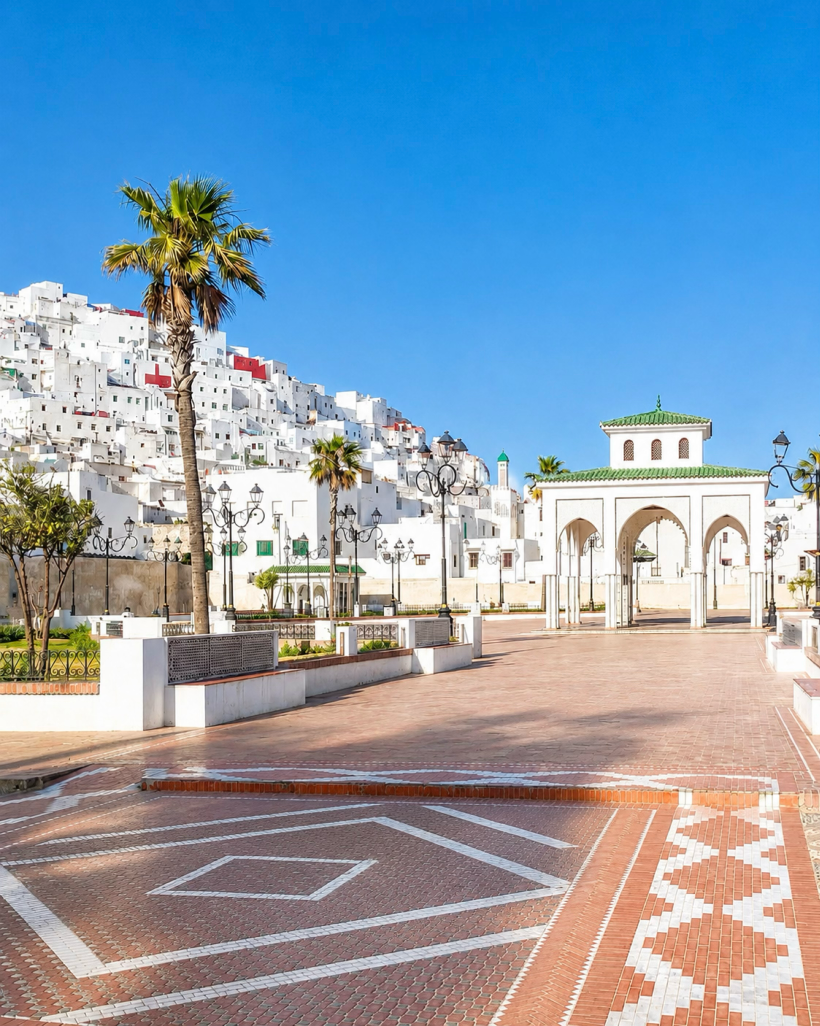
Tétouan square with white hillside houses, a palm tree and a green tiled gateway

Map orientation

Use the map to place Oued Laou between the Mediterranean shoreline, the Laou river mouth and the road connection back toward Tétouan.

Editorial reading

The shoreline is beautiful because it is legible.

The first view is generous: sea, beach, town and mountains in one frame. But the deeper reading begins when the coast stops being a postcard and becomes a system. The road follows the slope, the town holds the waterfront, the harbour keeps the sea practical, and the river explains the valley behind the beach.

This is why Oued Laou rewards a slower eye. Watch how the colour changes from mountain brown to white walls to blue water. Notice where the beach becomes working edge, where the town turns inland, and where the river mouth softens the line between land and sea.

The place also asks for seasonal awareness. In high summer it can be lively with Moroccan holiday families; in calmer periods, the same coast reads through space, wind and light. Neither version is more authentic than the other. They are different rhythms of the same local coastline.

Photograph it from above if you can, then return to human scale. The high view explains geography; the promenade, harbour, sand and river edge explain use. Keeping those two views together gives the visit more intelligence than a single beach image can carry.

The strongest memory is usually the meeting of contrasts: mountain road and sea horizon, bright walls and rough slopes, family beach life and fishing work, open water and the quieter line of the river. Oued Laou is modest, but it is not thin.

Respect begins with that modesty. This is a lived coast, not a resort stage. Give space to families, fishers, local businesses and private homes, and treat the river mouth and beach as shared environments rather than disposable scenery.

EXPLORE

Oued Laou

Historical and coastal orientation

Read the place through river, road and sea.

Oued Laou is a northern Moroccan coastal place whose identity is tied to the Laou river, the Mediterranean shore and the Rif landscape behind it. The safest editorial reading is geographic rather than inflated: this is not a monument claiming grand status, but a beach town and river-mouth coast where movement, water and everyday use shape the visitor experience.

01Place type

Coast and river mouth

The name points to the watercourse. Oued Laou is best introduced as a Mediterranean coastal place at the mouth of the Laou river, with beach, town and harbour all belonging to the same setting.

02Regional setting

Tétouan province context

The coast sits in the northern Morocco orbit of Tétouan, with the city providing the clearest cultural and travel base for understanding the route, the white urban language and the wider Mediterranean edge.

03Landscape logic

Rif slopes meet the sea

Oued Laou's visual force comes from compression: steep land, open water, a compact town edge and a coast road that reveals the shoreline from above before visitors reach the beach itself.

04Visitor caution

Seasonal and local rhythm

The coast can feel very different between high summer and quieter months. Avoid fixed assumptions, check local conditions, and treat swimming, parking, roads and services as practical details that can change.

A visual bridge

Three readings between water, slope and town

Oued Laou is easy to enjoy quickly, but more rewarding when read in layers. These three readings help visitors move beyond beach scenery and notice how the coast is organised.

01

Water

River meeting sea

The river mouth gives Oued Laou its deeper structure. It connects the beach to the valley and reminds visitors that the coast is part of a water system, not just a line of sand.

  • Look for the shift between river edge and open sea.
  • Notice how the flat coast contrasts with the rising Rif.
  • Treat the river mouth as a sensitive shared space.
02

Slope

The coast from above

The arrival view is part of the place. From the road and higher edges, Oued Laou reads as a meeting of white town, wide water, beach curve and mountain mass.

  • Begin with the full shoreline before entering the town.
  • Use distance to understand the scale of the bay.
  • Watch how late light warms the slopes without losing the blue water.
03

Use

A lived Mediterranean edge

The coast has leisure, but it is also practical. Harbour activity, simple food places, family movement and local traffic all keep the waterfront connected to everyday life.

  • Give room to working spaces near the harbour.
  • Read restaurants and beach life as local rhythm, not decoration.
  • Keep photography respectful around people and homes.

Quick orientation

Type of place

A Mediterranean coast and river-mouth place, best understood through beach, harbour, Laou river, white town edge and Rif mountain setting.

Region context

Part of the northern Morocco and Rif travel map, with a coastal identity shaped by Mediterranean water and routes back toward Tétouan and the mountain interior.

Best for

Wide coastal views, sunset light, beach walks, fishing-harbour atmosphere, relaxed food stops, landscape photography and a slower reading of the Rif shoreline.

Closest city context

Tétouan is the strongest guide-city context, especially for travellers combining a UNESCO-listed medina, Andalusian craft heritage and Mediterranean day trips.

What visitors experience here

A coast that changes from panorama to local detail.

Oued Laou works first as a wide view. The Mediterranean opens in blue, the town gathers in pale blocks, and the Rif slopes hold the background. Then the visit becomes more intimate: a harbour edge, beach umbrellas in season, small food places, river-mouth quiet and the practical rhythm of a town facing the sea.

Arrival

The bay from the road

The best first impression often comes before arrival, when the coast appears below the road. This higher angle makes the geography clear: slope, town, beach, water and mountain line in one calm composition.

Water

Mediterranean blue with a river memory

The sea gives the page its colour, but the river gives it intelligence. Look for the softer river-mouth edge and how it changes the reading of the beach from leisure space into landscape system.

Town

White walls against dry slopes

Oued Laou's buildings sit between water and hillside. Their light surfaces make the coast feel bright without needing heavy visual drama, especially when the late sun warms the mountain edges.

Harbour

Working life beside the beach

The harbour keeps the coast grounded. Boats, nets, movement and simple food places help visitors understand that the shoreline is used, maintained and lived, not only admired.

Season

Family energy and quieter pauses

In peak summer, the waterfront can be full of Moroccan holiday life. At quieter times, the same place opens into more space, more wind and a stronger sense of the surrounding landscape.

Pace

A visit that benefits from slowing down

The coast is more rewarding when visitors move in stages: viewpoint, beach, harbour, river mouth, then a return toward Tétouan or the Rif interior. Each stage changes what the place means.

Place details and orientation

Read Oued Laou through six defining elements

No single detail explains the coast. Its identity comes from the relationship between river mouth, beach, harbour, town edge, coastal road and the Rif landscape behind it.

1
Laou river mouth

The river gives the place its name and links the beach to the inland valley, making water movement central to the reading of the coast.

2
Mediterranean beach

The beach is the most immediate visitor surface, but it changes with season, weather, family use and local conditions.

3
Fishing harbour

The harbour adds working character and keeps the coast connected to everyday maritime life rather than pure resort imagery.

4
White town edge

The town's pale buildings create the bright coastal profile seen from above and form the human scale behind the beach.

5
Rif coastal road

The approach road is part of the visual experience, giving elevated views across cliffs, sea and settlement before the coast is reached.

6
Tétouan connection

Tétouan gives the strongest urban context, pairing Oued Laou's coast with medina heritage, craft traditions and northern Morocco travel structure.

Coast, not backdrop

The place asks for a wide eye.

Stand above the bay before reducing Oued Laou to beach detail. The first lesson is spatial: a compact town held between a blue Mediterranean plane and dry mountain slopes, with the river giving the shoreline a second direction.

Then move closer. The harbour, seafront, sand, road edges and river mouth each change the meaning of the coast. What looked simple from above becomes a set of working relationships between water, movement, family life and local economy.

Finish by reconnecting the view to Tétouan and the Rif. That wider frame helps Oued Laou feel like part of northern Morocco's coastal geography rather than an isolated beach stop.

Landscape and water intelligence

The river mouth is the quiet key.

Oued Laou's visual pleasure is immediate, but its landscape intelligence sits in the river mouth. The coast is shaped by a meeting of fresh water, sea movement, beach use and valley geography. That makes the place more complex than a simple Mediterranean view.

The Rif slopes matter just as much. They compress the coast, frame the town and make the arrival view dramatic without needing artificial colour. The best photography keeps the water blue, the walls bright and the mountain tones natural.

What to notice slowly

  • Look at the full curve of sea, town and slope before entering the waterfront.
  • Notice where the river mouth changes the texture and mood of the beach edge.
  • Distinguish leisure spaces from working harbour areas and private homes.
  • Watch how late light warms the mountain sides while the sea stays clear and blue.
  • Connect the coast back to Tétouan rather than treating it as a detached resort stop.
  • Keep local conditions in mind around swimming, wind, traffic and crowded summer periods.

Visual reading

Three coastal languages to notice

Blue water and dry land

The coast is strongest when the Mediterranean is allowed to stay blue and the Rif slopes stay earthy. The contrast is natural, precise and more convincing than heavy colour grading.

Town edge and harbour use

Oued Laou's human rhythm comes from the line where beach, harbour, promenade and homes meet. Look for use before ornament: boats, paths, terraces, parking, shade and movement.

River line and inland memory

The river mouth pulls the eye inland. It reminds visitors that the place belongs to a valley as much as to the sea, and that water links coast, gardens, roads and settlements.

Visual atmosphere

Light, water and quiet transitions

From panorama to waterfront

Start with the high view, then let the scene become smaller: rooftops, beach lines, harbour details, fishing gear, cafe terraces and the soft edge where the river reaches the sea.

From mountain colour to sea colour

The palette is already rich: dusty slopes, white walls, terracotta roofs, blue water and pale evening sky.

From photo to memory

The lasting memory comes from relationships: the road above the town, the curve of the bay, the sound of the waterfront, the quieter river mouth and the sense of Tétouan waiting behind the coast.

Nearby places and onward links

Connect Oued Laou to the wider northern Morocco map

Oued Laou belongs naturally to a Tétouan-based coastal and Rif itinerary. Use it to connect Mediterranean water, mountain roads, medina heritage and slower northern Morocco travel.

Tétouan

The strongest city context for Oued Laou. Tétouan gives visitors UNESCO-listed medina depth, Andalusian craft memory and a refined base for Mediterranean day trips.

Open Tétouan city guide

Northern Morocco & Rif

The regional frame for Rif mountains, Mediterranean towns, white medinas, coastal roads and the quieter landscapes that sit between city and sea.

Explore the region

Visit Morocco places

Continue through beaches, lagoons, mountains, caves, valleys, coastlines and heritage places beyond the city guides.

Browse Visit places

Architecture & Heritage

Pair Oued Laou with Tétouan's white medina and craft traditions to understand how northern Morocco moves between coast, city and material culture.

Read the theme

Plan your journey

Treat Oued Laou as a coastal anchor in a wider route rather than a single beach stop. Build time for road views, weather changes and local rhythm.

Plan your journey

Stories from Morocco

Use the Stories section for richer reading around place, memory, landscapes and the human rhythm behind Morocco's visual geography.

Read stories

How to visit respectfully

Good coastal behaviour keeps the place generous.

Oued Laou is a lived waterfront. Respect begins with simple awareness: families may be using the beach, fishers may be working near the harbour, homes sit close to visitor areas, and the river mouth should not be treated as empty ground.

Move with care around sand, water, roads and local businesses. Do not leave litter, block working access, photograph people closely without asking, or treat private buildings as scenery. A slower visitor usually sees more and creates less pressure.

  • Ask before photographing people, family groups, fishers, shopkeepers or private thresholds.
  • Keep distance from working harbour areas unless access is clearly public.
  • Carry out litter and avoid leaving plastic, food waste or beach debris behind.
  • Check local advice for swimming, wind, currents and weather, especially outside calm conditions.
  • Drive patiently on coastal and mountain roads, and avoid unfamiliar road sections after dark when visibility is poor.

A strong first visit

Begin from an elevated view if your route allows it. Seeing the whole coast first gives the visit its structure: Mediterranean water, pale town edge, river mouth and Rif slopes can be understood together before the beach details take over.

Then walk the waterfront slowly. Let the place shift from panorama to use: beach, harbour, seafront food, local movement, fishing work and the softer river edge. This rhythm keeps Oued Laou from becoming only a quick photo stop.

After the coast, reconnect the visit to Tétouan. The city adds cultural depth through its medina, craft heritage, white architecture and northern Moroccan urban rhythm, making Oued Laou feel part of a larger travel landscape.

  • Start with the full shoreline and mountain setting from above or from the edge of town.
  • Walk the beach and harbour areas without intruding on work or private space.
  • Pause near the river mouth with care for water, birds, vegetation and local use.
  • Keep the visit flexible around weather, wind, traffic and summer crowds.
  • Finish by linking the coast back to Tétouan and the wider Rif route.

Careful planning note: swimming conditions, services, road comfort and seasonal crowding can change. Verify practical details locally before travelling.

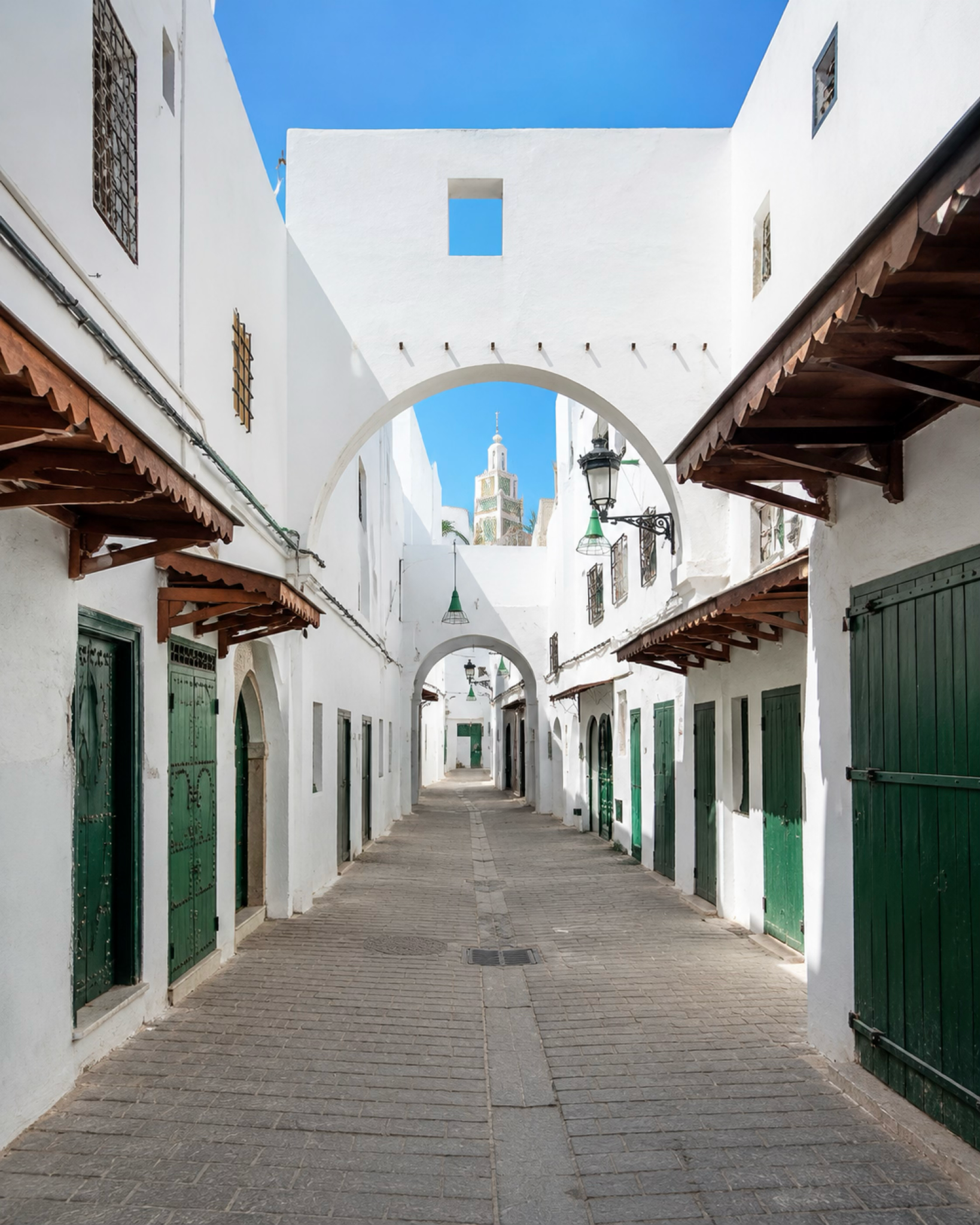
Whitewashed lane in Tétouan medina with green doors and a minaret framed by arches

Go deeper through the nearest city context

Tétouan - the cultural gateway to Oued Laou Coast

Oued Laou makes strongest sense when paired with Tétouan. The city brings the coastal visit into a wider northern Moroccan story: a UNESCO-listed medina, Andalusian urban memory, craft traditions, whitewashed streets and a Mediterranean orientation that reaches beyond the beach.

Use Tétouan before or after the coast to give the journey more structure. The city sharpens the eye for white walls, green details, artisan rhythm and the way northern Morocco moves between mountain, medina and sea.

UNESCO medina contextAndalusian urban memory Craft and white-city detailMediterranean day-trip base Rif and coast orientationPractical northern route planning

Continue the journey

Continue from Oued Laou Coast into northern Morocco.

Read the shoreline through river, sea, harbour and Rif slopes, then connect it to Tétouan, the northern coast and the wider Exotic Morocco Visit map.