
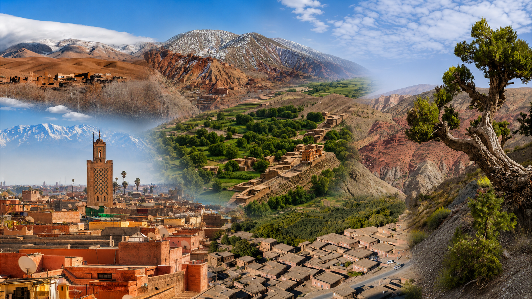
Panoramic montage of Aït Bouguemez Valley, Atlas villages and mountain scenery, with a Marrakech city scene

Visit / Place · Central High Atlas · Azilal province

Aït Bouguemez Valley Fields, mountain villages and the wide horizons of the High Atlas

A broad cultivated valley where Amazigh villages, orchards and field paths lie beneath the Central High Atlas. Its landscape rewards a stay measured in walks, conversations and changing light.

Begin around Tabant, then explore at the pace of the valley. Leave room for a village walk and a higher viewpoint before planning longer mountain routes.

Why Aït Bouguemez Valley matters

A landscape shaped by water and work.

Aït Bouguemez is a mountain valley in Azilal province, in the Central High Atlas. Its identity comes from a network of villages and cultivated land. Tabant provides a useful point of orientation within the valley; Azilal connects the visit to the wider region.

The fields are fundamental to the view. Irrigation channels, orchards and small plots bring the valley floor into close relation with the settlements around it. The contrast between green cultivation and exposed slopes makes these connections unusually easy to see, even on a short walk.

Amazigh heritage here includes the knowledge involved in caring for land and water. Field research with women in Aït Bouguemez describes springs, grazing areas and agricultural ground through everyday responsibilities and shared experience. The landscape carries this human knowledge alongside its more visible buildings and paths.

Heritage also has distinct landmarks. The hilltop granary of Sidi Moussa introduces the history of communal storage and a sacred local setting. Dinosaur tracks near Ibaqalliwn open a much longer perspective on the valley’s past. Each calls for a different kind of attention.

The familiar nickname “Happy Valley” appears in Moroccan tourism material. A useful visit goes beyond the name: spend time learning how individual villages fit the landscape, what is growing during your stay, and which routes make sense for your interests and the conditions.

Further reading: the Moroccan National Tourist Office on Azilal, the M’Goun UNESCO Global Geopark profile and research on local landscape stewardship.
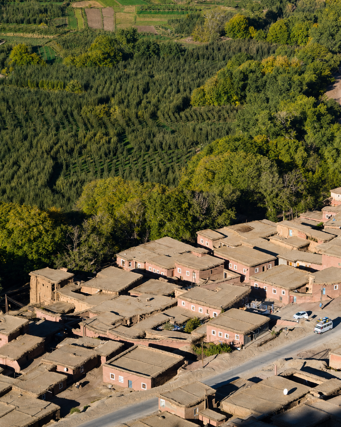
Village houses beside green orchards and cultivated fields in Aït Bouguemez Valley

Valley orientation

Centered on Tabant, within Aït Bouguemez Valley. Zoom out for the Azilal approach, or open the map to explore the surrounding villages.

Editorial reading

The valley has more than one scale.

An elevated view turns the fields into a pattern of narrow strips, tree rows and earth-coloured boundaries. At ground level, that apparent simplicity breaks into small decisions: where a path bends, where water crosses it and where a village meets cultivated ground.

The most useful comparison is between the centre and the edges. Open land gives the eye room to travel; clustered houses bring it back to doors, roofs and the width of a lane. Let both scales register before choosing a favourite view.

Mountains can dominate a photograph so completely that the valley below becomes incidental. Try the reverse: begin with a field boundary or a roofline and follow it toward the rising ground. The mountain then becomes a measure of the place around it.

Colour deserves the same care. Fields differ with planting and harvest; bare soil is part of that cycle. A green photograph records one moment. It cannot promise the same palette, the same water level or the same snow cover on a later visit.

Contemporary details belong in the reading too. Roads, vehicles, new building materials and working guesthouses share space with older fabric. They reveal a place whose residents make present-day choices, with needs that extend beyond the visitor’s preferred image.

A local guide can turn an attractive view into a more precise one by naming a village, explaining a route or clarifying a building’s role. Ask specific questions, and allow answers to complicate the first impression.

Keep one pause free of the camera. Watch the light move across a slope or the traffic pass through a village. That brief interval gives the journey a sense of duration that a sequence of viewpoints alone rarely provides.

Landscape and heritage orientation

Four layers of a mountain valley.

Aït Bouguemez brings together geological evidence, agricultural knowledge and built heritage. These layers have different timescales: a fossil track, a granary and a cultivated plot tell different stories about the same landscape.

01Place type

A cultivated High Atlas valley

The valley contains several settlements, with Tabant serving as a practical reference point. Plan around the village where you will stay and the walks you want to make; the place extends well beyond a single map marker.

02Rural heritage

Knowledge held in practice

Water management and care for agricultural land are part of local heritage. Research in Aït Bouguemez highlights women’s knowledge of springs, fields and grazing areas, widening the story beyond the buildings that first attract attention.

03Built heritage

Sidi Moussa

The granary near Timit combines communal storage history with a shrine. Its prominent hilltop position makes it a useful landmark. Learn its local significance and confirm permitted access before treating it as a viewpoint.

04Earth history

Traces in the rock

Dinosaur tracks near Ibaqalliwn add a geological dimension to the visit. A local explanation helps identify the impressions and distinguish them from other surface marks. Leave the rock undisturbed so its evidence remains readable.

A visual bridge

Follow the lines that organise the view

A few visual cues make the valley easier to understand. Look first for its broad shape, then for the smaller lines that connect water, cultivated land and villages. These observations can begin from any suitable public viewpoint.

01

Water

Find the narrow connections

A channel is easily overlooked beside a mountain panorama. Follow its visible course from a path and notice how a small line of water relates to a much larger area of cultivation.

  • Look for crossings and changes in level.
  • Notice where plots meet the water route.
  • Observe from the path without stepping onto channel banks.
02

Settlement

Read the village edge

The meeting between roofs and open ground often tells more than an isolated façade. Look at the spaces between buildings, the direction of lanes and the point where an inhabited cluster gives way to fields.

  • Compare rooflines with the slope behind them.
  • Notice how lanes reach the cultivated ground.
  • Keep private entrances outside your walking route.
03

Relief

Separate foreground and horizon

Use one nearby object to judge distance: a tree, a wall or the bend of a public path. The wider view becomes clearer when there is a visible step between human scale and the mountain backdrop.

  • Begin with a clear foreground.
  • Follow the ground through the middle distance.
  • Let the skyline complete the view.

Quick orientation

Type of place

A cultivated mountain valley with Amazigh villages, rural heritage and walking routes. Best approached as a landscape with several local starting points.

Landscape context

Central High Atlas, Azilal province, in Béni Mellal-Khénifra. Explore the wider mountain setting through the Morocco regions overview.

Best for

Village walks, field and orchard landscapes, geology, thoughtful photography and locally guided mountain excursions. The travel mood is unhurried and attentive.

City and local base

Azilal provides the wider city context. Tabant and the valley’s guesthouses are more immediate reference points for walks and an overnight stay.

What visitors experience here

Space opens up, then becomes personal.

The experience changes between a road approach, an orchard path and a village lane. Each brings a different balance of space, sound and movement. Allow a walk to include more than one setting without turning it into a list of stops.

Arrival

The floor of the valley

After the folds of the approach, the cultivated ground gives the eye a longer, calmer line. Pause only where stopping is safe. An open view is a useful introduction to the walking landscape that follows.

Light

Shadow travelling across slopes

Watch where direct light ends and the shaded mountain begins. That boundary reveals relief more clearly than colour alone. A pause in the same place can change a photograph more than moving to another viewpoint.

Walking

Paths between plots

A field path narrows the experience to footsteps, turns and the next crossing. In planted areas, keep within its edges and leave space for other users. The route is part of someone’s working day.

Village

Roofs, doors and passing traffic

A lane brings small details into view: the depth of an opening, the junction between materials, a roof above the road. Notice these from public space and leave doorways clear for residents.

Sound

A changing foreground

Pay attention to what is close enough to hear: footsteps, a passing vehicle, conversation or water where a channel is flowing. Sound gives the landscape a scale that the distant mountain cannot supply.

Hospitality

Time at the guesthouse

An overnight stay leaves time to discuss tomorrow’s route and understand the surroundings of your accommodation. Agree meals and services directly with your host; a relaxed evening can be as useful as another excursion.

Place details and orientation

Six useful points of orientation

Use these as a way to understand the valley and choose a visit. They range from everyday orientation to specific heritage stops and mountain routes requiring separate preparation.

1
Tabant

A useful local centre for orienting yourself in the valley. Confirm your accommodation’s exact village and location rather than relying on the broad destination name.

2
Fields and orchards

Cultivation occupies the valley floor and changes through the agricultural year. Choose an established walking route through this landscape and respect planted ground.

3
Sidi Moussa near Timit

A hilltop granary and shrine that brings storage history and local belief into the same place. Ask about access and its meaning before visiting.

4
Ibaqalliwn dinosaur tracks

A distinct stop for those interested in earth history. Ask a knowledgeable local guide to show the site and explain how to observe the traces without damaging them.

5
Irrigation channels

Small watercourses connect the agricultural landscape at close range. Use proper crossings; avoid loosening their edges or introducing litter into the water.

6
M’Goun trekking approaches

The valley is a starting area for longer High Atlas treks. Mountain routes require their own assessment of terrain, conditions, equipment and guide arrangements.

A careful eye

Ask what a detail can actually tell you.

A photograph can show a channel, a wall or a path. It cannot tell you who maintains it, which land it serves or whether access is public. Keep that distinction in mind when interpreting a landscape whose practical arrangements may be unfamiliar.

The same restraint helps with older buildings. A distinctive form invites questions about storage, use and repair, but appearance alone cannot establish a date. Ask for the local name and explanation, and distinguish a remembered story from a documented fact.

For geological features, clear identification matters more than a dramatic photograph. See the dinosaur traces with someone who knows the site, observe from a suitable position and leave every fragment where it belongs.

Landscape and water intelligence

Water gives the fields their structure.

The small divisions visible from above are an invitation to look more closely at the ground. Irrigation reaches cultivated plots through channels that need care. Their modest size can disguise their importance: a narrow crossing may sit on a route essential to the work around it.

Read the valley vertically as well as along its length. A walk on cultivated ground and an excursion toward a high pass belong to different environments. The conditions at your guesthouse provide only part of the information needed to decide what is sensible farther uphill.

What to notice slowly

  • Trace one visible channel from a public path.
  • Compare planted, harvested and uncultivated ground.
  • Notice which routes serve fields and which connect villages.
  • Look for changes of slope before estimating walking effort.
  • Ask how the season affects the route you have chosen.
  • Leave water structures, crops and property boundaries intact.

Visual reading

Three ways to make the landscape legible

The spaces between

Give attention to the open ground between buildings. A lane, a small threshold or a gap facing the fields can explain how a settlement is used more clearly than a view filled entirely with façades.

The direction of lines

Follow an orchard row, a field edge and a roofline in turn. Notice where they align and where they change direction. This is a simple way to see how cultivation and building respond to the ground.

The evidence of change

Look at junctions between older surfaces and newer work without assuming that every difference has the same story. Repair, extension and replacement can be visually similar; local explanation gives them context.

Visual atmosphere

Green, earth and the movement of light

Colour with a season

Let the valley keep the colours it has when you arrive. Fresh growth, mature foliage, exposed soil and harvested plots each give the view a different balance. Look for those differences rather than expecting every field to match a spring photograph.

Depth in the ordinary

A shaded doorway, the overlap of two roofs or a tree against open ground can give an image depth without a spectacular sky. Look for one clear relationship in the foreground and allow the wider setting to remain quiet.

An image with context

Choose a frame that keeps enough surroundings to explain its subject. A granary belongs with its hill, a village with its approach and a field with its boundaries. That context helps the photograph remain recognisable after the journey.

Nearby places and onward links

Give the valley room in a wider Atlas journey

Use Azilal as the wider city reference, then choose onward places according to your route. Ouzoud, Bin El Ouidane and the Demnate area belong to a broader regional journey; allow transport and mountain-road planning between them.

Azilal

Connect your valley stay to the city guide for a broader introduction to this part of the Atlas and its regional travel possibilities.

Open Azilal city guide

Atlas and mountain regions

Place Aït Bouguemez within a longer itinerary by exploring Morocco’s regional overview and choosing a coherent mountain route.

Explore Morocco’s regions

Ouzoud and Bin El Ouidane

Two options for widening an Azilal journey toward waterfalls and lake scenery. Plan them as separate stops with sufficient time between destinations.

Browse Visit places

Architecture and heritage

Continue from the granary and village fabric to the wider questions of materials, storage and the care of Morocco’s built heritage.

Read the heritage theme

Plan your journey

Arrange the exact village, arrival transport and onward connection before adding walks. Keep demanding treks separate from your basic valley plan.

Plan your journey

Learn Morocco

Add background on culture, language and history to the journey. A little context can make a local explanation much easier to follow.

Explore Learn Morocco

How to visit respectfully

Walk with care for the place around you.

Village lanes and field paths have everyday users. Keep entrances clear, give people and animals room to pass, and avoid shortcuts across crops or orchard plots. If a route becomes unclear, turn back to a known junction or ask before continuing.

At Sidi Moussa and other heritage stops, follow current local guidance about access and photography. Ask before photographing people or private interiors. Treat geological traces as evidence to observe: avoid walking on, marking or collecting material from them.

  • Confirm that your planned walk follows an appropriate route.
  • Use established crossings over irrigation channels.
  • Agree guiding, meals and transport arrangements clearly.
  • Carry water, sun protection, a warm layer and suitable footwear.
  • Check weather and road conditions locally before setting out.

A strong first visit

Settle into your accommodation before choosing a long walk. Confirm the village name, locate it on the map and ask your host about the paths immediately around it. A short orientation walk helps you judge the ground and your own pace.

Choose one main interest for the next outing. A visit focused on Sidi Moussa differs from time spent with the dinosaur traces near Ibaqalliwn. Leave enough space for explanation and for the journey between stops instead of trying to complete every landmark.

Add an orchard or field walk where an established route allows it. Stop in a suitable public place to read the wider view, and return by a route you understand. Plan the day around daylight and the conditions rather than a fixed list of photographs.

If the mountains are the main reason for your stay, discuss the proposed trek with a qualified local mountain guide. Clarify the route, expected demands, equipment, weather assessment and return arrangements before committing to a higher or longer itinerary.

  • Locate your accommodation and a clear starting point.
  • Choose one heritage or landscape focus for the outing.
  • Allow time for a local explanation.
  • Agree a return plan before leaving the valley paths.
  • Keep an alternative for a change in conditions.

Planning note: confirm access to individual sites, guiding fees, accommodation and transport directly with local providers. The map is for orientation and does not replace a mountain route plan.

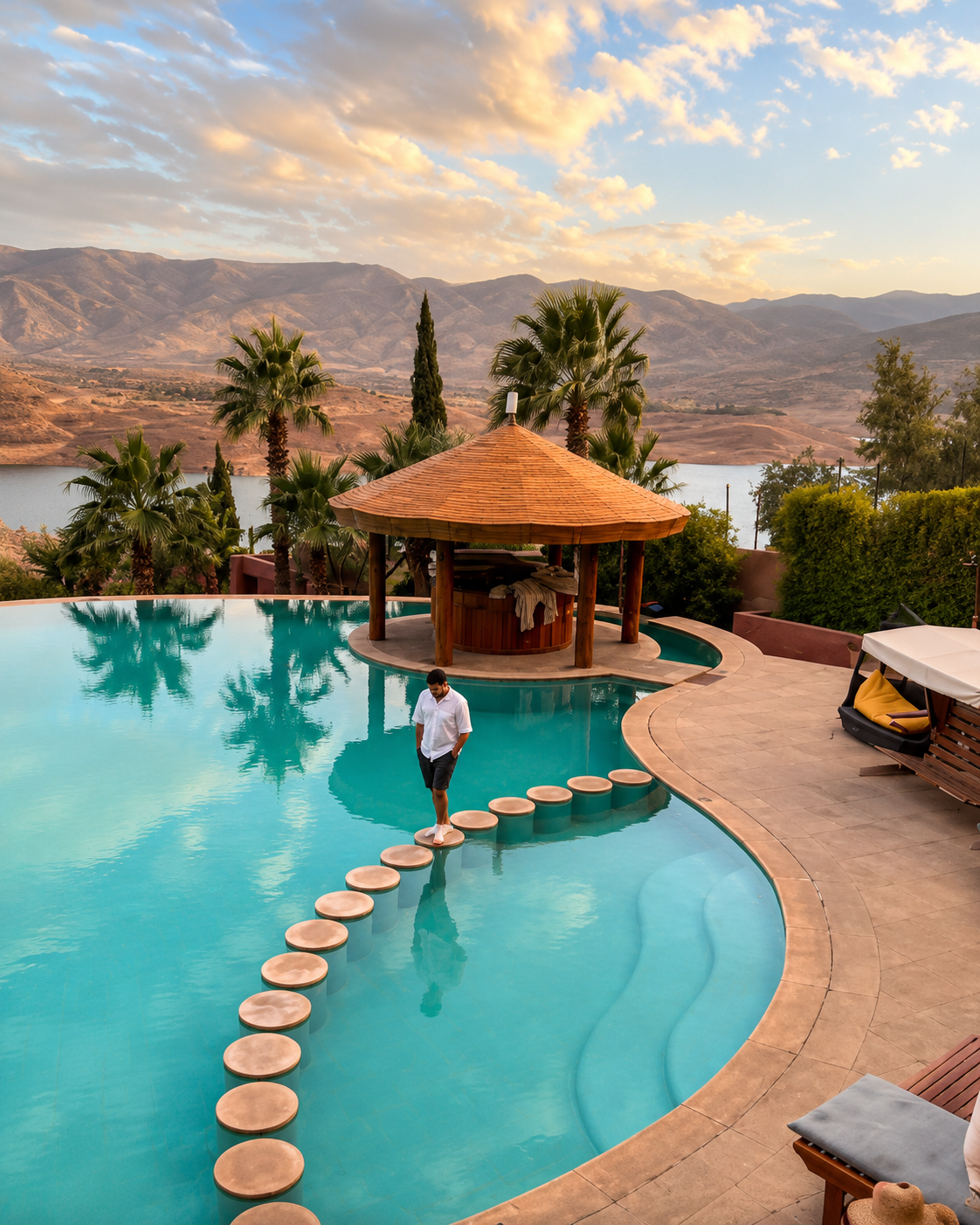
Pool terrace overlooking a lake and mountain landscape in the Azilal area

Go deeper through the city context

Azilal — the wider setting for your valley stay

The Azilal guide connects Aït Bouguemez with a wider landscape of mountain journeys, Ouzoud’s waterfalls and Bin El Ouidane’s lake scenery. Use it to choose what belongs before or after your time in the valley.

Keep the scale of the journey clear: Azilal supplies the regional context, while your chosen valley village supplies the immediate base for walks. Give each destination enough time, and confirm the connections between them before travelling.

Azilal city contextCentral High Atlas landscapes Ouzoud and lake sceneryValley accommodation planning Heritage and village walksOnward regional journeys

Continue the journey

Continue from the valley into the Atlas.

Carry the valley’s scale with you: fields, villages and mountain horizons. Use Azilal to shape the next part of your journey.