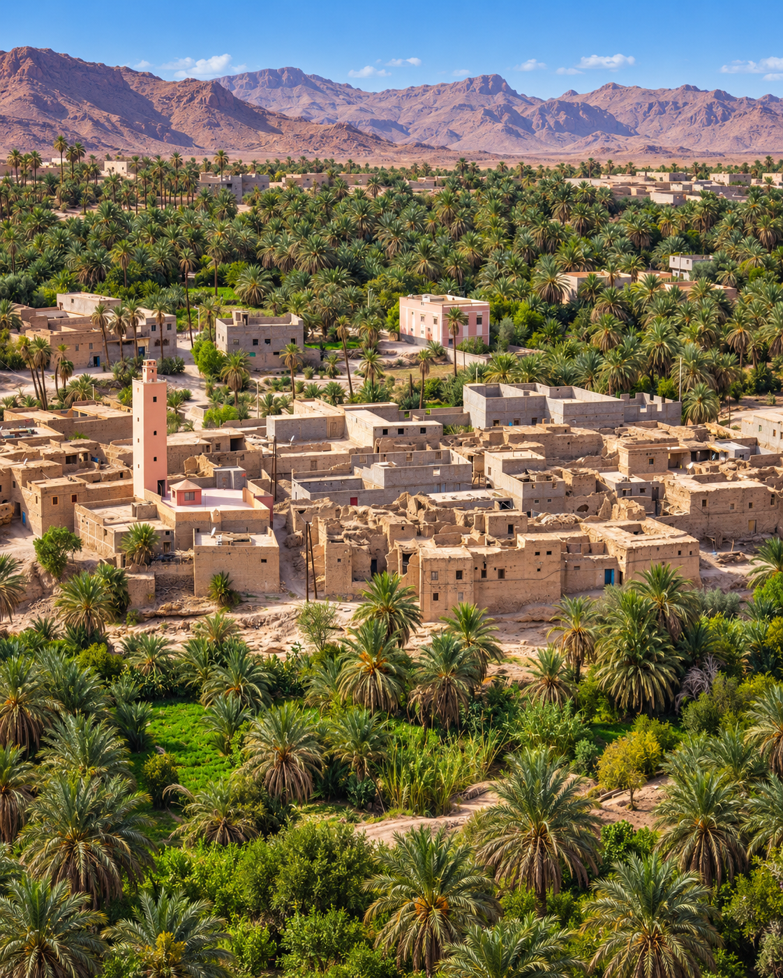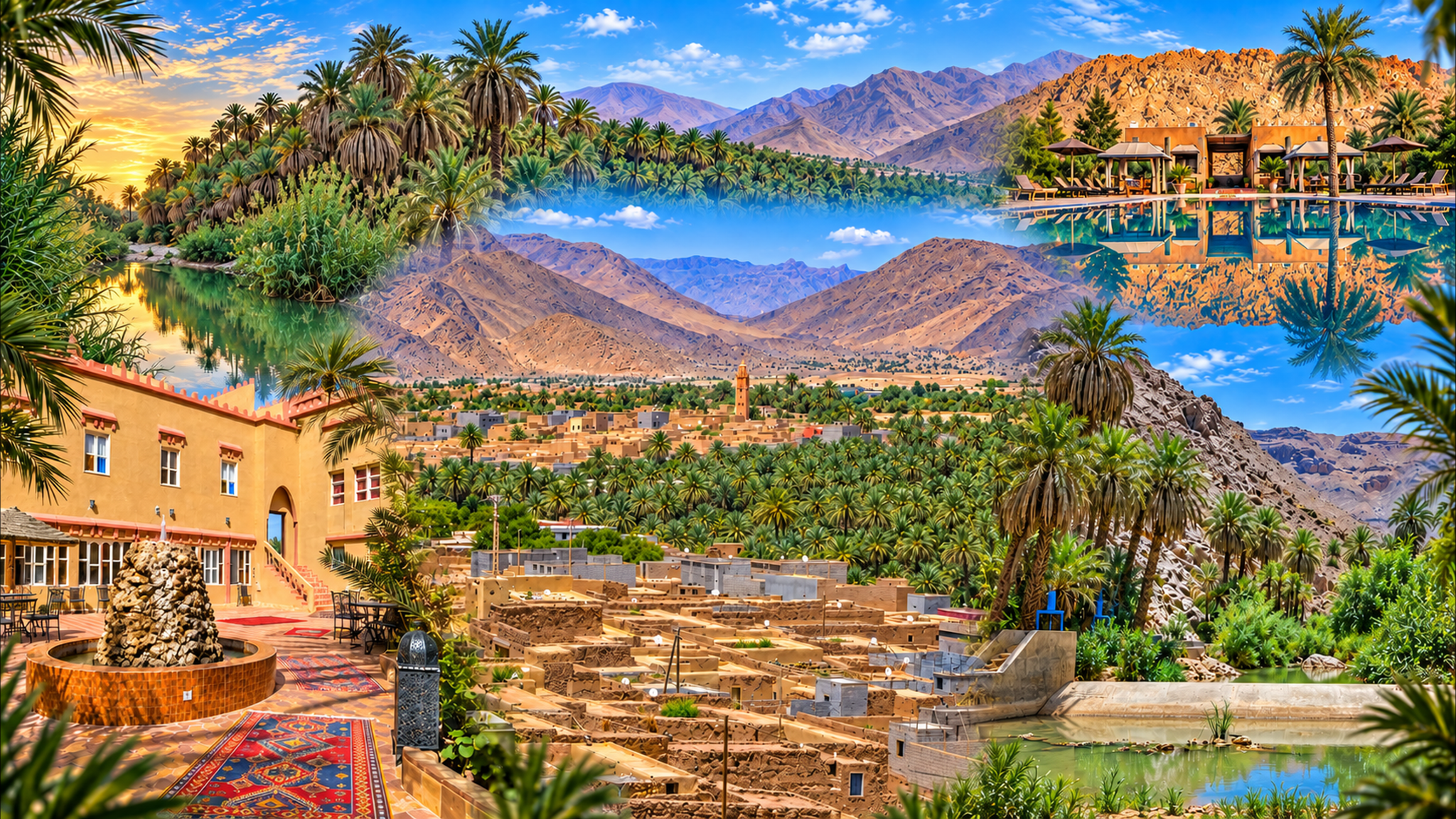
Panoramic composition of palms, mountain ridges, village buildings and water, illustrating the Akka Oasis guide

Visit / Place · Jbel Bani · Tata province

Akka Oasis Palm gardens, rocky ridges and the traces of southern routes

In Morocco’s south, Akka brings cultivated land and desert relief into close view: palms beneath the Jbel Bani, villages along the oasis and monuments with histories of their own.

Begin with the palm grove, then choose a heritage stop. Leave time between them for the paths, small details and conversations that a panoramic view cannot hold.

Why Akka Oasis matters

Cultivated ground at the desert’s edge.

Akka is an oasis landscape in Tata province, in the Souss-Massa region. The town, surrounding villages and palm gardens sit among the relief of the Jbel Bani. Its significance begins with a simple relationship: limited water has made settlement and cultivation possible in an otherwise arid setting.

The green of the palm grove is agricultural. Reading it as cultivated ground changes what deserves attention: field boundaries, routes into the gardens and the connection between trees and nearby homes. The oasis belongs to the people who live and work here; a path between palms is not automatically a public walking trail.

History extends beyond the gardens. Agadir Ouzrou occupies a rocky position above the oasis, while the Lalla Baytou Allah minaret survives at Agadir Amghar. These are distinct sites within Akka’s wider setting, each worth understanding on its own terms.

The surrounding territory also carries the memory of Tamdoult, a medieval mining and caravan centre south of Akka. That connection places the oasis within a larger history of exchange across southern Morocco. The surviving evidence is more useful than an embellished story of a lost city.

For a first visit, keep the geography clear: this is Akka, southwest of Tata. Akka Ighane and Akka N’Ait Sidi belong to a different part of the province, toward Tissint. Similar names should not send an itinerary to the wrong oasis.

Place and route context: Visit Agadir’s Akka overview and the regional heritage guide to Tata.
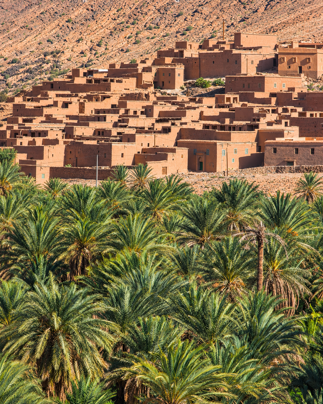
Dense palm crowns below earth-coloured village buildings and a rocky hillside, Akka Oasis context

Map orientation

The view centres on the oasis near Agadir Ouzrou. Zoom out for Akka town and the N12 toward Tata. Open the map.

Editorial reading

The edge explains the oasis.

The most revealing view includes the end of the green. Follow the palm canopy until bare ground takes over; that boundary makes the extent of cultivation easier to understand than a photograph filled entirely with foliage.

Next look for changes in height. Rooflines, palm crowns and the ridge behind them make three different scales visible. A house offers a human measure within a landscape that can otherwise feel difficult to judge.

Do not treat everything beyond the trees as dunes. Akka’s rocky relief is central to the view. Read the shape and texture of the slopes before fitting the place into a familiar image of the Sahara.

Inside the grove, a smaller field of vision takes over. A bend, a boundary wall or a gap between trunks can be more informative than another broad panorama. Let a few details hold your attention.

The buildings deserve individual attention too. A village cluster, a freestanding minaret and an agricultural enclosure serve different purposes, even when their colours appear closely related from afar.

Use local names when asking about a site. “Agadir Ouzrou” and “Lalla Baytou Allah” give a conversation more precision than “the old kasbah”. Spellings vary, so confirm the destination on a map as well.

The result is a more legible visit: one view to locate the oasis, a walk to understand its scale and a named monument to deepen its history. Each adds something the others cannot.

Historical and heritage orientation

Several histories share this oasis.

Akka’s heritage includes fortified settlement, religious architecture and the traces of trade. Monument dates and local traditions are not always reported consistently; the distinctions below keep to the better documented context.

01Settlement

Agadir Ouzrou

This fortified village stands on a rocky outcrop overlooking the palm grove and oued. Its position makes the relationship between built enclosure and surrounding land particularly clear.

02Religious heritage

Lalla Baytou Allah

The surviving minaret at Agadir Amghar is associated with the former Lalla Baytou Allah mosque. Its geometric surface pattern is a more reliable starting point for looking than an unqualified date or legend.

03Trade and mining

Tamdoult’s hinterland

Regional tourism sources connect Akka with nearby Tamdoult, a medieval centre of mining and trans-Saharan exchange. Its archaeological remains require local orientation; do not expect a complete standing town.

04Conservation

Archaeology and repair

Architect Salima Naji documents work at Agadir Amghar undertaken with archaeologists and Moroccan heritage institutions. The project shows why excavation and building conservation need to inform each other. Read the project account.

A visual bridge

Three ways to read the oasis

A broad view can be beautiful and still leave the place unexplained. Give the eye three separate tasks: establish the setting, follow a boundary and find a useful sense of scale.

01

Setting

Ridge and valley

Hold the rocky horizon and the palm canopy in the same view. Their different forms reveal the oasis as a particular strip of inhabited land within a much larger dry landscape.

  • Trace the ridge before following individual trees.
  • Include bare ground in a wide composition.
  • Notice where the valley narrows or opens.
02

Cultivation

The garden boundary

Look for the line where a path meets a plot. A garden edge can show how movement is kept separate from growing space without needing to step inside.

  • Observe from an established public path.
  • Keep entrances clear for their users.
  • Ask before entering a cultivated enclosure.
03

Scale

A village in the frame

Use doorways and roof levels to judge distance. With these familiar dimensions in view, the size of nearby palms and the height of the slopes become easier to read.

  • Find one clear building as a reference.
  • Compare its roofline with the palm crowns.
  • Use distance to separate overlapping forms.

Quick orientation

Type of place

A cultivated oasis with palm gardens, villages and heritage sites. The page covers the wider oasis around Akka town, rather than a single enclosed attraction.

Best for

Palm-grove scenery, village architecture, attentive photography and a measured heritage visit. A short walk with time to ask questions suits the place well.

Town and travel base

Akka is the local town; Tata is the wider provincial travel base to the northeast. Combine them with time for the road and your chosen stops.

What visitors experience here

From open light to the scale of a path.

Choose a walk that is locally appropriate and let the surroundings set its pace. The interest lies in small changes along the way, rather than in trying to cover every part of the palm grove.

Arrival

An opening between ridges

As the view opens toward the oasis, identify where the town ends and the gardens begin. This first orientation helps avoid confusing a road through settlement with a route into the grove.

Light

Shade with moving edges

Beneath palms, the canopy breaks sunlight into narrow patches. Watch a shadow shift across a wall or path; even a brief pause can change the balance of light in a photograph.

Texture

Trunks at close range

Palm trunks offer a different visual language from the broad green canopy: fibrous surfaces, old leaf bases and irregular vertical lines. Look closely without pulling material away from the tree.

Sound

Listen when the wind changes

When there is a breeze, fronds make the air audible. Traffic and voices may remain part of the experience too: the oasis is inhabited, so silence should not be an expectation imposed on it.

Village edge

Doorways and daily routes

At a village boundary, give way to residents and working traffic. A threshold can be visually appealing while remaining private; observe the street without turning a home into a viewing stop.

A pause

Look back along the path

A return view often reveals a different composition. The same bend may now align a palm trunk, roofline and strip of sky, giving a modest section of the walk a clearer shape.

Place details and orientation

Six points of orientation around Akka

These elements help organise a visit. They are not a fixed circuit: choose what is accessible and relevant on the day, with local guidance for the heritage sites.

1
Akka town

Use the town as the point for confirming directions and meeting arrangements before approaching the surrounding gardens or monuments.

2
The palm gardens

The grove gives the oasis its cultivated scale. Select an established path and agree on a turning point before entering an unfamiliar network of tracks.

3
The oued corridor

A dry riverbed is still a drainage route. View it from stable ground; surface water and safe crossing conditions should never be inferred from an older photograph.

4
Agadir Ouzrou

This is the elevated fortified settlement overlooking the grove. Ask which approach and public areas are currently suitable for visitors.

5
Agadir Amghar minaret

Also identified with the Lalla Baytou Allah mosque, this monument is a separate heritage stop. Its surroundings deserve the same care as the standing structure.

6
The road toward Tata

The N12 connects Akka with Tata to the northeast. Keep this direction distinct from journeys onward toward the province’s other similarly named oases.

A careful eye

Read what is there before adding a story.

A low wall can be a field boundary; a path can serve a home; a tower can belong to religious architecture. Their functions are worth asking about before assigning every old structure the same name.

At a heritage stop, separate what can be observed from what needs explanation. Material, openings and position are visible. A construction date, former use or account of abandonment calls for a source or an informed local guide.

Treat a photograph as one moment, not a promise of current conditions. Vegetation, water, access and the appearance of buildings may differ when you arrive. That difference is part of visiting an actual place.

Water and landscape intelligence

Water gives cultivation its limits.

The essential question beneath an oasis view is how water reaches the growing land. Akka’s cultivated valley depends on managing a limited supply. An apparently dry channel does not, by itself, explain whether a nearby garden receives water or how that supply is organised.

Ask about the system that serves the particular plot in front of you. Water sources, distribution arrangements and seasonal conditions should be explained locally, rather than borrowed from another Moroccan oasis. Keep channels and their edges undisturbed while looking.

What to notice slowly

  • Ask where the water for a particular garden comes from.
  • Distinguish irrigation features from natural drainage.
  • Notice how paths cross or follow plot boundaries.
  • Look for shade at ground level as well as canopy height.
  • Leave gates, channel controls and planted ground untouched.
  • Let current local conditions determine the walking route.

Landscape and built form

Three relationships beyond the panorama

Outcrop and enclosure

At Agadir Ouzrou, compare the shape of the rocky support with the line of the built edge. Reading both together gives more information about the settlement’s position than isolating a single façade.

Geometry on the minaret

The minaret’s repeating diamond forms give its surface a rhythm distinct from the mass of a village wall. Follow the pattern with your eye from a permitted viewing position, keeping a respectful distance.

A boundary is a threshold

Around the gardens, an opening marks a change between movement and use. Notice how a path leads toward it, then respect that transition: visual access does not establish permission to enter.

Visual atmosphere

Light, texture and quiet transitions

Green is more than one colour

Look for the difference between a sunlit frond and one turned away from the light. The canopy gains depth through these variations, with dry leaf material adding another tone. A photograph can retain this range without forcing every palm into the same saturated green.

The ridge under changing light

Side lighting separates ledges and small folds; more direct light can flatten them. Neither view is less real. Observe how the ridge changes during a stop and keep its natural colour, rather than expecting a particular sunset effect.

Choose a quieter frame

A doorway edge, a narrow strip of shade or a single trunk may hold a stronger composition than a crowded panorama. Make room around the subject. When photographing near homes, choose a frame that preserves the privacy of the people using them.

Nearby places and onward links

Continue through Tata and the wider south

Tata provides the provincial context for Akka. For onward reading, use the established city, region and theme collections below; a nearby heritage stop and a longer regional journey call for different amounts of time.

Tata

Keep Tata as the wider base for arranging a provincial journey. Akka deserves its own stop within that plan, with time allocated to the grove and selected heritage sites.

Explore the city guides

Southern Morocco, Oases & Sahara

Put Akka’s rocky oasis landscape alongside the south’s other valleys and desert margins. Use the regional overview to build a coherent sequence of places.

Explore the region

Architecture & Heritage

Continue the reading of settlement, building materials and conservation. The theme offers context for questions raised by Akka’s village fabric and monuments.

Read the theme

More Visit places

Compare other landscapes and heritage sites before choosing the next stop. Keep room in the itinerary for the character of each place to emerge.

Browse Visit places

Plan the road journey

Check road conditions, transport and the day’s destination together. Agree on a return arrangement before adding a remote monument or an unfamiliar track.

Plan your journey

Stories from Morocco

Follow a question from the visit into further reading, whether it concerns local memory, materials or the relationship between a community and its surroundings.

Read stories

How to visit respectfully

Visit with the gardens and residents in mind.

Confirm a suitable route before walking into the palm grove. Cultivated plots, homes and religious sites have their own boundaries; stay on public approaches and ask before crossing a gate or entering an interior.

Around old structures, keep to permitted ground and avoid climbing walls or ruins. In the gardens, leave fruit, plants and water infrastructure untouched. Carry out litter and give residents room to continue their work.

  • Ask before photographing people or private interiors.
  • Carry drinking water, sun protection and shoes suitable for uneven ground.
  • Choose a cooler part of the day when heat makes walking uncomfortable.
  • Keep clear of oueds and crossings during or after heavy rain; seek local advice.
  • Agree on the route, duration and fee before engaging a guide or driver.

A strong first visit

Start in Akka by confirming which paths and heritage stops are appropriate that day. Pick one manageable section of the grove and one named monument; the visit will be easier to follow with a clear focus.

Take an initial view from an accessible public approach, then walk the agreed route. Set a turning point that leaves enough time and water for the return. Do not extend the walk simply because another track looks inviting.

If visiting Agadir Ouzrou or the minaret, ask for the site’s local name and what is known about its history. An explanation of one feature can be more rewarding than a long list of uncertain dates.

Finish with your onward arrangements settled. For a return to Tata, account for the road as well as the stops you have chosen. Leave additional sites for another outing when conditions or daylight call for it.

  • Confirm the route in town.
  • Choose a short, permitted grove walk.
  • Allow time for one heritage stop.
  • Return before fatigue or daylight becomes a concern.
  • Keep the onward plan realistic.

Before setting out: confirm access, weather and transport locally. This guide does not assume fixed opening hours or entry arrangements.

Tata oasis landscape with palm gardens, village roofs, a minaret and rocky ridges

The wider travel base

Tata — give Akka a wider context

Tata gives the journey a provincial frame: a place to organise the next stage and consider which other oasis landscapes fit the route. Keep Akka’s own geography in view as you plan outward from it.

There is no need to turn the province into a checklist. Leave space between destinations for the road, a proper meal and a walk that has time to develop. One well chosen extension can add more than several hurried stops.

Tata as a travel baseAkka town orientation Palm-grove walkingNamed heritage stops Road and weather checksA measured onward route

Continue the journey

From Akka, follow the landscape onward.

Keep the palm grove, the ridge and one well understood place in mind as you continue through southern Morocco.