
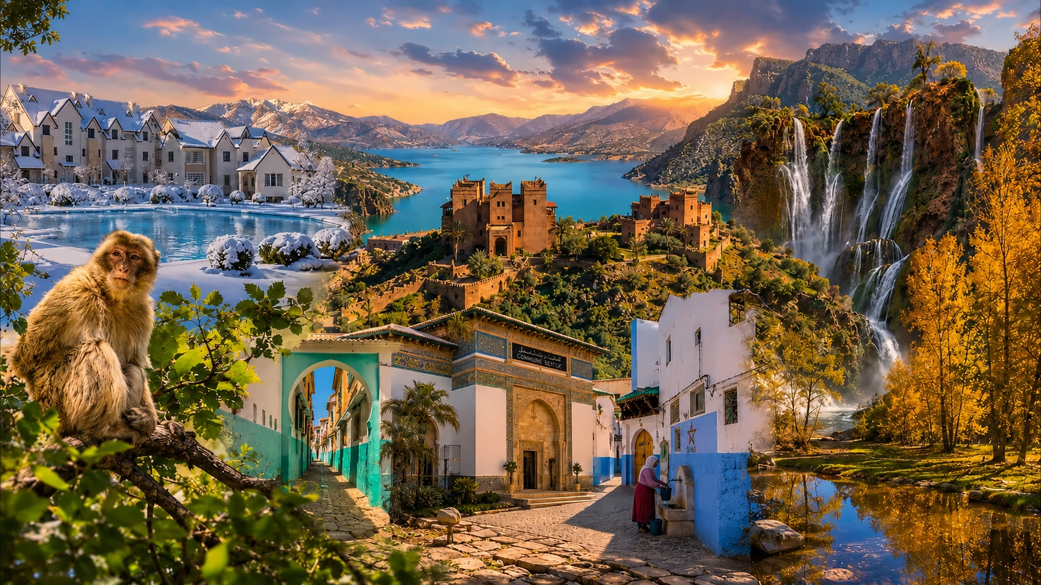
Composite panorama of Moroccan mountain landscapes, lakes, waterfalls and settlements across the Atlas Mountains

Visit / Mountain landscape · Morocco · High, Middle & Anti-Atlas

Atlas Mountains Morocco's great mountain system of peaks, forests, valleys and lived landscapes

The Atlas Mountains are not one viewpoint or one road. In Morocco, the High, Middle and Anti-Atlas form distinct worlds shaped by altitude, geology, water and generations of Amazigh life.

Choose the range before choosing the route. A cedar plateau, a high pass, a cultivated valley and an arid southern massif belong to the same mountain story, but they ask for different preparation and attention.

Why the Atlas Mountains matter

A mountain system, not a single excursion.

Morocco's Atlas is best understood as several connected ranges. The High Atlas carries the country's highest summits and major passes; the Middle Atlas is marked by plateaus, lakes, oak and cedar country; the Anti-Atlas shifts south-west into older, drier massifs and desert-edge valleys. Treating them as one interchangeable backdrop hides the differences that make each journey meaningful.

The High Atlas is Morocco's strongest topographic divide. The Moroccan National Tourist Office describes a chain extending roughly 750 kilometres and identifies Jbel Toubkal, at 4,167 metres, as the highest summit in North Africa. Valleys cut deeply through that height, linking mountain agriculture, seasonal water, settlements and roads to the plains and pre-Saharan south.

The Middle Atlas tells a different story. Forests, lakes, volcanic plateaus and broad grazing country give water and vegetation a more visible role. Official geography material connects the range to the Sebou, Bouregreg, Oum Er-Rbia and Moulouya basins—an important reminder that the mountains organise watersheds far beyond the ridgelines visitors see.

Farther south, the Anti-Atlas is leaner and more arid. Rock structure, sparse vegetation, folded slopes and oasis approaches often dominate the view. Its scale is not the same as the High Atlas, but the long geological lines and sharp transition toward Saharan landscapes make it equally important to Morocco's physical geography.

These mountains are also cultural landscapes. Amazigh communities have shaped and maintained villages, terraces, paths, irrigation systems, grazing routes and craft traditions across very different environments. Visitors should therefore read cultivated land, water channels and settlement position as evidence of knowledge and work—not as picturesque decoration.

Geographic orientation is grounded in the Moroccan National Tourist Office overview of the Atlas ranges and the UNESCO profile of M'Goun Global Geopark. Mountain access, weather, road and trail conditions should be checked for the exact route close to travel.
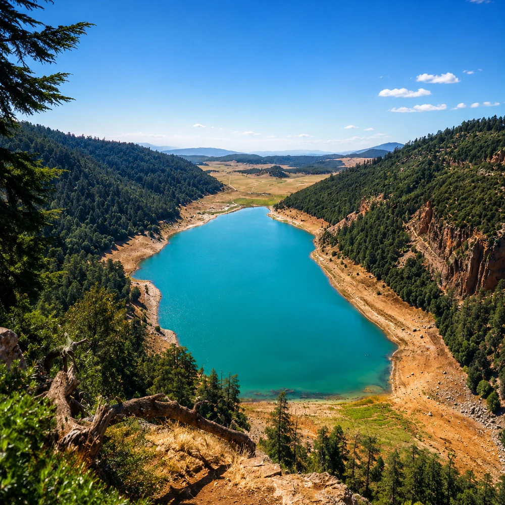
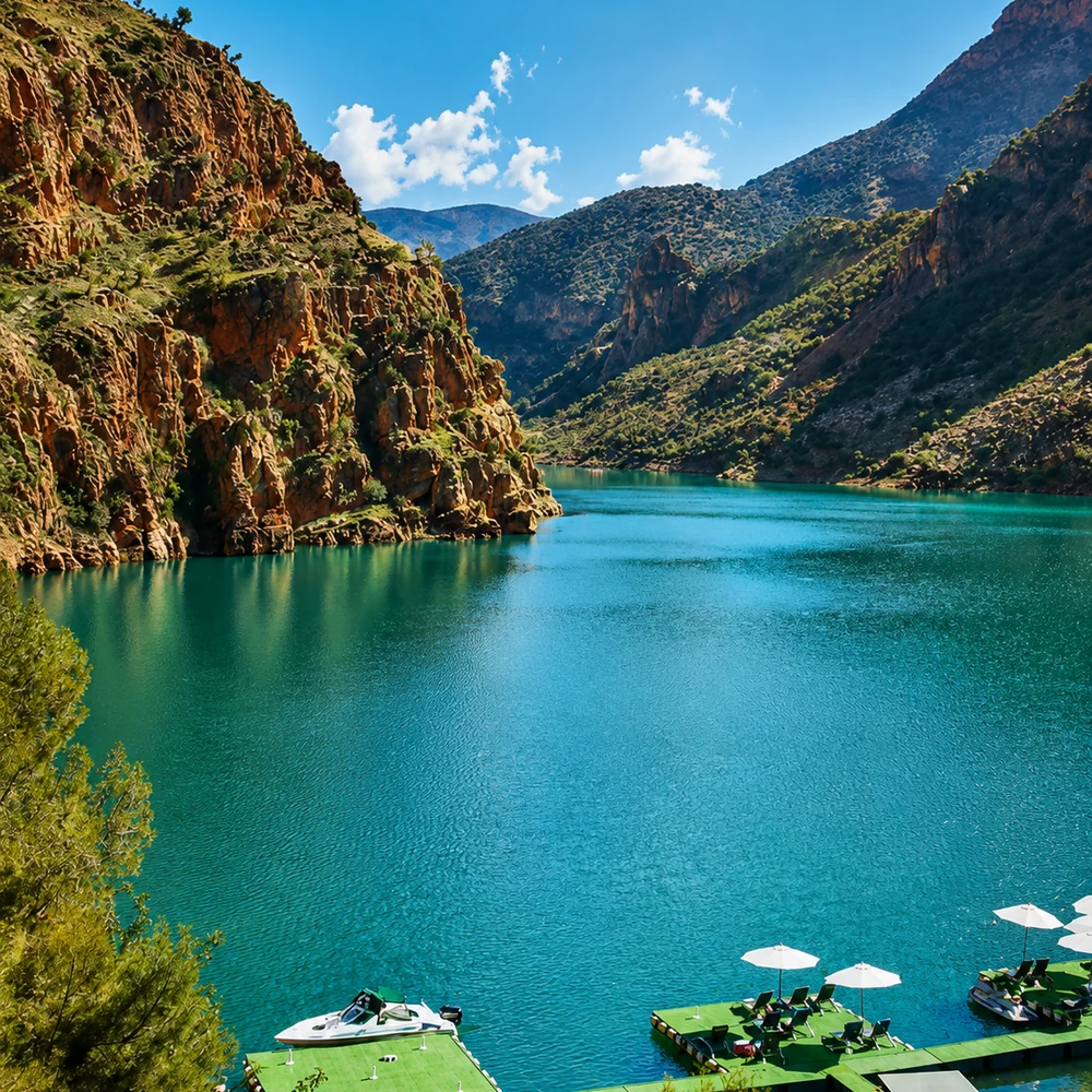
Turquoise mountain lake enclosed by wooded slopes in Morocco's Atlas landscape

Map orientation

Use the map to separate the High, Middle and Anti-Atlas before planning a specific valley, pass, trail or city base.

Editorial reading

The view is wide; the visit must be precise.

“The Atlas Mountains” can mean snow above Imlil, cedar country near Ifrane, the M'Goun massif, a pass toward the south or granite forms near Tafraoute. A useful plan begins by naming the exact range and landscape rather than treating the mountains as one destination.

Altitude changes more than temperature. It changes vegetation, road exposure, walking effort, the availability of shade and water, and the time required to move safely. A valley that feels gentle from a road can rise quickly into demanding terrain.

Water is one of the clearest guides to the landscape. Reservoirs, springs, rivers, irrigated terraces and dry channels reveal how rainfall and snowmelt move through the mountains. Their appearance can change substantially between seasons.

Settlement form is equally informative. Villages often occupy carefully chosen slopes or valley edges, while cultivated plots follow the land and water rather than a formal grid. These are working environments with homes, fields and local traffic.

The visual language shifts with geology: pale limestone, red earth, dark volcanic ground, folded rock and weathered granite produce different profiles. Reading those changes makes a road journey more than a sequence of viewpoints.

Photography should follow the same discipline. Wide scenes explain scale, but smaller observations—terraces, retaining walls, tree lines, paths and the meeting of built earth with bedrock—show how the landscape is inhabited.

The strongest memory is not a generic mountain panorama. It is knowing which range you crossed, how water shaped the valley, why a settlement stands where it does, and what care the route required.

Geographic and cultural orientation

One name, three Moroccan ranges and many local landscapes.

The Atlas Mountains extend beyond Morocco, but the Moroccan Atlas is usually read through the High, Middle and Anti-Atlas. These are geographic ranges, not one protected area or one UNESCO property. Specific parks and the M'Goun UNESCO Global Geopark protect or interpret parts of the larger system; their status should never be applied to the entire Atlas.

01Highest range

The High Atlas

Long ridges, deep valleys and major passes define the chain. Jbel Toubkal reaches 4,167 metres, while western, central and eastern sections lead toward different cities and southern routes.

02Forests and plateaus

The Middle Atlas

Lakes, oak and cedar landscapes, grazing plateaus and volcanic forms distinguish much of the Middle Atlas. The range also feeds several of Morocco's principal river basins.

03Arid south-west

The Anti-Atlas

Lower, drier massifs, exposed rock and oasis-facing valleys create a different mountain experience. The Anti-Atlas is read through geological structure and desert transition rather than alpine scale.

04UNESCO 2015

M'Goun Global Geopark

This designated territory in the central High Atlas interprets more than 200 million years of Earth history alongside dinosaur tracks, valleys, villages, terraces and irrigation heritage.

A visual bridge

Three readings from skyline to inhabited valley

A mountain panorama becomes more legible when the eye follows height, water and human use in sequence. These three readings connect distant ridges to the ground-level details that make every Atlas route distinct.

01

Relief

Follow the height

Begin with the ridgeline, then trace spurs and slopes into the valley. Snow, forest, exposed stone and cultivated ground often occupy different altitude bands, making elevation visible before a map confirms it.

  • Separate the skyline from nearer foothills.
  • Notice where vegetation thins or changes character.
  • Read passes as openings through the relief.
02

Water

Trace the watershed

Water explains the movement from summit to settlement. Streams, reservoirs, irrigated plots and dry channels show how mountain weather becomes a resource, a route constraint and a seasonal force downstream.

  • Look for terraces and irrigation lines.
  • Distinguish permanent water from seasonal channels.
  • Give riverbanks and reservoirs a light footprint.
03

Human landscape

Read work in the terrain

Fields, tracks, retaining walls and villages reveal deliberate responses to slope and water. The relationship between settlement and terrain is often more instructive than an isolated building or viewpoint.

  • Notice how paths follow contour and gradient.
  • Keep private homes and fields out of your route.
  • Let daily work take priority over photography.

Quick orientation

Type of place

A vast North African mountain system. In Morocco, the visitor-facing geography is organised mainly around the High Atlas, Middle Atlas and Anti-Atlas.

Range character

High summits and passes in the High Atlas; lakes, forests and plateaus in the Middle Atlas; arid rock massifs and oasis approaches in the Anti-Atlas.

Best for

Landscape reading, hiking, mountain roads, geology, water systems, rural architecture, careful photography and understanding Amazigh cultural landscapes.

Useful gateways

Marrakech and Azilal for parts of the High Atlas, Ifrane for the Middle Atlas, and Taroudant or Tafraoute for different Anti-Atlas routes.

What visitors experience here

The landscape changes before the road is finished.

An Atlas journey is usually experienced as a sequence rather than a single arrival. Plains tighten into foothills, valleys narrow, settlement patterns shift and distant summits begin to control the horizon. The exact rhythm differs by range, but the feeling of moving through altitude is central.

Arrival

The road becomes geography

Gradients, switchbacks and narrowing valleys make the mountain system physical. A route seen as a simple line on a map becomes a measured passage through rock, water and elevation.

Light

Shadow reveals scale

Side light separates overlapping ridges and exposes folds in the terrain. At midday, distance can flatten; earlier and later light often makes the structure of slopes, terraces and gorges easier to read.

Sound

Wind, water and working valleys

The soundtrack can change from river and wind to livestock, tools, village voices or road traffic. Quiet is not universal here, and inhabited valleys should not be expected to perform isolation for visitors.

Surface

Geology underfoot

Broken limestone, red earth, rounded granite and dark volcanic ground each affect colour, footing and plant cover. The material beneath the route is one of the clearest differences between Atlas landscapes.

Settlement

Villages fitted to slope

From a distance, a settlement may appear fused with the hillside. Closer views reveal paths, retaining walls, water channels and cultivated plots arranged around the practical limits of terrain.

Weather

Exposure changes quickly

Sun, wind, cold and visibility can shift with elevation and season. Conditions in a city below are not a reliable substitute for checking the forecast and route status of the exact mountain area.

Place details and orientation

Read the Atlas through six defining elements

The Atlas is easier to understand when peaks are connected to passes, watersheds, vegetation, cultivated valleys and the drier southern ranges. Each element explains a different part of the system.

1
Jbel Toubkal

At 4,167 metres, Morocco's highest summit anchors the western High Atlas. It represents one demanding mountain area, not the character of every Atlas route.

2
Mountain passes

Passes connect plains, valleys and southern approaches. They reveal the Atlas as a corridor as well as a barrier, while concentrating weather and road exposure.

3
Watersheds

Snow, rainfall and springs feed rivers, reservoirs and irrigated valleys. Water links high terrain to farms, towns and ecosystems far from the summits.

4
Middle Atlas forests

Cedar and oak country creates a cooler, greener mountain reading. Forest edges, plateaus and lakes distinguish this range from the exposed High Atlas and arid Anti-Atlas.

5
Terraced valleys

Retaining walls, plots and irrigation channels show how communities have worked with steep ground and limited water rather than simply occupying a scenic setting.

6
Anti-Atlas massifs

Dry valleys, folded strata and weathered rock forms mark the transition toward pre-Saharan landscapes and give the south-western range its own visual grammar.

Range, not backdrop

The mountains ask for geographic precision.

Start with the name of the range. The High Atlas, Middle Atlas and Anti-Atlas are not visual variations on one scene: they differ in elevation, geology, vegetation, settlement pattern and access. That distinction should shape both the route and the expectations brought to it.

Then identify the valley or massif. A road-based viewpoint, a village walk, a forest circuit and a high-altitude trail involve different surfaces, weather exposure and local guidance. “Visiting the Atlas” is too broad to describe the practical reality.

Finally, connect the wide view to what sustains it. Water, cultivated terraces, grazing land, paths and inhabited villages turn mountain scenery into a working landscape. This closer reading makes the panorama more accurate, not less beautiful.

Landscape, water and route intelligence

Altitude reorganises the entire journey.

Elevation changes temperature, exposure, vegetation and walking effort over short horizontal distances. It also shapes where roads can cross, where water gathers and where settlements can hold cultivated ground. In the Atlas, height is not a statistic added to the view; it is the system organising the view.

That system is never static. Snow cover, river flow, reservoir levels, road surfaces and trail conditions vary with season and recent weather. Responsible planning starts with a defined route and current local information, especially when a journey leaves a main road or enters higher terrain.

What to notice slowly

  • Compare sun-facing and shaded slopes; vegetation and settlement can change between them.
  • Notice how a pass redistributes views, wind and movement on either side of the ridge.
  • Follow water from exposed channels toward terraces, orchards, reservoirs and valley floors.
  • Read road cuts as brief geological sections, while stopping only in genuinely safe places.
  • Observe how building materials echo the ground without assuming every village is open to visitors.
  • Leave fragile plants, rocks, fossils and archaeological traces exactly where they are.

Landscape reading

Three visual languages to notice

Relief and shadow

Overlapping ridges compress distance until light separates them. Watch how shadow describes ravines, shoulders and folds; the mountain's structure often becomes clearer through tone than colour.

Water and cultivation

Green does not appear randomly. Springs, channels and river corridors concentrate orchards and fields, making the line between dry slope and cultivated valley one of the Atlas's most informative visual boundaries.

Road and footpath

A paved pass follows engineering logic; a footpath may follow contour, access to fields or older movement between settlements. Reading both reveals how different generations have negotiated the same terrain.

Visual atmosphere

Distance, surface and changing mountain light

From horizon to valley floor

Wide views establish the scale of the range, but depth appears through layers: a far summit, a darker middle ridge, a cultivated bench and the road below. Let the eye move through those planes before isolating a single peak.

From stone to vegetation

Surface colour changes with geology, moisture and plant cover. Grey limestone, red sediment, dark forest and pale dry grass each catch light differently, giving neighbouring slopes distinct visual temperatures.

From photograph to memory

The most lasting impressions are often physical: cooler air at a pass, reflected light near water, the sound of a valley settlement or the sudden openness beyond a gorge. A photograph records the view; attention records the transition.

Nearby places and onward links

Choose a gateway that matches the range

There is no single “nearby” city for the entire Atlas. Build the journey around a defined section: western or central High Atlas, Middle Atlas, or Anti-Atlas. These existing Exotic Morocco routes give the page honest onward structure.

Marrakech

A major base for the western High Atlas, including routes toward Imlil and Toubkal country. The city and the mountains remain distinct experiences.

Open Marrakech city guide

Azilal

A central High Atlas gateway for mountain valleys, lakes, geological sites and the wider M'Goun landscape.

Open Azilal city guide

Ifrane

A useful base for Middle Atlas forests, plateaus and lake country, with a landscape character very different from the High Atlas.

Open Ifrane city guide

Morocco's regions

Place a mountain route inside the wider geography of interior plateaus, Atlantic plains, pre-Saharan valleys and southern oases.

Explore the regions

Visit Morocco places

Continue with individual valleys, waterfalls, lakes, caves and protected landscapes after choosing the Atlas section that interests you.

Browse Visit places

Plan your journey

Turn a broad mountain idea into a defined route with an appropriate base, current conditions and enough time for altitude and road changes.

Plan your journey

How to visit respectfully

Preparation and restraint belong together.

Mountain villages, orchards, grazing areas and water sources are lived and worked spaces. Keep to appropriate roads and paths, give residents and livestock room, and ask before photographing people, homes or work. A panoramic view does not make everything inside it public.

Natural features also require distance. Do not remove rocks, fossils, plants or archaeological material; avoid cutting paths across terraces and stream banks; carry litter out. Around lakes and reservoirs, respect local access rules and keep water edges free from noise and waste.

  • Ask clearly before photographing residents, guides, homes, fields or private activity.
  • Use recognised paths and safe stopping places; never block narrow roads for a photograph.
  • Follow local guidance around grazing land, reservoirs, forests and protected sites.
  • Carry sufficient water, sun and cold protection for the route rather than the city forecast.
  • Check current weather, road, trail and access conditions close to departure.

A strong first visit

Begin by choosing one range and one base. For a first High Atlas visit, that might mean a defined valley or road corridor rather than a summit; for the Middle Atlas, a forest-and-lake route; for the Anti-Atlas, a town-linked circuit through dry massifs. A smaller geographic promise produces a more coherent day.

Match the route to conditions and ability. A scenic drive still requires attention to bends, elevation and safe stopping; a walk requires suitable footwear, water, navigation and a realistic turnaround point. Seek qualified local guidance for unfamiliar, remote or high-altitude routes.

Build pauses around interpretation, not only photography. Identify the rock, watershed, vegetation and settlement pattern, then compare how they change after a pass or farther along the valley. That sequence turns movement into understanding.

Finish where the route remains safe and legible. The Atlas rewards return visits: leaving one valley unexplored is wiser than compressing several distinct landscapes into a rushed itinerary.

  • Name the range, valley and route before leaving the city base.
  • Check conditions for the exact elevation and road or trail.
  • Choose legal, stable stopping points away from traffic and fragile edges.
  • Keep villages, fields, water sources and livestock routes unobstructed.
  • Set a turnaround point and allow mountain travel to take its own pace.

Careful planning note: weather, snow, water levels, road works and trail access can change. Verify the exact route locally before travelling.

Clear mountain lake framed by rocky Atlas slopes under a blue Moroccan sky

Go deeper through a central mountain gateway

Azilal — a gateway to the central High Atlas

Azilal gives the broad Atlas story a more precise geographic frame. From this central High Atlas context, visitors can connect mountain valleys and water landscapes with the geological heritage interpreted by the M'Goun UNESCO Global Geopark.

Use the city as an orientation point, then plan individual routes separately. Distances, elevation, road character and access differ across the province, so a clear destination matters more than a long list of stops.

Central High Atlas contextAzilal city orientation Valleys and water landscapesM'Goun geological heritage Defined mountain routesResponsible local planning

Continue the journey

Continue across Morocco's mountain landscapes.

Choose one range, read its valleys carefully and connect the journey to the cities, regions and communities that give the Atlas its human scale.