
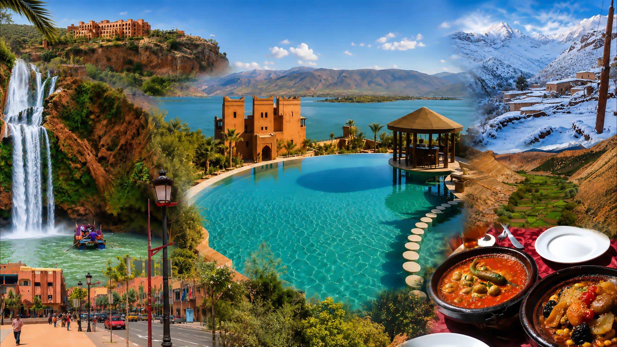
Visual composition centred on Bin el Ouidane Lake, with Azilal streets, waterfalls, Atlas mountain scenery and Moroccan food

Visit / Place · Atlas Mountains · Azilal province

Bin el Ouidane Lake Blue water, folded hills and an open Atlas horizon

In the mountains of Azilal province, Bin el Ouidane opens into a broad reservoir of winding shores, sheltered inlets and long views across the water.

Give the lake room in your journey: a viewpoint above the shore, time beside the water and a slower connection to the surrounding Atlas landscape.

Why Bin el Ouidane Lake matters

Mountain water with a wider purpose.

Bin el Ouidane is a reservoir created by a dam on the Oued El Abid in Azilal province, within the Béni Mellal-Khénifra region. Its importance extends beyond the shoreline: the dam was built for hydroelectric generation and irrigation, linking mountain water to the needs of communities and agricultural land downstream.

That origin changes how the landscape should be understood. The surrounding relief gives the basin its shape, while impounded water reaches into the valleys between the hills. The result is a place where engineering and mountain geography can be read together, even when the dam itself is outside the view.

The lake also belongs to the visitor geography of Azilal. Morocco's national tourism office places it alongside the area's waterfalls, gorges and mountain valleys. Within that wider journey, its appeal is the opportunity to pause: a stretch of open water gives the eye a different rhythm after enclosed valleys and winding roads.

For a visitor, the useful distinction is between seeing the lake and reaching a particular part of its shore. A terrace, a roadside panorama and a boat departure point offer different experiences. Choose the kind of visit you want before choosing an arrival point; a beautiful view from above does not necessarily provide access below.

Keep the inhabited landscape in the picture. Buildings, cultivated plots, local roads and places of hospitality are part of the lake's surroundings. Their presence gives the view a human scale and makes considerate use of shore paths and local services part of the visit.

For background, see the Moroccan National Tourist Office's Azilal overview and Structurae's dam record. The official outdoor guide describes the lake's water-sports setting.
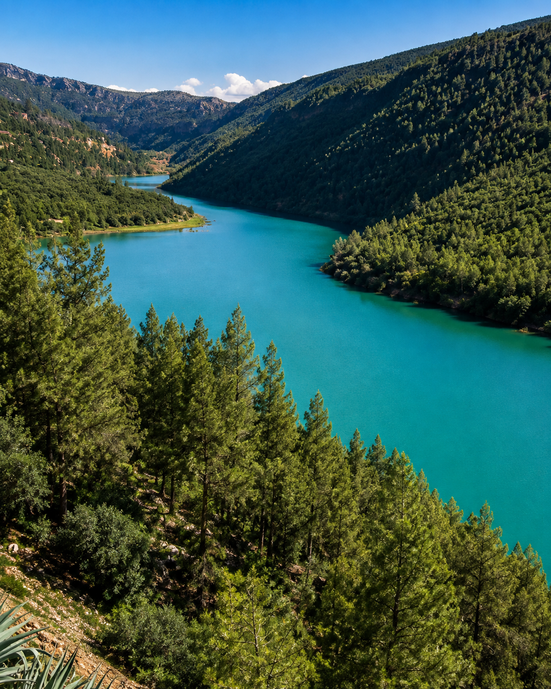
Blue water winding between wooded slopes at Bin el Ouidane

Map orientation

The map centres on the lake. For arrival, choose a confirmed shore access or your accommodation. Open the lake map.

Editorial reading

The shoreline reveals the shape of the hills.

Follow one edge of the water with your eye. It turns behind a ridge, opens into a bay and returns along another slope. This irregular outline is a useful way to understand the ground beneath the reservoir: the water occupies a landscape whose valleys and high points still govern its form.

A wide view can flatten those relationships. A nearer headland may seem to touch a distant bank, closing a passage that is actually open. Move to a second permitted viewpoint and the apparent arrangement can change; overlapping hills separate and the length of an inlet becomes easier to judge.

Look at the land before naming the colour of the lake. Dark vegetation, pale exposed ground and the shadowed side of a ridge all influence how blue or green the adjacent water appears. The colour is part of a changing scene, rather than a fixed promise attached to the destination.

The distinction between foreground and distance is especially rewarding here. A branch, a path or a building can establish the near scale, while successive ridgelines carry the view outward. Leave enough space between them in a photograph for the lake to remain legible.

Finally, allow the view to be incomplete. A bend disappearing behind a hill can say more about the reservoir's extent than an attempt to fit everything into one frame. Bin el Ouidane rewards a sequence of observations: one bay, one crossing of light, one clear relationship between water and slope.

Historical and landscape orientation

A reservoir shaped by a twentieth-century dam.

The lake's modern history begins with the construction of the Bin el Ouidane Dam between 1949 and 1953. Keep that history distinct from the much older mountain setting: the basin is a meeting of natural relief, river flow and a major water-engineering project.

01Place type

An artificial lake

The expanse of water is a dam reservoir. Calling it a mountain lake describes its setting; identifying it as a reservoir explains how it came to occupy the valleys.

021949–1953

The dam project

Designed by Coyne et Bellier, the arch dam established the lake's modern form. Its curved concrete structure adds a distinct engineering chapter to the landscape.

03Water use

Power and irrigation

The scheme serves electricity generation and agricultural irrigation. The water seen from the shore therefore belongs to a system with responsibilities extending well beyond tourism.

04Today

A changing waterline

Reservoir levels respond to inflow and water management. Exposed shore, the reach of individual bays and practical launching points can differ from photographs taken on an earlier visit.

A visual bridge

Three ways to read water and relief

Use the lake as a way of seeing the mountains more clearly. These three simple observations give a broad panorama structure without turning the visit into a checklist.

01

Contour

Trace a single bay

Choose one inlet and follow its edges from the mouth toward the narrowing end. The curve makes the slope easier to understand than a quick glance across the whole lake.

  • Find where the water turns out of sight.
  • Compare the two sides of the inlet.
  • Notice how the ridge encloses the view.
02

Scale

Give distance a reference

An isolated boat or a building across the water can reveal the width of a scene that otherwise has few measurements. Let that small reference explain the surrounding space.

  • Separate the near shore from the far bank.
  • Use one modest detail to establish scale.
  • Leave room around the point of interest.
03

Surface

Watch a reflection break

Where the water is still, a slope may be doubled below its own edge. A breeze or passing wake breaks that reflection, replacing a solid shape with a moving pattern.

  • Compare sheltered water with open water.
  • Look for the boundary between shade and glare.
  • Pause long enough to notice a change.

Quick orientation

Type of place

A mountain reservoir on the Oued El Abid: open-water scenery, branching shores and a dam whose role extends into the surrounding region.

Best for

Landscape photography, a lakeside pause and locally arranged water activities. Allow time to settle into one part of the shore.

City and travel base

Connect the lake with Azilal and the surrounding mountain area. For an overnight stay, consider how your accommodation connects to the shore you want to visit.

What visitors experience here

From a mountain approach to the water's edge.

The experience depends on where you stop. A high panorama opens the basin at once; a shore path brings stones and vegetation into focus; time on the water changes the apparent height of the surrounding hills.

Arrival

The first broad opening

After looking along slopes and bends, a clear view over the lake gives the eye room to travel sideways. Stop only where there is a safe, permitted place to pull off and stand.

Light

Bright water, darker folds

Sunlit water can dominate the view while neighbouring hollows remain shaded. Turn slightly away from the strongest glare to pick out the smaller folds of the hills and details on the opposite bank.

On the water

A lower line of sight

A locally arranged boat outing brings the horizon closer to the surface. Bays become spaces to move through, while slopes that looked gentle from above can appear much steeper from below.

Close detail

Where land meets water

At an accessible shore, look down as well as outward. Stones, exposed soil, roots and the small movement of water against the bank give the visit a tactile scale that panoramic images leave out.

Sound

Quiet with interruptions

The soundscape depends on the shore you choose: wind in trees, voices, a boat engine or water against the bank. A busy departure point and a quieter terrace can feel very different within the same landscape.

Hospitality

Time at a table

A meal or tea overlooking the water gives changing light time to become noticeable. Ask what is available, settle the practical arrangements and let the pause become part of the visit.

Place details and orientation

Six elements that organise the lake

These features help distinguish the reservoir itself from the roads, buildings and visitor services around it. Each belongs to a different scale of the landscape.

1
The main basin

The broad expanse of open water provides the central reference for orienting viewpoints and understanding which shore you are looking toward.

2
Branching inlets

Narrower arms extend between hills. Their bends explain why a destination that appears close across the water may require a longer journey by land.

3
Ridges and headlands

Projections of higher ground divide the view into separate reaches. They give individual bays their enclosure and create overlapping layers in a panorama.

4
The dam

The engineered boundary holds back the reservoir. Treat it as operational infrastructure and observe any restrictions around its structures and approaches.

5
The inhabited shore

Homes, accommodation and local routes occupy parts of the surrounding slopes. Public access should be established on the ground rather than assumed from a map.

6
Arrival and departure points

Your booked accommodation or activity provider should confirm the appropriate meeting point. A pin in the centre of the lake is useful for orientation, not road navigation.

Reading the ground

A clear view can conceal a complicated route.

Across open water, distances are easy to underestimate. A terrace visible on another slope may be separated from you by several bays. Before setting out, compare the road route with the direct line your eye draws across the lake.

The same applies vertically. A viewpoint above a steep bank can offer an excellent panorama without a suitable path down. Decide whether your aim is a view, a walk or a water activity, then choose a place that supports that specific experience.

A local host can often clarify the distinction quickly. Ask where to park, which path is appropriate and where to meet a boat operator. Those small details turn a general destination into a workable visit.

Water and landscape intelligence

The waterline is part of the story.

A reservoir has a moving edge. As its level changes, gently sloping ground can emerge over a broad area, while a steeper bank may show a narrower exposed band. Read those differences alongside the terrain, without treating a single photograph as a measure of current conditions.

The practical consequences matter more than trying to interpret every mark on the shore. A previous launching point may sit farther from the water, and a once-familiar approach may need to change. Confirm your activity arrangements close to the visit and keep a flexible plan for time on land.

What to notice slowly

  • Compare the angle of an exposed bank with the hillside above it.
  • Look for sheltered coves and more open reaches of water.
  • Distinguish a visible track from a confirmed public walking route.
  • Observe the dam from permitted areas without approaching working structures.
  • Check where your chosen service actually meets its visitors.
  • Use present conditions to plan the day, rather than an older image of the lake.

Landscape reading

Three relationships beyond the panorama

Height and access

Elevation changes what a visit offers. Higher ground clarifies the layout; a lower position reveals the bank itself. Choose viewpoints and shore stops for their distinct qualities instead of expecting one location to provide everything.

Exposure and shelter

A hillside may shelter one inlet while the broader basin remains open to wind. Conditions experienced from a protected terrace do not necessarily describe those a boat will encounter farther out.

Visitors and daily use

The lakeside serves more than leisure. Notice access roads, homes and working spaces, and leave their entrances clear. An attractive shore remains part of someone's everyday surroundings.

Visual atmosphere

Colour, texture and space to look

Blue beside green

The meeting of water and vegetation gives the shore a clear visual edge. Look for a place where one wooded slope reaches toward the lake; keeping that simple relationship in the frame can be more expressive than including every distant feature.

Rough beside smooth

Rock, soil and the uneven canopy of trees create a textured foreground. Water offers a contrasting surface, sometimes smooth and sometimes finely rippled. Let both remain visible so the image conveys the physical character of the setting.

Space around a subject

Resist filling every part of the frame. A stretch of uninterrupted water beside a headland or small boat gives the eye a place to rest. The lake's sense of breadth often survives best when a photograph leaves something open.

Nearby places and onward links

Connect the lake to Azilal and the Atlas

Use Azilal as the city-guide connection, then build an itinerary around the mountain landscapes that interest you. Waterfalls and valleys in the wider area need their own route planning; they are separate outings from the lake.

Azilal

The provincial town gives the journey a useful urban counterpoint: streets, local services and a broader introduction to the surrounding mountain area.

Open Azilal city guide

Atlas and interior Morocco

Place Bin el Ouidane within the country's mountain geography. Explore the region directory to connect landscape choices with the direction of your journey.

Explore the regions

Waterfalls and valleys

Ouzoud Falls and Aït Bouguemez offer different ways of encountering the wider Azilal area. Browse the Visit collection when choosing a separate onward excursion.

Browse Visit places

Morocco through its themes

Follow a subject beyond a single destination: landscapes, architecture, food or craft can each give the next stage of a journey a clear focus.

Explore the themes

Plan your journey

Arrange transport, an arrival point and any booked activity together. Leave enough flexibility for a slower approach and changing conditions on the water.

Plan your journey

Stories from Morocco

Continue with editorial reading that gives destinations a wider cultural context and adds another perspective to what you notice along the way.

Read stories

How to visit respectfully

Choose your access with care.

Start with a confirmed place to arrive. Ask your accommodation or activity provider about parking and shore access, and respect private land and any restrictions near the dam. Keep roads and working entrances clear when stopping for a view.

For a water activity, agree the route, duration, total price and return arrangements before leaving. Ask about weather conditions and suitable life jackets for everyone in the group. Do not infer that a stretch of water is suitable for swimming from its colour or an attractive photograph.

  • Wear a properly fitted life jacket for boating or paddling.
  • Stay away from dam structures, intakes and marked restricted areas.
  • Use established access points and keep children closely supervised near the shore.
  • Carry drinking water, sun protection and footwear suited to uneven ground.
  • Take litter away and ask before photographing people or entering private spaces.

A strong first visit

Begin at a safe viewpoint with room to stand away from traffic. Identify the shore you have reached, the broad basin and the hills separating its bays. This first orientation helps you understand the rest of the day without needing to chase every possible panorama.

Then choose one closer experience. It might be a meal overlooking the lake, a short walk on an appropriate path or a prearranged boat outing. Give that choice enough time to be worthwhile instead of moving repeatedly between distant arrival points.

Before going onto the water, confirm who is responsible for the trip and how you will return. If the wind or access conditions make the outing unsuitable, a land-based visit can still offer a full sense of the lake.

Finish with a clear onward plan. Azilal provides the next city-guide connection; other mountain excursions deserve their own time and transport arrangements. A measured day beside the reservoir can stand on its own.

  • Orient yourself from one safe, permitted viewpoint.
  • Choose a shore stop that matches the experience you want.
  • Confirm equipment and arrangements for any water activity.
  • Leave time for a meal, a pause and the return journey.
  • Plan the next destination as a separate stage.

Before you travel: confirm current water conditions, access and activity availability with your host or operator. The map shows the lake, not a guaranteed meeting point.

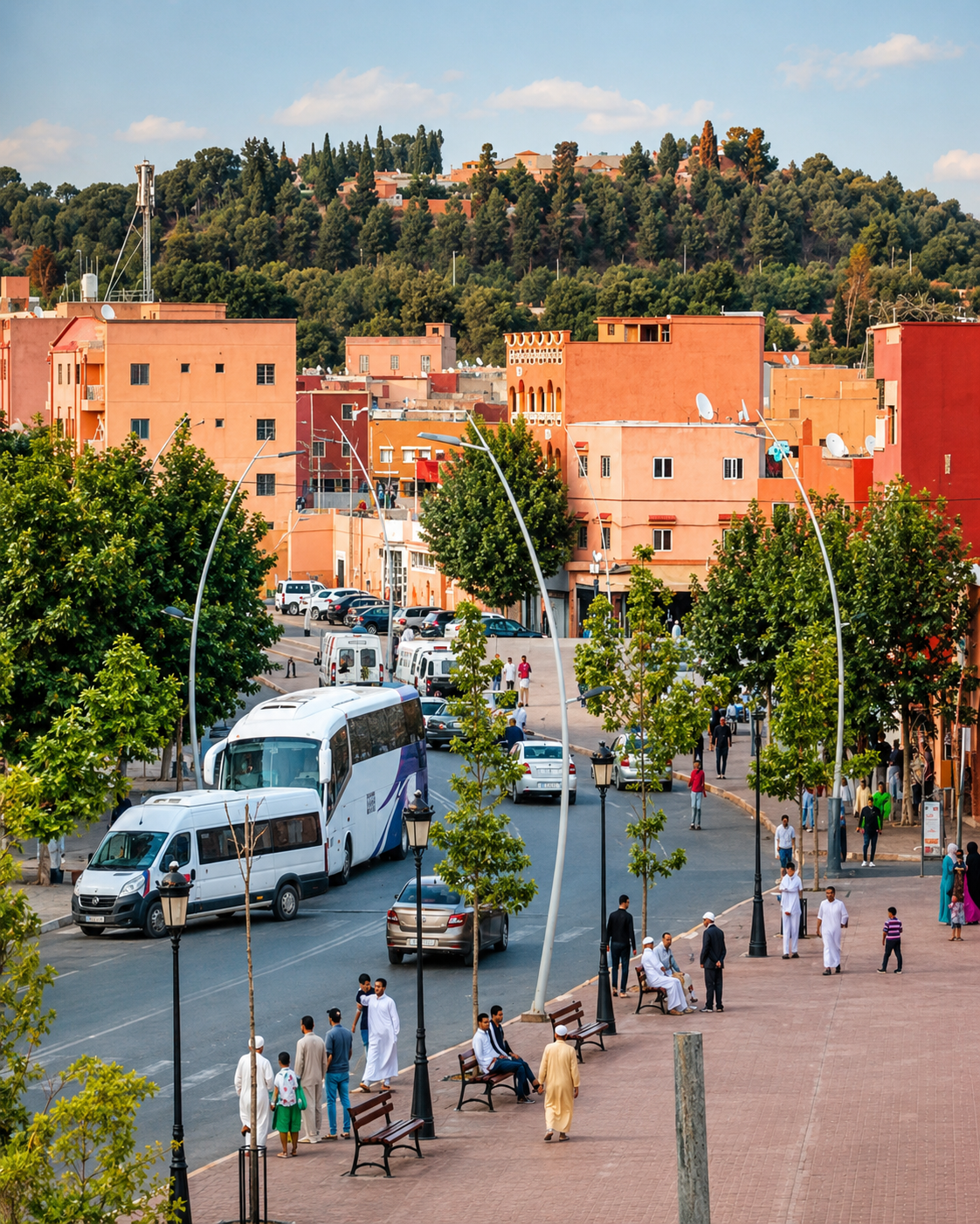
A tree-lined street in Azilal with warm-coloured buildings, pedestrians and a wooded hillside

Go deeper through the city context

Azilal — the next chapter of the journey

After the open water of Bin el Ouidane, Azilal shifts the scale toward streets, shops and everyday town life. Use the city guide to connect the lakeside visit with the provincial setting around it.

From that wider perspective, choose what deserves another day: waterfall scenery, a mountain valley or more time in the town itself. The strongest itinerary allows each place its own character and gives the roads between them the time they need.

Azilal city orientationTown and mountain context Waterfall and valley ideasLocal food and everyday life Practical travel planningFurther Atlas exploration

Continue the journey

From Bin el Ouidane to the wider Atlas.

Carry the lake's sense of space into a journey through Azilal, mountain towns, valleys and the varied landscapes of Morocco.