
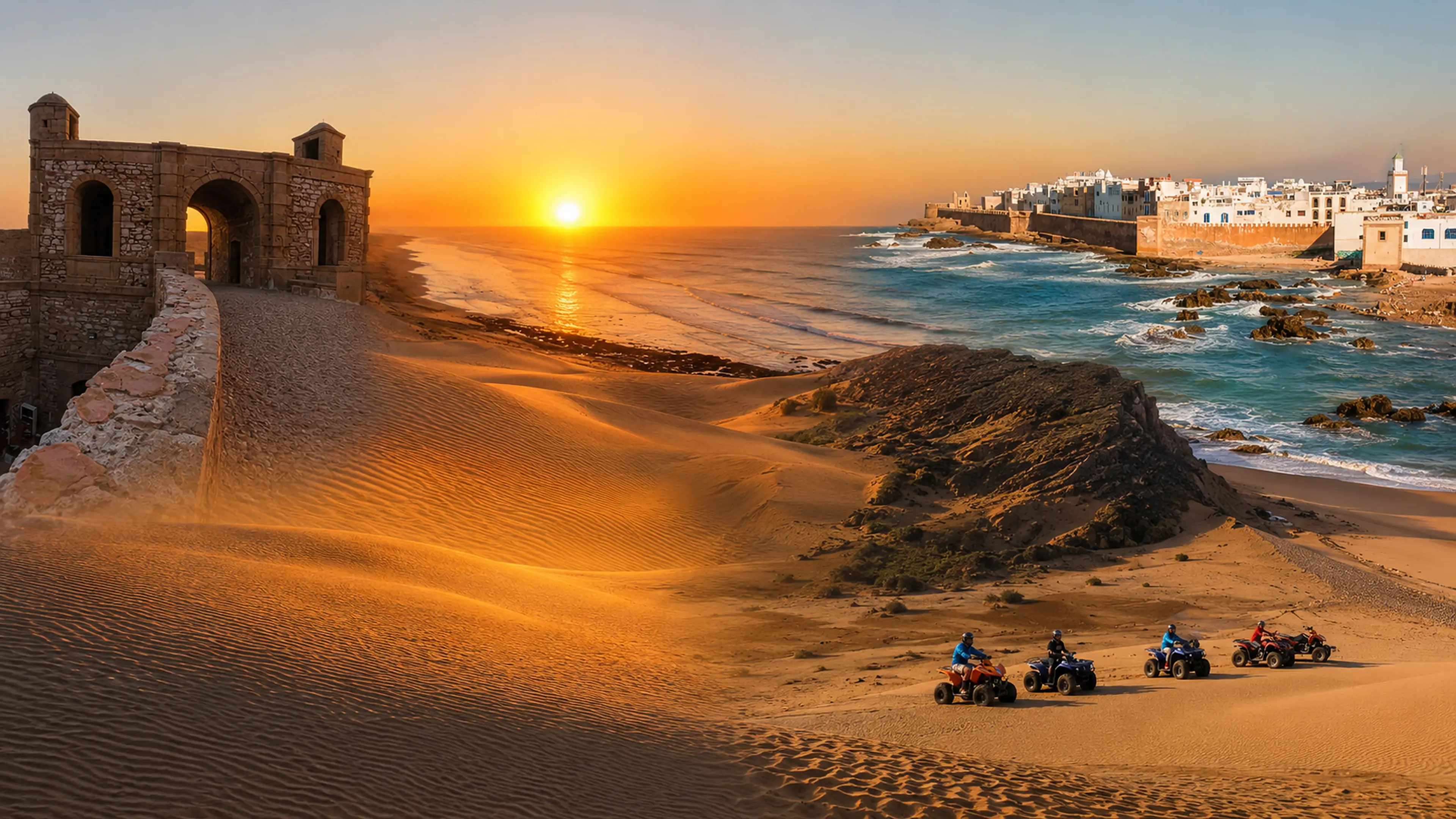
Cap Sim Dunes meeting the Atlantic coast in warm evening light near Essaouira, Morocco

Visit / Place · Atlantic coast · Essaouira province

Cap Sim Dunes Atlantic sand, ocean wind and a wild coastal edge near Essaouira

Cap Sim Dunes is a coastal landscape where sand ridges, surf light, rocky edges and open Atlantic air create one of Essaouira's most memorable natural approaches.

Start wide. The dunes make sense when the eye holds the whole setting together: low sand forms, the sea line, wind-marked texture, lighthouse context and the route between Essaouira and Sidi Kaouki.

Why Cap Sim Dunes matters

A coast before it is an adventure stop.

Cap Sim Dunes matters because it shows a different side of the Essaouira coast. The place is not only a beach view or a sports route; it is a meeting point between mobile sand, Atlantic swell, wind-shaped vegetation, rock and the broad light that gives this part of Morocco its open horizon.

The dunes should be read as a living surface. Their ridges change with wind, footsteps, tracks and season, so the beauty is not fixed like a monument. It comes from movement: the way sand gathers, thins, folds and catches low light before dropping toward the water.

Cap Sim also gives Essaouira a wider geographic frame. The medina and harbour explain one face of the city; the dune coast explains another. It reminds visitors that Essaouira is not only walls, blue boats and craft streets, but also a windy Atlantic landscape where land, sea and route are constantly negotiating with each other.

The lighthouse context matters because it turns the dunes into a navigational coast rather than a loose postcard scene. A cape, a light, exposed water and a line of sand create a readable maritime edge: beautiful, but also practical, weathered and shaped by the sea.

For visitors, the strongest experience is careful looking. Cap Sim rewards people who notice texture, distance and restraint: ripples in sand, the pressure of wind, the colour shift between beach and rock, and the need to keep fragile dune surfaces from becoming damaged shortcuts.

Orientation is kept conservative and cross-checked against public references describing Cap Sim's dunes near Essaouira and maritime listings for the Cap Sim light. See EnVols and MarineTraffic; practical access should still be verified locally.
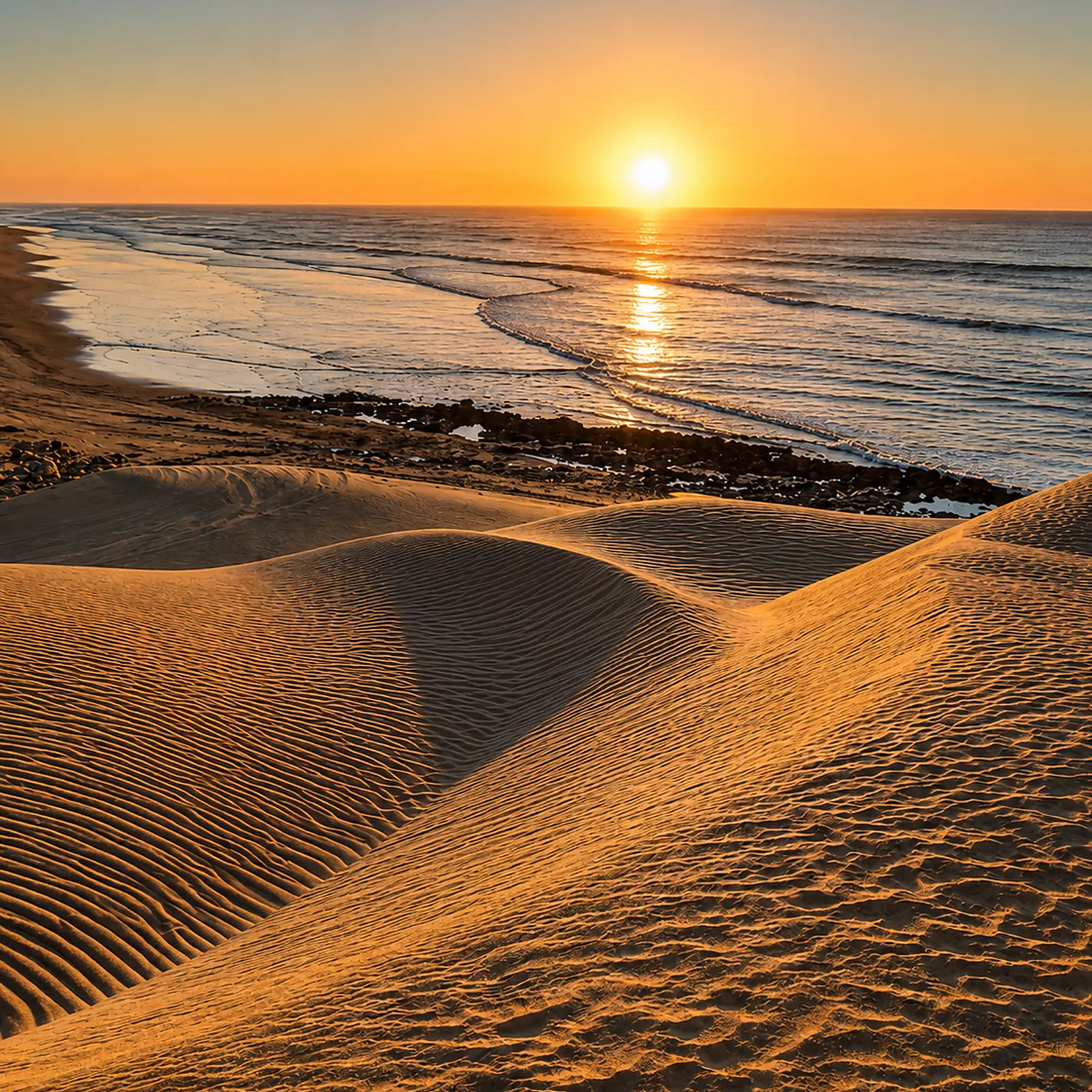
Golden Cap Sim dune ridges above the Atlantic shore near Essaouira

Map orientation

Use the map to place Cap Sim on the Atlantic edge south of Essaouira, close to the coastal route and the wider Sidi Kaouki landscape.

Editorial reading

The beauty is written by wind.

Cap Sim is strongest when read through motion. Wind draws the sand into lines, the Atlantic pulls the eye outward, and the rocky edges stop the dunes from feeling like an inland desert. The landscape is coastal first: salty, exposed, bright and open.

That is why the dunes should not be sold as a miniature Sahara. Their identity is different. They belong to the Essaouira coast, where ocean air, surf sound, low scrub and pale sand create a softer but sharper kind of drama.

Look at the foreground before the horizon. The small ridges in the sand show wind direction and foot pressure. The shape of each dune tells you that this landscape is being remade constantly, which is exactly why visitors need to move through it with care.

The coast also changes the emotional rhythm. In one direction, the view feels empty and elemental; in another, Essaouira's city context returns through memory, craft streets, harbour walls and Atlantic trade. Cap Sim sits between those readings without needing to become either one completely.

A good visit keeps speed under control. Guided riding, walking and photography can all belong here when handled responsibly, but the best memory comes from pausing: sand underfoot, sea glare, wind at the ears and a coastline that refuses to be reduced to a quick image.

Natural and coastal orientation

Read the dunes as a fragile Atlantic system.

Cap Sim is best understood as a coastal landscape rather than a single attraction. Sand, wind, ocean, rock, vegetation and lighthouse context all shape the visit. The exact practical route can vary, so the page keeps fixed claims limited and focuses on what visitors can read with confidence once they are there.

01Place type

Atlantic dune coast

The identity comes from the meeting of dune ridges and the Atlantic edge. It is not an inland desert scene; the sea, wind and coastal exposure are essential to the place.

02Coastal marker

Cape and lighthouse context

The Cap Sim light helps visitors understand the place as a maritime edge. It gives the dune landscape a navigational and coastal reading, not only a scenic one.

03Surface

Sand that records movement

Dune surfaces show wind, texture and pressure. Ripples, slopes and footprints can change quickly, so the visual character is dynamic rather than fixed.

04Care

A landscape easily marked

Tracks, litter and shortcuts can remain visible and harm the experience. Responsible access matters because the dunes are soft, exposed and visually delicate.

A visual bridge

Three readings between sand, sea and Essaouira

Before Cap Sim becomes a photograph, it is a relationship between wind, water and route. These three readings help visitors slow down and see why the dunes feel powerful without needing monumentality.

01

Sand

Texture as evidence

The dune surface is the first text. Ripples, soft shadow, slope and broken edges show how wind has moved across the coast before the visitor arrived.

  • Read small ridges before chasing the panorama.
  • Notice how low light sharpens the sand surface.
  • Keep to durable paths where local guidance indicates them.
02

Sea

The Atlantic sets the scale

The ocean keeps Cap Sim from feeling closed. Waves, glare and horizon pull the dunes outward, giving the place its wide coastal intelligence.

  • Keep the shoreline in view while reading the sand.
  • Watch how rock, beach and water interrupt each other.
  • Treat surf and wind as part of the place, not background.
03

Route

Essaouira beyond the medina

Cap Sim extends the city story into open terrain. It connects Essaouira's Atlantic identity with dunes, lighthouse context and the road toward Sidi Kaouki.

  • Use Essaouira as the cultural base.
  • Let Cap Sim show the landscape outside the walls.
  • Return with a wider reading of the coast.

Quick orientation

Type of place

A wind-shaped Atlantic dune and coastal landscape near Essaouira, best read through sand texture, ocean exposure and the cape's maritime setting.

Landscape context

Cap Sim belongs to the open coast south of Essaouira, with dune ridges, beach edges, rocky interruptions and the broad light associated with this Atlantic region.

Best for

Landscape photography, slow coastal walking, dune texture, sea views, guided outdoor activity and a deeper reading of Essaouira beyond the medina.

Closest city context

Essaouira is the natural base for understanding Cap Sim, linking the dunes with harbour history, craft streets, Atlantic weather and onward coastal routes.

What visitors experience here

A landscape that changes with every step.

Cap Sim works through gradual shifts. First comes the openness of the coast. Then the eye begins to separate sand ridges, darker rock, surf lines, low vegetation and tracks of movement. The place becomes richer when the visitor stops treating the dunes as empty space and starts reading them as a surface full of signs.

Arrival

The coast opening wide

The first impression is space: sky, sand and sea held together by wind. Cap Sim feels broad before it feels detailed, which is why the opening view should not be rushed.

Light

Sand changing colour

Warm light brings out gold, amber and pale grey in the dune surface. The colour is strongest when shadow reveals texture rather than flattening the sand into one tone.

Sound

Wind and surf together

The soundscape is simple but not empty. Wind, distant waves and footsteps give the visit a coastal rhythm, especially away from the busiest access points.

Texture

Ripples under the eye

The dune skin is full of small lines. Look down as much as outward: ridges, footprints and wind marks explain how exposed the landscape is.

Edge

Rock, water and dune

Cap Sim is not pure sand. The stronger reading comes from the interruptions: darker rock, beach margins, surf and the places where the dunes drop toward the ocean.

Pace

A slow coastal memory

The best visit leaves room for pauses. Move less, look more, and let the Atlantic scale do the work instead of turning the landscape into a checklist.

Place details and orientation

Read Cap Sim through six defining elements

No single feature explains the dunes. Their identity comes from the relationship between sand movement, Atlantic water, rock, vegetation, lighthouse context and Essaouira's coastal route.

1
Dune ridges

Low and high sand forms create the main visual rhythm, especially where light turns small ripples into sharp lines.

2
Atlantic shoreline

The sea gives the dunes their scale, sound and brightness. The landscape should always be read as coastal, not inland.

3
Lighthouse point

The cape's light adds maritime context and helps connect the dunes to navigation, exposure and the wider Atlantic edge.

4
Rocky breaks

Dark stone, beach margins and uneven coastal edges interrupt the sand and keep the view visually grounded.

5
Coastal vegetation

Low scrub and wind-shaped greenery help hold parts of the dune edge and remind visitors that the surface is not empty.

6
Essaouira route

The dunes make most sense when linked with Essaouira, Diabat, Ouassane and the coastal movement toward Sidi Kaouki.

Coast, not backdrop

The place asks for a slower eye.

Stand back before entering the dune area. The first lesson is spatial: sand does not sit apart from the coast, it folds toward the Atlantic and receives its shape from wind, water and exposure.

Then move closer. The surface becomes more precise: ridges, footprints, grain, broken edges and small plants all change the reading. What looked empty from a distance becomes a record of movement.

Keep the lighthouse context and Essaouira route in mind. They prevent Cap Sim from becoming a generic dune image and return it to its real coastal geography.

Landscape and material intelligence

Sand is not empty surface.

The dune character of Cap Sim is not just visual atmosphere. Sand, salt air, wind, coastal vegetation and rock form a delicate landscape that changes quickly and records pressure clearly. Its beauty depends on openness, but also on restraint.

That is why the strongest reading is practical as well as visual. Visitors should understand where they are walking, how tracks affect the scene, why low plants matter and why a quiet approach protects both the landscape and the experience for the next person.

What to notice slowly

  • Look for wind lines before focusing only on the ocean view.
  • Notice where sand meets rock, scrub, beach and water.
  • Distinguish Cap Sim's coastal dunes from inland desert imagery.
  • Keep the lighthouse and cape context in the visual reading.
  • Use Essaouira as the wider cultural and travel base.
  • Avoid cutting new paths across fragile-looking dune surfaces.

Visual reading

Three coastal languages to notice

Wind and grain

Cap Sim speaks first through small lines. The dunes hold evidence of wind direction, footsteps and recent movement, so close looking matters as much as the wide view.

Horizon and edge

The Atlantic horizon opens the landscape, while rocks and shoreline details keep it from becoming abstract. The tension between openness and edge gives the place its authority.

Route and return

The visit belongs inside an Essaouira journey. After the dunes, the city feels different: its walls, harbour, markets and wind all connect back to the same Atlantic condition.

Visual atmosphere

Light, texture and coastal memory

From distance to detail

Start with the whole coastline, then move closer to read small ripples, broken slopes, shadowed troughs and the line where sand gives way to beach or rock. The shift from panorama to grain is essential.

From sand to sea

The strongest contrast is the meeting of warm dune colour with blue Atlantic water. Watch how light changes both at once: sand becomes textured, water becomes metallic, and the horizon pulls the view open.

From photo to memory

The image may be dramatic, but the deeper memory is quieter: wind against clothing, bright salt air, sand underfoot and the sense of leaving Essaouira's urban fabric for a rawer coastal edge.

Nearby places and onward links

Connect Cap Sim to the wider Essaouira coast

Cap Sim belongs naturally inside an Atlantic Coast itinerary. Essaouira gives the clearest city context, while the wider region opens toward port history, craft culture, surf towns and open coastal landscapes.

Essaouira

The closest major city context for Cap Sim. Use it to connect dune light with harbour walls, medina lanes, craft streets, Atlantic weather and coastal planning.

Open Essaouira city guide

Atlantic Coast & Historic Port Cities

The regional frame for Morocco's ocean-facing medinas, fortified ports, surf edges, fishing towns and long Atlantic horizons.

Explore the region

Hidden Morocco

Cap Sim works well for readers who want Morocco beyond the obvious frame: quiet edges, slower routes and landscapes that need careful looking.

Read the theme

Visit Morocco places

Continue through beaches, dunes, waterfalls, lagoons, valleys, caves, monuments and natural places beyond the city guides.

Browse Visit places

Plan your journey

Treat Cap Sim as a landscape stop within an Essaouira route, not as an isolated detour. Check access and conditions close to travel.

Plan your journey

Stories from Morocco

Use the Stories section for richer cultural reading around coast, craft, movement, weather and the human rhythm behind Moroccan places.

Read stories

How to visit respectfully

Good behaviour keeps the dunes beautiful.

Cap Sim is open and photogenic, but openness can make damage feel invisible until it accumulates. Move with local guidance, avoid cutting unnecessary tracks across dune surfaces, and treat the landscape as a place with texture, vegetation and quiet, not as a blank playground.

Respect also means choosing a pace that fits the coast. Keep noise low, avoid litter, give space to walkers and guided groups, and do not pressure drivers, guides or animals into routes that look unsafe or damaging. The best visit protects the calm that made the place worth visiting.

  • Follow local guidance on safe and appropriate access routes.
  • Do not leave litter, food waste or plastic in the sand or near the shore.
  • Avoid trampling low vegetation or fragile-looking dune edges.
  • Ask before photographing people, guides, riders or private activity.
  • Check wind, tide, route and access conditions close to travel.

A strong first visit

Begin with the wide view so the coast has time to settle in the eye. Read the dunes, ocean and cape together before focusing on one dramatic frame. This prevents the visit from becoming only a sunset photograph.

Move slowly enough to notice the sand surface. The small ridges, footprints, plant edges and colour changes reveal more than a fast crossing. Where access is unclear, wait for local guidance rather than guessing a route.

If your visit is part of a guided outdoor activity, let the guide set safe lines and pace. Cap Sim can carry adventure, but the landscape should still feel intact after the experience is over.

Afterward, return to Essaouira with the coast in mind. The city's wind, walls, harbour and craft streets make more sense when connected to the open Atlantic landscape just outside it.

  • Start from the wide coast view, then move into detail.
  • Give extra attention to wind marks and sand texture.
  • Keep off fragile edges when there is a clearer route nearby.
  • Leave space for others to experience quiet and open views.
  • Connect the visit back to Essaouira's Atlantic identity.

Careful planning note: access, wind, tide and activity conditions can change. Verify practical arrangements locally before travelling.

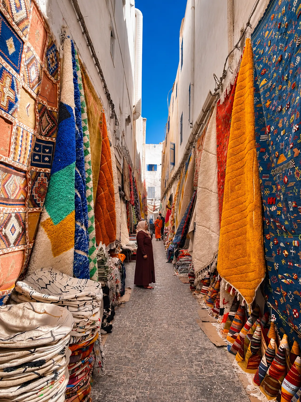
Colourful carpets in Essaouira medina, the city gateway context for Cap Sim Dunes

Go deeper through the nearest city context

Essaouira - the city gateway to Cap Sim Dunes

Cap Sim belongs naturally inside a wider Essaouira journey. The city gives visitors a stronger base for reading Atlantic Morocco: harbour walls, craft streets, trade memory, wind, surf light and the open coastal landscapes beyond the medina.

Use Essaouira to widen the context after the dunes. The city explains why this coast feels both cultural and elemental: a place of built edges, ocean weather, handwork, movement and horizon.

Atlantic city orientationMedina and harbour context Craft and market streetsCoastal route planning Wind, surf and open lightNearby natural landscapes

Continue the journey

Continue from Cap Sim into Atlantic Morocco.

Read the dunes slowly, then connect them to Essaouira, the Atlantic coast, open horizons and the wider landscape map of Morocco.