
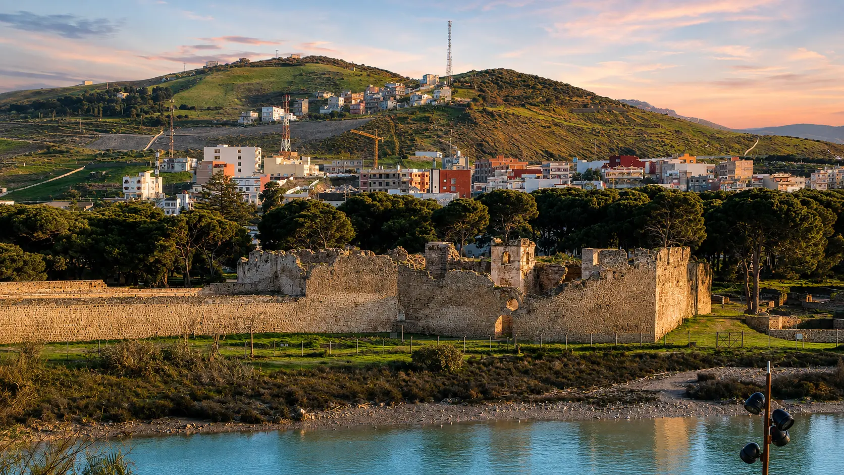
Ksar Sghir fortress walls beside the water on Morocco's Strait of Gibraltar coast

Visit / Place · Strait of Gibraltar coast · Fahs-Anjra

Ksar Sghir Coast & Fortress A circular port-fortress where Morocco faces the strait

Ksar Sghir is a coastal archaeological place where ruined walls, river mouth, sea access and northern Moroccan route history meet in one compact, powerful landscape.

Begin with the whole setting: stone walls close to the water, the town rising behind them, the strait beyond, and the feeling that this was never only a ruin. It was a controlled edge between coast, river, passage and defence.

Why Ksar Sghir matters

A small fortress with a wide horizon.

Ksar Sghir matters because it compresses a large northern Moroccan story into a very legible place. The site stands on the strait coast between Tangier and Ceuta, where sea passage, military control, river access and settlement all shaped the value of the shore.

The Moroccan Ministry of Culture describes the medieval site as one of Morocco's major archaeological places and as part of the wider Circle of the Strait of Gibraltar. That framing is important: Ksar Sghir is not just a quiet ruin by the water, but a coastal document of movement between Morocco, the Mediterranean and al-Andalus.

The site is also unusual in plan. Official heritage material describes the Islamic city inside a circular enclosure of about 200 metres in diameter, giving it a rare urban form in Moroccan and western Islamic medieval planning. From above, that geometry explains why the walls read as one controlled coastal system rather than scattered remains.

Its later Portuguese layer adds another reading. The Ministry identifies two monumental and urban units: the Islamic city and the Portuguese citadel. It also points to the Couraca, a defensive sea-linked structure that makes the relationship between the town and the water impossible to ignore.

For visitors, the reward is not spectacle alone. Ksar Sghir asks you to read wall curve, tower rhythm, water edge, town life and strategic horizon together. Its beauty comes from position: a place small enough to understand slowly, but open to one of the most consequential maritime corridors in the region.

Core heritage facts are grounded in the Moroccan Ministry of Culture page for CIP Ksar Sghir and the Journal of Field Archaeology abstract hosted by Arizona State University. Practical details should be checked close to travel.
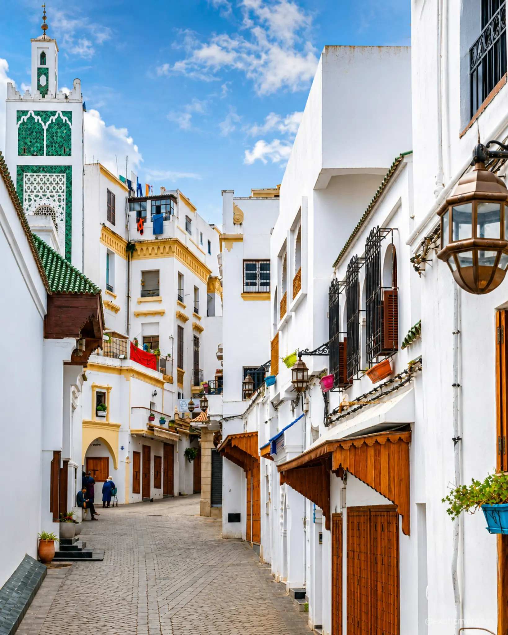
White medina street and minaret in Tangier, the nearest city context for Ksar Sghir

Map orientation

Use the map to place the fortress at the river mouth and coastal edge before connecting it back to Tangier and the strait corridor.

Editorial reading

Its beauty is strategic, not ornamental.

Ksar Sghir is most rewarding when read as a coastal instrument. The wall line does not only frame a ruin; it records how a town controlled approaches from land and sea, how gates shaped movement, and how the shoreline made defence and departure part of the same story.

The first visual lesson is the circle. Unlike a long medina wall or a hilltop kasbah, the enclosure gathers the site into a compact form. That roundness gives the visitor a clear way to look: trace the edge, then ask how entrances, towers and sea-facing structures managed movement.

The second lesson is the water. The fortress is not set back from the coast as a romantic viewpoint. It belongs to a practical maritime edge, where ships, soldiers, goods and communities could be organised around a protected bay and river mouth.

The third lesson is layering. Islamic urban fabric and Portuguese fortification logic occupy the same archaeological field. That does not make the place confused; it makes it historically dense. Different powers used the same strategic shoreline because the geography kept mattering.

Look beyond the broken surfaces. Ruins can make visitors rush to the most dramatic wall, but Ksar Sghir asks for a slower eye: curve, gate, tower, wall thickness, sea wind, hillside and the ordinary town around the site all contribute to the reading.

Tangier gives the page its city context, but the place itself should not disappear into a Tangier excursion. It deserves its own pause because it explains the coast between city and strait: less polished, more archaeological, and deeply tied to northern Morocco's history of passage.

The strongest memory comes from holding two scales together. At close range, the masonry is rough, repaired and fragmentary. From a distance, the site becomes whole again: a circular port-fortress watching the water.

Historical and heritage orientation

Read the site through sea routes, circular planning and layered occupation.

Ksar Sghir is best understood as an archaeological coastal landscape rather than a single monument. The medieval site brings together an Islamic circular city, a later Portuguese citadel, sea-facing defences, river-mouth geography and the long importance of the Strait of Gibraltar corridor.

01Archaeological setting

A strait-edge site

Official Moroccan heritage material places Ksar Sghir within the Circle of the Strait of Gibraltar and describes it as a major archaeological site with occupation evidence in the surrounding territory reaching back before the medieval town.

02Urban form

The circular city

The Islamic city is described as standing inside a circular enclosure about 200 metres across, a form that gives the site its rare planimetric and urban originality in Moroccan medieval heritage.

03Marinid 1287

Fortified for passage

Ministry heritage notes identify a Marinid fortification phase in 1287, when the town was strengthened with a circular wall and monumental gates at a time when the coast remained tied to movement toward al-Andalus.

041458-1550

The Portuguese citadel

The Portuguese occupation introduced major defensive transformations, including the citadel and the Couraca. After evacuation in 1550, the site later served as a landing point for Moriscos expelled from al-Andalus.

A visual bridge

Three readings between coast, wall and passage

Before Ksar Sghir becomes a photograph, it is a relationship between shoreline, circular plan and historical movement. These three readings help visitors slow down and understand why the ruins still feel organised.

01

Coast

Sea before wall

Start with the water. The fortress belongs to a bay and river-mouth setting, so the sea is not background scenery; it is part of the reason the site was valued, defended and repeatedly transformed.

  • Read the shore as part of the architecture.
  • Notice how the wall sits close to water and town.
  • Connect the view to the wider strait corridor.
02

Plan

Circle and control

The circular enclosure gives Ksar Sghir its strongest visual grammar. It gathers gates, towers, streets and later interventions into a compact field that can be read from distance before it is read in fragments.

  • Trace the curve before focusing on details.
  • Look for gate logic and tower rhythm.
  • See the plan as movement control, not decoration.
03

Passage

A shore shaped by crossings

Ksar Sghir's history is tied to movement across and along the strait. The site makes more sense when the visitor imagines not only walls and stones, but departures, landings, watchfulness and the pressure of a contested coast.

  • Read the place as a port-fortress.
  • Keep Tangier and Ceuta in the mental map.
  • Let the landscape explain the layers.

Quick orientation

Type of place

A coastal archaeological place and medieval port-fortress, best read through its circular enclosure, Islamic city layer, Portuguese citadel and sea-facing defensive logic.

Landscape context

The site sits on Morocco's northern strait coast in Fahs-Anjra Province, close to a river mouth and coastal bay between Tangier and Ceuta.

Best for

Fortress architecture, archaeological reading, strait history, careful photography, Tangier-based exploration and a deeper understanding of Morocco's northern coast.

Closest city context

Tangier is the strongest city base for travellers who want to connect Ksar Sghir with the wider northern Morocco and Strait of Gibraltar story.

What visitors experience here

A fortress that changes when you include the sea.

Ksar Sghir works in stages. First comes the setting: water, town, hillside and wall. Then the circular form becomes visible. Only after that do the smaller readings appear: masonry, openings, broken edges, coastal wind and the quiet evidence of different historical layers sharing the same ground.

Arrival

The wall at the water edge

The first impression is compact and direct. The fortress does not rise as a distant mountain monument; it sits low and firm near the shore, making the relationship between defence and landing immediately visible.

Light

Stone, green slopes and strait air

Late light can make the walls warmer, while clear daylight shows the sharper contrast between masonry, trees, hillside houses and blue water. The visual mood is coastal rather than desert-like.

Plan

The curve before the detail

The circular logic is the key. Instead of looking only for one dramatic tower, trace how the enclosure gathers the site and gives the remains a strong readable outline.

Water

A port memory, not just a ruin

The sea-facing context changes the way the walls should be read. This was a place of watching, landing, departure and control, so the visitor should keep the shoreline in view while moving around the site.

Town rhythm

Heritage beside ordinary life

Ksar Sghir is not isolated from daily movement. Houses, local paths, road edges and small-town rhythm sit close to the archaeological field, which makes respectful behaviour part of the experience.

Photography

Wide frame, then masonry

The best images usually begin wide enough to hold water, wall and hillside together. Details matter afterward: rough stone, openings, shadowed edges and the way the fortress returns to one shape from a distance.

Place details and orientation

Read Ksar Sghir through six defining elements

No single feature explains the place. Its meaning comes from the relationship between circular urban planning, gates, coastal access, Islamic settlement, Portuguese fortification and the living town around the archaeological site.

1
Circular enclosure

The wall curve gives the site its rare urban identity and makes the medieval city readable as a planned coastal unit.

2
Gate logic

Monumental gates controlled access and movement. Read them as practical thresholds between land route, enclosed town and maritime edge.

3
Islamic city layer

The medieval Islamic city is one of the site's two major heritage units, giving Ksar Sghir its original urban and strategic structure.

4
Portuguese citadel

The later citadel records a different defensive system added to the same strategic coast during the Portuguese occupation.

5
Couraca

This famous sea-linked defensive feature helps explain how the fortress related physically and militarily to the water.

6
River mouth and bay

The sheltered coastal setting is part of the site's logic. Geography made the place useful before it made it picturesque.

Fortress, not backdrop

The place asks for a coastal eye.

Stand back before focusing on individual stones. The first lesson is spatial: the fortress belongs to water, wall, town and hillside together. Its outline makes more sense when the visitor sees the whole coastal setting before entering the detail.

Then move closer. Broken masonry, gate edges, tower rhythm and traces of defensive adaptation make the site human again. This is where the visit becomes more than a view: the eye begins to understand how people controlled movement and protected a strategic shore.

Keep returning to the water in your reading. Ksar Sghir was never only an inland fort placed near the sea by accident. Its strength comes from the way a compact urban form was made to answer the strait.

Architecture and material intelligence

Coastal defence is the design language.

At Ksar Sghir, the most important architecture is not decorative surface. It is organisation: enclosure, gateways, towers, citadel, sea access and the way the town's plan turns geography into defence. The site teaches visitors to read built form as a response to pressure.

The circular wall is especially important because it gives the site an immediate order. Even where the fabric is broken, the plan remains legible. That is why the place should be understood as an archaeological urban system, not as a loose group of photogenic ruins.

What to notice slowly

  • Look at the whole wall curve before isolating individual towers or openings.
  • Notice where the fortress relates to the river mouth, shoreline and hillside town.
  • Read the Portuguese citadel as a later layer placed onto an older strategic site.
  • Distinguish coastal defence from inland kasbah imagery; this is a strait-edge place.
  • Keep Tangier in view as the main city context, but let Ksar Sghir keep its own identity.
  • Respect fragile masonry, fenced zones, local movement and any current site guidance.

Architectural reading

Three architectural languages to notice

Circular urbanism

The enclosure is not a decorative outline. It is the main reading tool, gathering streets, gates, towers and later defensive layers into one compact coastal plan.

Maritime defence

The site faces the logic of the strait. Walls, citadel and sea-linked structures should be read with the water, because access and defence were inseparable here.

Layered occupation

Islamic city and Portuguese citadel do not cancel each other. Their overlap makes the place richer, showing how the same geography was reinterpreted across different periods.

Visual atmosphere

Water, wall and northern light

From coast to circle

Begin with the relationship between sea and enclosure. The wall curve becomes more powerful when it is seen beside water and hillside, because the place reads as a controlled coastal threshold rather than a freestanding ruin.

From stone to movement

Look for the marks of practical design: turns, entrances, edge conditions, repaired surfaces and the places where the fortress once organised movement. The visual atmosphere comes from use, not polish.

From photograph to memory

The image is strongest when it keeps context. Ksar Sghir is remembered through the sound of the coast, the warm wall surface, the slope of the town behind it and the awareness that this small place opened onto a much larger world.

Nearby places and onward links

Connect the fortress to the northern Morocco map

Ksar Sghir belongs naturally to a Tangier-based northern journey. The fortress gives the coast between city, strait and Mediterranean edge a deeper historical reading.

Tangier

The nearest major city context for Ksar Sghir. Use it to frame the strait, port history, medina life and northern Morocco orientation.

Open Tangier city guide

Northern Morocco & Rif

The regional frame for Tangier, Tetouan, Chefchaouen, the Rif landscapes and the northern coast shaped by mountain, sea and movement.

Explore the region

Architecture & Heritage

Ksar Sghir is a strong gateway into Moroccan coastal fortification, archaeological reading and the relationship between built form and strategic geography.

Read the theme

Visit Morocco places

Continue through fortresses, caves, kasbahs, lagoons, mountains, monuments and archaeological places beyond the city guides.

Browse Visit places

Plan your journey

Treat Ksar Sghir as a coastal heritage stop that works best when connected with Tangier, the strait and a wider northern route.

Plan your journey

Stories from Morocco

Use the Stories section for richer cultural reading around place, memory, coastlines, architecture and the human rhythm behind heritage landscapes.

Read stories

How to visit respectfully

Good behaviour keeps the site readable.

Ksar Sghir is close to ordinary town life, so respectful visiting means more than protecting old walls. Move calmly, avoid blocking local paths, ask before photographing people, and remember that the best view is not worth disturbing residents or other visitors.

Respect also means treating the archaeological fabric as fragile. Do not climb on walls, scratch surfaces, lean into unstable edges, cross barriers, leave litter or force access into closed areas. A slower visitor sees more and leaves less pressure behind.

  • Ask before photographing residents, workers, guides, shopkeepers or private spaces.
  • Keep away from fragile edges, loose masonry and any restricted or fenced areas.
  • Read the shoreline carefully, especially in wind, bright sun or changing coastal conditions.
  • Support local services with courtesy and avoid turning the site into a quick photo prop.
  • Check current access, restoration conditions and local guidance close to travel.

A strong first visit

Begin with the wide view so the fortress, water, hillside and town can be read together. This first frame gives the visit its structure: coast, wall, circular plan and strategic position all become visible before the details begin to compete for attention.

Walk the site slowly, giving attention to curve, gate logic, tower rhythm and sea-facing edges. The most useful movement is not rushed. Let the plan reveal itself, then move closer to read masonry, thresholds and places where later defensive work changed the older urban fabric.

If you arrive from Tangier, resist treating Ksar Sghir as a minor stop between larger destinations. Its strength is exactly its compactness: a small archaeological field that opens onto the history of the strait.

Afterward, connect the visit back to Tangier and the northern Morocco coast. That wider context helps the fortress feel less like an isolated ruin and more like part of a living geography of ports, crossings, mountains and sea light.

  • Start wide, with the fortress and shoreline in the same view.
  • Trace the circular enclosure before focusing on single walls.
  • Use the map to understand the river mouth and strait position.
  • Leave space for local movement and everyday life around the site.
  • Finish by connecting Ksar Sghir back to Tangier and northern Morocco.

Careful planning note: opening hours, prices, access arrangements and exact travel times can change. Verify practical details locally before travelling.

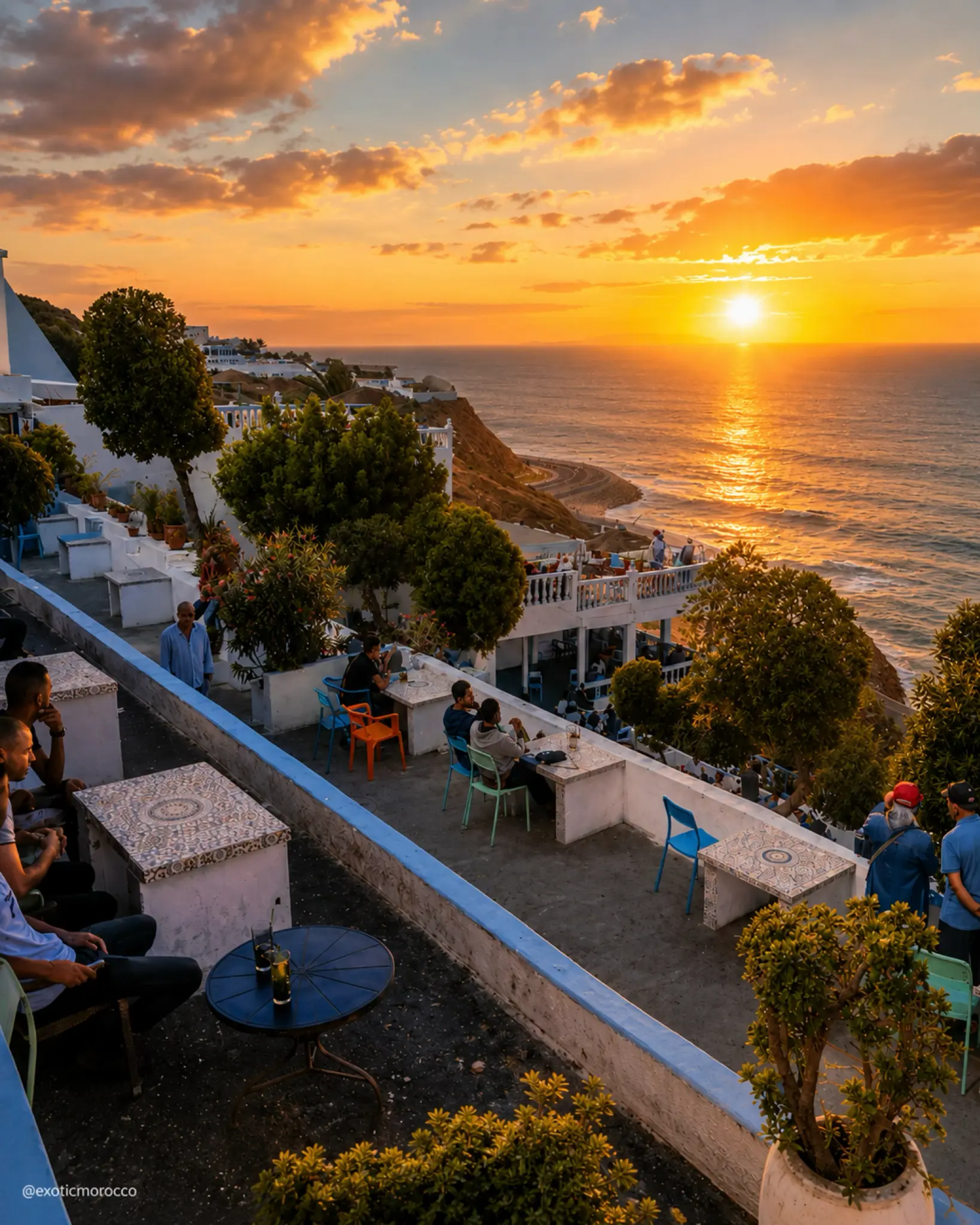
Sunset over Tangier's coast, the city gateway context for Ksar Sghir

Go deeper through the nearest city context

Tangier - the city gateway to Ksar Sghir

Ksar Sghir belongs naturally inside a wider Tangier journey. The city gives visitors a stronger base for reading the strait: port history, medina life, Atlantic and Mediterranean horizons, and the layered routes that make northern Morocco feel open in several directions at once.

Use Tangier to widen the context after the fortress itself. The coast east of the city becomes easier to understand when Ksar Sghir is treated as a historical hinge between local town life, maritime defence and the wider story of passage across the strait.

Strait and port contextTangier city orientation Coastal heritage readingArchitecture and archaeology Northern route structureNearby Morocco highlights

Continue the journey

Continue from Ksar Sghir into northern Morocco.

Read the fortress through water, walls and passage, then connect it to Tangier, the Strait of Gibraltar, northern landscapes and Morocco's wider heritage map.