
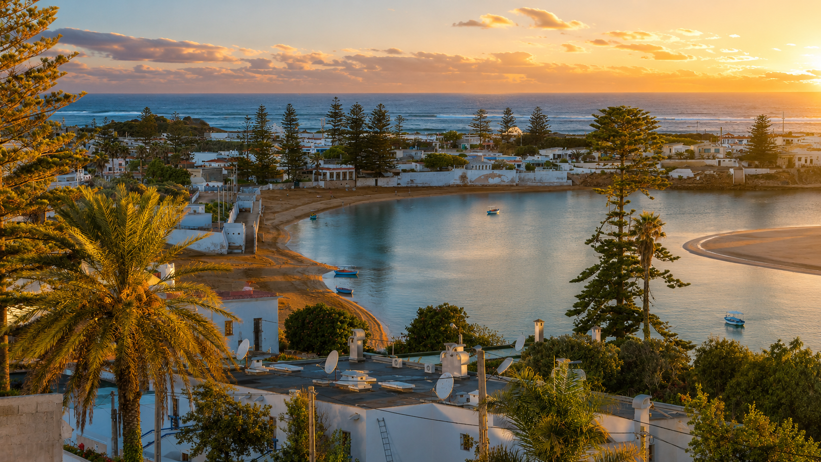
Oualidia Lagoon at sunset with calm water, Atlantic waves, palms, boats and white coastal houses

Visit / Place · Atlantic lagoon · Between Safi and El Jadida

Oualidia Lagoon A sheltered Atlantic lagoon of tide, oysters, birdlife and soft coastal light

Oualidia Lagoon is a coastal place where protected water, open Atlantic energy, oyster farming, fishing rhythm and wetland birdlife meet in one readable landscape.

Begin from above the lagoon before moving closer to the water. From the higher road, the place becomes clear at once: white houses, palms, boats, sandbars, ocean swell and the protected sheet of water that gives Oualidia its identity.

Why Oualidia Lagoon matters

A lagoon before it is a beach escape.

Oualidia matters because it is not simply a pretty coastal stop. Its identity comes from the meeting of a sheltered lagoon, the Atlantic shore, dune edges, fishing activity, oyster culture and wetland habitats that change with tide and season.

The wider Sidi Moussa-Oualidia wetland complex is identified by Morocco's biodiversity portal as a Ramsar wetland. That gives the lagoon a wider meaning: it is scenery, but also habitat, passage, work, food culture and coastal geography.

Visitors feel the calm first, but the calm is not empty. Boats move across protected water, oyster areas sit close to the shore, birds use the wetland spaces, and the Atlantic remains visible beyond the sheltered inner lagoon.

For Exotic Morocco, Oualidia adds a softer Atlantic chapter to the Visit collection. It connects naturally with Safi, El Jadida and the wider coastal route, while giving the journey a different tempo: less monumental, more tidal; less urban, more reflective.

The lagoon is strongest when seen as a living edge between water and settlement. Boats, oyster beds, palms, white facades, sandbars and the ocean line all belong to the same composition.

Core place facts are grounded in Morocco's Biodiversite du Maroc profile for the Sidi Moussa-Oualidia complex, the Visit Safi Oualidia overview, and the Casablanca-Settat tourism profile for Oualidia Beach. Practical details such as access, water conditions and services should be checked close to travel.
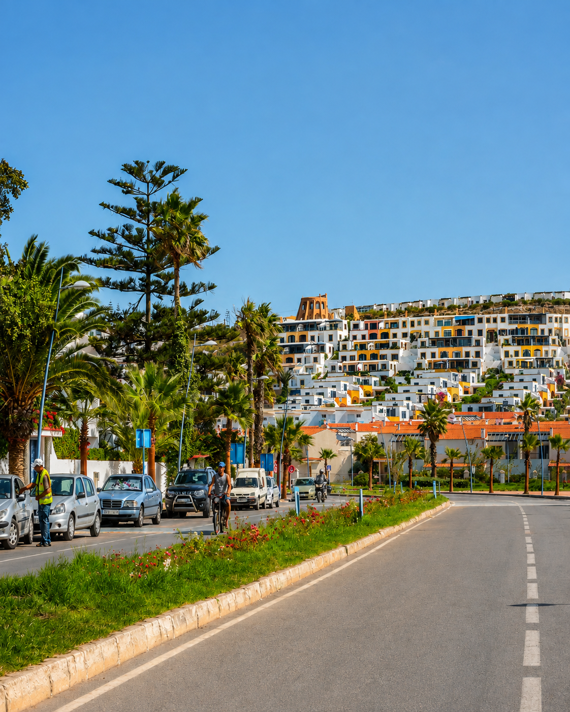
Palm-lined road into Oualidia with white hillside buildings and a clear Atlantic sky

Map orientation

Use the map first to place the lagoon between the protected inner water, the Atlantic opening and the coastal route linking Safi and El Jadida.

Editorial reading

Its beauty is tidal, not decorative.

The famous view is not a fixed object. Oualidia changes as the water moves. A sandbar can feel close in one hour and distant later; boats sit differently on the surface; the colour of the lagoon shifts as the light drops.

That is why Oualidia should be read as a rhythm rather than a single viewpoint. The town, palms, water, oyster culture, fishing boats and Atlantic edge form a sequence. Visitors who rush straight to the beach miss the quiet structure that makes the place special.

The richest experience is visual and practical at the same time. Look for the protected curve of the lagoon, the line of the open ocean, the working areas along the water and the places where birds gather at a distance.

Oualidia rewards visitors who accept softness without turning it into vagueness. The lagoon has real geography, real work and ecological value. Its calm is the visible result of shelter, tide, dune, shore and human use held in balance.

From above, the whole place becomes easier to read. White buildings and palms frame the water, small boats mark scale, and the Atlantic horizon reminds visitors that the lagoon is protected, not isolated.

Natural and coastal orientation

Read the lagoon through water, wetlands and working shorelines.

Oualidia is best understood as a coastal lagoon landscape rather than a simple beach resort. The official biodiversity profile for the Sidi Moussa-Oualidia complex describes a series of wetlands separated from the sea by dune formations, with coastal marine strip, sandy beach, lagoon habitats and human uses including oyster farming, fishing and tourism.

01Place type

Sheltered Atlantic lagoon

The identity begins with protected water. The lagoon softens the Atlantic coast without removing the ocean from view, creating a balance of calm surface and exposed horizon.

02Wetland context

Sidi Moussa-Oualidia complex

The lagoon belongs to a wider wetland system recognised for coastal habitats and migratory bird passage. Quiet observation is more appropriate than intrusive exploration.

03Human rhythm

Oysters, fishing and tourism

Oualidia's appeal is tied to work as well as leisure. Oyster farming, shellfish culture, fishing activity and visitor life all meet around the same body of water.

04Landscape care

A shore that needs restraint

Wetland edges, sandbars and bird areas are sensitive spaces. Distance, quiet movement and respect for local guidance help protect the experience.

A visual bridge

Three readings between tide, town and Atlantic edge

Before Oualidia becomes a sunset photograph, it is a relationship between water movement, coastal shelter and human use. These readings help visitors understand why the lagoon feels calm without becoming flat.

01

Tide

Water that redraws the shore

The lagoon changes shape through tide and light. Sand, boats and reflections shift throughout the day, so the best visual reading begins by noticing the waterline before looking for details.

  • Watch exposed sandbars and returning water.
  • Notice how boats mark scale on the calm surface.
  • Let the lagoon change before deciding the best viewpoint.
02

Edge

Protected water, open ocean

Oualidia's drama comes from contrast. Inside the lagoon, the surface can be still and reflective; beyond the sand and rocks, the Atlantic remains wider and more exposed.

  • Keep lagoon and ocean in the same mental frame.
  • Read shelter as geography, not only mood.
  • Use higher viewpoints to understand the opening.
03

Life

Working coast and bird passage

The lagoon is animated by people and wildlife without needing spectacle. Oyster areas, fishing boats, shore birds and walking routes give the place its human and ecological rhythm.

  • Keep distance from working and bird areas.
  • Notice quiet activity rather than searching for noise.
  • Let food, water and landscape belong together.

Quick orientation

Type of place

A sheltered Atlantic lagoon and coastal wetland setting, best understood through tide, sandbars, calm water, oyster culture and the meeting of lagoon and ocean.

Landscape context

Oualidia sits on Morocco's Atlantic coast between the Safi and El Jadida contexts, making it a natural pause on a wider coastal route.

Best for

Soft coastal light, lagoon walks, oysters and seafood, birdwatching from a respectful distance, photography and slow Atlantic travel.

Closest city context

Safi gives a strong nearby city context, while El Jadida helps connect the lagoon to a broader Atlantic heritage itinerary.

What visitors experience here

A place that changes with water and light.

Oualidia works in stages. First comes the wide view from above: town, palms, lagoon, boats, sand and ocean. Then come the edges: oyster areas, fishing rhythm, sheltered beaches, wetland life and the shifting mirror of the water.

Arrival

The lagoon from above

The strongest first impression comes from height. From the road or terraces above town, visitors can read the full relationship between water, houses, palms, boats and the Atlantic horizon.

Water

Stillness inside the coast

The protected water gives Oualidia its softness. Reflections, small boats and sandbars make the lagoon feel calm, while the open ocean beyond keeps the scene alive.

Light

Sunset without heaviness

Late light can turn the lagoon silver, blue or gold. The best images keep the place natural: clean water, visible town, recognisable shore and a sky that supports the scene.

Food

Oysters and the working shore

Seafood belongs to the identity of Oualidia because it comes from the same coastal system visitors are looking at. A meal near the water should feel connected to place.

Nature

Birdlife at respectful distance

The wider wetland context makes birdwatching part of the lagoon's appeal. The right rhythm is quiet: observe from appropriate places and let the habitat remain undisturbed.

Pace

A coastal pause, not a checklist

The lagoon becomes memorable when visitors give time to tide, light, work, food, sound and the way the town wraps around the water.

Place details and orientation

Read Oualidia Lagoon through six defining elements

No single detail explains the lagoon. Its meaning comes from the relationship between sheltered water, Atlantic exposure, sandbars, oyster culture, bird habitats and the town's elevated view over the bay.

1
The inner lagoon

The calm inner water is the center of the experience, giving Oualidia its quiet surface, reflections, boats and easy visual orientation.

2
The Atlantic opening

The ocean remains part of the scene. Waves, rocks and horizon clarify why the lagoon feels sheltered rather than simply still.

3
Sandbars and waterlines

Changing sand and tide make the landscape flexible. The edge can feel different through the day, which is why timing matters visually.

4
Oyster and fishing rhythm

Oualidia's food culture is connected to the water. Oyster farming, shellfish activity and small boats keep the lagoon grounded in work.

5
Wetland birdlife

Birds give the wider lagoon system ecological presence. They are best appreciated through quiet observation and distance.

6
Town above the water

White buildings, palms and road views frame the lagoon from above, turning the place into a complete coastal composition.

Lagoon, not backdrop

The place asks for a patient eye.

Stand above the water before moving down to it. The first lesson is spatial: the lagoon is protected, but not separate from the ocean. The town, palms and boats help the eye measure scale, while the Atlantic line explains why shelter matters.

Then move closer. Reflections, small waves, oyster areas, working boats and wet sand make the place human again. This is where the visit becomes more than a view: food, labour, leisure and habitat share the same coastal edge.

Look for the relationship between high viewpoint and water level. From above, Oualidia feels composed; at the shore, it feels tidal and alive. The best memory keeps both readings together.

Landscape and water intelligence

The lagoon is geography, not just atmosphere.

Oualidia's softness comes from real coastal structure. The lagoon is protected by the shape of the shore, sand and Atlantic edge, while the wider wetland complex includes habitats where water, dune, marsh and human use meet.

The water also organises the visitor experience. It determines where the eye goes first, how boats sit in the view, where birds gather, how the shore is walked and why late light can transform the same scene without changing its identity.

What to notice slowly

  • Read the wide lagoon shape before focusing on cafes, boats or beach details.
  • Notice the difference between protected inner water and the ocean outside.
  • Watch sandbars, waterlines and reflections change with tide and light.
  • Keep working oyster and fishing areas in the same reading as visitor leisure.
  • Observe birdlife quietly from appropriate distance.
  • Respect wetland edges, dunes, shore plants and local access guidance.

Visual reading

Three landscape languages to notice

Tide and waterline

Oualidia speaks through change. The waterline adjusts the shape of the beach, sandbars and boats, so the same viewpoint can offer different readings through the day.

Dune, ocean and shelter

The lagoon becomes meaningful when contrasted with the open Atlantic. Shelter is not an abstract mood; it is visible in the way the ocean sits just beyond the calmer inner water.

Work and leisure together

Oyster culture, fishing, beach life and quiet observation overlap. The visitor should see this as a shared coastal landscape, not a stage arranged only for travel images.

Visual atmosphere

Light, reflection and quiet transitions

From distance to reflection

Start with the whole lagoon from above, then move closer to read reflections, wet sand, boats and the small shifts where water meets shore. The wide view gives structure; the close view gives texture.

From blue to gold

Oualidia's colour is strongest when it remains natural. Blue water, white buildings, green palms and warm sunset can feel premium without heavy contrast or artificial drama.

From photo to memory

The image is powerful, but the deeper memory comes from watching tide, food, birds, road, town and ocean line belong together. A careful visitor leaves with a sense of rhythm, not only a frame.

Nearby places and onward links

Connect the lagoon to the wider Atlantic coast

Oualidia belongs naturally inside a coastal itinerary. Safi gives a strong nearby city context, El Jadida opens a historic Atlantic chapter, and the wider region connects beaches, ports, craft, food and sea light.

Safi

A strong nearby city context for Oualidia, especially for visitors who want Atlantic port atmosphere, ceramics, seafood and a less hurried coastal rhythm.

Open Safi city guide

El Jadida

Use El Jadida to connect Oualidia with Morocco's Atlantic heritage, fortified coastal history and a broader route north along the ocean.

Open El Jadida city guide

Atlantic Coast & Historic Port Cities

The regional home for ocean towns, port histories, coastal food culture, shore landscapes and Atlantic-facing Moroccan identity.

Explore the region

Visit Morocco places

Continue through lagoons, waterfalls, valleys, caves, monuments, heritage sites and natural places beyond the city guides.

Browse Visit places

Plan your journey

Treat Oualidia as a coastal pause with real route logic, especially when connecting Safi, El Jadida and wider Atlantic travel.

Plan your journey

Stories from Morocco

Use the Stories section for richer cultural reading around place, food, craft, water, coast and the everyday rhythm behind visual Morocco.

Read stories

How to visit respectfully

Good behaviour keeps the lagoon beautiful.

Oualidia is gentle enough to make visitors relax quickly. That is exactly why respect matters. Move quietly near bird areas, keep distance from working oyster and fishing zones, avoid leaving waste on beaches or wetland edges, and ask before photographing people at close range.

Respect also means accepting the place on its own terms. Water, wind, tide and access conditions can change. Do not force a route across sensitive shorelines, disturb birds for a photograph, step into working areas without invitation or treat the lagoon as a private backdrop.

  • Observe birds from a distance and avoid chasing or surrounding them.
  • Give working boats, oyster areas and local businesses room to function.
  • Keep beaches, dunes, wetland edges and water clean.
  • Check current tide, weather, access and local guidance close to travel.
  • Let food, photography and walking stay connected to respect for place.

A strong first visit

Begin from a high view above the lagoon, where the full composition is easiest to understand. Look for the protected water, Atlantic line, sandbar shapes, white houses, palms and small boats before choosing where to walk.

Then move down toward the water without rushing. Let the shoreline, boats, oyster culture and reflections organise the visit. A good stop in Oualidia is not complicated: a careful walk, a meal that belongs to the coast, and enough time for the light to change.

If the tide, wind or water conditions are not what you expected, adjust the rhythm instead of forcing the plan. The lagoon is most rewarding when visitors accept that it is alive and variable.

Afterward, connect the visit to Safi, El Jadida or the Atlantic Coast region. That wider context helps Oualidia feel less like an isolated beach and more like part of Morocco's coastal geography.

  • Start from above, where the lagoon and ocean can be read together.
  • Walk slowly near the water and notice tide, sandbar and boat movement.
  • Build the visit around light, food and quiet observation rather than speed.
  • Keep a respectful distance from birds and working shoreline areas.
  • Finish by connecting the lagoon to Safi, El Jadida and the wider Atlantic route.

Careful planning note: water conditions, services and access details can change. Verify practical arrangements locally before travelling.

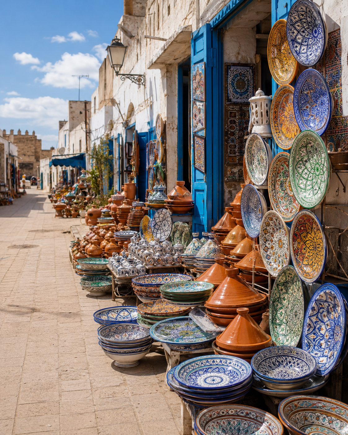
Safi ceramic street display with blue doors, patterned plates and Atlantic medina light

Go deeper through the nearest city context

Safi — the Atlantic city context near Oualidia

Oualidia fits naturally beside Safi in a wider coastal journey. Safi brings port texture, ceramics, seafood, working-city atmosphere and another face of Morocco's Atlantic identity, while Oualidia gives the same route a gentler lagoon pause.

Use Safi to widen the context after the lagoon itself: craft, coast, food, ocean-facing streets and regional movement all become easier to understand when Oualidia is treated as part of a broader Atlantic chapter.

Nearby city contextAtlantic port atmosphere Ceramics and craft routeSeafood and coastal food culture Practical travel structureOnward Atlantic highlights

Continue the journey

Continue from Oualidia Lagoon along Morocco's Atlantic coast.

Read the lagoon slowly, then connect it to Safi, El Jadida, oyster culture, wetland birdlife, coastal food and the wider Atlantic map of Morocco.