
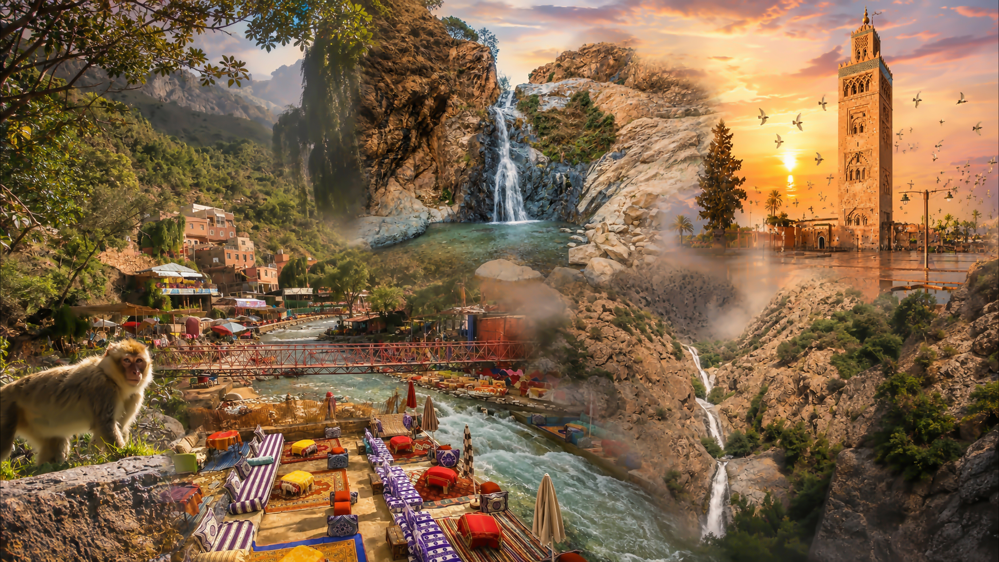
Visual montage connecting Setti Fatma waterfalls, the Ourika riverfront and Marrakech

Visit / Place · Ourika Valley · High Atlas

Setti Fatma Waterfalls From the riverfront into the folds of the mountain

Above Setti Fatma, a mountain stream drops through a rocky side valley: a succession of falls, shaded recesses and open views over the Ourika.

A riverside village and a mountain walk belong to the same day. Choose the length of your climb with care; the upper falls demand more than a casual stroll.

Why Setti Fatma matters

Water gives the mountain a human scale.

Setti Fatma Waterfalls lie above the village of the same name in the Ourika Valley, in Al Haouz province. Often called the Seven Cascades or Cascades Ourika, they descend through a steep side valley in the High Atlas. The Ourika riverfront is the arrival point; the falls themselves are reached on foot.

The significance of the place lies in that connection. Water brings mountain scenery into close contact with settlement, work and leisure. Bridges, cafés and village paths occupy the lower valley, while the waterfall approach turns the eye toward the slopes above. The visit joins these different scales within one landscape.

Setti Fatma also belongs to the Amazigh cultural geography of the Atlas. It is a village with residents, local businesses and connections beyond the waterfall trail. Treating it as a place to spend time, ask questions and use local services gives the day more substance than simply reaching a viewpoint.

The name “seven waterfalls” is an invitation to explore, not a requirement to complete them all. The lower cascade and the higher reaches involve different levels of effort and exposure. Understanding that distinction leaves room for a rewarding visit shaped by the people in your group and the conditions you find.

Place context: Marrakech's official tourism guide. Terrain and approach: Rother's waterfall route. Check current access locally before walking.
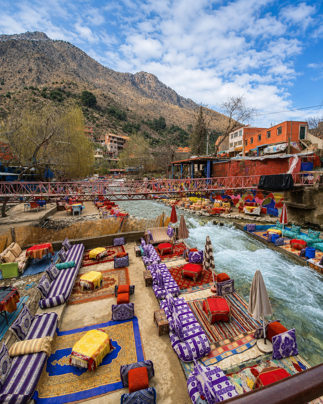
Colourful riverside seating and a footbridge in Setti Fatma, beneath the High Atlas slopes

Map orientation

The map centres on the village approach. Continue to the falls on foot; a road destination does not describe the mountain trail.

Open Setti Fatma map

Editorial reading

Follow the change in scale.

The riverfront is horizontal: a line of terraces, bridge crossings and buildings following the water. The waterfall valley introduces a different direction. Here the eye moves upward, meeting ledges, recesses and a stream broken into separate drops.

This change gives the place its visual character. A wide scene becomes an enclosed one; a river seen from a seat becomes moving water beside a walking route. The mountain stops being a backdrop and starts determining where you can stand and what you can see.

At a cascade, notice the whole frame before concentrating on the falling water. The width of the rock face, the shadow behind the stream and the size of the receiving basin explain its proportions. A close photograph can conceal much of this relationship.

Then consider what sits outside the frame. The return path, the people passing and the changing weather remain part of the place. They influence the experience just as much as the view that brought you here.

The most revealing comparison comes back in the village. After the enclosed climb, the open river corridor becomes easier to understand: a place where movement through the mountains meets the everyday business of stopping, eating and gathering.

Landscape and cultural orientation

A waterfall valley within a lived mountain landscape.

Start with four distinctions: the village, the cascade sequence, the wider Atlas setting and the changing water conditions. Each explains a different part of the visit.

01Identity

Several names, one destination

Setti Fatma and Setti Fadma are common spellings. Cascades Ourika and the Seven Cascades refer to the falls above the village, rather than every stretch of the Ourika River.

02Mountain setting

A steep side valley

The sequence is tucked into rising terrain. Rock steps separate the falls, so there is no single level promenade from which the entire series can be viewed.

03Community

An Amazigh village

Local life extends beyond the visitor route. Respect household thresholds, leave access clear and ask before photographing residents or their work.

04Water conditions

A responsive river system

The Ourika basin has a documented flood history. Weather and upstream rainfall matter even when the riverfront looks inviting; local warnings take priority over an itinerary.

A visual bridge

Three ways to connect the river and the falls

Use the approach to establish direction, then look at the water itself and finally at the scale of the surrounding slopes. These observations give the waterfall a setting.

01

Direction

Trace the valley opening

From an appropriate stopping place, identify where the narrower waterfall valley meets the larger river corridor. This junction helps explain the route before the path begins to climb.

  • Find the river's main direction.
  • Locate the opening between the slopes.
  • Keep the village in the wider picture.
02

Movement

Watch the water change form

Where visible, compare a smooth run of water with a broken cascade and a quieter basin. The same stream can produce a ribbon, a spray or a reflective surface within a short distance.

  • Look for a clear edge to the falling stream.
  • Notice where water separates around rock.
  • Compare the fall with its receiving pool.
03

Proportion

Leave room around the cascade

A little surrounding hillside gives a photograph depth. Rock, vegetation and a sliver of sky can show the setting more clearly than a frame filled entirely with white water.

  • Include the walls of the valley.
  • Use foreground rock to establish depth.
  • Choose a safe stopping point before framing.

Quick orientation

Type of place

A sequence of mountain waterfalls reached from Setti Fatma village. Expect a walking excursion with uneven ground, rather than a roadside waterfall viewing platform.

Landscape context

Ourika Valley, High Atlas, Al Haouz province in Marrakech-Safi. Place the visit within the mountain landscapes on the Morocco regions map.

Best for

Waterfall scenery, attentive landscape photography and a village-and-mountain day. The mood combines a sociable riverfront with a more physically demanding ascent.

City base

Marrakech is the main city base for this excursion. Allow the valley outing its own space in your plans, with transport and the return meeting point agreed beforehand.

What visitors experience here

From open riverbanks to enclosed rock.

The character of the day changes as you leave the village. The riverfront offers a broad, busy scene; the climbing route brings smaller spaces, closer surfaces and a different pace.

Arrival

A colourful riverfront

Terraces and café seating gather beside the Ourika, with bridges tying the banks together. The setting is sociable and can be lively; leave time to find your bearings before following a route uphill.

Walking

The ground sets the pace

Rocks, steps and narrow passages interrupt a steady stride. Your attention moves between the view and your footing, especially where people are descending along the same confined section.

Sound

Listen at a bend

A sheltered turn can change how strongly you hear the stream. Pause clear of passing walkers and listen for the difference between a continuous rush, a nearby splash and voices carried along the path.

Light

Bright water, shaded rock

The eye takes time to adjust between an exposed slope and a darker recess. Let the details emerge before photographing: the brightest part of a fall can otherwise hide the texture around it.

Surface

Stone at close range

Compare the appearance of dry rock with the darker surfaces close to the stream. Edges, cracks and changes in sheen become visible at walking distance, adding detail that disappears in a distant panorama.

Return

A table beside the river

Back in the village, a meal or tea can give the day a slower finish. Choose a suitable terrace, check the menu and price before ordering, and make sure your transport arrangements leave time to sit.

Place details and orientation

Six reference points for the visit

These are features to distinguish as you move through Setti Fatma. They are not a promise that every section will be suitable or accessible on the day.

1
The Ourika river corridor

The broad geographical reference for arrival, village activity and the journey back down the valley.

2
Village crossings

Bridge approaches connect the banks. Confirm which crossing serves your chosen walk and note it for the return.

3
The lower cascade

A common objective for a shorter waterfall visit, though its approach still includes rough ground and climbing.

4
The upper sequence

Higher falls require a more demanding route. Discuss the terrain with a qualified local guide before continuing.

5
Basins and wet edges

Water collects below individual drops. Observe from secure ground; a clear-looking pool does not establish safe depth or footing.

6
The outward view

Where the permitted path opens, look back toward the village to reconnect the enclosed climb with the larger valley.

Looking with care

A viewpoint is also a place to stand.

Before raising the camera, consider the space around your feet. Choose a stable position that leaves the route open and does not require leaning over a wet edge. This small decision gives you time to look properly.

There is no need to force every view into a single photograph. One image might describe the enclosure of the valley, another the falling stream, and another the bridge and riverfront below. Keeping these views distinct preserves their different scales.

A good record of Setti Fatma includes the relationship between them. Note where each photograph was taken and what stage of the walk it represents; the sequence will explain more than an unlabelled collection of waterfall close-ups.

Water and landscape

The channel gives water its shape.

Read the falls as changes in gradient. A stream accelerates over a drop, meets rock or a basin, then gathers into a channel again. The visible sequence makes these transitions easy to notice without needing to assign a geological age or name every rock.

Water volume changes the picture. A fuller stream can cover ledges that are exposed in a quieter flow, while rainfall can change colour and visibility. The Ourika basin's documented flood risk is a reminder that these changes can also affect access.

What to notice slowly

  • Where the stream narrows before a drop.
  • Whether water falls freely or follows the rock face.
  • How a basin interrupts the downward movement.
  • The boundary between wet stone and dry surfaces.
  • Vegetation visible in sheltered pockets along the channel.
  • The way the path responds to obstacles in the valley.

Landscape reading

Three relationships that shape the view

Vertical and horizontal

The descending stream draws the eye upward, while ledges and pools interrupt that movement. Look for the point where a continuous line becomes a series of separate steps.

Enclosure and opening

A close rock wall limits the view; an opening restores a sense of distance. These alternating spaces give the walk its rhythm and explain why a modest change of position can reveal a different scene.

Natural and built edges

Bridges, paths and terraces show where people have made room to cross, walk and stop. Notice their relationship to the river without assuming that every accessible-looking edge is a public route.

Visual atmosphere

A palette that changes with the viewpoint

The riverfront palette

Coloured cushions, awnings and bridge rails stand out against the restrained tones of the slopes. This is a different visual register from the waterfall gorge, and an essential part of the village's character.

Reflections within the shade

Still patches of water can reflect the sky or nearby rock. Move your gaze across the surface and notice where reflected colour gives way to visible depth; the change may be subtler than the cascade itself.

The mountain beyond the frame

A tight photograph makes a waterfall appear self-contained. A wider view restores the slopes around it and the uneven distances between features. Keep both if you want your images to describe the place honestly.

Nearby places and onward links

Connect Setti Fatma with the wider journey

The Ourika Valley provides the immediate landscape context. Marrakech supplies the city base, while the broader Atlas deserves separate planning if you want to extend the mountain experience.

Ourika Valley

Read the approach through the wider valley: river bends, cultivated land, settlements and the changing relationship between the road and the mountains.

Explore Ourika Valley

Marrakech

Return to the city's gardens, medina and architectural landmarks. Give the mountain outing and your city visits enough time to keep both enjoyable.

Open Marrakech city guide

Atlas Mountains

Use the wider mountain guide to understand the range of landscapes and routes. An outing to Setti Fatma is one introduction to a much larger region.

Explore the Atlas Mountains

Morocco by region

Place Al Haouz and the High Atlas within your wider itinerary, especially when combining mountain travel with other parts of Morocco.

Browse the regions

Plan your journey

Organise the practical details that hold the day together: transport, footwear, weather checks, a suitable walking objective and the return meeting point.

Plan your journey

More places to visit

Compare waterfalls, coastlines, gardens and other landscapes before adding another excursion. Choose a different experience, with time to appreciate it.

Browse Visit places

How to visit respectfully

Leave room for the mountain and its people.

Keep paths and bridge approaches clear, ask before photographing people, and treat cafés and shops as working businesses. Agree prices and what is included before accepting guiding, transport or other services.

Wear footwear with reliable grip and carry drinking water. The waterfall route includes uneven, potentially slippery ground; it should not be presented as a step-free outing. If your group has mobility needs or young children, discuss the actual terrain before setting off and choose an appropriate alternative when needed.

  • Use established routes and follow current local access advice.
  • Carry litter out, including tissues and food packaging.
  • Avoid entering pools or climbing wet rock for photographs.
  • Do not feed, handle or pursue animals for a closer image.
  • In heavy rain, storms or rising water, leave the gorge and river margins and follow local instructions.

A strong first visit

Begin by locating your return meeting point in the village. Check the weather and ask about the day's path conditions before choosing how far to walk. If using a guide, discuss the lower waterfall separately from any extension to higher ground.

Start at a pace your whole group can sustain. Decide at the lower falls whether to continue, considering footing, energy, daylight and the descent still ahead. Stopping there can make a complete outing; the waterfall count should not determine your limit.

Leave enough time to return without hurrying. A route that felt manageable uphill can require more concentration going down. Once back in the village, choose a suitable place for a meal and confirm your departure arrangements before settling in.

  • Agree the route, guide fee and expected return before departure.
  • Keep water and essentials in a bag that leaves your hands free.
  • Pause away from narrow passages to let others pass.
  • Turn back when the terrain exceeds anyone's comfort or ability.
  • Keep your driver or onward transport contact readily available.

Before travel: verify current road and trail access locally. Weather, water levels and path conditions can change; photographs and old route descriptions cannot confirm today's situation.

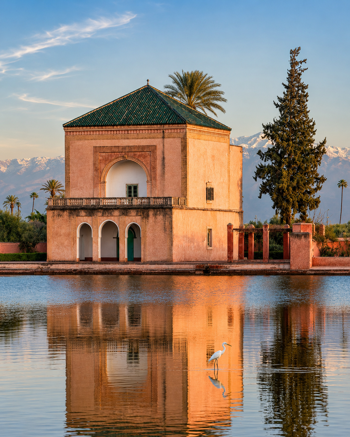
The Menara pavilion in Marrakech reflected in its basin, with the Atlas Mountains beyond

Go deeper through the city base

Marrakech — a city base for the Ourika Valley

Use the Marrakech guide to build the city days around your mountain excursion. Gardens, medina walks and architectural visits bring a different pace after the rocky paths and riverfront of Setti Fatma.

The Menara view is a fitting visual connection: a pavilion, a broad basin and the Atlas beyond. Back in the city, the mountains become a distant horizon again, giving a new perspective on the landscape you have just visited.

Marrakech city orientationMedina and neighbourhoods Gardens and architectureOurika Valley context Excursion planningA balanced city-and-mountain stay

Continue the journey

From Setti Fatma, follow the valley back to Marrakech.

Carry the mountain perspective into your city visit, with time for the gardens, streets and architecture that give Marrakech its own character.