
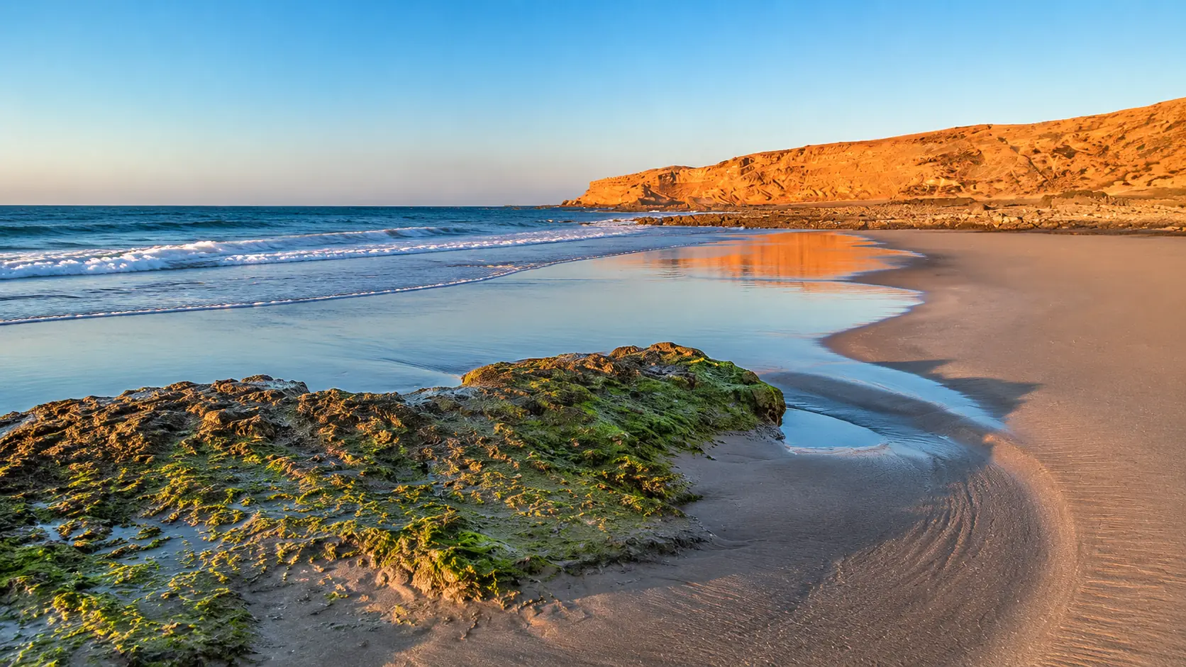
Atlantic beach, rock pools and warm coastal cliffs in the Souss-Massa landscape south of Agadir, Morocco

Visit / Place · Atlantic coast · South of Agadir

Souss-Massa National Park A protected coastline of dunes, estuaries, birdlife and Atlantic light

Souss-Massa National Park turns the coast south of Agadir into a living lesson in water, wind, sand, cliffs and protected wildlife.

Read it as a long coastal system rather than a single viewpoint: river mouths, open Atlantic light, sandy edges, rocky shelves, quiet wetlands and dry-country habitats all belong to the same protected landscape.

Why Souss-Massa matters

A national park before it is a day trip.

Souss-Massa National Park matters because it protects a rare Atlantic meeting point: river mouths, wetlands, dunes, cliffs, beaches and semi-arid land close to one of Morocco's busiest coastal cities. The landscape looks open and simple at first, but its value lies in how many habitats touch each other within a narrow coastal band.

Regional tourism sources describe the park as created in 1991, covering 33,800 hectares along the Atlantic coast and stretching from the Agadir area toward Aglou. That scale is important. Souss-Massa is not a single beach stop; it is a protected coastal corridor where the Oued Souss and Oued Massa help shape wetland, estuary and birdwatching environments.

The park is especially important for birdlife, including migratory birds and the northern bald ibis, one of the emblematic conservation species associated with this coast. Visitors should therefore come with patience. The strongest experience is not speed or spectacle, but learning to watch without disturbing what the park exists to protect.

For Agadir, Souss-Massa gives the region a deeper nature context. It shows another face of the Atlantic coast: less resort frontage, more wind, water, sand, cliffs, reeds, tracks, quiet observation and careful access. The park adds ecological depth to the journey south from the city.

Its beauty is not separate from protection. The same open spaces that feel cinematic are also sensitive habitats, shaped by seasonal water, coastal wind, grazing pressure, visitor movement and conservation management. A good visit keeps the view and the responsibility together.

Core park facts are grounded in the Souss-Massa Regional Tourism Development Company access note, the regional tourism presentation and the Protected Planet WDPA profile. Practical access, prices, local routes and guide arrangements should be checked close to travel.
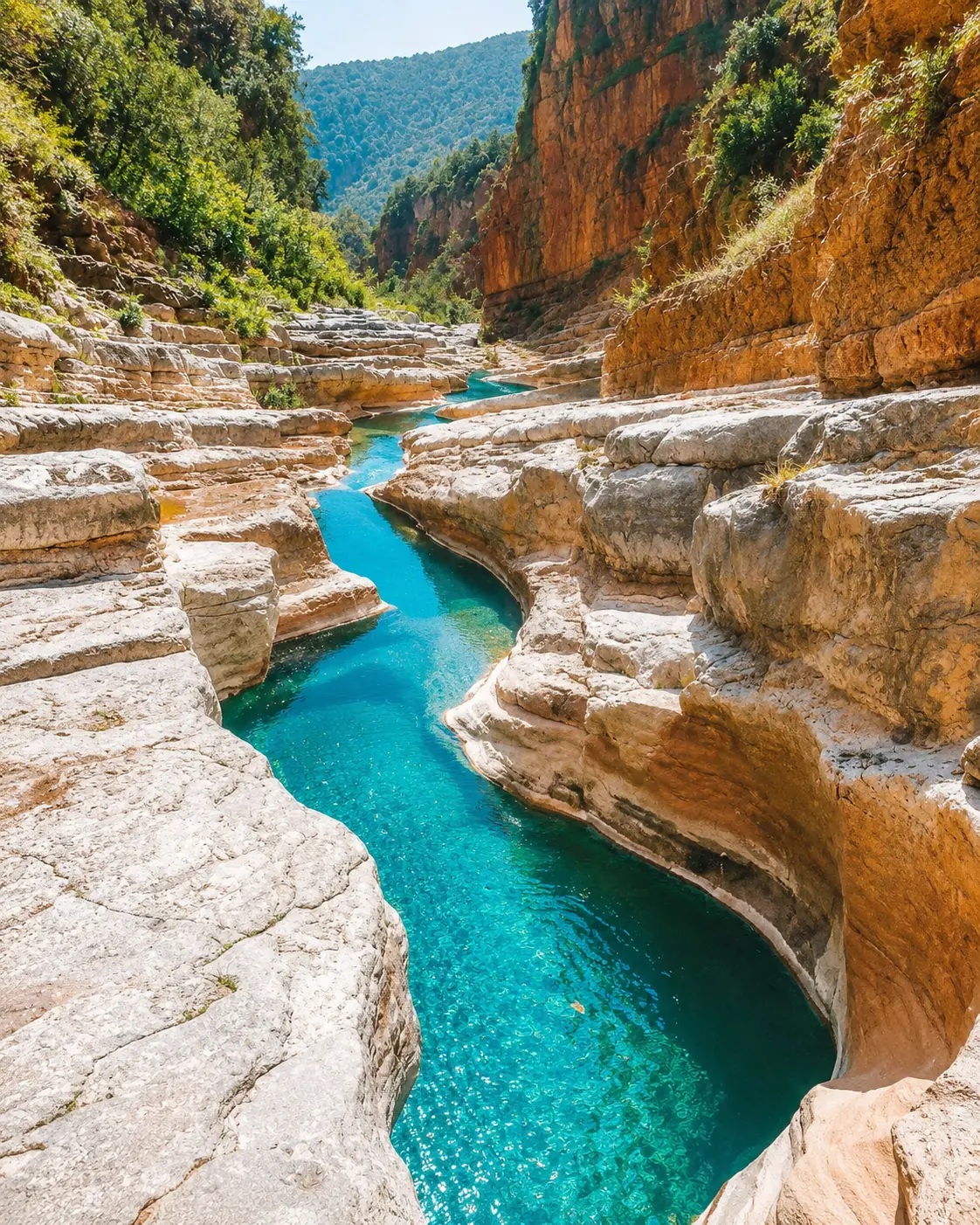
Turquoise water, rock terraces and sunlit canyon walls in the wider Souss-Massa nature region near Agadir

Map orientation

Use the map to read the park as a coastal strip south of Agadir, linked by estuaries, dunes, cliffs and the Atlantic edge.

Editorial reading

Its beauty is ecological, not decorative.

The first impression may be wide beach, blue water and golden rock. Look longer and the park becomes a study in relationships: river meeting sea, wind moving sand, birds using wetland edges, dry vegetation holding ground, cliffs catching light and human access needing restraint.

That is why Souss-Massa rewards a slower eye. The park is most powerful when visitors stop treating the coast as scenery and start reading it as habitat: a place where open space, silence, movement and distance all carry meaning.

The water matters, but so does the dry land around it. Estuary, dune, steppe and cliff should be seen together, because wildlife does not experience the park as separate postcard zones. The landscape works through transitions.

A careful visitor notices scale before detail. The line of the coast, the pale sand, the river mouth and the low vegetation explain the park's structure. Birds, tracks, reeds, rock surfaces and changing light then give the visit its finer grammar.

The best photographs here come from patience rather than intrusion. Keep distance, use longer lenses where possible, avoid pressure on birds and sensitive edges, and let the landscape keep its quiet. The park is beautiful because it is alive, not because it performs for the camera.

Natural and protection orientation

Read the park through water, coast and conservation.

Souss-Massa is best understood as a protected coastal landscape. Its identity comes from the Atlantic shore, the mouths of the Souss and Massa rivers, dune and cliff systems, wetland birdlife and managed conservation work for vulnerable species and habitats.

01Established

National park since 1991

Regional and protected-area sources identify Souss-Massa as a national park created in 1991, giving formal protection to a major Atlantic coastal landscape south of Agadir.

02Water system

Two river mouths

The Oued Souss and Oued Massa shape the park's ecological reading. Their estuary and wetland settings make the coast more than beach: water, reeds, mudflats, sand and birds all meet here.

03Birdlife

A major birdwatching area

The park is widely associated with migratory birds and with the northern bald ibis. Visitors should approach birdlife through observation, distance and local guidance rather than pursuit.

04Conservation

Habitats under care

Official regional material links the park to wildlife protection, environmental awareness, scientific research and local sustainable development. The visitor experience belongs inside that conservation frame.

A visual bridge

Three readings between ocean, estuary and dry land

Before Souss-Massa becomes a coastal photograph, it is a relationship between moving water, wind-shaped ground and protected habitat. These three readings help visitors slow down and understand why the park feels open, fragile and quietly complex.

01

Water

River mouths as anchors

The estuaries give the park its ecological pulse. They gather birds, vegetation, reflection, mud, sand and changing water levels into places where the coastline becomes visibly alive.

  • Watch edges rather than only open water.
  • Notice reeds, channels, wet sand and bird movement.
  • Read the river mouth as habitat, not scenery alone.
02

Wind

Dune, cliff and Atlantic force

Wind gives the park much of its shape. It works through sand, salt, exposed slopes, low vegetation and the hard line where cliff and ocean meet.

  • Look for textures made by wind and water.
  • Keep cliffs, beach and dunes in one visual reading.
  • Notice how open space changes the pace of the visit.
03

Watching

Distance before detail

The best nature reading begins with restraint. Distance reveals the park's full structure; patience allows details to appear without forcing them.

  • Use quiet observation before moving closer.
  • Give birds and sensitive habitats real space.
  • Let the landscape set the rhythm, not the camera.

Quick orientation

Type of place

A protected Atlantic coastal national park, best understood as a nature and conservation landscape rather than a simple beach excursion.

Landscape context

The park sits south of Agadir along the Atlantic coast, with river mouths, wetlands, dunes, cliffs, beaches and semi-arid terrain shaping the experience.

Best for

Birdwatching, coastal scenery, quiet photography, nature learning, guided conservation visits and a slower reading of the Souss-Massa shoreline.

Closest city context

Agadir is the clearest city base for visitors connecting the park with Atlantic coast travel, regional routes and practical planning.

What visitors experience here

A protected coast that unfolds in zones.

Souss-Massa does not reveal itself as one monument or one view. It unfolds through changing edges: city to open coast, river to sea, dune to cliff, wetland to dry scrub, broad horizon to small movements in water and sky.

Arrival

Leaving the city edge

The shift from Agadir toward the south matters. Urban beach energy gives way to wider space, lower vegetation, exposed light and a coastline that feels more protected than performed.

Light

Atlantic blue and pale sand

The park's colour is built from contrast: blue water, pale sand, warm rock, dry vegetation and late light on cliffs. The best visual moments often come from restraint rather than heavy contrast.

Water

Estuary rhythm

At the river mouths, the visit slows naturally. Water channels, reeds, wet ground and bird movement make visitors aware that the coast is also a working ecological system.

Wildlife

Watching without chasing

Birdlife is central to the park's identity, but good observation keeps distance. The experience improves when visitors use silence, patience and local guidance instead of trying to force close encounters.

Terrain

Dunes, cliffs and rock shelves

The coastal ground changes under the eye: soft sand, harder rock, low plants, cliff lines and ocean-cut edges. These transitions give Souss-Massa its strong sense of place.

Pace

A slower coastal visit

The park rewards time: a pause at the map, a quiet walk where allowed, a long look across the estuary, and enough patience to let the landscape reveal movement on its own terms.

Place details and orientation

Read Souss-Massa through six defining elements

No single feature explains the park. Its meaning comes from the relationship between Atlantic shore, river mouths, dunes, cliffs, wetland birdlife and carefully managed conservation landscapes.

1
Atlantic shoreline

The ocean edge gives the park its scale, light and sense of openness, from beaches and rock shelves to distant cliff lines.

2
Oued Souss and Oued Massa

The two river-mouth contexts are central to the park's ecological identity, especially for wetlands, estuary edges and birdwatching.

3
Dunes and sandy flats

Wind-shaped sand creates a fragile surface language. It should be crossed only with care and local guidance where access is permitted.

4
Coastal cliffs

Cliffs and rocky shelves give the park dramatic visual structure while also forming sensitive habitat edges that should not be pressured.

5
Wetland birdlife

Bird movement gives the park its quiet theatre. The most respectful viewing uses distance, silence and patience.

6
Saharan fauna reserves

Regional material links parts of the park to reserves and acclimatization work for vulnerable fauna, adding a managed conservation layer to the coastal visit.

Nature reserve, not beach scenery

The place asks for patient attention.

Start by reading the whole coast. The first lesson is spatial: an Atlantic strip where water, wind and dry land meet. Beaches, cliffs, dunes and estuaries should be understood together before any single viewpoint takes over.

Then narrow the eye. Watch where birds gather, where vegetation thickens near water, where sand changes texture and where rock shelves hold the last warm light. These details make the park feel alive without needing spectacle.

The strongest visit balances beauty with restraint. A visitor who keeps distance, follows local guidance and moves quietly sees more than someone chasing a perfect frame.

Landscape and ecological intelligence

Water, wind and sand make the park readable.

Souss-Massa is shaped by forces that are easy to see once the eye slows down: Atlantic swell, river flow, wind across sand, seasonal wetland change, low vegetation and the hard protection of cliff and rock. The park's intelligence is not decorative; it is environmental.

This is why the landscape should not be flattened into a beach image. The coast is part of a wider ecological structure where birds, plants, dry-country species, water and human access must be held in balance.

What to notice slowly

  • Read the park as a long coastal strip before focusing on one stop.
  • Notice the change from beach to dune, cliff, wetland and dry vegetation.
  • Use quiet distance when watching birds or sensitive habitat edges.
  • Follow marked routes, guide instructions and local access rules where they apply.
  • Carry water and sun protection; exposed coastal light can still be strong.
  • Leave no litter, avoid noise and keep the protected purpose of the park visible in the visit.

Visual reading

Three landscape languages to notice

Estuary grammar

River mouths create layered edges: wet ground, reeds, open water, mud, sand and bird movement. These transitions are where the park's ecological meaning becomes easiest to see.

Wind-made texture

Dunes, low plants, exposed paths and cliff faces record wind and salt. Their beauty depends on surfaces that can be easily damaged, so the visual reading must include care.

Distance and restraint

Souss-Massa asks visitors to respect space. Keeping distance protects wildlife and often gives a better view of how coast, water and dry land work together.

Visual atmosphere

Light, water and quiet coastal transitions

From ocean to river mouth

Start with the broad Atlantic line, then let the eye follow water inward toward estuary, reeds and wetland edges. The shift from surf to stillness is one of the park's strongest visual movements.

From sand to vegetation

The coast is not empty. Pale sand, low shrubs, dry grasses and occasional denser growth reveal how life adapts to exposure, salt, wind and scarce shade.

From photograph to attention

The hero image is only the opening frame. The deeper memory comes from watching slowly enough to connect tide, light, bird movement, cliff colour and the quiet discipline of a protected landscape.

Nearby places and onward links

Connect the park to Agadir and the Atlantic coast.

Souss-Massa belongs naturally to an Agadir-based Atlantic itinerary. The city gives the clearest gateway, while the wider coast, Visit collection and planning pages help place the park inside a slower Morocco journey.

Agadir

The closest city context for Souss-Massa National Park. Use Agadir to frame the park, the Atlantic shoreline and south-coast travel planning.

Open Agadir city guide

Atlantic Coast & Historic Port Cities

The regional frame for Morocco's ocean-facing places, from port cities and beaches to coastal heritage, wind, light and onward routes.

Explore the region

Visit Morocco places

Continue through national parks, lagoons, valleys, waterfalls, caves, monuments and natural heritage places beyond the city guides.

Browse Visit places

Plan your journey

Treat Souss-Massa as a protected nature visit. Check current access, guide arrangements, weather and transport details close to travel.

Plan your journey

Themes of Morocco

Use the Themes section for broader reading around Moroccan landscapes, heritage, coastlines, craft, food and cultural context.

Explore themes

Stories from Morocco

Use Stories for richer editorial context around places, memory, landscapes and the human rhythms behind Moroccan travel.

Read stories

How to visit respectfully

Good behaviour protects the landscape.

Souss-Massa is a protected area, not an open playground. Move quietly, keep to appropriate routes, respect guide instructions, avoid pressuring birds or sensitive habitats, and treat the coast as living ecology rather than empty scenery.

Respect also means planning with uncertainty. Access arrangements, local routes, guide availability, vehicle rules and seasonal conditions can change. Verify practical details close to travel and avoid writing your own route across fragile terrain.

  • Keep distance from birds, nesting or roosting areas and wetland edges.
  • Use binoculars or longer lenses instead of moving too close for photographs.
  • Stay on permitted paths or guided circuits where those are required.
  • Carry water, sun protection and enough patience for exposed coastal conditions.
  • Leave no litter, keep noise low and avoid damaging dunes, plants or cliff edges.

A strong first visit

Begin with orientation. Look at the map first so the park reads as a coastal strip south of Agadir rather than a single beach pin. That mental frame makes the river mouths, wetland areas, dunes and cliffs feel connected.

Choose a slow rhythm. If visiting with a guide, let local knowledge shape the route and the distance kept from wildlife. If walking in an accessible area, move quietly and pause often; the park reveals more through waiting than through rushing.

Watch the transitions. Notice where water becomes sand, where vegetation appears near moisture, where cliffs catch light and where birds use the edges between habitats. These changes are the real structure of the visit.

Afterward, connect the park back to Agadir and the wider Atlantic coast. Souss-Massa makes the region feel larger: city, beach, protected nature, estuary and south-coast routes start to belong to one map.

  • Start with map context, then choose one careful route or guided circuit.
  • Give the estuary and wetland edges time before looking for dramatic views.
  • Photograph landscape scale without disturbing wildlife or vegetation.
  • Use Agadir as the clean city base for planning and onward coastal links.
  • Verify current access, opening conditions and local guidance before travelling.

Careful planning note: prices, exact travel times, access points and local rules can change. Confirm practical arrangements close to the visit.

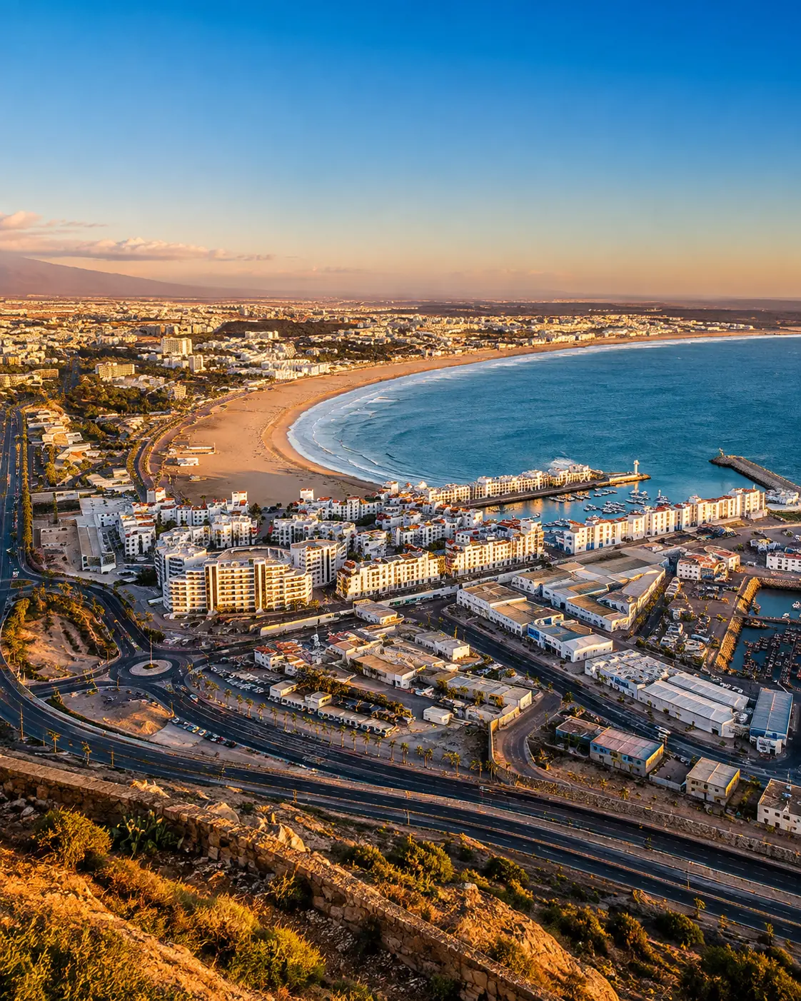
Golden-hour view over Agadir's bay, marina and Atlantic coastline, the city gateway for Souss-Massa National Park

Go deeper through the nearest city context

Agadir - the city gateway to Souss-Massa

Souss-Massa National Park belongs naturally inside an Agadir journey. The city gives visitors a practical Atlantic base before the coast opens into quieter estuaries, dunes, cliffs and protected nature south of the urban shoreline.

Use Agadir to widen the context after the park itself: the marina and bay explain the modern coastal gateway, while the national park shows the region's slower ecological dimension.

Atlantic city orientationNational park gateway Coast and estuary contextBirdwatching and nature travel Practical route planningSouth-coast onward links

Continue the journey

Continue from Souss-Massa into Atlantic Morocco.

Read the park slowly, then connect it to Agadir, Atlantic coast routes, estuary landscapes and the wider protected nature map of Morocco.