
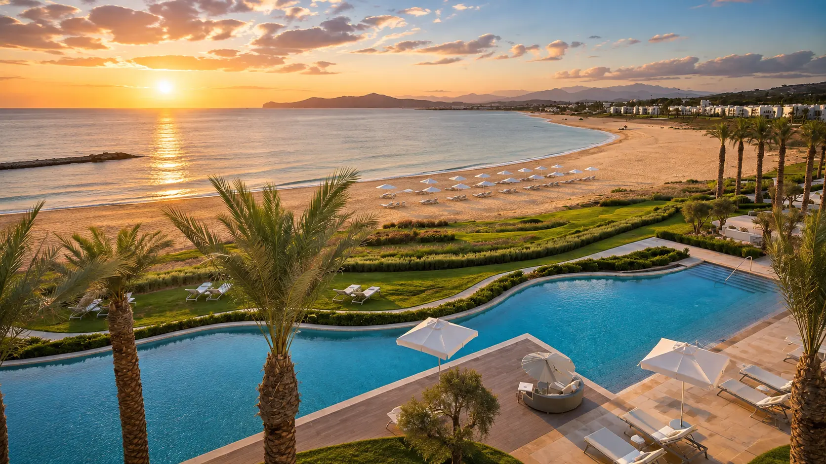
Tamuda Bay coastline at sunset with Mediterranean water, beach, palms and resort gardens in northern Morocco

Visit / Place · Mediterranean coast · M'diq-Fnideq

Tamuda Bay Morocco's refined northern coast between sea, mountains and Mediterranean light

Tamuda Bay is the contemporary name for a coastal stretch between M'diq and Fnideq, where beach light, resort gardens, marina edges and Rif foothills frame Morocco's Mediterranean side.

Read it as coastline first: open water, pale sand, planted gardens, white buildings, port rhythms and the road that links the bay with Fnideq, M'diq and inland Tetouan.

Why Tamuda Bay matters

A modern bay with a real northern context.

Tamuda Bay is not an old walled monument and it should not be confused with the ancient Tamuda archaeological site near Tetouan. Here, the name belongs to the Mediterranean coast around M'diq and Fnideq: a contemporary seaside identity shaped by beaches, resorts, marinas, fishing towns, summer movement and the mountains behind the shore.

That modern identity matters because it shows a different Morocco from the Atlantic cities and inland routes. The visual language is lighter and more marine: blue water, white architecture, palms, planted resort edges, road bends and long views toward the Rif foothills. The place asks to be read through coast, not through a single landmark.

The bay also sits inside a layered northern map. Fnideq gives the closest city context to the north, M'diq gives port and beach rhythm, while Tetouan brings the cultural depth of an inland Andalusian-Moroccan city. A strong visit keeps those relationships visible instead of reducing Tamuda Bay to a private hotel backdrop.

For visitors, the value is in balance: beach ease without losing orientation, comfort without ignoring public life, polished resort views without forgetting the working coast nearby. Look at how the seafront, gardens, road, marina edges and mountains build a composed Mediterranean scene.

Because much of the coast is experienced through hotels, beaches and seasonal movement, practical details can shift. Confirm access, beach conditions, transport and public/private boundaries close to travel, especially during busy holiday periods.

Location and context were checked against regional hospitality sources including Royal Mansour Tamuda Bay and Banyan Tree Tamouda Bay. Practical travel details should be verified locally before visiting.
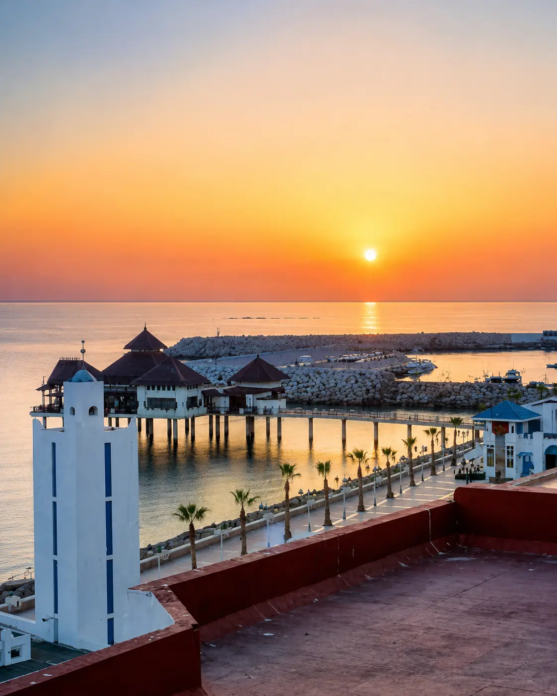
Sunset over the Tamuda Bay waterfront and marina context on Morocco's Mediterranean coast

Map orientation

Use the map to orient the coastal stretch between M'diq, Fnideq and inland Tetouan, then read the bay as part of a wider northern route rather than one isolated stop.

Editorial reading

Its beauty is coastal composition, not only luxury.

The first impression may be polished: pools, gardens, umbrellas, pale buildings and a calm line of water. Look longer and the bay becomes more interesting. Its order comes from the relationship between shore, road, planted edges, marinas, nearby towns and the mountains that hold the coastline from behind.

Tamuda Bay rewards a visitor who keeps public and private space distinct. Some beaches and resort fronts are managed, some seafront areas belong to everyday town life, and some views are best understood from the road or promenade rhythm rather than from inside one property.

The strongest photographs are not only the brightest ones. Watch how sunset light changes the water from blue to silver, how palms cut the horizon, how white buildings catch shade, and how the bay opens toward both the Mediterranean and the inland north.

There is also a useful correction here. Tamuda Bay is a contemporary coast name, while Tamuda itself refers to a separate archaeological site near Tetouan. Keeping that distinction clear makes the page more honest and the journey more intelligent.

The best visit lets the bay breathe: one wide view, one shoreline walk, one pause near the water, one look back toward the hills, and then a connection onward to Fnideq or Tetouan. The place is strongest when seen as part of northern Morocco, not as an isolated resort label.

Coastal and regional orientation

Read the bay through coast, towns and northern light.

Tamuda Bay is best understood as a modern Mediterranean coastal area, not as one enclosed monument. Its identity comes from a sequence of beaches, resort fronts, marina edges, road views and nearby city contexts between M'diq, Fnideq and Tetouan.

01Place type

Coastal bay

The name Tamuda Bay is used for the Mediterranean seaside area around M'diq and Fnideq. It is a coast to orient through beaches, hotels, marinas, roads and nearby towns.

02Setting

Between sea and hills

The visual strength of the bay comes from a simple northern geography: the Mediterranean in front, planted shorelines and resort edges at water level, and Rif foothills behind.

03Context

Not ancient Tamuda

The ancient site of Tamuda is separate and inland near Tetouan. Tamuda Bay is a contemporary coastal identity.

04Visitor rhythm

Seasonal coast

The coast can feel calm, polished or lively depending on season and access point. Verify beach conditions, public access and local transport details close to travel.

A visual bridge

Three readings between water, shore and road

Before Tamuda Bay becomes a beach image, it is a relationship between Mediterranean water, built edges and the road that threads the coast. These readings help visitors slow down and see the bay as a sequence.

01

Water

The Mediterranean first

The bay begins with water: a calmer northern surface, open horizon and changing light. Read the sea before the buildings, because the entire coastal rhythm depends on its colour, weather and seasonal mood.

  • Watch the water colour shift with sun and haze.
  • Notice where the beach feels public, managed or quiet.
  • Keep weather and sea conditions in mind.
02

Shore

Gardens, palms and white edges

Tamuda Bay's polished look comes from the meeting of sand, resort gardens, low coastal architecture and palms. The design feels strongest when it lets the water remain visible instead of overwhelming the shore.

  • Read planted edges against sand and water.
  • Notice shade, terraces and walking lines.
  • Look for restraint rather than visual clutter.
03

Route

Fnideq, M'diq and Tetouan

The bay is easier to understand when connected to its neighbours. Fnideq holds the northern city context, M'diq gives port and beach rhythm, and Tetouan adds inland cultural depth.

  • Use the coast road as an orientation line.
  • Keep the inland hills in the visual frame.
  • Connect beach time with nearby city context.

Quick orientation

Type of place

A Mediterranean coastal bay and resort area in northern Morocco, best understood through beaches, seafront design, marina edges and nearby town life.

Regional context

The bay belongs to the M'diq-Fnideq coast in the wider Tanger-Tetouan-Al Hoceima region, with Tetouan inland and Fnideq to the north.

Best for

Seaside stays, sunset views, coastal photography, gentle beach rhythm, northern Morocco orientation and combining Mediterranean water with city context.

Closest city context

Fnideq is the strongest guide base for this page, while M'diq and Tetouan help visitors understand the wider coastal and cultural setting.

What visitors experience here

A coast that changes with light, access and pace.

Tamuda Bay works in stages. First comes the broad Mediterranean view. Then the beach edge, palms, gardens, hotels, marina forms and road movement begin to separate. The place becomes richer when visitors read both the polished coast and the everyday northern context around it.

Arrival

The wide bay first

The best first view is broad: water, sand, planted edges and the inland rise behind the coast. This prevents the visit from becoming only a hotel or beach stop.

Light

Soft northern sunset

Late light gives the bay its strongest mood. Blue water warms, white buildings soften, palms become silhouettes and the coast feels more spacious without needing exaggerated colour.

Water

Sea rhythm and weather

The Mediterranean can look calm, but the real visit still depends on wind, visibility and local swimming conditions. Read the water as a living surface, not only a backdrop.

Movement

Road, port and promenade

Movement shapes the coast: cars along the road, people near the waterfront, boats around marina or port edges, and evening walking rhythms where public space is available.

Texture

Sand, palms and white walls

The bay's detail is clean rather than dense. Look for the contrast between pale architecture, planted gardens, beach grain, blue shade and the darker green of the hills.

Pace

A composed coastal pause

The strongest experience is unhurried: one shoreline walk, one long view, one pause at sunset, and enough orientation to know how the bay connects to Fnideq and Tetouan.

Place details and orientation

Read Tamuda Bay through six defining elements

No single detail explains the bay. Its character comes from the relationship between water, beach, resort edges, road access, nearby towns and the northern hills behind the coast.

1
Beach curve

The shoreline gives the bay its first shape: a soft meeting of sand, water and built edges rather than a single monument.

2
Mediterranean horizon

The horizon keeps the place open. It gives scale to pools, palms, terraces and promenades that might otherwise feel enclosed.

3
Resort gardens

Planted edges are part of the visual experience. They soften the coast and frame the transition from buildings to beach.

4
Marina and port rhythm

Boats, breakwaters and waterfront structures add movement and orientation, especially where the coast connects to M'diq and nearby harbours.

5
Coast road

The road between M'diq and Fnideq is part of how visitors read the bay: glimpses, turns, access points and sudden views of water.

6
Rif foothills

The hills behind the shore keep Tamuda Bay from feeling flat. They give the Mediterranean scene its northern Moroccan depth.

Coast, not just resort

The place asks for a wide reading.

Stand back from the most polished view. The first lesson is spatial: beach, water, gardens, buildings and hills all belong to one coastal composition. Tamuda Bay loses depth when it is treated only as a luxury label.

Then move closer. The textures are quieter than in a medina or kasbah: sand, water glare, palm shade, white walls, tiled terraces, road edges and the movement of people between sea and town.

Look also beyond the beach. Fnideq, M'diq and Tetouan give the bay a real northern frame. Without that context, the coast looks beautiful but thin; with it, the visit becomes more grounded.

Landscape and coastal intelligence

The bay is a sequence, not a single spot.

Tamuda Bay is easiest to misread when seen as one resort address. In reality, the visitor experience is a sequence of coast: open water, managed beachfront, road views, marina forms, town edges and inland hills. Each part changes the mood.

The built environment should be read with restraint. Low profiles, shaded terraces, gardens and white surfaces work best when they protect the view rather than compete with it. The landscape intelligence is in keeping sea, shore and mountain visible at once.

What to notice slowly

  • Start with the full waterline before focusing on one beach or hotel.
  • Notice how palm shade, terraces and gardens frame the sea.
  • Distinguish public coastline from private resort frontage.
  • Read marina and port edges as part of the working coastal rhythm.
  • Keep the hills behind the shore in view whenever possible.
  • Let the sunset stay natural: warm, clear and not overprocessed.

Visual reading

Three coastal languages to notice

Water and horizon

The bay speaks first through openness: a long Mediterranean plane, reflective light and a horizon that makes the shore feel expansive rather than crowded.

Built edge and garden

Resort architecture, palms and planted ground create a softened threshold between room, terrace, pool, beach and sea. The best views keep that threshold calm.

Town and route

Fnideq, M'diq and Tetouan keep the bay connected to real urban life. The coast is most interesting when luxury, road movement and local context stay in the same frame.

Visual atmosphere

Light, water and clean transitions

From wide view to shoreline

Start with the whole bay, then move closer to the sand, palms, terraces and waterline. The shift from panorama to shoreline gives the place its human scale.

From blue to gold

The strongest colour is natural: blue water, pale sand, green planting and a warm sky at sunset. Avoid reading the coast through exaggerated orange; the beauty is softer.

From resort to memory

The image is polished, but the deeper memory comes from connecting it to the wider north: Fnideq, M'diq, Tetouan, the coast road, the hills and the Mediterranean air.

Nearby places and onward links

Connect Tamuda Bay to the wider northern Morocco map

Tamuda Bay belongs to a northern itinerary. Fnideq gives the closest city base for this page, Tetouan adds inland cultural depth, and the wider Rif region connects coast, mountains and city routes.

Fnideq

The closest northern city context for Tamuda Bay, useful for reading the coastline near the Morocco-Spain frontier and the route toward the Mediterranean beaches.

Open Fnideq city guide

Tetouan

The inland cultural anchor for the coast, with Andalusian-Moroccan architecture, craft traditions and a stronger sense of the region behind the beach.

Open Tetouan city guide

Northern Morocco & Rif

The regional home for Rif landscapes, Mediterranean towns, white cities, mountain roads and coastal routes across Morocco's north.

Explore the region

Visit Morocco places

Continue through beaches, caves, lagoons, mountains, viewpoints, monuments and natural sites beyond the city guides.

Browse Visit places

Plan your journey

Treat Tamuda Bay as a coastal base, then connect it logically with Fnideq, Tetouan, Tangier, Rif roads and other northern highlights.

Plan your journey

Stories from Morocco

Use the Stories section for richer cultural reading around place, coast, memory, architecture, food, movement and everyday life behind the view.

Read stories

How to visit respectfully

Good behaviour keeps the coast generous.

Tamuda Bay combines public coastline, managed beachfronts, resort spaces, town movement and family holiday rhythms. Respect begins with reading boundaries clearly: not every terrace, beach chair, pier, garden or waterfront edge is public just because it is photogenic.

Respect also means protecting the shore itself. Avoid litter, keep noise low where families are relaxing, give people privacy, do not photograph strangers closely without permission, and check local guidance before swimming, boating or using water-sport services.

  • Ask before photographing people, staff, families, private interiors or close beach scenes.
  • Keep public and private beach areas distinct, especially around resorts and managed facilities.
  • Leave no litter on sand, paths, rocks, roadsides or parking areas.
  • Check sea, weather and local safety advice before swimming or boating.
  • Support local cafes, guides, taxis and services with courtesy and fair-minded interaction.

A strong first visit

Begin with a wide look at the bay before choosing where to stop. This gives the visit structure: waterline, beach, planted edge, road, marina forms, town context and hills can be understood together.

Then slow down at one shoreline point. Walk where access is clearly public, look back toward the hills, watch how the light changes the buildings, and let the coast read as a full northern landscape rather than a quick resort photograph.

Use Fnideq as the close city context for this page. It keeps the bay tied to real coastal life and gives the final cover image its role: not decoration, but a reminder that Tamuda Bay belongs to a lived northern corridor.

Afterward, widen the route toward Tetouan or other Rif and Mediterranean places. The bay becomes more memorable when it connects beach calm with the region's cities, roads, hills and everyday movement.

  • Start with a broad bay view before focusing on one beach or resort edge.
  • Walk only where access is clear and avoid cutting through private property.
  • Use sunset for natural light, not exaggerated colour treatment.
  • Leave space for local movement, families, service workers and waterfront businesses.
  • Finish by connecting the bay back to Fnideq, Tetouan and northern Morocco.

Careful planning note: beach access, traffic, prices, water activities and exact transport conditions can change. Verify practical arrangements locally before travelling.

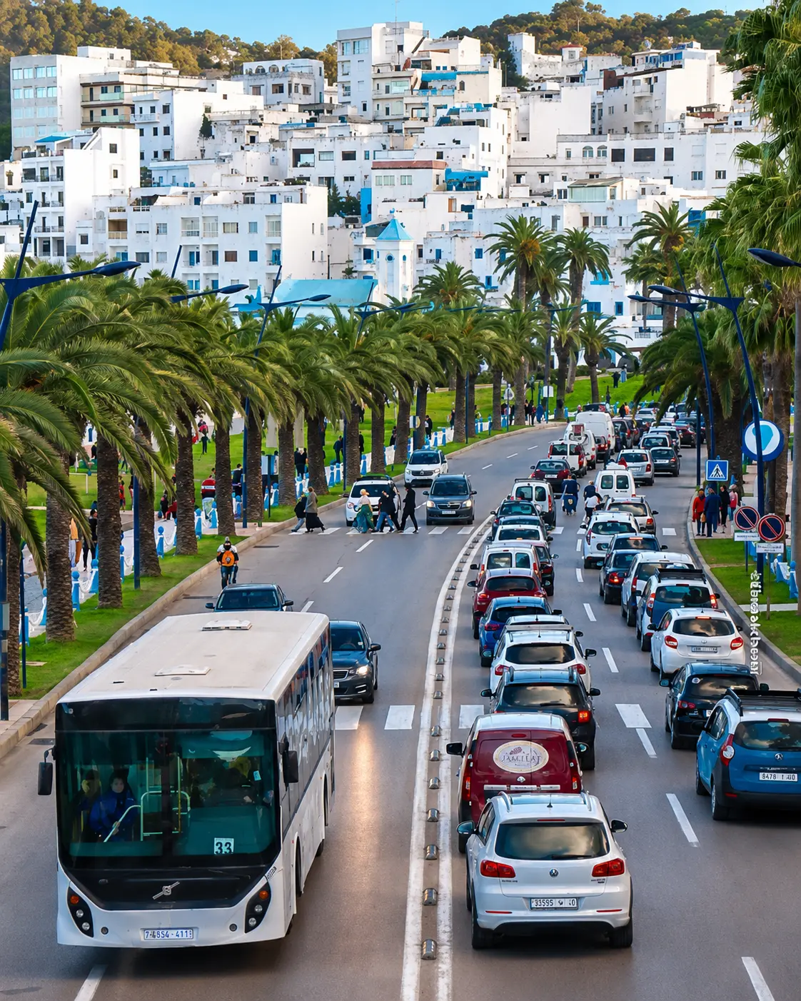
Fnideq city street and white hillside buildings near Tamuda Bay in northern Morocco

Go deeper through the nearest city context

Fnideq - the city gateway to Tamuda Bay

Tamuda Bay belongs naturally inside a wider Fnideq journey. The city gives visitors a stronger base for reading the northern coast: white hillside buildings, road movement, frontier geography, Mediterranean beaches and the practical rhythm of the M'diq-Fnideq corridor.

Use Fnideq to widen the context after the bay itself. The coast becomes clearer when its polished resort image is connected to town life, Tetouan's inland depth, the Rif foothills and the routes that keep northern Morocco close to both sea and city.

Northern coastal contextFnideq city orientation M'diq-Fnideq corridorMediterranean beach rhythm Practical travel structureNearby Rif and Tetouan links

Continue the journey

Continue from Tamuda Bay into northern Morocco.

Read the coast slowly, then connect it to Fnideq, M'diq, Tetouan, the Rif foothills and the wider Mediterranean map of Morocco.