
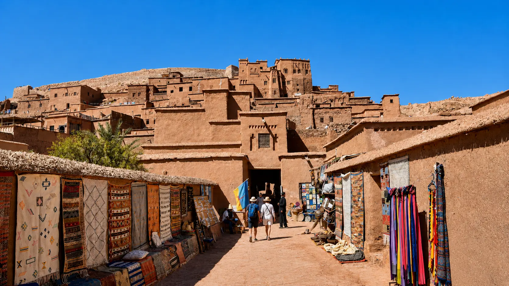
Aït Ben Haddou ksar rising above earthen lanes in Ouarzazate province, Morocco

Visit / Place · Ounila Valley · Ouarzazate province

Aït Ben Haddou A southern Moroccan ksar of earth, walls, towers and valley light

Aït Ben Haddou is a fortified earthen settlement whose power comes from the relationship between material, climate, protection, route, memory and the wider Ounila Valley landscape.

Begin from a distance before entering. The ksar is most powerful when the whole outline is visible first: earth walls, compact dwellings, towers, upper ridge and the valley setting that gives the place its scale.

Why Aït Ben Haddou matters

A ksar before it is a postcard.

Aït Ben Haddou is often called a kasbah in casual travel language, but the more precise word for the site is ksar: a fortified collective settlement. That distinction matters. A kasbah can refer to a fortified house, residence or citadel-like structure; a ksar is an inhabited or formerly inhabited settlement system, usually with houses, shared spaces, defensive edges and a logic of community life.

UNESCO describes the Ksar of Aït-Ben-Haddou as a group of earthen buildings surrounded by high walls, with houses crowded within defensive walls reinforced by corner towers. It also identifies the site as a striking example of the architecture of southern Morocco and as the most famous ksar in the Ounila Valley. That wording is useful because it keeps attention on the whole settlement, not only on the most photographed outline.

The place matters because it makes southern Moroccan earthen architecture legible at scale. Walls, towers, compact dwellings, public space, grain-related areas and the upper fortification are not isolated attractions. Together they show how settlement, defence, storage, movement and climate were organised through local materials. The power of the ksar comes from that complete system.

Aït Ben Haddou also matters as route memory. It sits in a valley landscape associated with movement between High Atlas approaches, Ouarzazate and the south-facing routes beyond. The architecture should therefore be read with the landscape: slope, riverbed, exposed light, packed earth, raised defensive edges and the sense of a settlement watching over passage.

For visitors, the site offers a clear lesson in looking carefully. It is possible to admire the view in a few minutes, but the richer experience comes from noticing how materials answer climate, how walls produce shade and enclosure, how upper viewpoints clarify the valley, and how fragile earthen heritage depends on maintenance rather than spectacle.

Core heritage facts are grounded in the UNESCO World Heritage Centre listing for the Ksar of Aït-Ben-Haddou. Practical details such as prices, opening hours, access arrangements and transport times should be checked close to travel.
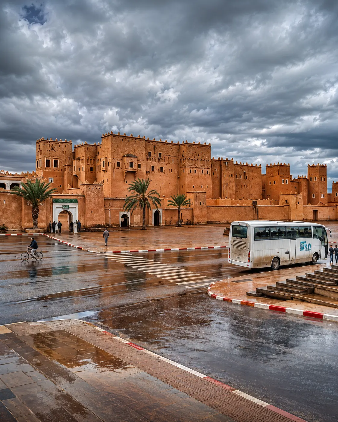
Ouarzazate earthen kasbah architecture, the city context for Aït Ben Haddou

Map orientation

Use the map first to place the ksar in relation to Ouarzazate, the Ounila Valley and the southern route landscape.

Editorial reading

Its beauty is structural, not decorative.

The famous silhouette is only the beginning. Look longer and the ksar becomes a lesson in proportion: earth walls rising from earth-coloured ground, towers measuring the edge, lanes climbing through shade, and an upper perspective that reconnects the settlement to the valley.

That is why Aït Ben Haddou rewards more than a fast stop. The stronger experience comes from seeing construction logic, social memory and fragility together, then letting those observations shape the way the place is photographed and remembered.

The most rewarding visit keeps both feelings together: admiration for the beauty, and awareness that the beauty comes from lived architecture, local materials, maintenance, vulnerability and respect for the people and landscapes around it.

Read the ksar in layers. The outer wall gives the first grammar: enclosure, protection and collective life. The towers give the skyline its rhythm. The lanes pull the visitor into a narrower scale, where shade, steps, turns and thresholds matter as much as the famous view.

Decoration is present in parts of southern earthen architecture, but the deeper beauty here comes from structure: mass, height, compactness, wall surface, openings and the way buildings rise with the hill. This is why the place should not be reduced to a film location or a quick backdrop.

The best reading also includes restraint. Some spaces may be private, closed, restored or fragile; some details make sense only when approached slowly. A respectful visitor looks carefully, keeps distance where needed, and lets the ksar remain a place rather than turning it into a prop.

From the upper view, return mentally to the beginning of the visit. The walls, lanes, public spaces, grain-related areas and valley position start to read as one system. That final connection is what makes the site memorable: the visitor has not only seen a famous Moroccan landmark, but understood why it stands where it does.

Historical and heritage orientation

Read the site through architecture, vulnerability and continuity.

Aït Ben Haddou is best understood as a heritage landscape rather than a single monument. UNESCO's description brings together material, settlement form and cultural vulnerability: the ksar illustrates traditional earthen habitat in southern Morocco, and the World Heritage listing recognises both its architectural value and the pressure placed on such habitats by social and economic change.

01Place type

A collective ksar

The site is not one palace-like building. It is a fortified grouping of earthen structures where the identity comes from the whole settlement pattern: dwellings, walls, towers and shared spaces.

02Architecture

Earthen construction

UNESCO links the site to the main types of earthen constructions visible in southern Moroccan valleys, especially the Dra, Todgha, Dadès and Souss contexts. The material is beautiful because it belongs to the climate and landscape.

03UNESCO 1987

World Heritage status

The Ksar of Aït-Ben-Haddou was inscribed on the UNESCO World Heritage List in 1987. The listing gives the site international recognition and asks visitors to treat its architecture with real care.

04Preservation

Fragility of earth

UNESCO notes the vulnerability of earthen buildings where maintenance and regular repair are lacking. A visitor should therefore see the site as living heritage under pressure, not as an indestructible stage set.

A visual bridge

Three readings between valley, earth and route

Before Aït Ben Haddou becomes a photograph, it is a relationship between valley, material and movement. These three readings help visitors slow down and understand why the ksar feels so complete from a distance, then so intricate at human scale.

01

Material

Earth as architecture

Earth gives the ksar its colour, mass and climate intelligence. It also explains why the place should be treated carefully: what looks monumental is still made from materials that depend on skilled repair and protection.

  • Read wall thickness, shade and surface texture.
  • Notice repair, weathering and small changes in tone.
  • Understand beauty as construction, not ornament alone.
02

Route

Valley and southern movement

The ksar makes most sense when connected to Ouarzazate, the Ounila Valley and the wider southern route landscape. Its position helps visitors understand why settlement, protection and passage belong in the same reading.

  • Keep the valley in view before entering.
  • Connect the site to Ouarzazate and Atlas approaches.
  • See the settlement as part of a route, not an isolated image.
03

Looking

Distance before detail

The strongest visit begins outside the walls. Distance reveals the complete form; walking reveals lanes, thresholds, shade and human scale; the upper perspective brings the valley and built earth back into one view.

  • Start with the full silhouette.
  • Move slowly through turns and thresholds.
  • Use viewpoints to understand scale, not only to photograph.

Quick orientation

Type of place

A fortified earthen ksar in Ouarzazate province, best understood as a heritage settlement and architectural landscape rather than a single standalone monument.

Landscape context

The site sits in the Ounila Valley context on the southern side of the High Atlas. Its visual force depends on the meeting of built earth, slope, light and route landscape.

Best for

Earthen architecture, heritage reading, careful photography, quiet walking, southern Morocco route planning and a deeper understanding of ksour beyond the surface image.

Closest city context

Ouarzazate is the strongest city context for travellers who want to connect the ksar with kasbah landscapes, valley roads and the wider southern Morocco journey.

What visitors experience here

A place that changes as you approach it.

Aït Ben Haddou works in stages. First comes the silhouette: a mass of earthen forms rising against a dry southern landscape. Then come the edges: walls, towers, stepped buildings and the feeling that the settlement has been shaped by both defence and adaptation. Only after that do the smaller details begin to speak.

Arrival

The outline from outside

From a distance, the ksar reads as one compact form. This is part of its authority. The eye first understands the settlement as a protected whole before noticing individual dwellings, towers and passages.

Light

Earth catching the sun

The colour of the walls is not a flat orange postcard tone. Earthen surfaces shift with light, dust, shadow and distance. Early or late light can make the relief more readable, while harsher light reveals the dryness and exposure of the setting.

Movement

Lanes and thresholds

The most rewarding walking rhythm is slow. Narrow turns, shaded sections and upward movement make visitors aware of the settlement's human scale, not only its famous outer image.

Material

Texture before ornament

In many Moroccan interiors, decoration may lead the eye first. Here, texture often comes first: earth, timber, plastered surfaces, wall thickness, openings and the practical beauty of climate-aware building.

Upper view

The summit reading

Official Moroccan tourism material describes the ksar's buildings as flanking a hill toward an old granary at the summit. Whether seen from below or above, the climb helps connect architecture to valley scale.

Pace

A slower kind of visit

The site loses meaning when treated only as a backdrop. The better visit gives time to the public spaces, the walls, the edges, the changing view and the care required by earthen heritage.

Place details and orientation

Read Aït Ben Haddou through six defining elements

No single detail explains the ksar. Its meaning comes from the relationship between fortification, dwellings, shared spaces, upper storage, valley setting and the vulnerability of earthen construction.

1
Defensive walls

High enclosing walls create the settlement's protective outline and help explain why the ksar appears so unified from outside.

2
Corner towers

The towers are part of the defensive and visual language described by UNESCO. They give rhythm to the skyline and mark the edges of the settlement.

3
Collective dwellings

Houses crowd within the walls, making the ksar a community fabric rather than a single monumental object.

4
Public and communal spaces

UNESCO identifies community areas including a mosque, public square, grain threshing areas outside the ramparts, cemeteries and sanctuary context.

5
Upper granary context

The upper zone helps visitors read scale, storage logic and the connection between the settlement's lower lanes and wider landscape.

6
Ounila Valley setting

The ksar is inseparable from the valley context. Its colour, position and visual strength depend on the surrounding slopes and routes.

Ksar, not scenery

The place asks for a careful eye.

Stand back before entering. The first lesson is spatial: a settlement gathered inside walls, shaped by earth, valley, climate and protection. The outline is not simply picturesque; it explains how the ksar holds together as a fortified community fabric.

Then move closer. Lanes, thresholds, wall thickness, shaded turns and repaired surfaces make the place human again. This is where the visit becomes more than a view: the eye starts to understand how people moved, protected goods, managed exposure and used local materials with intelligence.

Look for the relationship between the lower lanes and the upper perspective. The climb is meaningful because it turns the ksar back into landscape, connecting the settlement to the Ounila Valley and reminding visitors that heritage is both built form and setting.

Architecture and material intelligence

Earth architecture is not a style effect.

The earthen character of Aït Ben Haddou is not just visual atmosphere. Earth construction is tied to local availability, climate response, repair cycles and the way buildings sit inside the landscape. It gives the ksar its warmth, but it also gives the place its fragility.

UNESCO's authenticity note is important here: the site has preserved its architectural authenticity in configuration and materials, and its earthen constructions are adapted to climatic conditions and in harmony with the natural and social environment. Material, setting and care all belong to the same heritage reading.

What to notice slowly

  • Look at the whole outline before focusing on individual doors, lanes or viewpoints.
  • Notice where earth surfaces are smooth, rough, repaired, sunlit or shadowed.
  • Distinguish the communal settlement pattern from the idea of a single kasbah building.
  • Read the towers and upper structures as part of protection and storage logic.
  • Keep the Ounila Valley in view; the setting is part of the site's meaning.
  • Respect closed spaces and fragile surfaces, especially where walls or passages show wear.

Architectural reading

Three architectural languages to notice

Mass and enclosure

Aït Ben Haddou speaks first through compact mass: defensive edges, corner towers, clustered dwellings and a silhouette that reads as one protected settlement before it separates into individual spaces.

Route and storage

The upper climb and granary context help visitors understand movement, protection and storage as part of the same settlement logic. The ksar is not a backdrop; it is an organised built landscape.

Surface and repair

Earthen surfaces record light, weathering, maintenance and vulnerability. Their beauty depends on care, which is why the most respectful visitor avoids touching, climbing or treating fragile fabric as scenery.

Visual atmosphere

Light, texture and quiet transitions

From distance to detail

Start with the whole ridge and settlement outline, then move closer to read doorways, turns, wall thickness, repaired earth and the way shade changes the lanes. The shift from wide view to narrow passage is essential: it turns the ksar from a distant silhouette into a human-scale settlement.

From earth to sky

The strongest visual contrast is not artificial colour, but the meeting of earthen walls, pale ground, upper structures and open southern sky. Look for how the same wall can feel dense, warm, dry or sculptural depending on light, angle and distance.

From photo to memory

The image is powerful, but the deeper memory comes from walking slowly enough to connect the ksar with valley, route, material and living heritage. A careful visitor leaves with more than one frame: the sound of footsteps, the pressure of sun, the shade of lanes and the sense of a place maintained through care.

Nearby places and onward links

Connect the ksar to the wider southern Morocco map

Aït Ben Haddou belongs to a broader southern itinerary. Ouarzazate gives the clearest city context, while the wider region opens toward oases, kasbah landscapes and architecture-focused routes.

Ouarzazate

The closest major city context for Aït Ben Haddou. Use it to frame kasbah landscapes, film-route identity and southern travel orientation.

Open Ouarzazate city guide

Southern Morocco, Oases & Sahara

The regional home for desert-edge travel, oasis routes, valley landscapes and earthen architecture across Morocco's south.

Explore the region

Architecture & Heritage

Aït Ben Haddou is one of the clearest gateways into Moroccan earthen architecture, heritage preservation and the relationship between material and place.

Read the theme

Visit Morocco places

Continue through kasbahs, valleys, waterfalls, lagoons, caves, monuments and natural heritage places beyond the city guides.

Browse Visit places

Plan your journey

Treat Aït Ben Haddou as a route anchor, not just a stop. Link it logically with Ouarzazate, High Atlas approaches and southern Morocco planning.

Plan your journey

Stories from Morocco

Use the Stories section for richer cultural reading around place, memory, materials, landscapes and the human rhythm behind visual heritage.

Read stories

How to visit respectfully

Good behaviour protects the experience.

Aït Ben Haddou is well known enough to attract fast visits. That makes respectful behaviour more important, not less. Move quietly through narrow areas, avoid blocking paths, ask before photographing people, and remember that not every threshold is public just because the site is famous.

Respect also means caring for material heritage. Earthen surfaces can look massive and still be vulnerable. Do not climb on walls, scratch surfaces, lean into unstable edges, leave litter, shout through lanes or treat interiors as props. A slower visitor sees more and harms less.

  • Ask clearly before photographing local people, guides, shopkeepers or private interiors.
  • Keep to appropriate walking routes and avoid pressure on fragile walls or edges.
  • Support local services with courtesy and fair-minded interaction.
  • Carry water, protect yourself from exposed light, and avoid turning discomfort into impatience with the place.
  • Check current access, local guidance and restoration conditions close to travel.

A strong first visit

Begin outside the ksar so the full silhouette, valley position and defensive outline can be read. This first view gives the visit its structure: walls, towers, clustered dwellings and upper ridge can be understood together before the details begin to compete for attention.

Inside, move slowly enough to notice thresholds, shade, wall thickness and repaired surfaces. Climb only where access is appropriate, pause at shaded turns, and use the upper perspective to understand scale rather than only to collect a photo. The best rhythm is outward, inward, upward, then outward again toward the valley.

If you arrive with a guide, listen for the words that clarify the site: ksar, earthen construction, collective settlement, defensive wall, upper granary context and Ounila Valley. These terms help organise what the eye is seeing and prevent the visit from becoming only a sequence of photographs.

Afterward, connect the visit to Ouarzazate and the wider southern route. That wider context helps the ksar feel less like an isolated attraction and more like part of a regional landscape of earth architecture, valley movement and careful heritage reading.

  • Start outside, where the full profile and valley position are easiest to understand.
  • Enter slowly, giving attention to thresholds, shaded turns and the feel of wall thickness.
  • Use higher viewpoints to read settlement scale, not only to photograph the panorama.
  • Leave space for local movement, guides and small businesses around the site.
  • Finish by connecting the ksar back to Ouarzazate, the Ounila Valley and southern Morocco.

Careful planning note: opening hours, prices and exact travel times can change. Verify practical arrangements locally before travelling.

Earthen kasbah architecture in Ouarzazate, the city gateway context for Aït Ben Haddou

Go deeper through the nearest city context

Ouarzazate — the city gateway to Aït Ben Haddou

Aït Ben Haddou belongs naturally inside a wider Ouarzazate journey. The city gives visitors a stronger base for reading southern Moroccan routes: kasbah landscapes, film-route memory, High Atlas approaches, valley roads, oasis directions and the visual grammar of earth architecture.

Use Ouarzazate to widen the context after the ksar itself: nearby kasbahs, desert-edge routes, valley landscapes and practical southern travel planning all become easier to understand when Aït Ben Haddou is treated as part of a larger regional story.

Historic and regional contextOuarzazate city orientation Kasbah and valley routesArchitecture and heritage reading Practical travel structureNearby southern highlights

Continue the journey

Continue from Aït Ben Haddou into southern Morocco.

Read the ksar slowly, then connect it to Ouarzazate, the Ounila Valley, earthen architecture, southern routes and the wider heritage map of Morocco.