
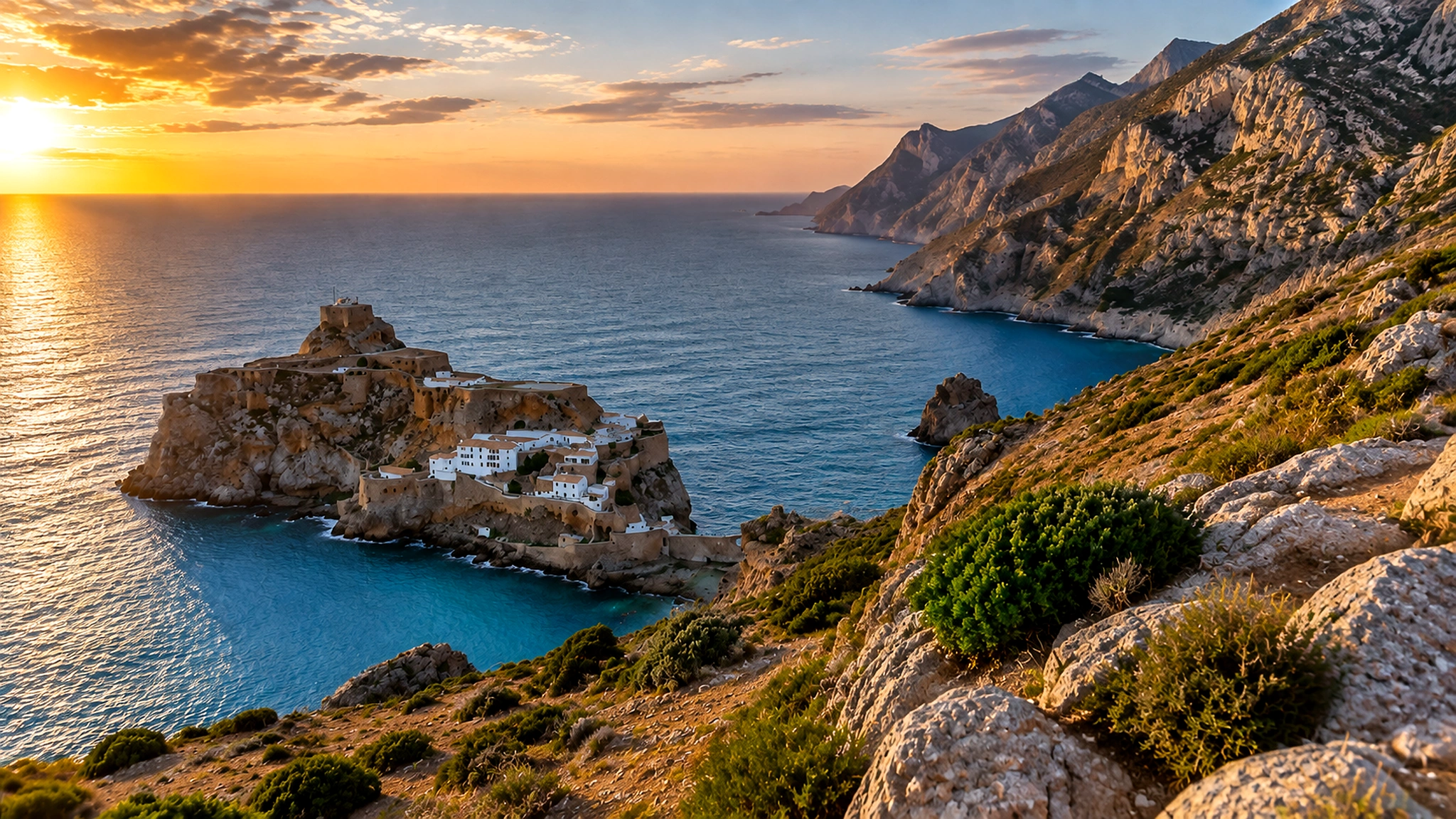
Sunset over Rif cliffs, Mediterranean water and rocky coves in Al Hoceima National Park, Morocco

Visit / Place · Rif coast · Mediterranean Morocco

Al Hoceima National Park Rif cliffs, blue coves and protected Mediterranean light

Al Hoceima National Park is where Morocco's northern mountains meet the Mediterranean with unusual force: cliffs, coves, marine protection, coastal roads and a quieter Rif rhythm all held in one landscape.

Begin from above before descending toward the water. The park is most powerful when the coastline is read as a whole first: rock, sea, slope, village edges, fishing life and the protected marine horizon.

Why Al Hoceima National Park matters

A coast before it is a viewpoint.

Al Hoceima National Park matters because it refuses the easy separation between beach, mountain and sea. The visitor does not meet a single attraction here, but a protected coastal system where Rif slopes, small coves, rocky edges and marine habitats shape one another.

UNESCO describes the Marine Protected Area of Al Hoceima National Park as covering 48,460 hectares on Morocco's Mediterranean coast. That scale is important. It makes the park more than a scenic drive: it is a serious northern conservation landscape with land, water, biodiversity and local livelihoods tied together.

The park also changes the visual grammar of Moroccan travel. Instead of imperial walls, desert lines or medina passages, the eye reads cliffs, exposed rock, blue water, changing light and the sharp drop from mountain to sea. The beauty is not soft; it is structural, coastal and intensely Mediterranean.

Its human context matters as well. Marine protection around Al Hoceima is connected to fishing communities and careful resource use, so a good visit should avoid treating the area as empty scenery. The strongest reading holds nature, work, access and restraint together.

Core protected-area facts are grounded in UNESCO reporting on the Al Hoceima National Park Marine Protected Area and the Protected Planet profile for Al-Hoceima National Park. Access conditions, sea state, road surfaces and local arrangements should be checked close to travel.
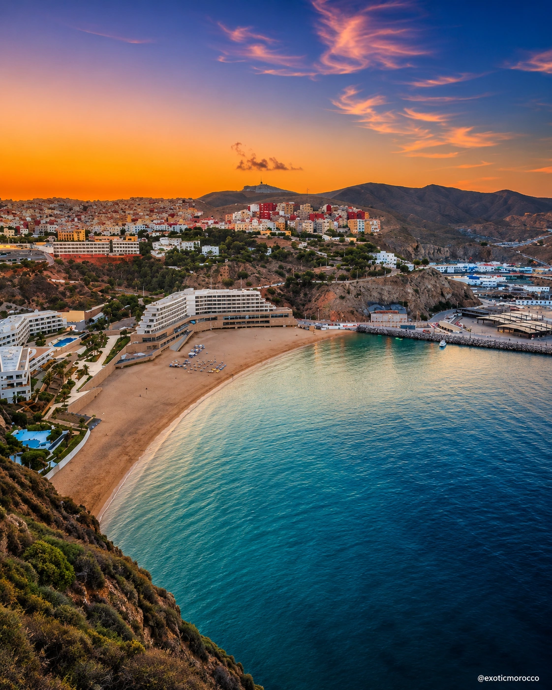
Al Hoceima city and bay at sunset, the coastal city context for the national park

Place the park before choosing the route.

Use the map to understand the park west of Al Hoceima, where coastal roads, Rif slopes and Mediterranean coves meet. The exact experience depends on the route, season, weather and local access.

Editorial reading

Read the edge slowly.

The first mistake is to read the park only as a collection of beaches. The stronger experience begins higher up, where the coastline appears as a continuous edge between mountains and sea.

From there, details become clearer: cliffs measuring the drop, paths and roads following the relief, coves protected by rock, and water shifting from deep blue to green where the seabed rises near shore.

The park rewards visitors who connect beauty to protection. A cove is not only a swimming place. A cliff is not only a photograph. A fishing boat is not only atmosphere. Together they reveal how coastal life and marine ecology share the same space.

That is why Al Hoceima National Park asks for restraint. Move carefully, keep to appropriate routes, avoid damage and noise, and let the landscape remain a protected place rather than a backdrop for hurried consumption.

Natural and protected-area orientation

A northern Moroccan park where land and sea belong together.

Al Hoceima National Park is best understood as a coastal protected landscape rather than a simple seaside escape. Its meaning comes from the meeting of Rif topography, Mediterranean water, marine habitats, small-scale human use and the care required by fragile coastal environments.

01Place type

Coastal national park

The park combines land and sea in one visitor reading. Roads, viewpoints, coves and marine space should be understood together instead of as separate attractions.

02Protected scale

48,460 hectares

UNESCO gives this figure for the Marine Protected Area of Al Hoceima National Park, underlining the importance of the park's marine dimension as well as its visible coastline.

03Landscape

Rif cliffs and coves

The visual force of the park comes from steep coastal forms, rocky inlets, open sea and mountain-backed views. The water is only one part of a larger land-and-sea composition.

04Care

Protection and livelihoods

UNESCO links marine protection work here with fishing communities. Visitors should keep that human context in mind and avoid treating protected coastal space as empty or ownerless.

A visual bridge

Three ways to read the park before the camera takes over.

Al Hoceima National Park becomes more memorable when visitors slow down and read the relationship between height, water and access. These three lenses keep the coast from becoming a flat postcard.

01

Height

Start with the cliff line.

From above, the coast becomes legible. The slopes show how limited the passages are, how coves are protected by rock, and why the Mediterranean horizon feels so close to the mountains.

  • Look for the drop from road to water.
  • Read each cove as part of the larger edge.
  • Keep the horizon in the frame before focusing on details.
02

Water

Let the sea explain scale.

The Mediterranean is not a decorative background here. It changes the colour, sound, route logic and ecological meaning of the park, especially where clear water meets rock and sheltered inlets.

  • Notice where blue water turns shallow and green.
  • Watch how cliffs cast shade across small bays.
  • Connect the view to marine protection, not only leisure.
03

Access

Respect the thresholds.

Some approaches feel inviting; others may be seasonal, rough, private, fragile or unsuitable without local knowledge. A careful visitor reads the coast through permitted access, not only desire.

  • Choose routes with care and local confirmation.
  • Avoid disturbing fishing work or quiet village edges.
  • Leave coves cleaner and quieter than you found them.

Quick orientation

Type of place

A protected coastal and marine national park on Morocco's northern Mediterranean side, best read through cliffs, coves, water, roads and conservation context.

Landscape context

Rif coastal terrain west of Al Hoceima, where steep slopes, rocky shorelines and small Mediterranean bays create a more rugged northern Morocco experience.

Best for

Coastal viewpoints, careful photography, nature-focused routes, quieter coves, marine landscape reading and travellers who want Morocco beyond the usual city circuit.

Closest city context

Al Hoceima is the natural city gateway, giving the park practical context through its bay, port, coastal roads and wider northern Morocco orientation.

What visitors experience here

From city bay to protected coast, the park unfolds by edges.

Al Hoceima National Park works through contrast. One moment the view is open sea and glowing cliffs; the next it narrows into a cove, a bend in the road, a village edge or a quiet place where the sound of water feels larger than the route itself.

Arrival

The coast begins to steepen

The transition from Al Hoceima toward the park feels physical. The city bay gives way to rougher coastal forms, and the road starts to teach the visitor how close the mountains are to the sea.

Light

Rock catching warm sun

Late light strengthens the park's character without needing heavy contrast. Cliffs turn gold and earth-toned, water keeps its blue depth, and the coastline gains relief without becoming dark.

Water

Coves that change colour

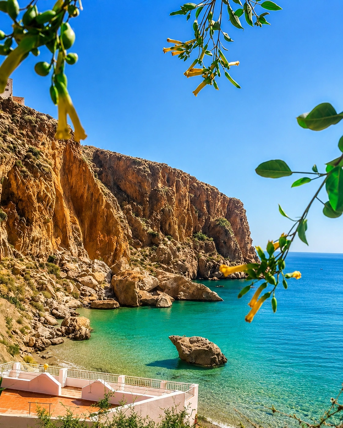
The Mediterranean shifts with depth, seabed, rock shadow and wind. A cove can look turquoise from above, transparent at the edge and dark blue again where the shore drops away.

Movement

Slow roads and careful paths

The park is not best consumed quickly. Road bends, viewpoints and descents ask visitors to slow down, observe conditions and avoid treating every visible track as an invitation.

Scale

Mountains pressed to the sea

The strongest views come from the compression of elements: Rif slopes above, rock faces below, small human traces at the edge and the Mediterranean opening everything outward.

Pace

A quieter northern rhythm

The better visit gives time to stillness: wind on the slope, water against stone, road dust, fishing activity seen from a respectful distance and the feeling of a protected coast continuing beyond the frame.

Place details and orientation

Read Al Hoceima National Park through six defining elements

No single beach or viewpoint explains the park. Its character comes from the relationship between cliff, water, access, marine protection, human use and the wider Rif coast.

1
Mediterranean cliffs

Steep rocky edges give the park its drama and help visitors understand why distance and height matter before any descent toward the shore.

2
Marine protected area

The sea is part of the park's identity, not a background surface. UNESCO's reporting keeps attention on marine biodiversity and protection.

3
Coves and small bays

Sheltered inlets create the most intimate views, but they should be approached with care, local awareness and respect for changing conditions.

4
Rif slopes

The mountainous setting shapes roads, visibility, settlement edges and the sense that the coast is carved rather than gently drawn.

5
Fishing-community context

Protection here is linked to coastal livelihoods. Photographs, routes and pauses should leave space for people who work around the sea.

6
Viewpoint logic

The best orientation often begins from above, where visitors can understand the coastline before choosing a cove, path or coastal road stop.

Landscape, not scenery

The park is a system of edges.

Stand back first. The opening lesson is spatial: mountains descending toward sea, rock protecting water, roads negotiating slope and small human traces showing that this is a lived coast as well as a protected one.

Move closer only after that wider reading. Details become richer when they are connected to the whole: scrub and rock, clear water, fishing context, sheltered coves, road turns, changing wind and the light that makes the Rif coast feel both sharp and generous.

Landscape and ecological intelligence

The design here belongs to coast, relief and water.

For a natural place, the intelligence is not architectural. It sits in the way landform controls movement, water reveals depth, cliffs protect coves and the visible coastline reminds visitors that beauty and vulnerability can occupy the same frame.

The protected-area reading matters because Al Hoceima National Park includes marine space as well as land. UNESCO's reporting on the park's marine protected area connects biodiversity, red coral reserve context, key species and fishing-community involvement. The visitor does not need to turn this into a lecture; the point is to look with more care.

What to notice slowly

  • How the road and path choices follow the slope rather than ignoring it.
  • How water colour changes around rock, depth, shade and wind.
  • How coves feel intimate but remain part of a larger protected coast.
  • How fishing activity, village edges and quiet work belong to the view.
  • How sunset can warm the cliffs while the sea stays clear and bright.
  • How restraint makes the experience stronger, not smaller.

Visual reading

See more than a beautiful coastline.

Relief and restraint

The steepness of the coast is part of the visitor ethic. Where the land is fragile, access should be chosen with patience, not forced because the view looks close on a map.

Sea as protected space

The water is visually seductive, but it is also ecological space. The most intelligent photographs keep the marine horizon, rock edge and protected context in the same reading.

City and park together

Al Hoceima gives the park its gateway rhythm. The city bay, port and coastal identity help visitors understand the park as part of northern Morocco, not as an isolated remote scene.

Visual atmosphere

Cliff, water, road and memory.

From distance to detail

Start with the whole curve of the coast, then move toward details: folds in the slope, sheltered water, rock texture, low vegetation, a boat line, a bend in the road or a narrow place where the horizon suddenly opens again.

From blue to earth

The park's colour is strongest when it stays natural: clear Mediterranean blue, pale rock, warm earth, green scrub and sunset light that brightens the cliffs without turning the scene artificial or heavy.

From photo to memory

The image may begin with a spectacular view, but the memory is quieter: salt air, road curves, the sound of water below, the caution of a steep edge and the sense that the coast continues beyond what the camera can hold.

Nearby places and onward links

Connect the park to the northern Morocco coast.

Al Hoceima National Park belongs naturally inside a northern Morocco journey. Use the city of Al Hoceima for orientation, then widen the route through Rif landscapes, Mediterranean coastlines and broader Exotic Morocco planning.

Al Hoceima

The closest city context for the park. Use it to frame the bay, port, coastal roads and the practical rhythm of exploring this part of the Rif coast.

Open Al Hoceima city guide

Northern Morocco & Rif

The regional home for mountain-backed towns, Mediterranean views, Rif landscapes and a more layered reading of Morocco's north.

Explore the region

Mediterranean & Eastern Morocco

Use the wider Mediterranean route context to connect Al Hoceima with coastal travel, eastern gateways and northern shoreline contrasts.

Read the regional guide

Visit Morocco places

Continue through national parks, caves, lagoons, valleys, waterfalls, monuments and major landscapes beyond the city guides.

Browse Visit places

Plan your journey

Approach the park as a route decision. Weather, access, road surfaces and sea conditions can affect how the coast should be experienced.

Plan your journey

Themes of Morocco

Use the Themes section to place the park within broader readings of landscape, heritage, culture, food, craft and Moroccan visual identity.

Explore themes

How to visit respectfully

Keep the coast protected, quiet and legible.

Al Hoceima National Park is powerful because it still feels like a coast with limits. Respect those limits. Avoid litter, loud behaviour, careless parking, damage to vegetation or rock, and intrusive photography around fishing work, homes or quiet village edges.

  • Check local access, weather, road conditions and sea state before committing to a route.
  • Stay on appropriate roads and paths; do not force fragile slopes or informal tracks.
  • Keep distance from wildlife, nesting areas, fishing gear and working boats.
  • Ask before photographing people, homes, boats or working spaces.
  • Carry water, sun protection and enough time so the visit does not become rushed.
  • Leave no waste, avoid noise and keep the protected-area context in mind.

A strong first visit

Begin high, then choose one coastal descent.

Start with a viewpoint or road section where the park can be read from above. This gives structure to the visit before the details compete for attention: sea colour, cliff mass, route choices, small coves and the relationship between Al Hoceima and the protected coast.

Then choose one focused experience rather than trying to consume the whole park at speed. A single cove, a careful viewpoint sequence or a slow coastal route can be stronger than a scattered day of brief stops.

If you go with local guidance, listen for practical detail: which roads are suitable, where access is respectful, how weather or sea conditions affect the day and where photography should remain discreet. The best visit feels precise, not improvised.

  • Start with the whole coastline before moving toward details.
  • Keep Al Hoceima as the practical city anchor.
  • Let local access advice shape the route.
  • Finish with a wider northern Morocco context, not only a single photo stop.

Careful planning note: exact access, route suitability, swimming conditions, boat options and local restrictions can change. Verify practical arrangements locally before travelling.

Rocky cove, clear water and warm cliffs on the Al Hoceima coast

Go deeper through the nearest city context

Al Hoceima - the city gateway to the park

Al Hoceima gives the national park its clearest visitor base. The city connects the protected coast with a real urban rhythm: bay views, port life, beach edges, road access and the wider identity of Morocco's Mediterranean north.

Use the city guide to widen the context after the park itself. The coastline becomes easier to understand when Al Hoceima is treated not just as a departure point, but as the place where Rif landscape, sea culture and northern Morocco orientation come together.

Coastal city orientationRif and Mediterranean context

Continue the journey

Continue from Al Hoceima National Park into northern Morocco.

Read the park through cliff, water, protection and city context, then connect it to Al Hoceima, the Rif coast and the wider Mediterranean map of Morocco.