
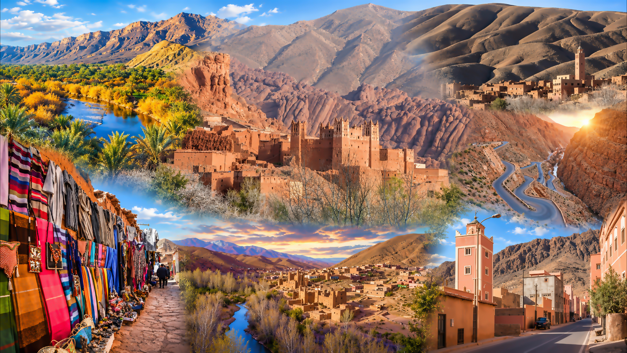
Dadès Valley montage with river scenery, earthen kasbahs, sculpted rocks, mountain roads and village life

Visit / Place · High Atlas · Tinghir province

Dadès Valley River gardens, earthen kasbahs and the sculpted foothills of the High Atlas

Follow the Dadès through cultivated valley floors, villages and narrowing gorges: a southern Moroccan landscape shaped by water, rock and the work of generations.

Begin around Boumalne Dadès, then give the valley time to unfold. A riverside walk, a village stop and a well-chosen viewpoint reveal different parts of the journey.

Why Dadès Valley matters

A valley sustained by water and work.

The Dadès links the southern High Atlas to a landscape of small farms, villages and earthen kasbahs. Around Boumalne Dadès, the contrast is immediate: cultivated ground follows the river while exposed slopes rise above it. That green strip is productive land, sustained by irrigation and the people who maintain it.

The valley deserves attention as a whole. Its famous gorge roads occupy only part of a much longer river landscape. Wider stretches allow room for fields and settlement; narrower reaches bring water, rock walls and movement close together. These changes in available space help explain the different character of each stop.

Agriculture gives this landscape its finer grain. Plot boundaries, channels and access paths divide a seemingly continuous ribbon of green into places with different uses. Seen carefully, the valley floor is a working arrangement of land and water. Its appearance changes with the crops, the season and the amount of water available.

The built heritage adds another layer. Earthen towers and older houses share the valley with newer homes, roadside businesses and accommodation. Look at their condition individually: a dramatic silhouette cannot tell you whether a building is occupied, accessible or structurally sound. The valley remains a place of contemporary life.

A rewarding visit makes room for both the broad landforms and the small decisions visible at ground level: where a path meets a field, how a house faces the valley, or where a bridge makes crossing possible. These observations give the journey meaning beyond its best-known photographic stops.

Further context: Drâa-Tafilalet’s Tinghir guide, IFAD on irrigation in Dadès, and research on the region’s geological sites.
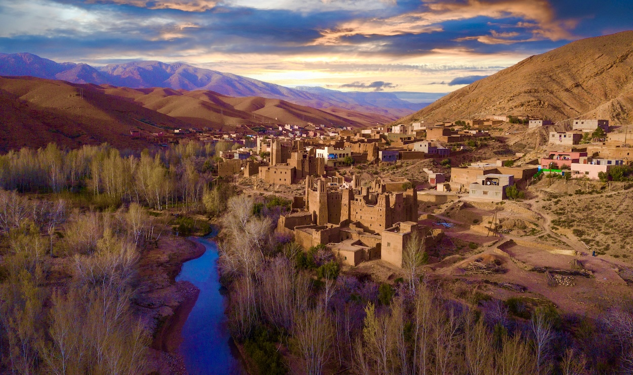
Earthen kasbahs and village houses above a river bend in Dadès Valley

Valley orientation

Follow the river north from Boumalne Dadès towards the gorges. Tinghir lies farther east, beside the separate Todgha valley. Open map ↗

Editorial reading

Notice where the valley makes room.

The most revealing change is often a change in width. At an open bend, the eye travels across plots, trees and buildings. Farther upstream, a constricted passage may leave only a narrow corridor between the river and rock. Compare those spaces before comparing individual sights.

Choose a viewpoint where more than one layer is visible. A foreground wall or field gives scale to a village; the village gives scale to the cliffs behind it. Without those intermediate distances, even a remarkable photograph can flatten the valley into a single surface.

Then consider what the road reveals and what it hides. An elevated bend may show the river’s course clearly while concealing the paths below. From a lower position, the same slope can appear much steeper and the settlement more closely gathered.

A useful visual question is where one surface ends and another begins. Look for the edge of cultivation against bare ground, a roofline against a hillside, or the point where a gravel bank meets moving water. Those boundaries are often clearer than the centre of a view.

The well-known rounded formations near Tamlalt deserve a stop, but their nickname, Monkey Fingers, is only a starting point. Notice the smaller grooves, shadows and changes of profile that give the rock its character. A roadside view and a canyon walk offer different levels of access.

Leave room for what cannot be read from appearance. A doorway may lead to a family home; a narrow track may serve a field; a picturesque ruin may be unsafe. Local knowledge adds the information that a distant view cannot supply.

At the end of the visit, think back to the place where the valley opened or narrowed most noticeably. Recalling that change of space often gives a more useful understanding of Dadès than trying to remember every bend in the road.

Natural and cultural orientation

A river landscape with a living heritage.

Dadès brings together geological landforms, irrigated agriculture and the built heritage of southern Morocco. Keep these histories distinct: the rocks, the fields and the houses have different origins and change at different rates.

01River landscape

From Atlas to valley

The Dadès descends from the High Atlas, cutting through gorge sections before continuing along the mountains’ southern side. The upper valley road gives access to a sequence of settlements and contrasting landforms.

02Agriculture

Cultivation through irrigation

In this dry setting, irrigation is central to farming. Channels and cultivated parcels are part of the valley’s cultural landscape, requiring continuing work as well as access to water.

03Built heritage

Kasbahs among villages

Older fortified houses and earthen buildings form part of the valley’s architectural heritage. Their histories and conditions vary; avoid assigning a common age or ownership to every tower.

04Present-day life

A changing rural landscape

Farming, local services and tourism coexist along the valley. New construction and maintained homes belong in an honest reading of the place, alongside the older buildings visitors come to see.

A visual bridge

Three ways to follow the landscape

Give each stop a different purpose: study the valley floor, compare the rock forms, then read the spaces between villages. These three approaches help a varied journey remain coherent.

01

Water

Trace the cultivated edge

Follow the shape of the fields around a river bend. Their boundaries make the available ground easier to understand, especially where the valley floor becomes narrow.

  • Look for the edge between fields and bare slopes.
  • Notice channels from an established public path.
  • Compare broad plots with tighter spaces at bends.
02

Rock

Compare rounded and layered forms

The valley offers very different rock profiles. Compare the rounded shapes around Tamlalt with the more sharply layered faces elsewhere, allowing light and viewing angle to reveal their relief.

  • Study the outline before the surface texture.
  • Look for shadows within grooves and ledges.
  • Use visible strata to follow changes in direction.
03

Settlement

Read the spaces between buildings

A village view becomes more informative when you notice the ground around the houses. Paths, cultivated strips and road access show how the built area meets the wider valley.

  • Include the land below the buildings in your view.
  • Distinguish a public lane from a private threshold.
  • Notice how newer and older buildings sit together.

Quick orientation

Type of place

A High Atlas river valley with cultivated land, villages, earthen kasbahs and a series of gorges. Explore it through several selected stops rather than as a single enclosed attraction.

Landscape & region

The valley and gorge corridor around Boumalne Dadès lies in Tinghir province, Drâa-Tafilalet. Connect it to Southern Morocco, Oases & Sahara.

Best for

Landscape photography, village walks, geological observation and an unhurried road journey. Short public-path walks and longer guided outings suit different abilities and conditions.

Gateway & onward city

Boumalne Dadès is the valley’s gateway town. Tinghir, farther east, provides the onward city guide for a separate visit to the Todgha valley and its gorges.

What visitors experience here

Open bends, close rock and village streets.

The road changes the view repeatedly, but a stop changes the experience more. Leave time to hear the river where it is audible, walk through an accessible village lane and watch a familiar cliff change under passing light.

Arrival

The first view over the valley

Around the gateway town, look beyond the roadside buildings towards the lower ground. Seeing the river corridor from above gives a useful first impression of how settlement and cultivation fit within the slopes.

Light

Relief in the rock

Side light brings out folds, grooves and projecting edges; direct light can make the same face appear flatter. An interesting view need not wait for sunset. Look for a position where the shape remains legible.

Walking

A lane at ground level

Away from a wide panorama, attention shifts to doorways, steps, garden edges and the width of a path. Let local movement set your pace, particularly where people or animals need room to pass.

Sound

Water, leaves and the road

The valley has no single soundtrack. A sheltered stretch near the river may carry water and leaves; a roadside stop brings vehicles and conversation. Choose a pause that lets you notice the difference.

Road

The gorge bends

The well-known switchbacks are experienced differently from a vehicle and from a safe viewpoint. Let the driver concentrate on the road, and stop only where there is a proper place to pull clear of traffic.

Season

A changing foreground

Trees may be leafy or bare, plots green or recently worked, and the river high or low. Those changes affect the whole composition. Photographs from another month are a reference, not a promise of identical conditions.

Place details and orientation

Six elements to place on your route

Use these as points of orientation when choosing stops. They describe different parts of the Dadès experience; seeing one does not mean you have seen the whole valley.

1
Boumalne Dadès

The gateway town connects the main southern road with the route into the upper valley. It is a practical place to orient yourself before continuing north.

2
The river and field margins

Where the valley widens, cultivated ground becomes a defining feature. View it from public paths without stepping into planted areas or onto irrigation structures.

3
Earthen kasbahs

Towers and older buildings punctuate the valley around its villages. Appreciate their exterior form while checking any proposed interior visit locally.

4
The Tamlalt rock formations

The rounded outcrops known as Monkey Fingers are one of the valley’s distinctive landmarks. Viewing the formations does not require committing to a narrow-canyon walk.

5
The Tissadrine switchbacks

These bends provide the best-known road image of the Dadès gorge corridor. They are part of an active mountain road, so choose a safe stopping place before taking photographs.

6
The route towards M’semrir

Farther upstream, the valley continues towards mountain settlements. Treat travel beyond your planned turnaround as a separate decision, based on current road and weather advice.

A careful eye

Let each stop have a clear purpose.

A named viewpoint is only one way to understand a long valley. At each stop, identify what is actually in front of you: an inhabited village, an old building, a rock formation, a cultivated bend or a stretch of gorge.

Keep a simple distinction between looking and entering. A clear view of a kasbah does not establish public access. Seeing a track below the road does not confirm that it is a walking route. Ask before extending a visit beyond a known public space.

A local guide can help match the day’s walk to your interests and ability. Agree the route and its demands in advance, especially where a proposed outing includes river crossings, scrambling or narrow passages.

Landscape and geological intelligence

Different rocks, different forms.

The Dadès landscape records more than river cutting alone. Rock structure and differences in resistance also influence the slopes and gorge walls. The region includes sandstone, marl and limestone; avoid treating every exposed face as the same material or assigning the whole valley one geological age.

You can begin reading that complexity without specialist equipment. Look for continuous layers, abrupt changes in slope and rock surfaces that weather into different shapes. For detailed identifications, the Dadès basin erosion study provides geological context beyond a visual impression.

What to notice slowly

  • Trace a visible rock layer across a face before looking at isolated shapes.
  • Compare projecting ledges with the softer-looking slopes beneath them.
  • Notice loose material at the base of cliffs without approaching unstable edges.
  • Observe how the river bends around or passes through resistant ground.
  • Compare an exposed sunny slope with a shaded face across the valley.
  • Leave rocks and any fossils in place; photographs preserve the observation.

Visual reading

Three relationships beyond the panorama

Height and usable ground

A high viewpoint shows how little flat ground there may be between the river and the slopes. Look for the broad patches and the constrictions: they make the placement of fields and buildings easier to follow.

A road negotiating relief

Where the road climbs away from the water, its curves show how a route accommodates steep terrain. Compare its gradient with the river below, rather than judging the valley’s course from the road alone.

Building and maintenance

Older earth surfaces and newer finishes can sit within the same village view. Look at their junctions and condition without assuming every change is decorative, or that every weathered building has been abandoned.

Visual atmosphere

Colour, depth and the space around a view

A foreground that gives scale

A riverbank, a tree or the edge of a village can make the height of the surrounding slopes more intelligible. When composing a photograph, keep some of that middle distance in the frame instead of cropping immediately to the most dramatic cliff.

Earth tones with variation

Dadès is richer than a uniform red landscape. Depending on the surface and the light, you may notice pale exposed ground, deeper rusty faces, muted village walls and cool shadows. Allow those small differences to remain visible rather than pushing every colour towards orange.

A view with time in it

Stay at one safe stopping place long enough for the scene to change: a shadow advances, wind lifts leaves, or traffic passes out of earshot. Remembering that brief interval can be more evocative than collecting another nearly identical photograph from the next bend.

Nearby places and onward links

Continue through southern Morocco

Use Tinghir for the next city chapter, and the regional guide to place Dadès within a wider southern itinerary. Keep enough time between destinations for the valley visit itself.

Tinghir

Continue east to Tinghir for its oasis setting and the separate Todgha valley. It offers a useful comparison with the Dadès landscape without treating the two as one place.

Open Tinghir city guide

Southern Morocco, Oases & Sahara

Place the valley within the wider geography of southern Morocco: mountain margins, oasis routes and the journeys that connect them.

Explore the region

Architecture & Heritage

Carry your observations of earthen buildings into a wider reading of Moroccan construction, materials and the care of built heritage.

Read the theme

More places to visit

Find other landscape and heritage chapters, then choose the places that fit your actual route and available time.

Browse Visit places

Plan your journey

Allow for walking stops, road conditions and the return journey when shaping a valley day. A distant onward destination changes how much time you can spend here.

Plan your journey

Stories from Morocco

Continue with editorial reading about places, craft and cultural life, giving the journey context beyond its sequence of destinations.

Read stories

How to visit respectfully

Share paths, protect fields, ask first.

Walk with awareness of how the valley is used. Keep farm access clear, stay out of cultivated plots and avoid sitting on irrigation channels or fragile earth walls. Ask before photographing people, entering a courtyard or taking close photographs through a doorway.

Choose walks for the conditions you actually find. Avoid riverbeds and narrow canyons when rain threatens, including rain upstream, and never cross moving floodwater. Loose rock and uneven paths deserve care even on a short outing; a scenic road stop is not automatically a safe trailhead.

  • Arrange a guide for unfamiliar canyon routes, crossings or scrambling.
  • Carry drinking water, sun protection and suitable walking shoes.
  • Use proper pull-offs; leave bends, bridges and village access unobstructed.
  • Agree the scope and price of guiding or other services before starting.
  • Take litter away and leave rock formations, trees and field boundaries intact.

A strong first visit

Start around Boumalne Dadès with a view of the valley floor. Identify the river, the cultivated ground and the direction of your route before setting off. Choose a realistic turnaround point so the day has room for stops and a comfortable return.

For a first outing, combine a short public-path walk with a village view and one geological stop. The formations around Tamlalt offer a distinctive rock landscape; a deeper walk among them should be planned separately with someone who knows the route.

Continue towards the gorge bends only if the day’s road and weather conditions suit your plans. A proper stopping place matters more than reproducing a famous camera angle. Keep the return drive in daylight where possible, especially on an unfamiliar mountain road.

If Tinghir follows in your itinerary, leave time for it as a separate chapter. Its oasis and Todgha gorge approach deserve their own visit. Trying to cover both valleys in a rushed sequence can leave little opportunity to walk or understand either one.

  • Confirm your route and turnaround before leaving the gateway town.
  • Choose a walk that matches the least confident person in your group.
  • Ask locally about any crossings or access uncertainties.
  • Allow time for a meal or break without relying on a precise timetable.
  • Reassess the plan if weather, road conditions or energy levels change.

Before setting out: confirm current weather, road conditions and your chosen walk with a local host or guide. Mountain connections beyond the valley require separate planning.

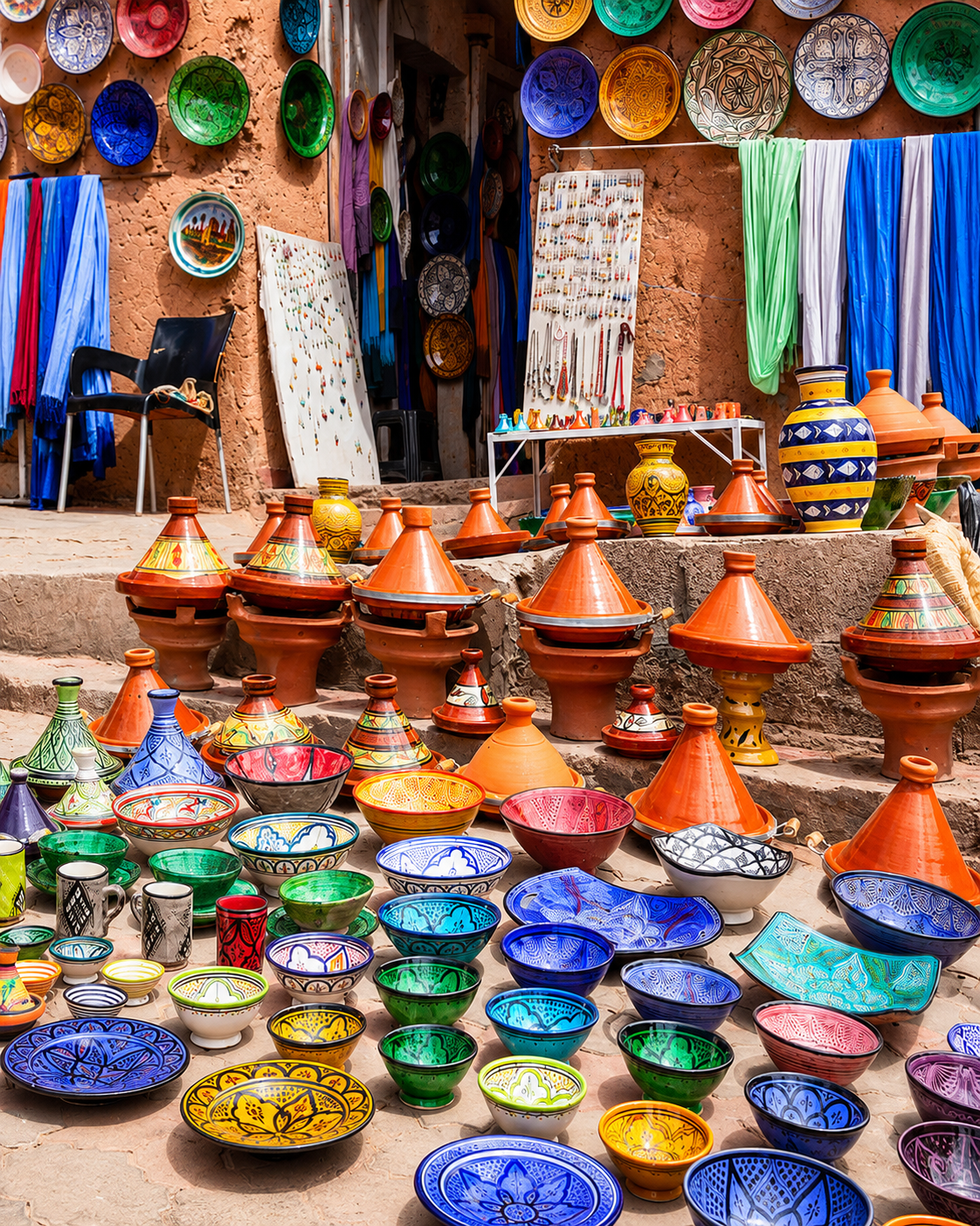
Colourful ceramics, tagines and textiles outside a shop in Tinghir

Go deeper through Tinghir

Tinghir — the next valley chapter

Continue from Dadès to Tinghir for another view of southern Morocco’s inhabited landscapes. The city’s oasis setting and the approach to the Todgha gorges offer a distinct place to explore, with their own streets, cultivated spaces and mountain backdrop.

Use the Tinghir guide to plan that onward visit. Boumalne Dadès remains the gateway for this valley; Tinghir gives the wider journey its next city chapter, rather than serving as another name for Dadès.

Tinghir city orientationTodgha valley context Oasis and village viewsStreets and local shops An onward travel baseSouthern Morocco connections

Continue the journey

From Dadès Valley, continue to Tinghir.

Give the valley time, then carry its lessons in water, rock and settlement into the next part of your southern Morocco journey.