God’s Bridge Akchour A natural rock arch above clear water, red stone and Rif mountain shade
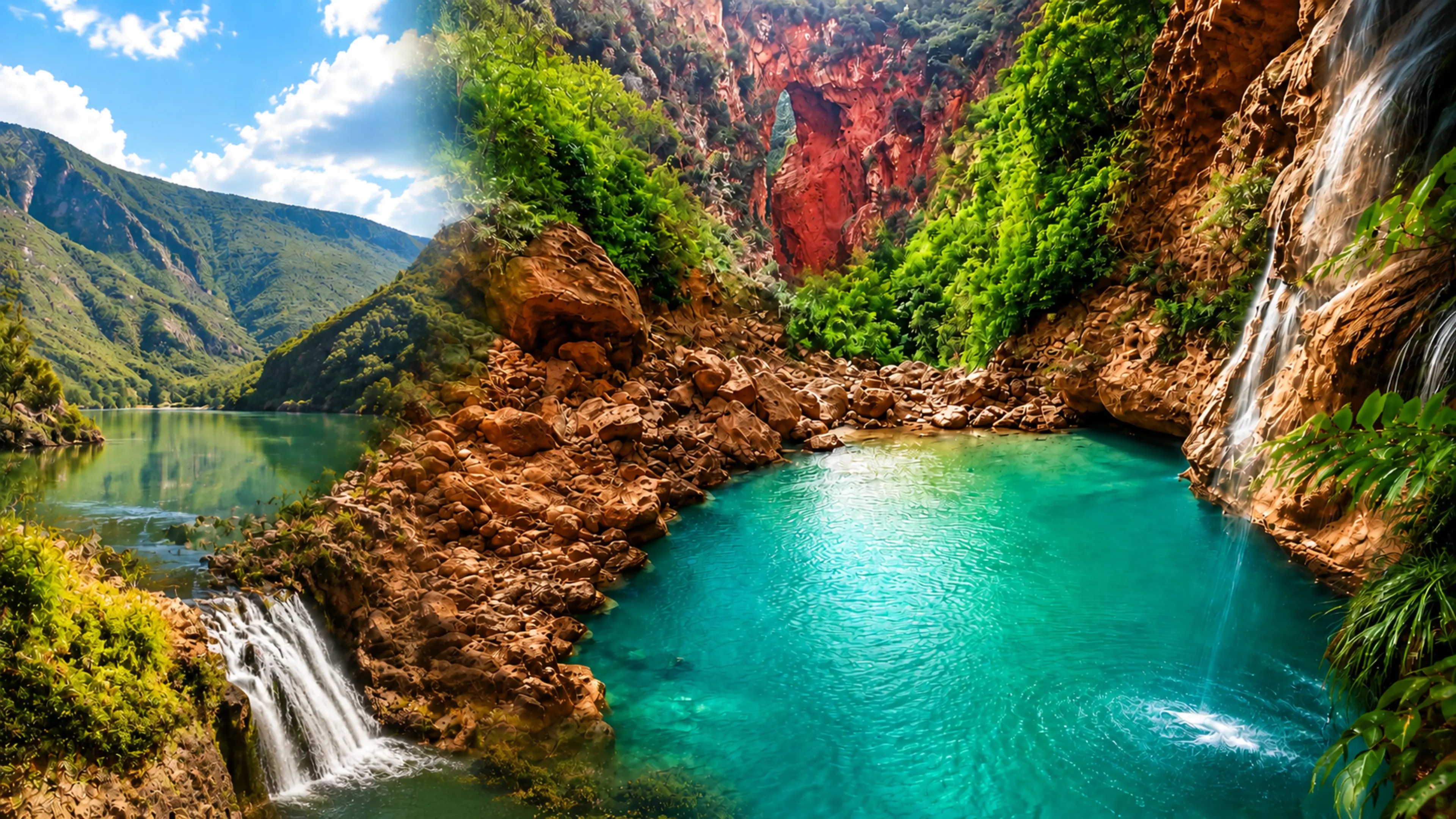
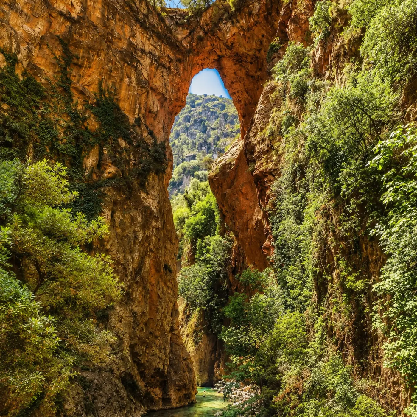
God’s Bridge, also known as Pont de Dieu, is one of Akchour’s most memorable natural sights: a rock arch suspended over a gorge where water, stone and forest shape the visit.
Read the place from below before looking only at the arch. The stronger memory comes from the whole setting: the riverbed, polished rock, narrow walls, green shade, sound of water and the mountain scale around Akchour.
God’s Bridge matters because it makes the Rif landscape immediately legible. The arch is the famous form, but the place is not only a stone span. It is a mountain gorge shaped by water, erosion, shade, seasonal flow and the walking route that brings visitors gradually from Akchour into a tighter natural scale.
The name Pont de Dieu can make the site sound like a single object. In reality, the experience is larger: river, boulders, vertical rock, green vegetation and the sudden view upward to the arch. That relationship between lower water and upper stone is what gives the place its authority.
Akchour also matters as part of the wider Talassemtane landscape near Chefchaouen. It is one of northern Morocco’s clearest introductions to the Rif as a place of gorges, forested slopes, fresh water and footpaths rather than only blue streets and mountain silhouettes seen from town.
For visitors, the value is not speed. The better visit slows down enough to notice how the sound changes inside the gorge, how light narrows between rock faces, how wet stones become slippery, and how the arch feels more impressive when the river below remains part of the reading.
That is also why care matters here. Natural places can feel robust, but narrow paths, river edges, vegetation and popular resting spots are easy to damage through litter, noise, unsafe climbing and careless shortcuts. A respectful Akchour visit protects the landscape that creates the beauty.
Use the map to place the arch within the Akchour gorge system, northeast of Chefchaouen and inside the wider Rif mountain walking landscape.
Editorial reading
Its beauty is geological, not staged.
The arch is dramatic because it feels improbable: a heavy band of rock held above a narrow river corridor. But the form is not decorative. It belongs to the long work of water, fractured stone, erosion and gravity.
Look upward only after reading the floor of the gorge. The riverbed explains the arch better than the skyline does. Smooth stones, shaded pools, damp edges and changing sound all point to the forces that opened the passage and left the bridge above it.
The most rewarding view keeps both scales together: the small human body walking below, and the heavy rock mass above. That contrast is why the place feels intimate and monumental at the same time.
Akchour’s popularity can make the walk feel social, especially in warmer months, but the landscape still asks for attention. Wet rock, narrow sections and uneven ground mean that the best visitor rhythm is patient rather than hurried.
Photography works best when it does not erase scale. Include water, cliff, vegetation or a small edge of path when possible; otherwise the arch becomes an isolated shape and the gorge loses its meaning.
Carry the Chefchaouen connection lightly. The blue city is the natural travel base, but God’s Bridge belongs to a different register: less urban, more physical, more dependent on weather, water and walking.
Leave with the place intact. That simple standard matters more here than grand language: stay on sensible paths, keep the water clean, keep noise low, and let the gorge remain a living natural space rather than a used-up backdrop.
Natural and route orientation
Read the site through water, rock and mountain access.
God’s Bridge is best understood as a natural arch inside the Akchour walking landscape near Chefchaouen. Public hiking references consistently place the site in the Talassemtane area of the Rif, where river gorges, forested slopes, waterfalls and mountain paths create one of northern Morocco’s strongest nature-based day trips.
01Place type
A natural rock bridge
The site is a natural arch rather than a built monument. Its meaning comes from the relationship between the span overhead, the gorge below and the water that defines the route.
02Landscape
Rif mountain gorge
Akchour sits in a northern Moroccan mountain setting of steep rock, clear water, trees and footpaths. The gorge is part of the experience, not a neutral route to the viewpoint.
03Route context
Near Chefchaouen
Chefchaouen is the clearest city base for visitors. The contrast between its medina streets and Akchour’s gorge landscape helps travellers understand the wider Rif beyond the town.
04Care
Conditions change
Water level, heat, crowds, path condition and local access arrangements can change. Treat fixed online details cautiously and verify practical information close to the visit.
A visual bridge
Three readings between water, stone and shade
Before God’s Bridge becomes a photograph, it is a sequence of approach, sound and scale. These three readings help visitors understand why the arch feels powerful only when the gorge around it is still present.
01
Water
The river writes the place
The water below is not decoration. It explains the corridor, the polished stones, the damp edges and the coolness that visitors feel inside the gorge. Start by listening before looking upward.
Notice where the sound becomes enclosed.
Read pools, boulders and wet surfaces carefully.
Treat clear water as something to protect, not consume.
02
Stone
The arch holds the eye
The natural bridge is powerful because it compresses mass and emptiness into one form. The opening under the rock turns the mountain into a frame, with sky and cliff visible through it.
Look at the arch from below before moving on.
Keep the cliff walls in the composition.
Avoid climbing or risky shortcuts for photographs.
03
Shade
A cooler Rif rhythm
Trees, cliff shadow and moving water soften the mountain heat, but they do not remove the need for care. Akchour is best experienced with time, grip, water and attention to local guidance.
Let the walk set the pace of the visit.
Give narrow sections room for others to pass.
Leave no litter near pools, paths or resting places.
Quick orientation
Type of place
A natural rock arch and river gorge walk near Akchour, known in French as Pont de Dieu and visited as part of the wider Akchour hiking landscape.
Landscape context
Rif mountain scenery with steep rock, shaded vegetation, clear water, uneven paths and a close relationship to the Talassemtane area near Chefchaouen.
Best for
Gorge walking, natural rock forms, mountain water, careful photography, quiet observation and understanding the Rif beyond the city streets of Chefchaouen.
Closest city context
Chefchaouen is the strongest visitor base and editorial context, while the broader administrative region is Tanger-Tetouan-Al Hoceima in northern Morocco.
What visitors experience here
A place that tightens around water and stone.
God’s Bridge works through compression. The route begins in a wider mountain mood, then narrows toward rock walls, river sound and shaded turns. By the time the arch appears overhead, the visitor has already been prepared by the gorge.
Arrival
From village edge to gorge
The approach from Akchour shifts quickly from road and resting places toward a walking landscape. The sense of arrival is gradual: path, water, rock and shade pull the visitor inward.
Water
Clear sound and cold light
The river gives the place much of its atmosphere. In shaded sections, water brightens the gorge from below, reflecting green and blue tones against warm rock.
Movement
A walk that asks for grip
The route is not a polished urban promenade. Uneven stones, wet surfaces and narrow sections make footwear, balance and patience part of the experience.
Rock
The arch above the river
The bridge itself feels strongest when seen with the cliff walls and water below. Its height is part of the drama, but the void beneath it is what makes the form readable.
Vegetation
Green against red stone
Trees and plants soften the gorge without hiding its structure. Their colour makes the warm stone feel sharper and gives shaded sections a cooler visual rhythm.
Pace
A slower nature visit
The visit loses depth when treated as a quick selfie route. Let the walk breathe: pause for water sounds, look up only after reading the river, and give others space on tighter paths.
Place details and orientation
Read God’s Bridge through six defining elements
No single detail explains the site. Its meaning comes from the relationship between arch, gorge, river, path, vegetation and the wider Rif mountain setting around Akchour.
1
Natural arch
The rock bridge is the main visual event, spanning the gorge above the water and turning the mountain into a dramatic frame.
2
River corridor
The water below gives the route its sound, coolness and shape. It also explains why the floor of the gorge deserves attention.
3
Steep rock walls
The cliff faces compress space and make the arch feel larger. Look at their colour, texture and shadows before isolating the bridge.
4
Shaded vegetation
Green growth softens the canyon edge and makes the contrast between water, stone and mountain light more intense.
5
Walking route
The experience depends on movement. The path prepares the eye gradually, moving from open approach to enclosed gorge.
6
Rif context
God’s Bridge belongs to the mountain world around Chefchaouen, where city, parkland, village routes and water landscapes sit close together.
Gorge, not scenery
The place asks for a careful eye.
Begin with the whole gorge. The arch matters most when the visitor understands the space under it: river, stones, cliff walls, vegetation and the narrow line of movement through the mountain.
Then look upward. The opening beneath the bridge turns rock into a frame, but it should not pull attention away from the water that shaped the corridor below. The best view keeps upper mass and lower river together.
Finally, return to the path. Where people step, rest, swim or photograph, the landscape becomes vulnerable. A good visit leaves the gorge visually and physically clean for the next person.
Landscape and water intelligence
The bridge belongs to erosion, shade and seasonal change.
The intelligence of God’s Bridge is natural rather than architectural. Water has opened the gorge, stone holds the span, vegetation follows available moisture, and the visitor route responds to whatever the season and river allow.
That makes fixed expectations unhelpful. The same place can feel different with low water, stronger flow, summer heat, winter shade or a crowded weekend. Read the actual conditions in front of you and let them guide the pace of the visit.
What to notice slowly
Listen for how the river sound changes as the gorge narrows.
Watch where stone is polished, damp or unstable underfoot.
Notice how green shade changes the colour of the water.
Keep the arch connected to the river below in photographs.
Avoid shortcuts that damage vegetation or create unsafe edges.
Visual reading
How to understand the natural landscape
Mass and opening
The bridge is powerful because stone and emptiness are held in tension. The mass above feels heavy; the opening below gives the gorge air, light and scale.
Route and water
The walking route follows the logic of water. Pools, boulders and narrower turns are not incidental details; they are the grammar of the visit.
Surface and care
Wet stone, loose gravel and river edges can be beautiful and unsafe at the same time. Respect here is practical: move carefully, stay aware and avoid stressing fragile edges.
Visual atmosphere
Light, texture and cool transitions
From approach to enclosure
The visual rhythm changes as the gorge tightens. Open mountain views give way to rock walls, enclosed sound and cooler shade, so the arch feels earned rather than simply placed in front of the visitor.
From water to stone
The strongest contrast is the meeting of clear water and warm rock. The river brightens the lower frame, while the arch and cliffs hold a heavier, more mineral colour above it.
From photo to memory
The photograph may remember the arch; the body remembers the walk. Uneven ground, river sound, shade, sunlight through vegetation and the moment of looking up all belong to the same memory.
Nearby places and onward links
Connect Akchour to the wider northern Morocco map
God’s Bridge belongs naturally to a Rif itinerary. Chefchaouen gives the nearest city context, while the wider north opens toward mountain parks, medina craft, Mediterranean routes and slower landscape travel.
Chefchaouen
The strongest city base for Akchour. Use it to connect the blue medina, mountain viewpoints and Rif nature into one coherent visit.
Akchour is a natural place with a visitor rhythm. Respect means more than being polite at the start of the trail: it means keeping the water clean, staying aware on uneven ground, leaving plants and rocks undisturbed, and giving narrow sections enough space for other walkers.
Move with the landscape rather than against it. Wet stones, shaded pools and tight paths can be inviting, but they are also where care matters most. Do not climb risky rock, force shortcuts, leave litter, play loud audio or turn popular resting spots into private territory.
Wear suitable footwear for uneven, wet or slippery sections.
Carry water and sun protection, especially in warmer months.
Keep litter out of the gorge, river, pools and resting places.
Give local walkers, guides, vendors and families calm space.
Check current trail conditions and local guidance close to travel.
A strong first visit
Begin by locating yourself in Akchour rather than rushing straight to the famous arch. The transition from village edge to water path helps the visit make sense: this is a mountain route, not only a viewpoint.
Walk slowly enough to notice how the gorge changes. Wider sections can feel social and bright; narrower sections feel cooler, louder and more enclosed. This shift prepares the eye for the bridge above the river.
At the arch, resist the urge to reduce the place to one frame. Look from below, include the water when possible, notice the stone around the opening, and let other visitors pass without pressure.
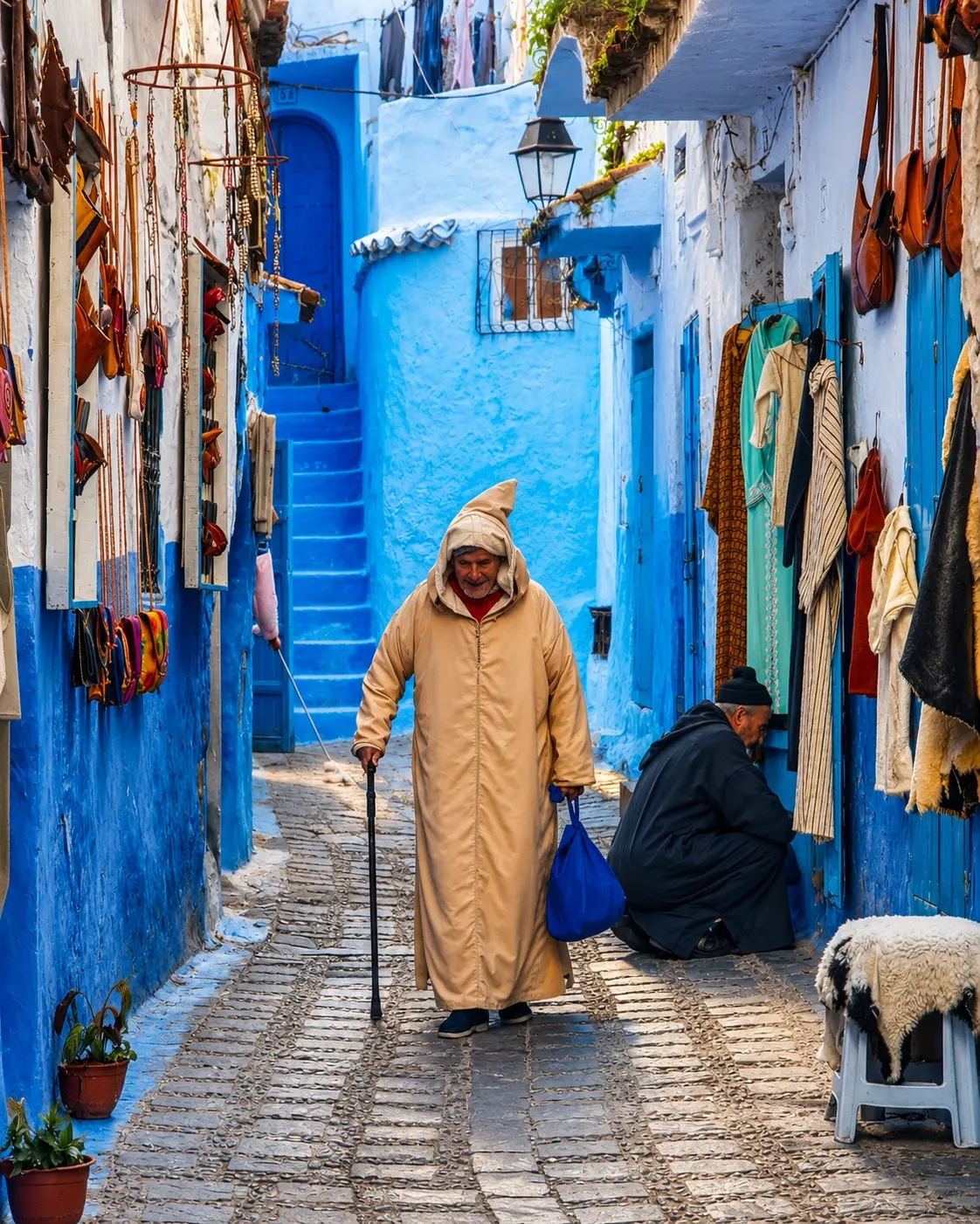
Afterward, connect the experience back to Chefchaouen and the Rif. The city’s blue medina and Akchour’s gorge are different expressions of the same northern journey: built colour, mountain water, careful walking and place-specific attention.
Start with the route, not only the final viewpoint.
Pause where river, rock and shade change the atmosphere.
Photograph without blocking narrow paths or unsafe edges.
Support local services with courtesy and fair interaction.
Leave the gorge cleaner and quieter than you found it.
Careful planning note: water level, path condition, weather, parking, guiding and local access arrangements can change. Verify practical details locally before travelling.
Go deeper through the nearest city context
Chefchaouen — the city gateway to Akchour
God’s Bridge belongs naturally inside a wider Chefchaouen journey. The city gives visitors a base for reading the Rif through both urban and natural forms: bluewashed lanes, mountain light, village routes, water sources and day trips into the surrounding gorges.
Use Chefchaouen to widen the context after Akchour itself. The medina’s colour, craft rhythm and hillside setting make more sense when paired with the nearby mountain landscapes that shape local movement, water and views.
Chefchaouen city orientationRif mountain contextAkchour day-trip planningWater and gorge landscapesSlow travel rhythmNorthern Morocco links