
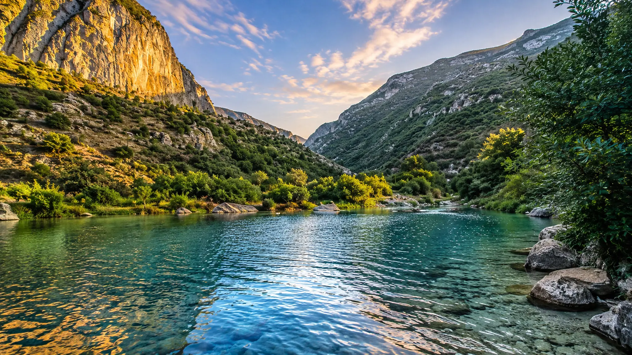
Clear mountain water, limestone cliffs and green Rif slopes in Talassemtane National Park, Morocco

Visit / Place · Rif Mountains · Chefchaouen

Talassemtane National Park Morocco's green Rif world of limestone, water, forest and mountain light

Talassemtane National Park protects one of northern Morocco's most memorable mountain landscapes: cedar and fir forest, limestone gorges, clear water, Akchour approaches and the wild edge behind Chefchaouen.

Begin with the water and the cliffs together. The park is strongest when the eye reads a full Rif composition first: blue-green pools, pale limestone, forested slopes, narrow gorges and warm mountain light.

Why Talassemtane National Park matters

A protected Rif landscape before it is an Akchour photograph.

Talassemtane National Park matters because it gives the Rif Mountains a protected, readable form. The visitor does not meet a single viewpoint here, but a mountain system where limestone peaks, forest, water, gorges, villages and Chefchaouen's wider landscape all belong together.

The UNESCO World Heritage Centre lists Parc naturel de Talassemtane on Morocco's Tentative List as a natural site submitted in 1998, noting its Mediterranean forest ecosystem, endemic plant richness, limestone mountain peaks, cliffs, gorges and caves overlooking Chefchaouen. That description is important because it keeps the park from being reduced to one trail or one pool.

UNESCO's Man and the Biosphere programme places the wider northern Moroccan mountain context inside the Intercontinental Biosphere Reserve of the Mediterranean, a landscape framed by mountains, water, Spanish firs, cedar, biodiversity and human use. Talassemtane should therefore be read as both beautiful and vulnerable.

For visitors, the park's power sits in sequence: blue city to green mountain, road to trail, forest shade to pale rock, quiet stream to open gorge, then the sudden theatrical force of a natural arch or waterfall. The experience works best when that sequence is not rushed.

A careful visit also recognises that this is a living mountain area, not empty scenery. Paths, grazing, water use, village edges and local guiding knowledge belong to the place. The strongest reading keeps conservation, visitor pleasure and local rhythm in the same frame.

Core orientation is grounded in the UNESCO Tentative List entry for Parc naturel de Talassemtane, UNESCO's Intercontinental Biosphere Reserve of the Mediterranean profile, Protected Planet's Parc National de Talassemtane profile and the Moroccan National Tourism Office page for Chefchaouen. Exact routes, water conditions, access and local guidance should be checked close to travel.
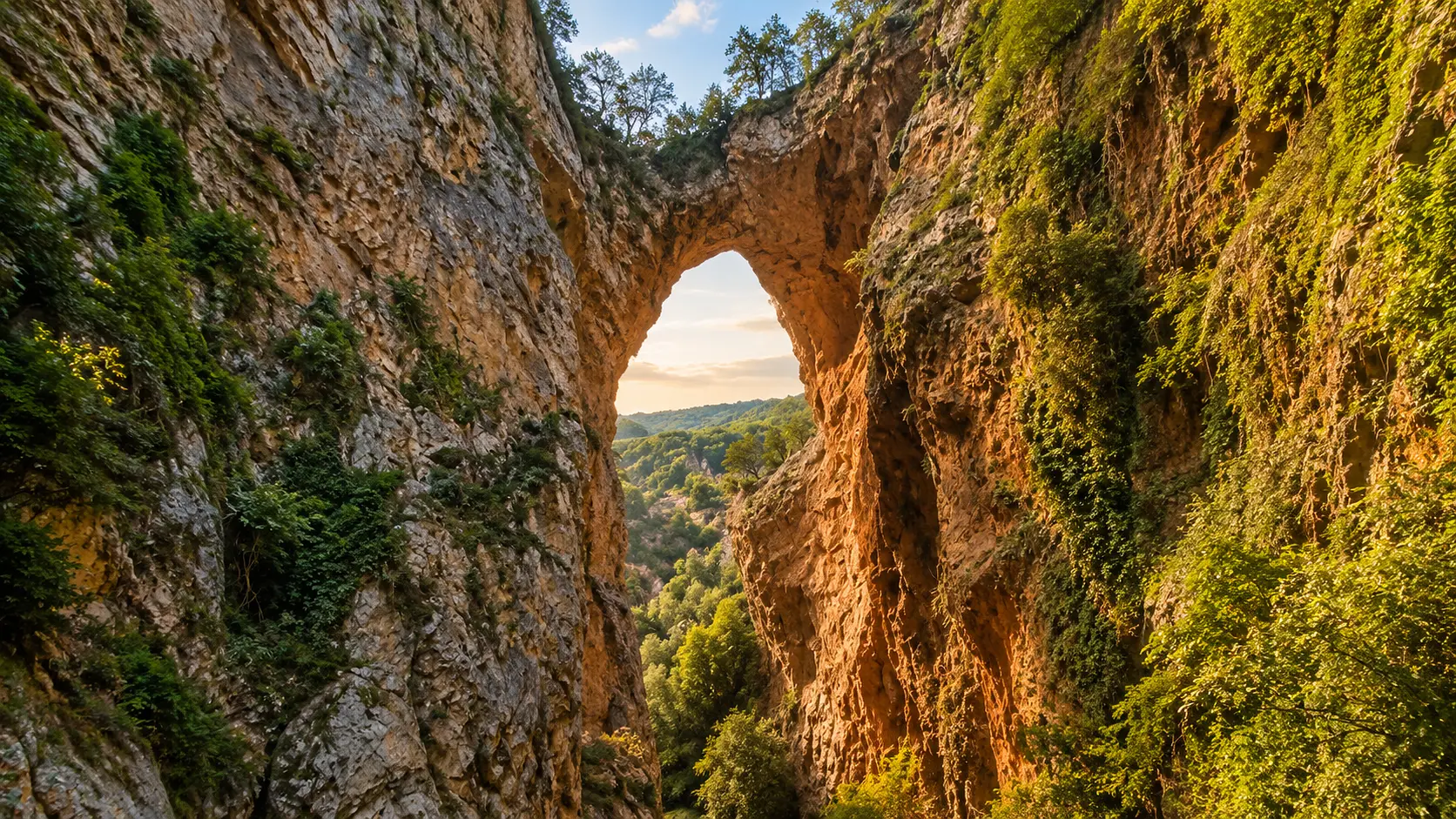
Natural limestone arch and green Rif slopes in Talassemtane National Park near Chefchaouen

Map orientation

Use the map to place the park behind Chefchaouen, where Rif ridges, Akchour approaches, forested slopes and limestone gorges shape the visitor experience. Route choice should follow current local advice.

Editorial reading

Its beauty is green, mineral and precise.

The first mistake is to treat Talassemtane as a quick nature escape from the blue city. The stronger reading begins with contrast: Chefchaouen's walls and lanes give way to a mountain landscape where water, rock and forest set the rhythm.

The park's limestone is not background texture. It creates cliffs, gorges, caves, narrow passages and natural forms that make the landscape feel sculpted. When warm light hits the pale rock, the green of the forest and the blue of the water become sharper without needing artificial drama.

Water gives the visit its clearest emotional pull, especially around Akchour-style routes and pools, but the water should not erase the rest of the place. Forest shade, route discipline, quiet village edges and protected-area care matter just as much as the photograph.

Look slowly at the transitions. A path moves from dust to shade, from trees to stone, from open hillside to a tight gorge. Those changes are the park's real story, and they are what make the landscape feel alive rather than staged.

Talassemtane also asks for restraint. Do not force fragile routes, disturb wildlife, leave waste, crowd narrow water edges or turn village approaches into photo sets. The more careful the visitor, the more powerful the park remains.

A good first reading is simple: begin wide, walk patiently, notice water and limestone together, and let Chefchaouen return at the end as the human gateway to the mountain, not just a separate blue postcard.

Natural and protected-area orientation

Read the park through protection, water and Rif continuity.

Talassemtane National Park is best understood as a protected Rif mountain landscape rather than a single waterfall stop. Its importance comes from Mediterranean forest, limestone relief, gorges, watercourses, endemic biodiversity, nearby communities and the way Chefchaouen sits at the edge of this wider natural system.

01Place type

Rif national park

Protected Planet identifies Parc National de Talassemtane as a terrestrial and inland-waters protected area in Morocco. The visitor should read it through both landform and water.

02UNESCO 1998

Tentative natural site

The UNESCO Tentative List entry describes a Mediterranean forest ecosystem with endemic plant richness, limestone peaks, cliffs, gorges and caves overlooking Chefchaouen.

03Biosphere context

Mediterranean crossroads

UNESCO's biosphere reserve profile frames the wider northern Moroccan landscape through mountains, water, firs, cedar, biodiversity and socio-economic systems typical of mountain areas near the sea.

04Visitor rhythm

Akchour and mountain routes

Chefchaouen is widely used as the practical gateway for walking routes toward Akchour, waterfalls, natural arches, gorges and forested Rif terrain. Conditions should always be checked locally.

A visual bridge

Three readings between water, limestone and forest

Before Talassemtane National Park becomes a photograph, it is a relationship between clear water, pale rock, green slopes and mountain access. These three readings help visitors slow down and understand why the park feels so complete.

01

Water

Let the pools explain the gorge

Clear water is the first visual magnet, but it also shows how the landscape is shaped. Pools, streams and cascades make the limestone visible through reflection, depth and sound.

  • Notice how water colour changes with depth and shade.
  • Read pools as part of a larger mountain system.
  • Protect water edges from litter, noise and crowding.
02

Limestone

Rock gives the park its architecture

The cliffs, gorges, caves and natural arch forms create a kind of mountain architecture. The park's drama comes from structure, not decoration.

  • Look at cliff faces before focusing on one landmark.
  • Keep scale visible when photographing narrow gorges.
  • Respect unstable edges and changing route conditions.
03

Forest

Shade makes the Rif readable

Forest is not a soft frame around the view. It changes temperature, light, route feeling and biodiversity, and it gives the park its northern Moroccan depth.

  • Watch how trees hold slopes and shade paths.
  • Notice the shift from open rock to green cover.
  • Treat vegetation as protected habitat, not scenery.

Quick orientation

Type of place

A Rif national park and protected mountain landscape, best understood through forests, limestone gorges, clear water, walking routes and biodiversity context.

Region or area

Northern Morocco and the Rif, close to Chefchaouen in the Tangier-Tetouan-Al Hoceima region, with Akchour commonly used as a nature-route context.

Best for

Mountain water, gorge scenery, careful hiking, forest shade, photography, natural arches, waterfall approaches and a deeper reading of Chefchaouen's landscape.

Closest city context

Chefchaouen is the clearest city gateway, linking the park to the blue medina, Rif walking culture, mountain views and practical visitor orientation.

What visitors experience here

A mountain park that moves from blue city to green gorge.

Talassemtane National Park works in stages. First comes Chefchaouen's mountain edge, then the road toward greener Rif slopes, then paths where water, rock and shade begin to take over. The experience is strongest when those stages are allowed to build slowly.

Arrival

The Rif rises behind the city

The transition from Chefchaouen toward the park is immediate and visual. Blue walls and town rhythms give way to ridges, trees, valleys and the feeling that the mountain is close enough to shape daily life.

Water

Clear pools and narrow sound

Streams and pools give the park a clean, bright intensity. The best views hold both water and rock, so the scene feels natural rather than flattened into a swimming-place image.

Stone

Limestone cliffs with real scale

Pale cliffs, gorges and natural arches create the park's strongest structure. They make the visitor feel the weight of the landscape before any single detail becomes decorative.

Forest

Shade, cedar and fir context

The UNESCO descriptions around the wider area keep attention on Mediterranean forest and endemic plant richness. Trees are part of the protected character, not just a green background.

Movement

Routes that require patience

Paths can feel inviting, but the park rewards planning and local confirmation. Water levels, heat, crowds, rock surfaces and route conditions can change the quality of a visit quickly.

Pace

A quiet northern rhythm

The better visit leaves room for pauses: light on rock, wind through trees, water sound in a gorge and the slow return to Chefchaouen with the mountain still present behind the city.

Place details and orientation

Read Talassemtane National Park through six defining elements

No single waterfall or arch explains the park. Its identity comes from the relationship between protected forest, limestone relief, water, walking routes, village edges and Chefchaouen's role as the nearest city context.

1
Limestone gorges

Cliffs, tight passages and pale rock faces create the park's structural drama and help visitors understand why distance and scale matter.

2
Clear mountain water

Streams, pools and cascades are central to the visitor experience, but they should be approached with care because water edges are easily damaged and crowded.

3
Forest habitat

Mediterranean forest, including fir and cedar context noted by UNESCO biosphere material, gives Talassemtane its ecological depth and cooler mountain atmosphere.

4
Akchour approaches

Akchour is one of the best-known practical contexts for routes into the park's waterfalls, gorge scenery and natural bridge landscapes near Chefchaouen.

5
Chefchaouen gateway

The blue city is not only a nearby stop. It helps visitors understand the park as part of a lived Rif mountain setting, with paths, views and local knowledge close at hand.

6
Protected-area care

The park's conservation value means visitors should stay on appropriate routes, keep waste out, avoid noise and treat forest, water and rock as fragile systems.

Landscape, not backdrop

The place asks for a layered eye.

Stand back first. The opening lesson is spatial: Chefchaouen at the mountain edge, forest rising behind it, valleys cutting through limestone and water gathering the whole scene into one clear line of movement.

Then let the route narrow. Stone underfoot, shade overhead, water sound, cliff texture and sudden openings make the park more intimate. This is where Talassemtane becomes more than a beautiful view: the eye starts to understand access, fragility and scale.

When the route reaches a pool, cascade or arch, return mentally to the wider landscape. The memorable image is not only the landmark itself, but the full Rif system that makes it possible.

Landscape and ecological intelligence

Water is not decoration here.

The mountain character of Talassemtane National Park is built by the relationship between water, limestone and forest. Clear pools make the site visually irresistible, but the deeper meaning is ecological and geographic: water cuts routes, cools valleys, reflects cliffs and supports fragile habitats.

The park's beauty feels precise because the elements are tightly connected. Rock creates the gorge. Forest holds the slopes. Water reveals depth. Chefchaouen gives the wider human context. A strong visitor reading keeps all of them visible.

What to notice slowly

  • How blue-green water changes with depth, sun and rock shadow.
  • How limestone cliffs create natural passages, arches and dramatic scale.
  • How forest shade changes the sound, temperature and pace of a walk.
  • How Chefchaouen remains part of the park's wider mountain identity.
  • How route conditions can change with season, weather and water flow.
  • How restraint makes the landscape feel cleaner, calmer and stronger.

Visual reading

Three Rif languages to notice

Water and reflection

Talassemtane speaks first through water clarity: green-blue pools, reflected cliffs, bright ripples and the quiet pull of shade along the gorge.

Rock and enclosure

The limestone gives the park a strong physical grammar. Cliffs, arches, caves and narrow passages turn the walk into a lesson in natural structure.

Forest and restraint

The green slopes are protected habitat, not decorative scenery. Good route choices, low noise, careful photography and clean behaviour keep the visit respectful.

Visual atmosphere

Clear water, pale rock and Chefchaouen light

From city to mountain

Start with Chefchaouen as the human threshold, then let the eye move outward to Rif ridges, green slopes and gorge routes. The park feels stronger when the city and mountain are connected.

From water to stone

The best colour is natural: blue-green pools, pale limestone, dark forest shade and warm sunset light on cliff faces. The scene should stay bright, clean and readable, not heavy or artificial.

From photo to memory

The image may begin with a pool or natural arch, but the deeper memory is sequential: walking, shade, water sound, rock texture, village edge, mountain air and the blue city waiting below.

Nearby places and onward links

Connect the park to Chefchaouen and the Rif.

Talassemtane National Park belongs naturally inside a northern Morocco journey. Use Chefchaouen for city context, then widen the route through Akchour, Rif landscapes, Mediterranean approaches and broader Exotic Morocco planning.

Chefchaouen

The closest city gateway for the park. Use Chefchaouen to frame blue medina atmosphere, mountain views, walking culture and practical Rif orientation.

Open Chefchaouen city guide

Akchour

One of the strongest nearby nature contexts, known for waterfall routes, limestone gorges, clear water and the natural-bridge reading linked to the park.

Open Akchour place guide

Northern Morocco & Rif

The regional home for mountain-backed towns, Rif landscapes, blue city context, Mediterranean approaches and slower northern Morocco routes.

Explore the region

Visit Morocco places

Continue through national parks, caves, lagoons, valleys, waterfalls, kasbahs, monuments and major landscapes beyond the city guides.

Browse Visit places

Plan your journey

Treat Talassemtane as a route decision. Weather, heat, water levels, path conditions and local access advice can affect the right plan for the day.

Plan your journey

Themes of Morocco

Use the Themes section to place the park within broader readings of landscape, heritage, culture, craft and Moroccan visual identity.

Explore themes

How to visit respectfully

Keep the gorge clean, calm and protected.

Talassemtane National Park is powerful because it still feels like a mountain landscape with limits. Respect those limits. Avoid litter, loud behaviour, careless parking, route shortcuts, damage to vegetation and intrusive photography around village edges or working local life.

Respect also means caring for water and rock. Do not crowd fragile pool edges, force unsafe paths, disturb wildlife or underestimate heat, slippery stone, sudden weather and seasonal water conditions. A slower visitor sees more and creates less pressure on the place.

  • Check current route, weather, water level and access advice before travelling.
  • Stay on appropriate paths and follow local guidance around gorge sections.
  • Carry out all waste and protect pools, streams, trees and fragile vegetation.
  • Ask before photographing residents, guides, shopkeepers or private spaces.
  • Carry water, sun protection and enough time so the visit does not become rushed.
  • Keep noise low and leave narrow places open for others.

A strong first visit

Begin with Chefchaouen as the gateway, then choose one focused nature route instead of trying to consume the whole park. A clear first visit can be built around water, gorge, forest and a patient return to the city.

Move slowly enough to notice transitions: blue streets to green slopes, open road to shaded path, loose stone to smooth water edge, bright cliff to narrow gorge. Each change explains more than a rushed checklist can.

If you go toward Akchour, waterfalls or natural-bridge landscapes, treat the route with practical seriousness. Conditions can change, and the best day is the one that respects local guidance, weather, time and the limits of the terrain.

Afterward, connect the visit back to Chefchaouen and the wider Rif. That wider context helps Talassemtane feel less like a single excursion and more like part of northern Morocco's mountain geography, biodiversity and visual identity.

  • Start with the full Rif setting behind Chefchaouen.
  • Choose one route carefully and give it enough time.
  • Use viewpoints to understand scale, not only to collect a panorama.
  • Leave space for local movement, guides and quiet mountain life.
  • Finish by connecting the park back to Chefchaouen and the Rif region.

Careful planning note: exact access, route conditions, water levels, guide arrangements and seasonal safety can change. Verify practical details locally before travelling.

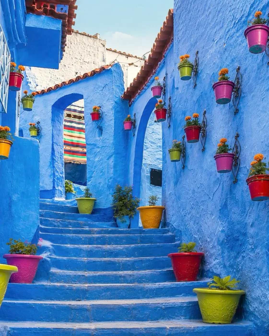
Blue Chefchaouen stairway with bright flower pots, the city gateway for Talassemtane National Park

Go deeper through the nearest city context

Chefchaouen - the city gateway to Talassemtane National Park

Talassemtane National Park belongs naturally inside a wider Chefchaouen journey. The city gives visitors the strongest base for reading the Rif: blue medina lanes, mountain views, walking culture, local guidance and the transition from urban threshold to forest and gorge.

Use Chefchaouen to widen the context after the park itself. The landscape becomes easier to understand when the city is treated not as a separate postcard, but as the human edge of a protected mountain world.

Chefchaouen city orientationRif mountain gateway Akchour route contextLandscape and culture reading Practical travel structureNorthern Morocco context

Continue the journey

Continue from Talassemtane National Park into the Rif.

Read the park slowly, then connect it to Chefchaouen, Akchour, limestone gorges, protected forest and the wider northern Morocco landscape.