
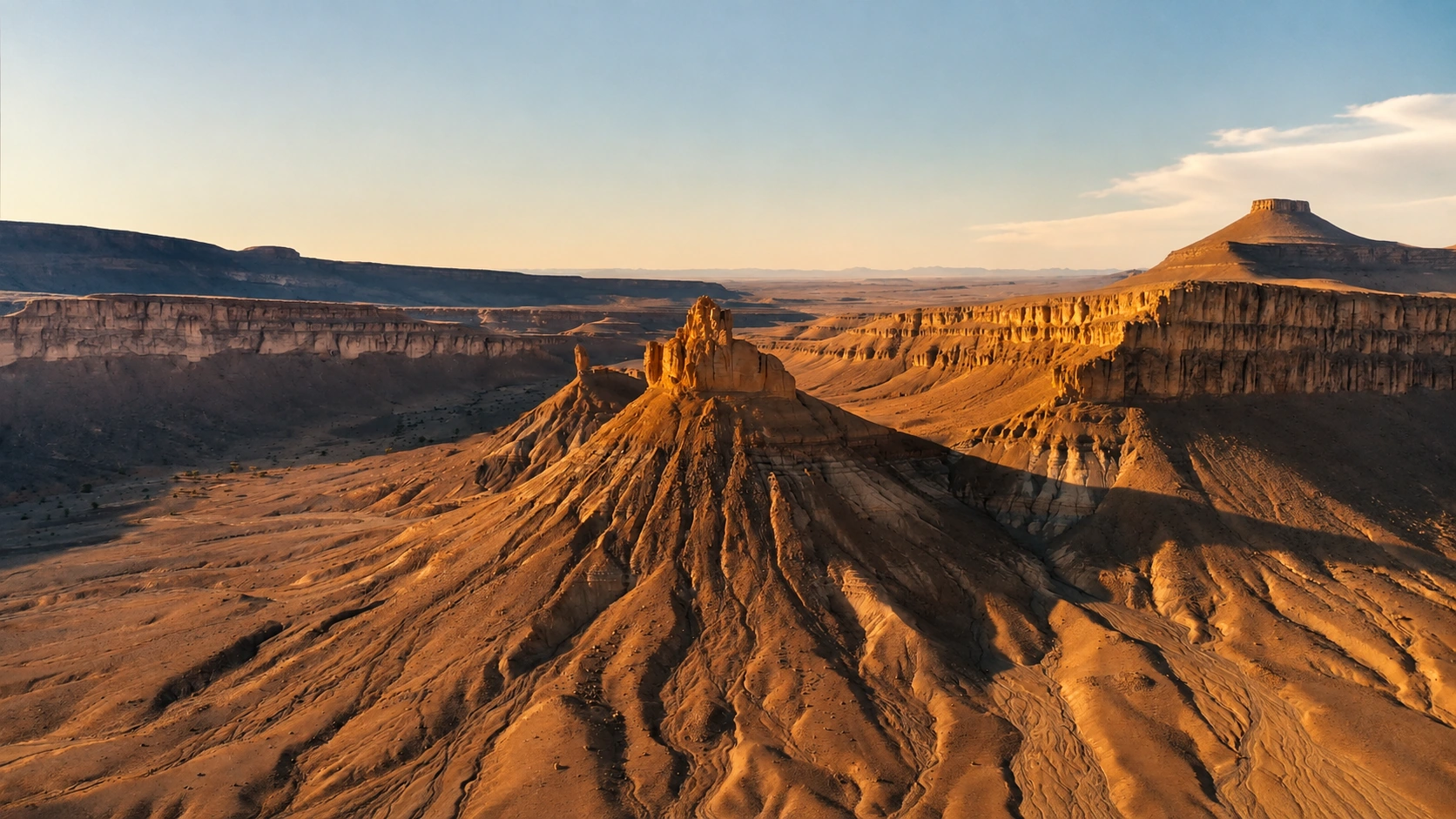
Iriqui National Park desert plateau at warm sunset in southern Morocco

Visit / Place · Sahara edge · Zagora and Tata provinces

Iriqui National Park A Sahara-edge national park of dry lake, dunes, acacia steppe and immense light

Iriqui National Park is one of Morocco's most powerful desert landscapes: a protected southern expanse where Lake Iriqui, stony plateaus, dunes and route memory meet.

Begin with scale. The park is not a single viewpoint but a wide desert system: open ground, wind-shaped surfaces, seasonal water traces, sparse vegetation and the long visual approach toward the Sahara.

Why Iriqui National Park matters

A desert park before it is a crossing.

Iriqui National Park matters because it makes Morocco's Sahara edge readable as a landscape system. It is often experienced as a route between southern towns, but the deeper value is wider: dry lakebed, plateau, dune, acacia steppe, temporary wetland and human movement all sit inside the same protected-area story.

Regional tourism information places the park between the dry bed of the Oued Draa and the southern slopes of the Anti-Atlas, across the Zagora and Tata province context. That position is important. Iriqui is not only desert scenery; it is a transition zone where mountain runoff, aridity, wind and long-distance travel leave visible traces.

Lake Iriqui is central to that reading. Much of the time it appears as a broad dry basin, pale and open under a vast sky. In wet periods, water can return temporarily, creating conditions that matter for migratory birds. The beauty of the place therefore depends on change as much as on emptiness.

The park also matters because desert landscapes are fragile. Vehicle tracks, litter, noise and careless stopping can remain visible for a long time in dry environments. A good visit treats the scale with humility: move with local knowledge, avoid turning the lakebed into a playground, and read the ground before rushing across it.

For travellers based around Zagora or moving toward Foum Zguid and M'Hamid El Ghizlane, Iriqui gives the southern journey a larger frame. It connects oasis towns, desert routes and protected natural space without reducing the Sahara edge to a single dune photograph.

Core protected-area facts are grounded in Protected Planet's Parc National d'Iriqui profile and regional park information from Explore Agadir Souss Massa. Practical access, weather and route conditions should be checked close to travel.
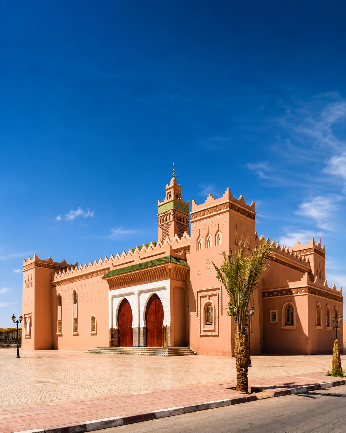
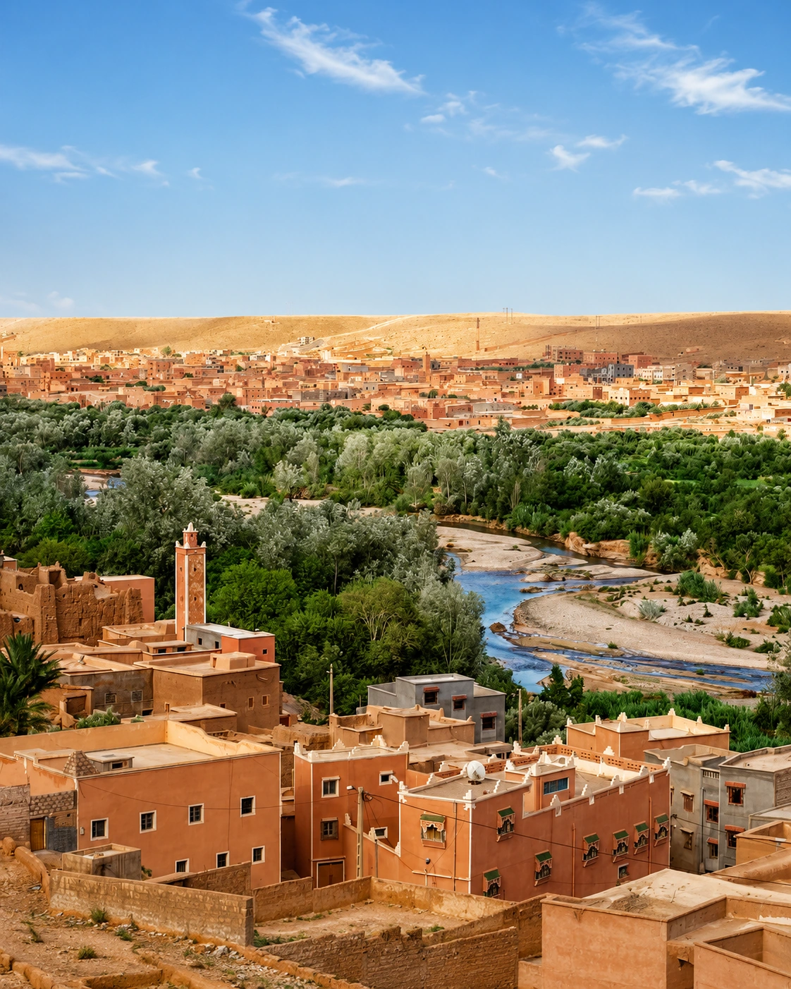
Zagora earthen mosque architecture with palm and blue sky, city context for Iriqui National Park

Map orientation

Use the map to read the park as a wide Sahara-edge landscape, not as a single pin: Lake Iriqui, desert tracks, Zagora context and the Anti-Atlas edge all matter.

Editorial reading

Its beauty is scale, restraint and environmental intelligence.

Iriqui is not beautiful because it is empty. It is beautiful because the landscape teaches proportion. The eye moves from wide basin to distant ridge, from stony ground to dune line, from dry surface to the memory of water.

That is why the park rewards a slower reading. A fast crossing sees flatness; a careful visitor sees wind direction, salt-pale ground, thorny vegetation, acacia shade, tracks, horizon lines and the quiet drama of a basin waiting for rare rain.

The most important visual lesson is distance. In cities, detail often comes first. In Iriqui, the large frame comes first: sky, exposed ground, plateaus and the long approach. Detail appears only when the visitor slows down enough to notice texture.

Water gives the place its hidden grammar. The lake can be dry for long periods, but its role as a temporary wetland explains why the basin should be treated carefully. A dry lake is still a lake landscape, not blank ground.

The Zagora context adds another layer. The city, palm valleys and desert routes help visitors understand that Iriqui belongs to a wider southern geography of oases, movement, dryness and careful adaptation.

A strong visit therefore combines wonder with discipline: use suitable guidance, keep the route light, leave no trace, give wildlife space and let the park remain larger than the photograph you take home.

Natural and route orientation

Read the park through water, aridity and movement.

Iriqui National Park is best understood as a protected desert landscape shaped by absence and return: long dry periods, rare water, exposed routes, sparse vegetation and the ecological importance of temporary wetland conditions around Lake Iriqui.

01Place type

A national park landscape

Protected Planet identifies Parc National d'Iriqui as a terrestrial and inland waters protected area in Morocco. The visitor should read it as protected space, not just open desert terrain.

02Lake basin

Dry ground with water memory

Lake Iriqui is often dry, but wet periods can temporarily transform the basin. That seasonal contrast gives the park much of its ecological and visual meaning.

03Desert vegetation

Acacia and tamarisk signals

Regional descriptions point to wooded steppe, acacia savannah and tamarisk in parts of the dune environment. These sparse forms make life in arid ground visible.

04Route context

Zagora, Tata and desert tracks

The park belongs to a wider southern route geography. Visitors should understand it through access conditions, local guidance and the long distances between oases, lakebed and dunes.

A visual bridge

Three readings between lakebed, dune and horizon

Before Iriqui becomes a desert photograph, it is a lesson in scale. These three readings help visitors slow down and understand how water memory, wind and route logic shape the park.

01

Water

The dry lake as memory

Read Lake Iriqui as a basin, not as empty space. Its pale surface, flatness and seasonal transformation explain why rare water has such force in desert geography.

  • Notice the openness before searching for detail.
  • Keep wet-season conditions in mind even when the ground is dry.
  • Treat the basin as fragile landscape, not a blank track.
02

Wind

Dunes, steppe and moving edges

The park's desert forms are shaped by wind, dryness and sparse vegetation. Dunes, stony flats and acacia or tamarisk marks should be read together.

  • Look for where hard ground gives way to sand.
  • Read vegetation as orientation, not decoration.
  • Notice how wind simplifies colour and texture.
03

Route

Distance before arrival

The strongest visit begins with the approach. Iriqui's meaning grows through long sightlines, changing ground and the awareness that desert routes require patience and preparation.

  • Use the horizon to understand scale.
  • Let local route knowledge shape the visit.
  • Connect the park back to Zagora and the Draa Valley.

Quick orientation

Type of place

A Sahara-edge national park and protected-area landscape associated with Lake Iriqui, desert plateaus, dunes, wooded steppe and temporary wetland conditions.

Landscape context

The park is described regionally between the dry Oued Draa context and the southern slopes of the Anti-Atlas, across the Zagora and Tata route landscape.

Best for

Desert scale, careful photography, landscape reading, 4x4 route awareness, natural quiet, ecological context and onward southern Morocco planning.

Closest city context

Zagora gives the clearest city context for travellers linking the park with the Draa Valley, oasis routes, M'Hamid direction and Sahara-edge itineraries.

What visitors experience here

A landscape that changes by distance, weather and light.

Iriqui works in wide stages. First comes the horizon, then the dry lake surface, then the shifts between stony ground, dune edge, sparse vegetation and distant relief. The place asks the visitor to read slowly because its strongest details are spread across distance.

Arrival

The first scale shock

The park opens as a large field of distance. Roads, tracks and horizons feel small against the basin and plateau. This first impression is essential: Iriqui is understood by scale before detail.

Lakebed

Flatness with meaning

The dry lake can appear almost minimal, but its flatness carries the memory of water. In the right conditions, the basin becomes part of a temporary wetland story rather than only a desert crossing.

Light

Warm ground, clear sky

Light is direct and revealing. Late or early sun can bring out ridges, channels and dune forms; high light makes exposure and distance more obvious. The visual power comes from clarity, not heavy contrast.

Vegetation

Small signs of life

Acacia, tamarisk and steppe vegetation should not be treated as background. In this arid setting, every green or thorny form explains something about water, salt, wind and survival.

Movement

Tracks that require judgment

Desert routes can look simple from a distance and become complex under the wheels. Local guidance, weather awareness and respect for fragile ground are part of the experience, not an afterthought.

Quiet

The sound of open space

Iriqui's quiet is not empty silence. It is wind, tyres on hard ground, footsteps in sand, distant voices near camp areas and the pause that comes when the horizon has more authority than the schedule.

Place details and orientation

Read Iriqui through six defining elements

No single stop explains the park. Its meaning comes from the relationship between Lake Iriqui, desert ground, dunes, sparse vegetation, route access and the wider Zagora-Tata southern landscape.

1
Lake Iriqui basin

The dry lake is the park's central visual and ecological reference. Its temporary water story gives the landscape depth beyond its dry appearance.

2
Stony desert plateaus

Hard ground, open flats and long horizons shape the first reading of the park and make distance feel almost architectural.

3
Dune and sand edges

Dune forms connect Iriqui to the wider Sahara experience, but they should be read as part of the protected landscape rather than as isolated scenery.

4
Acacia and tamarisk

Sparse trees and shrubs mark adaptation to arid and sometimes saline conditions, helping visitors understand how life appears in minimal forms.

5
Route discipline

Access across desert terrain requires preparation, suitable vehicles and local awareness. The route is part of the place's meaning.

6
Zagora context

Zagora connects the park to oasis life, Draa Valley orientation and the wider southern Morocco route network.

Desert, not blankness

The place asks for a wide eye.

Stand back before deciding what you are seeing. Iriqui is not a collection of dramatic objects; it is a large landscape where subtle changes in surface, horizon, wind and colour carry the meaning.

Then look lower. Tracks, small plants, crusted ground, patches of sand and shallow drainage lines reveal that the desert is not still. It stores movement: rain, wind, animals, vehicles and people all leave traces.

Finally, return the view to Zagora and the Draa Valley context. The park becomes clearer when connected to oasis settlement, southern routes and the discipline needed to travel well through exposed country.

Landscape and route intelligence

Desert clarity is not emptiness.

The intelligence of Iriqui lies in how much the landscape explains with very little. A dry basin, a ridge line, a stand of acacia or a change from stone to sand can tell the visitor about water, wind, season and movement.

Regional descriptions emphasise the park's desert landscapes, wooded steppe, acacia savannah, tamarisk and temporary wetland value. Read those elements together. The park is not one surface; it is a changing set of conditions.

What to notice slowly

  • Look at the full horizon before focusing on dunes or tracks.
  • Read the lakebed as a seasonal basin even when it is dry.
  • Notice where vegetation marks water, salt tolerance or shelter.
  • Watch how light changes ridges, hard ground and distant relief.
  • Use local route knowledge instead of improvising across fragile terrain.
  • Keep the Zagora and Draa Valley context in mind after leaving the park.

Visual reading

Three landscape languages to notice

Basin and horizon

Iriqui speaks first through the relationship between flatness and distance. The lakebed opens the view, while ridges and dunes give the eye points of return.

Wind and surface

Sand, hard ground, channels and crusted surfaces show that the landscape is always being revised. The best photographs keep that texture visible rather than smoothing it away.

Route and restraint

Tracks are visual lines, but they are also responsibility. A respectful visitor follows suitable routes, avoids careless driving and treats protected desert space as living terrain.

Visual atmosphere

Light, sand and the memory of water

From distance to detail

Start with the broad frame: basin, plateau, dune, sky. Only then move into details such as tyre marks, small shrubs, ridged earth and the fine line where sand begins to gather.

From dry ground to season

The lakebed may look fixed, but its meaning is seasonal. Rare rain can change the entire reading, bringing temporary wetland conditions and making access more sensitive.

From photo to memory

The strongest memory is not only the sunset image. It is the feeling of exposure, quiet, careful movement and the moment when the visitor understands that desert space has structure.

Nearby places and onward links

Connect Iriqui to the wider southern Morocco map

Iriqui belongs to a broader southern itinerary. Zagora gives the clearest city context, while the Draa Valley and the Southern Morocco region connect the park to oases, desert routes and Sahara-edge travel.

Zagora

The strongest city context for Iriqui National Park. Use it to frame Draa Valley life, oasis routes, desert approaches and southern travel planning.

Open Zagora city guide

Draa Valley

The valley helps explain the park's wider water, oasis and route geography, especially for travellers moving between palm landscapes and desert edges.

Open Draa Valley guide

Southern Morocco, Oases & Sahara

The regional home for desert-edge travel, oasis routes, valley landscapes and protected natural places across Morocco's south.

Explore the region

Hidden Morocco

Iriqui rewards visitors who value slow landscape reading, route awareness and places that are less easily reduced to a single city image.

Read the theme

Plan your journey

Treat Iriqui as a protected landscape requiring planning, weather awareness, route knowledge and enough time to move carefully.

Plan your journey

Visit Morocco places

Continue through national parks, valleys, lagoons, kasbahs, caves, waterfalls and other landscape-led places beyond the city guides.

Browse Visit places

How to visit respectfully

Good behaviour protects the desert experience.

Iriqui is a protected desert landscape, so respectful travel begins before arrival. Check route conditions, avoid improvised driving, travel with suitable local knowledge and treat the ground as sensitive even when it looks hard and empty.

After rain, dry-looking basins and tracks can become difficult or damaging to cross. In dry periods, careless driving still leaves marks. The right approach is calm, prepared and light: fewer unnecessary detours, no litter, no noise spectacle and no pressure on wildlife or vegetation.

  • Use suitable desert transport and local route advice where conditions require it.
  • Do not drive across sensitive ground simply for photographs or shortcuts.
  • Keep distance from birds, grazing animals and any wildlife encountered.
  • Carry water, sun protection and enough margin for exposed conditions.
  • Check current access, weather and route guidance close to travel.

A strong first visit

Begin by understanding the route. Iriqui is not a city monument with one front door; it is a large desert park where access, weather and ground conditions shape the visit. Know where you are entering, what vehicle is appropriate and how you will leave.

Once inside the landscape, slow down. Let the first view be wide: basin, horizon, plateau, dune edge and sky. This gives the visit structure before the smaller signs begin to matter.

Use pauses carefully. Stop where it is safe and appropriate, keep tracks light, avoid fragile vegetation and never turn the lakebed or dunes into a performance space. The most memorable visit is often the quietest one.

Afterward, connect the park back to Zagora and the Draa Valley. That wider frame helps Iriqui feel less like an isolated crossing and more like part of a southern Moroccan geography of water, aridity, oases and movement.

  • Start with route orientation rather than only a photo goal.
  • Read the lakebed and horizon before searching for close detail.
  • Move lightly across desert surfaces and stay on appropriate tracks.
  • Leave space for local movement, guides and pastoral use where encountered.
  • Finish by connecting the park back to Zagora, the Draa Valley and southern Morocco.

Careful planning note: access conditions, weather, route suitability and local guidance can change. Verify practical arrangements locally before travelling.

Zagora oasis and earthen buildings along the Draa Valley, southern Morocco

Go deeper through the nearest city context

Zagora - the city gateway to Iriqui National Park

Iriqui National Park belongs naturally inside a wider Zagora journey. The city gives visitors a stronger base for reading the Draa Valley, oasis settlement, desert-route culture, southern light and the practical rhythm of Sahara-edge travel.

Use Zagora to widen the context after the park itself: palm landscapes, route decisions, desert approaches, M'Hamid direction and the movement between oasis life and open desert all become easier to understand when Iriqui is treated as part of a larger regional story.

Draa Valley contextZagora city orientation Oasis and desert routesProtected landscape reading Practical travel structureSouthern Morocco highlights

Continue the journey

Continue from Iriqui into southern Morocco.

Read the park slowly, then connect it to Zagora, the Draa Valley, desert routes, protected landscapes and the wider Sahara-edge map of Morocco.