
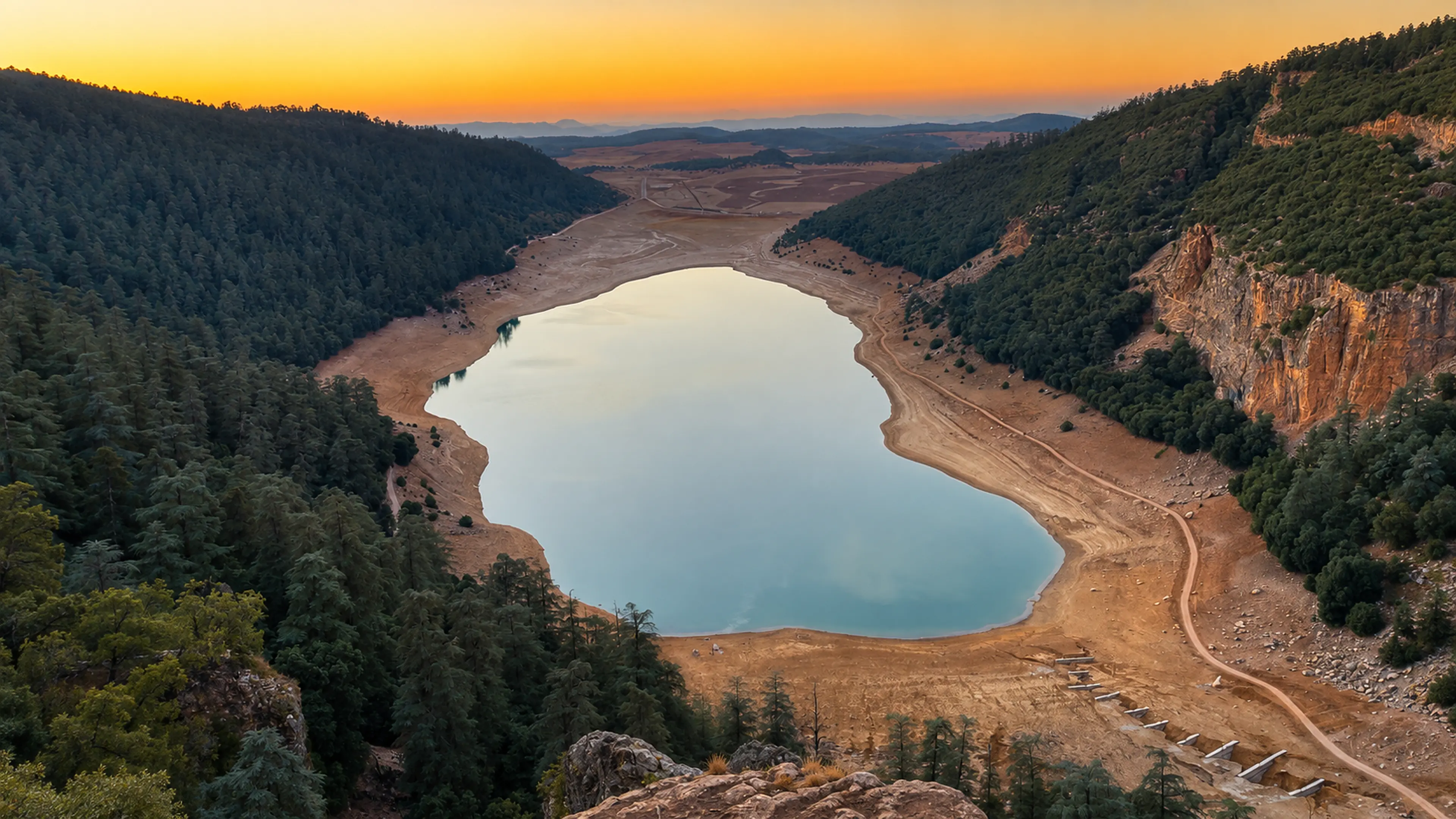
A calm lake framed by cedar forest and rocky Middle Atlas slopes at sunset in Khenifra National Park, Morocco

Visit / Place · Middle Atlas · Khenifra gateway

Khenifra National Park A Middle Atlas landscape of cedar shade, blue water, red rock and quiet highland scale

Khenifra National Park is best read as a living mountain landscape: forest, lakes, river edges, open slopes and the city gateway that makes the Middle Atlas feel close.

Begin with the wide view before chasing details. The strongest first impression is the relationship between still water, dark forest, exposed earth and the soft evening light that gives the park its calm authority.

Why Khenifra National Park matters

A protected landscape before it is a viewpoint.

Khenifra National Park matters because it gathers several Middle Atlas readings into one place: forest, inland water, mountain relief, seasonal roads and a nearby city that keeps the landscape connected to daily Moroccan life. It is not a single monument or a one-frame stop; it is a broad natural setting that asks visitors to understand scale first.

Protected Planet records Parc National de Khénifra as a protected area in Morocco and classifies it under terrestrial and inland waters protected areas. Morocco's National Clearing-House Mechanism for Biodiversity also places the creation of the park in April 2008, within the country's wider effort to strengthen protected-area conservation.

The careful way to read the park is through relationships. Water makes the highland basin visible. Forest gives shade, depth and ecological meaning. Rock and red earth give the route warmth. Khenifra gives the visit a practical and cultural threshold, so the park feels like part of a region rather than an isolated image.

That is why a strong page should stay calm and specific. The visitor needs orientation, but also visual intelligence: where to slow down, what to notice at the edges of water and forest, and how to move through a protected landscape without treating it as decoration.

Core protected-area facts are grounded in the Protected Planet profile for Parc National de Khénifra and Morocco's National Clearing-House Mechanism for Biodiversity. Exact access conditions, route surface and seasonal restrictions should be checked close to travel.
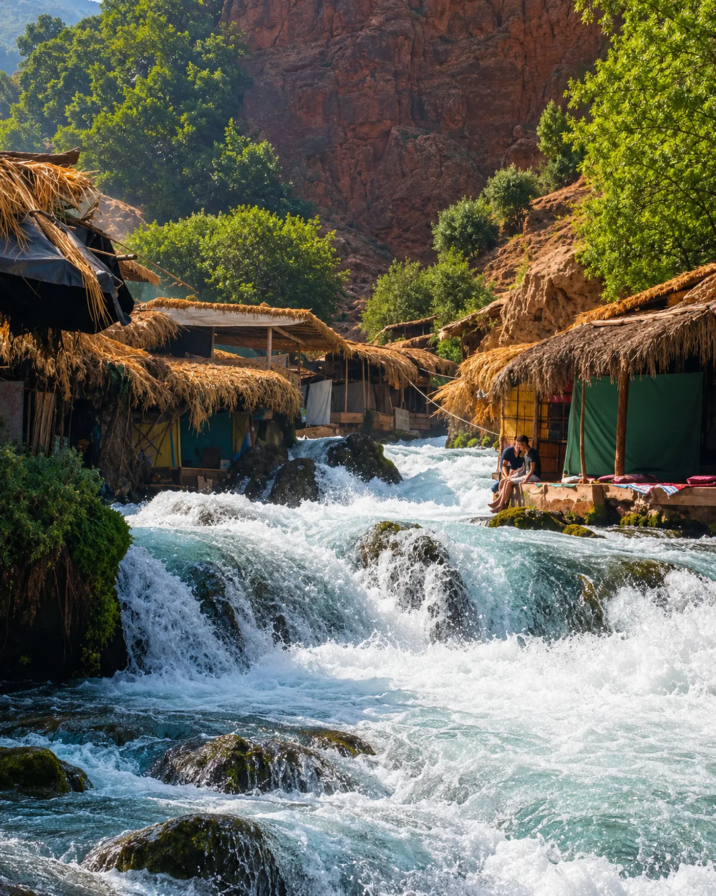
Clear rushing water, rustic riverside shelters and red rock in the Khenifra mountain landscape

Map orientation

Use the map to place the park in relation to Khenifra, Middle Atlas forest roads and inland water landscapes before planning the route in detail.

Editorial reading

Water gives the route its grammar.

The lake view is not only beautiful because it is blue. It works because water holds the centre while forest and exposed slopes frame the basin. That balance gives the park its quiet force.

Close views change the rhythm. Rushing water, river stones, rough shelters, red cliffs and green shade make the place feel tactile. The visitor moves from panorama to texture, from silence to sound, from horizon to edge.

Khenifra's role is also important. The city context prevents the park from becoming an empty wilderness image. It gives the journey a base, a river edge, local movement and a practical sense of arrival.

The best reading is patient. Notice where the landscape opens, where it narrows, where water changes speed, and where human use appears without overwhelming the natural setting.

Natural and protected-area orientation

A park of forest, water and Middle Atlas scale

Khenifra National Park should be introduced with care: it is a Moroccan national park and protected landscape, but the visitor-facing experience is shaped by scenery, season, route quality and local context. Keep the page focused on what can be understood confidently: inland waters, forested mountain country, Khenifra as gateway and the need for respectful access.

01Place type

National park landscape

The identity is broad rather than monumental. Visitors read the park through lakes, forest, slopes, river edges and road approaches, not through one single built landmark.

02Protected profile

Terrestrial and inland waters

Protected Planet lists Parc National de Khénifra in Morocco and identifies its protected-area type as terrestrial and inland waters, a useful frame for understanding why water and land belong together here.

03April 2008

Conservation network

Morocco's biodiversity clearing-house records the creation of Khenifra National Park in April 2008 as part of a wider national protected-area effort.

04Visitor care

Fragile mountain rhythms

Water levels, weather, road surfaces and local use can affect the experience. A careful visitor treats the park as a living landscape and checks current conditions before travelling.

A visual bridge

Read the park through water, forest and city threshold

Before Khenifra National Park becomes a photograph, it is a sequence of edges. These three readings help visitors move from the wide lake scene into a more intelligent understanding of landscape, route and place.

01

Water

Lakes before viewpoints

The water is the compositional centre of the park. Still lake surfaces create calm, while faster streams and river edges add movement and sound. Together they stop the visit from becoming only a lookout experience.

  • Read reflections as part of the landscape scale.
  • Notice shoreline changes before moving on.
  • Keep water edges clean and undisturbed.
02

Forest

Cedar shade and open slopes

Forest gives the park depth. The dark green mass around water and rock makes the landscape feel cooler, quieter and more layered than the exposed routes alone would suggest.

  • Look for the contrast between shade and open ground.
  • Let trees frame the water rather than hiding it.
  • Avoid noise and intrusive stops in quiet areas.
03

Gateway

Khenifra gives the visit its base

The nearby city matters because it connects the mountain landscape to services, movement and human rhythm. The park is easier to understand when the route begins and ends with Khenifra in mind.

  • Use the city as the practical orientation point.
  • Connect river, road and mountain views.
  • Keep the park tied to its regional context.

Quick orientation

Essential context for a first Khenifra National Park visit

Type of place

A Moroccan national park and protected Middle Atlas landscape best understood through forest, inland waters, highland roads and seasonal natural conditions.

Landscape context

The visual identity comes from blue water, cedar shade, red earth, rocky slopes and the transition between Khenifra city and mountain country.

Best for

Slow landscape reading, lake views, road-based exploration, nature photography, quiet stops and a calmer Middle Atlas route beyond the major city circuits.

Closest city context

Khenifra is the strongest practical gateway, giving the visit a base for supplies, orientation and a clearer sense of the region around the park.

What visitors experience here

Wide calm first, then texture at the water's edge

Khenifra National Park works in stages. First comes the open basin: water held between forest and mountain sides. Then come the smaller readings: river sound, rock colour, rough paths, shade, built shelters and the sense that the landscape changes quickly with light and season.

Arrival

The basin opens slowly

The strongest arrival is not abrupt. The road begins to show water, slopes and tree cover in pieces, then the park starts to read as one connected highland landscape.

Light

Warm slopes, pale water

Late light works beautifully here because it warms the exposed earth while leaving the water soft and readable.

Water

Still surfaces and fast edges

The visit can shift from quiet lake reflection to rushing water in close view. That contrast gives the park movement without needing dramatic copy.

Forest

Shade as structure

Trees are not background filler. They create depth, temperature, shadow and a sense of protection around the more open views.

Texture

Red rock, dry earth, clear flow

The visual palette is strongest when natural: green forest, pale blue water, warm rock and honest ground. Avoid exaggerated colour; the real contrast is already rich.

Pace

A route for patient stops

This is a place to pause, listen and look again. The best experience comes from short, careful stops rather than rushing from one viewpoint to the next.

Place details and orientation

Read Khenifra National Park through six defining elements

No single feature explains the park. Its identity comes from the relationship between inland water, forest cover, exposed slopes, river movement, Khenifra city context and the careful behaviour required in a protected landscape.

1
Lake basins

Still water gives the park its visual centre and helps visitors understand scale before they focus on small details.

2
Cedar and mountain forest

Forest creates shade, depth and ecological character, especially where dark green slopes frame open water.

3
River movement

Fast water changes the mood from calm to energetic and gives the close visit sound, texture and freshness.

4
Rock and red earth

The warm mineral palette connects the park to inland Morocco and keeps the images grounded rather than glossy.

5
Khenifra gateway

The city is the practical anchor for orientation, onward movement and a more complete reading of the region.

6
Seasonal caution

Weather, water levels and road conditions can change the experience, so practical arrangements should be checked near the visit.

Landscape, not backdrop

The park holds together through edges.

Stand back first. The lake, forest line, road, slope and sky need to be seen together before the details begin to compete for attention. That wide reading is what gives the park its first authority.

Then move closer. Water texture, red rock, shaded shelters, rough banks and the sound of flow bring the visitor into a human scale. The best page lets both readings exist: the grand basin and the near edge.

Landscape, water and route intelligence

The park is read through relationships, not single views.

Khenifra National Park is strongest when the visitor understands how its elements depend on each other. Water makes the basin legible. Forest gives the slopes weight and shade. Roads and city access give the landscape a route logic. Red earth and rock keep the view connected to inland Morocco.

A protected natural place does not need inflated language; it needs precise attention to what visitors can see, how they move, and how they should behave around water, paths and quiet local spaces.

What to notice slowly

  • Begin with the whole basin before focusing on the shoreline.
  • Notice where forest makes the water feel sheltered or hidden.
  • Read red rock and dry earth as part of the park's natural palette.
  • Pay attention to the change from still water to fast river movement.
  • Keep Khenifra in the route story; it is the human gateway to the park.
  • Check local conditions instead of assuming that every track is suitable in every season.

Visual reading

Three higher-level ways to see Khenifra National Park

Scale and containment

The first reading is spatial: water contained by forested slopes and exposed edges. The lake makes the park feel calm because it gathers the surrounding landscape into one visible form.

Texture and movement

Close details bring energy: river foam, stones, rough shelters, red cliff surfaces and pockets of shade. These textures keep the visit grounded in real observation.

Gateway and return

Khenifra gives the landscape a beginning and an end. Returning to the city after the park helps visitors understand the Middle Atlas as inhabited, practical and layered.

Visual atmosphere

Keep the mood clear, bright and natural

From distance to edge

Start with the lake and forest frame, then move toward the waterline, paths and rock surfaces. The memory becomes stronger when the visitor understands both the wide scene and the close detail.

From green to earth

The park's palette should remain honest: deep green trees, pale blue water, warm red earth and stone. Heavy contrast would flatten the place; natural brightness keeps it premium.

From image to memory

The photograph gives the first pull, but the lasting memory is slower: water sound, changing light, shade, dust, road bends and the feeling of entering mountain country from Khenifra.

Nearby places and onward links

Connect the park to the wider Middle Atlas map

Khenifra National Park belongs naturally to a Middle Atlas route. The strongest onward reading connects the park to Khenifra, regional mountain landscapes, related national parks and practical travel planning.

Khenifra

The city gateway for the park, useful for orientation, supplies, river context and a grounded reading of the surrounding Middle Atlas region.

Open Khenifra city guide

Atlas, Interior & Mountain Morocco

The regional frame for mountain towns, cedar landscapes, valleys, lakes and inland routes beyond the imperial and coastal circuits.

Explore the region

Ifrane National Park

A related Middle Atlas national park context for travellers comparing cedar landscapes, cool-climate routes and highland nature experiences.

Open Ifrane National Park

Visit Morocco places

Continue through parks, valleys, waterfalls, lagoons, caves, monuments and major natural heritage places beyond the city guides.

Browse Visit places

Plan your journey

Treat the park as a landscape route rather than a single stop. Check conditions, keep the day flexible and build the route around daylight.

Plan your journey

Themes of Morocco

Use the themes section to connect landscape, heritage, craft, food, architecture and cultural reading across the wider Exotic Morocco project.

Explore themes

How to visit respectfully

Move like a guest in a protected mountain landscape

Khenifra National Park rewards quiet attention. Respect here is practical: avoid litter, keep noise low, do not disturb water edges, stay cautious around informal tracks and treat nearby communities as real places rather than scenery for photographs.

  • Check current road, weather and access conditions before setting out.
  • Keep all lake, river and picnic areas cleaner than you found them.
  • Avoid loud music, intrusive drone use or blocking narrow local roads.
  • Ask before photographing people, homes, shelters or working spaces.
  • Stay on durable routes where possible and avoid damaging vegetation or soft banks.
  • Let the visit be slow enough to observe without putting pressure on the place.

A strong first visit

Begin with scale, then come closer.

Start by seeing the park as a whole: lake, forest, slope, road and sky. That first reading gives structure to the day and keeps the visit from becoming a rushed collection of stops.

After the wide view, choose fewer close moments and give them more time. A river edge, a shaded bend, a red-rock wall or a quiet lakeside pause can tell more about the park than trying to cover too much.

Finish by returning the landscape to its city context. Khenifra helps the visitor understand the park as part of a lived region, connected to markets, roads, homes, rivers and everyday movement.

  • Keep the itinerary flexible and daylight-aware.
  • Choose observation over speed.
  • Use Khenifra as the practical anchor for the route.

Careful planning note: opening arrangements, track suitability, water access and exact travel times can change. Verify practical details locally before travelling.

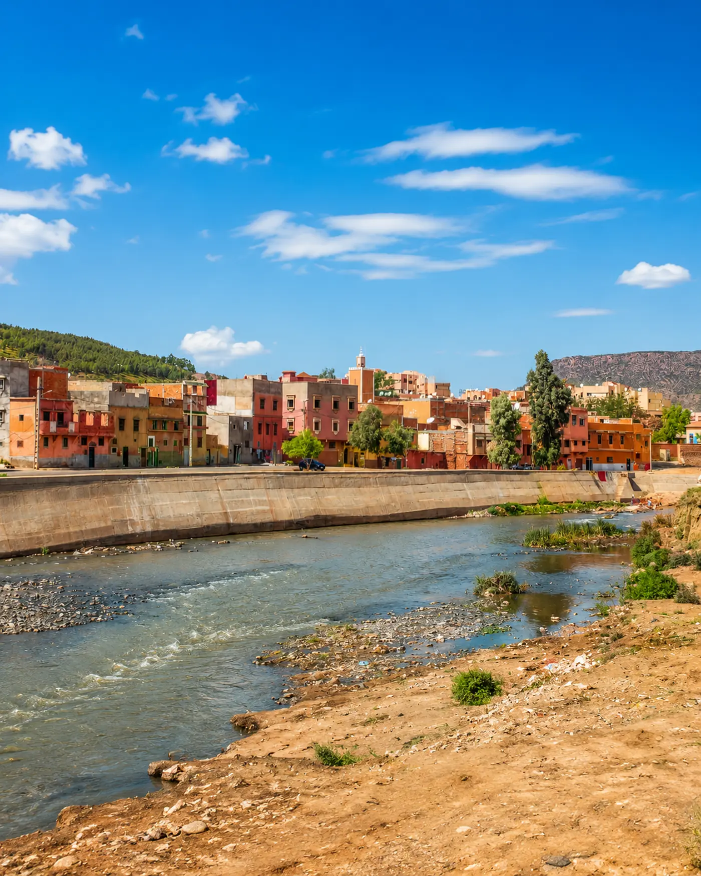
Khenifra city beside a river with colorful buildings, a mosque minaret and Middle Atlas hills under a bright sky

Go deeper through the nearest city context

Khenifra — the city gateway to the national park

Khenifra gives the park its most useful human context. The city sits close enough to make the landscape practical, while its river edge, streets and surrounding hills keep the visitor aware that the park belongs to a wider inland region.

Use Khenifra to widen the experience after the lake and forest route: city orientation, supplies, onward roads and a clearer understanding of Middle Atlas daily life all make the national park feel more complete.

Middle Atlas city contextKhenifra route orientation

Continue the journey

Continue from Khenifra National Park into the Middle Atlas.

Read the park slowly, then connect it to Khenifra, cedar landscapes, inland waters, mountain routes and the wider regional map of Morocco.