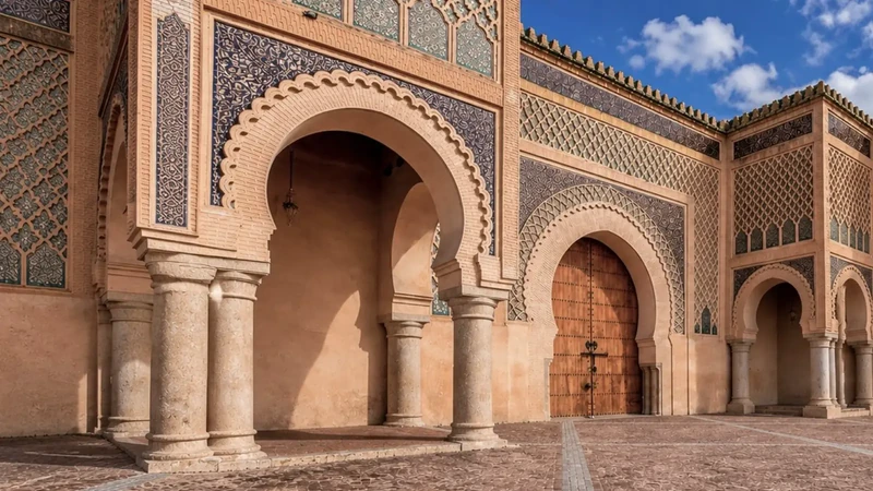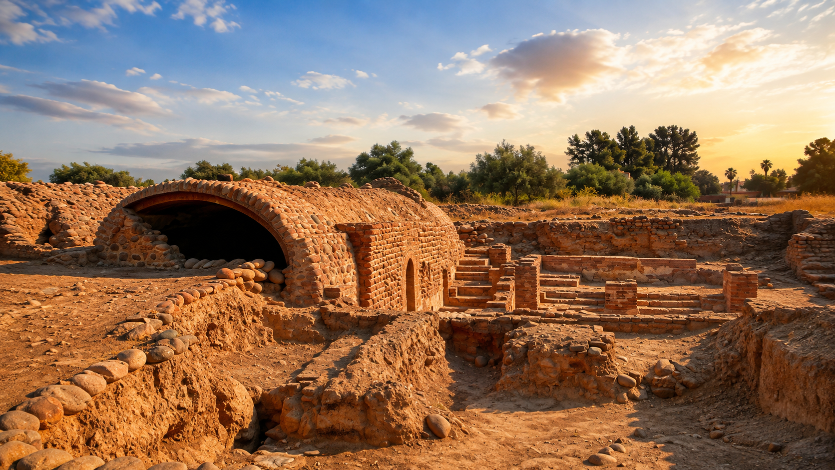
Sunset over brick and earth archaeological remains at Aghmat near Marrakech, Morocco

Visit / Place · Al Haouz · Marrakech-Safi

Aghmat Archaeological Site Medieval Haouz memory at the foot of the High Atlas

Aghmat is one of Morocco's most meaningful medieval archaeological landscapes: a former urban centre near Marrakech where buried foundations, hammam remains, water systems and route memory connect the Haouz plain with the Ourika foothills.

Read it as archaeology before scenery. The strongest visit begins with traces: brick, earth, excavated walls, water logic, orchard landscape and the quiet knowledge that Marrakech rose beside an older urban world.

Why Aghmat matters

Before Marrakech, there was an older urban memory.

Aghmat matters because it shifts the visitor's map of Marrakech. The site is not a minor ruin beside a famous city; it is part of the older Haouz story that helps explain how power, water, agriculture, trade and mountain routes were organised before Marrakech became the dominant capital.

The Mission Archeologique d'Aghmat describes the medieval city as a major urban, economic, agricultural and spiritual centre of southern Morocco until Marrakech gradually replaced it from the twelfth century. It also notes that much of the old city now lies below fields and the modern village of Ghmat, which makes the place a landscape of visible remains and buried knowledge at the same time.

Aghmat is especially important because archaeology can still read parts of a medieval city that was not completely erased by later urban rebuilding. The reserve and excavation areas help visitors imagine an urban fabric made of religious, domestic, political, hydraulic and productive spaces rather than a single monument.

The site also carries a literary and Andalusi memory. Aghmat is associated with Al-Mu'tamid ibn Abbad, the exiled poet-king of Seville, whose tomb is part of the wider place context. That story should be approached with care: it is powerful, but it sits inside a deeper local history of Amazigh, Idrisid, Almoravid, agricultural and urban life.

For visitors, Aghmat rewards attention to traces. Brick vaults, low walls, excavation edges and water-related remains may seem modest at first, but together they open a more intelligent reading of the Haouz: the ground under the orchards, the road toward Ourika, the old relationship between Marrakech and its southern foothill landscape.

Core historical orientation is grounded in the Mission Archeologique d'Aghmat and the Archaeological Institute of America site-preservation note. Practical details such as access, prices, opening hours and exact travel times should be checked close to travel.
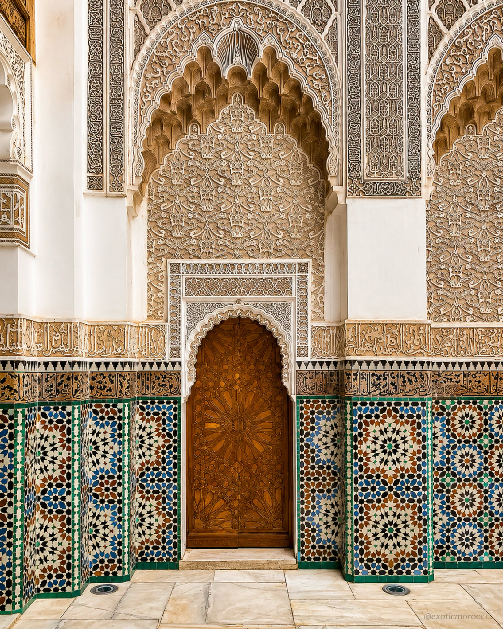
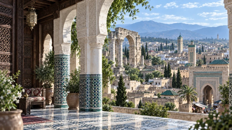
Marrakech decorative zellige and carved plasterwork, the city context for Aghmat

Map orientation

Use the map to place Aghmat southeast of Marrakech, near the Ourika foothill route and the agricultural edge of the Haouz plain.

Editorial reading

Its power is in the ground, not only in what still stands.

Aghmat asks for a different kind of looking. Some Moroccan monuments announce themselves through height, tile, symmetry or skyline. Here, the first language is excavation: low walls, brickwork, openings, surfaces, alignments and the sense that much of the city is still under the fields around you.

That makes the site unusually rewarding for visitors who like to understand places slowly. The visible remains do not perform like a restored palace; they invite reconstruction in the mind. A hammam wall, a water channel or a foundation line becomes meaningful when it is connected to a city that once organised movement, authority, exchange and daily life in the Haouz.

The best reading keeps Marrakech nearby without letting it swallow the story. Aghmat is not simply a prologue to Marrakech. It is a place with its own urban weight, its own agricultural setting, its own spiritual associations and its own archaeological future.

Look for the relationship between material and territory. Brick and earth sit beside olive groves, modern village life and the road toward the mountains. This is where the site becomes more than a ruin: it shows how a medieval city depended on water, land, routes and memory.

Marrakech gives visitors the nearest major base and a useful visual counterpoint: finished urban ornament beside Aghmat's excavated foundations, dense medina rhythm beside quieter archaeological ground.

Respect is part of the reading. Archaeological surfaces can be vulnerable, and excavation zones may change. The careful visitor keeps distance where needed, avoids touching fragile fabric and lets the site remain a place of study, memory and local continuity.

Historical and heritage orientation

Read Aghmat through city, water and archaeology.

Aghmat is best understood as a medieval urban landscape partly visible and partly buried. Research published by the Mission Archeologique d'Aghmat describes a city at the foot of the High Atlas, west of the Ourika river, with a large archaeological footprint beneath fields and the present village of Ghmat. Its story connects Idrisid-era evidence, Almoravid history, later decline and modern archaeological conservation.

01Place type

A medieval city site

Aghmat is not a single building. It is the archaeological trace of a city, with visible remains that help read a larger urban fabric now partly covered by fields and modern settlement.

02Early record

Haouz urban centre

The site's origins are not fully settled, but research notes that Aghmat emerges in written history at the beginning of the ninth century and became a major centre in medieval southern Morocco.

03Almoravid era

Before Marrakech rose

Aghmat was taken by the Almoravids around the mid-eleventh century and was later overshadowed as Marrakech developed nearby. This relationship makes it essential to the wider history of the region.

04Archaeology

Excavation and protection

Modern work at the site has focused on study, conservation and public understanding, with attention to the hammam, monumental quarter, water systems and the protection of buried remains.

A visual bridge

Three readings between ruin, orchard and city

Aghmat becomes richer when visitors connect what is visible to what is buried. These three readings keep the place specific: archaeology underfoot, water in the landscape, and Marrakech as the later city that changed the balance of the Haouz.

01

Archaeology

Fragments that still organise space

Low walls, brick vaults and exposed foundations are not leftovers without meaning. They mark rooms, routes, thresholds and public functions that once belonged to a much larger city.

  • Read alignments before individual details.
  • Notice where excavated edges suggest rooms or streets.
  • Let modest remains build a bigger urban picture.
02

Water

Ourika resources and Haouz agriculture

The old city depended on its foothill environment. Water, gardens, fields and routes explain why Aghmat mattered as more than a military or dynastic episode.

  • Keep the agricultural setting in view.
  • Connect hammam remains to water management.
  • Read the site with the foothills, not apart from them.
03

Marrakech

The later capital nearby

Marrakech is close enough to make comparison unavoidable, but Aghmat deserves its own attention. The older site clarifies how regional power moved, concentrated and changed.

  • Visit with Marrakech in mind, not as a replacement.
  • Compare excavation traces with finished urban ornament.
  • Use Aghmat to deepen the story of the Haouz.

Quick orientation

Type of place

A medieval archaeological site at Ghmat/Aghmat, best read as the remains of an urban landscape rather than as one isolated monument.

Landscape context

Al Haouz province, southeast of Marrakech, near the Ourika foothills where agriculture, water and mountain routes shape the site context.

Best for

Medieval Moroccan history, archaeology, hammam and water-system reading, quiet observation, careful photography and deeper Marrakech-region context.

Closest city context

Marrakech is the strongest nearby city base for visitors who want to connect Aghmat with the wider Haouz, Ourika and High Atlas foothill routes.

What visitors experience here

A quieter archaeological rhythm near Marrakech.

Aghmat does not work like a polished monument. Its atmosphere comes from contrast: open sky above excavated brick, old urban traces beside village life, and the feeling that a significant medieval city is partly visible, partly hidden under the surrounding land.

Arrival

The site as a field of traces

The first impression is horizontal rather than monumental. Walls, foundations and excavated areas ask the eye to assemble space from fragments instead of expecting one complete facade.

Light

Earth, brick and late sun

The site is strongest when warm light makes texture legible: brick courses, rounded stones, pale earth, low shadows and the dry edge between archaeology and planted land.

Water

Hammam memory

The hammam remains are central to the visitor's imagination because they connect architecture with water, heat, social life and urban sophistication in medieval Morocco.

Scale

A city larger than the visible ruins

What you see is only part of the story. Research describes a much broader archaeological footprint, so the surrounding ground matters as much as the exposed masonry.

Context

Ourika foothill setting

The proximity to the High Atlas foothills keeps the site connected to movement, water and agriculture. Aghmat should be read with the landscape around it, not as a detached ruin.

Pace

Slow looking, few assumptions

The best visit gives time to labels, local guidance and visible fabric. Avoid filling gaps with fantasy; let archaeology, landscape and verified history do the work.

Place details and orientation

Read Aghmat through six defining elements

No single feature explains Aghmat. Its meaning comes from the relationship between medieval urban life, water, excavation, buried fabric, Marrakech-region history and the agricultural foothill setting.

1
Excavated foundations

Low walls and exposed plans help visitors imagine rooms, circulation and the organisation of a larger medieval city.

2
Hammam remains

The bath complex is one of the clearest ways to read urban life, water use and social sophistication at the site.

3
Monumental quarter

Research identifies political and religious functions in the investigated area, including mosque, palace, hammam and water-reserve context.

4
Buried city fabric

Much of old Aghmat is still not visible at the surface. That hidden scale is part of the site's importance and vulnerability.

5
Al-Mu'tamid memory

The wider Aghmat area is associated with the exiled poet-king of Seville, adding an Andalusi literary layer to the site's Moroccan history.

6
Haouz foothill setting

Fields, village edges, water resources and the nearby mountain route help explain why the city developed here.

Archaeology, not backdrop

The place asks for a patient eye.

Stand back before chasing details. Aghmat's first lesson is not height but layout: traces of a city spread across land that still belongs to agriculture, village life and archaeological work.

Then move closer. Brick courses, wall thickness, thresholds and water-related remains begin to suggest how a medieval urban environment operated. The experience becomes strongest when the visitor connects each visible fragment to a larger hidden plan.

Keep Marrakech in the background of your mind. The later capital nearby helps frame Aghmat, but the older site has its own authority: it is a key to the Haouz before the red city became the region's dominant image.

Architecture and material intelligence

Brick, earth and water make the city readable.

Aghmat's visible beauty comes from material evidence rather than decorative display. Brickwork, earth, rounded stones, excavation cuts and restored or conserved surfaces show how architecture was tied to water, heat, movement and repair.

The hammam is especially useful for understanding this intelligence. A bath is never only a beautiful ruin: it requires water supply, heating, drainage, room sequence and social use. Reading that system helps visitors understand Aghmat as a functioning city, not a collection of isolated fragments.

What to notice slowly

  • Look for room outlines and circulation before focusing on single decorative details.
  • Notice how brick, earth and stone create different textures under changing light.
  • Connect the hammam to water, heat and public life rather than treating it as scenery.
  • Keep the agricultural ground and mountain direction in view while reading the ruins.
  • Respect excavation edges, barriers and areas that may be under conservation work.
  • Use Marrakech as a nearby reference, but give Aghmat its own historical weight.

Architectural reading

Three languages to notice at Aghmat

Horizontal urban memory

Aghmat speaks through ground plan more than skyline. Foundations and wall lines reveal the memory of rooms, streets and public functions across a wider buried city.

Water and civic life

The hammam and water-related remains show that medieval urban comfort depended on planning, supply, heat and maintenance. They make daily life legible through infrastructure.

Excavation and restraint

Archaeological sites change as research and conservation continue. A careful visitor avoids touching fragile surfaces and treats incomplete visibility as part of the site's truth.

Visual atmosphere

Low walls, warm light and buried scale

From ruin to city

Start with the visible walls, then imagine the missing fabric around them. Aghmat becomes more powerful when each fragment is understood as part of a larger urban organism.

From earth to orchard

The meeting of masonry, dry soil, trees and open foothill air gives the site its character. It is not sealed away from daily life; it sits inside a living rural and village landscape.

From Marrakech to memory

The nearby city gives the visit a strong contrast. After Marrakech's dense ornament and movement, Aghmat offers the quieter intelligence of foundations, water traces and historical depth.

Nearby places and onward links

Connect Aghmat to the wider Marrakech and Atlas map

Aghmat belongs naturally to a Marrakech-region itinerary. The strongest onward reading connects the site with Marrakech, the Atlas and Interior region, architecture themes and other Visit pages.

Marrakech

The closest major city context for Aghmat. Use it to compare finished urban ornament, medina scale and the later capital that reshaped the region's centre of gravity.

Open Marrakech city guide

Atlas, Interior & Mountain Morocco

The regional frame for foothill routes, valleys, mountain approaches and the landscapes that connect the Haouz plain to the High Atlas.

Explore the region

Architecture & Heritage

Aghmat is a strong gateway into archaeological reading, urban history, preservation and the relationship between material culture and place.

Read the theme

Visit Morocco places

Continue through archaeological sites, kasbahs, valleys, monuments, caves, deserts, lagoons and natural heritage places beyond the city guides.

Browse Visit places

Plan your journey

Treat Aghmat as a meaningful context stop near Marrakech, then connect it thoughtfully with Ourika, Atlas foothills and wider travel planning.

Plan your journey

Stories from Morocco

Use the Stories section for richer cultural reading around archaeology, memory, materials, landscapes and the human rhythm behind historic places.

Read stories

How to visit respectfully

Good behaviour protects fragile archaeology.

Aghmat is quieter than Morocco's most famous monuments, and that quiet is part of its value. Move carefully around exposed fabric, follow any local instructions, avoid stepping onto fragile walls or excavation edges, and give the site time before judging it by the standards of a restored landmark.

Respect also means reading the present landscape with tact. The archaeological reserve sits near village life, fields and local movement. Ask before photographing people, avoid intrusive drone-style behaviour unless explicitly permitted, and remember that the place is both heritage and community setting.

  • Stay on appropriate paths and keep off fragile masonry, wall tops and excavation edges.
  • Ask clearly before photographing local people, guides, workers or private surroundings.
  • Give space to conservation work, signage and any changing access arrangements.
  • Carry water and sun protection; exposed archaeological areas can feel hotter than they look.
  • Check current access, opening details and local guidance close to travel.

A strong first visit

Begin by understanding where you are: southeast of Marrakech, close to the Ourika foothills, in a place where agriculture, water and medieval urban history overlap. That first orientation makes the visible remains feel less isolated.

Move through the site as if reading a plan. Look for foundations, room edges, brick vaults, water-related features and changes in surface. The visit becomes more rewarding when the eye connects fragments to the idea of a larger city.

If a guide or site explanation is available, listen for terms that clarify the place: Haouz, hammam, monumental quarter, palace, mosque, water reserves, buried city and Al-Mu'tamid. These words help organise what may otherwise look quiet or incomplete.

Afterward, connect Aghmat back to Marrakech. The contrast is powerful: one city dense and celebrated, the other quieter and partly underground, both essential to understanding the region's historical depth.

  • Start with the map position before focusing on individual walls.
  • Read the hammam and water traces as evidence of civic life.
  • Keep village, field and mountain context in the same mental frame.
  • Let Marrakech add context without replacing Aghmat's own story.
  • Finish by connecting Aghmat with Marrakech and the Atlas foothill routes.

Careful planning note: opening hours, prices, conservation conditions and exact access can change. Verify practical arrangements locally before travelling.

Marrakech carved plaster and zellige detail, the city gateway context for Aghmat

Go deeper through the nearest city context

Marrakech - the city gateway to Aghmat

Aghmat belongs naturally inside a deeper Marrakech journey. The city gives visitors the nearest major base, but Aghmat changes the reading: it reminds travellers that the Haouz had an important urban and agricultural history before Marrakech became the dominant image of the region.

Use Marrakech to widen the context after the archaeological site itself: medina architecture, Almoravid memory, Atlas approaches, garden culture, craft surfaces and regional routes all become more meaningful when Aghmat is treated as part of the larger historical landscape.

Marrakech city orientationHaouz historical context Ourika and Atlas foothillsArchitecture and archaeology Practical travel structureNearby cultural routes

Continue the journey

Continue from Aghmat into Marrakech and the Atlas foothills.

Read the archaeological site slowly, then connect it to Marrakech, Ourika, the Haouz plain, medieval urban history and the wider heritage map of Morocco.