Taforalt Cave Grotte des Pigeons and the deep prehistory of eastern Morocco
Taforalt Cave, also known as Grotte des Pigeons, is one of North Africa's most important prehistoric cave sites: a mountain opening where archaeology, landscape and memory meet.
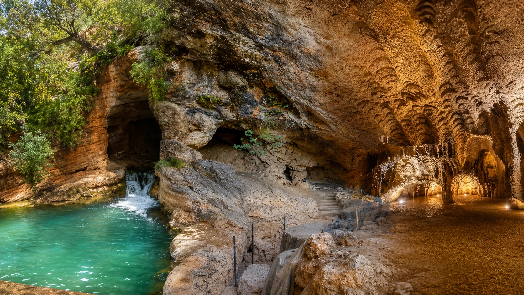
Begin from the landscape before reading the cave. Taforalt is most powerful when the rock face, shadowed entrance, village setting and Beni Snassen slopes are understood together, before the archaeological story begins to deepen the view.
Taforalt Cave is better known in archaeological writing as Grotte des Pigeons. It sits near Taforalt village in the Beni Snassen Mountains of eastern Morocco, in a landscape where stone, slope, vegetation and route all help explain why this place has held attention far beyond its modest exterior.
The site matters because it preserves a deep prehistoric record. Research on Taforalt has focused on layered deposits, stone tools, shell ornaments, burials, ancient human remains and environmental evidence. For visitors, that means the cave should be approached as a place of evidence before it is treated as a scenic stop.
UNESCO records Grotte de Taforalt on Morocco's Tentative List as a cultural site submitted in 1995. The record describes a prehistoric Paleolithic cave, including a gallery of about 55 meters and stratigraphy connected to the history of the Upper Paleolithic in North Africa. That status is precise: tentative-list heritage, not full World Heritage inscription.
Academic research gives Taforalt a wider importance. Published work connects the cave to Iberomaurusian burial evidence, Later Stone Age communities, early ornaments made from marine shells, and debates about mobility and human behavior in North Africa. The strongest visitor reading keeps those facts controlled and avoids turning the cave into legend.
The place also matters because it changes the scale of Moroccan heritage. Many visitors arrive expecting gates, palaces, kasbah architecture or visible monuments. Taforalt asks for a different eye: a respect for sediment, shadow, small objects, human remains, scientific context and the long relationship between people and mountain environments.
For a first visit, the best approach is slow and layered. Read the outside form, then the threshold, then the protected interior logic, then the region around it. The cave becomes richer when Taforalt village, the Beni Snassen Mountains, Berkane and Oujda are part of the same mental map.
Use the map first to place the cave above Taforalt village and within the Beni Snassen mountain setting, with Berkane, Oujda and the eastern Mediterranean corridor forming the wider visitor frame.
Editorial reading
Its beauty is evidence, not spectacle.
Taforalt Cave does not work like a grand monument. Its importance is quieter and more demanding: a protected opening in rock, a long archaeological sequence, and a body of research that connects landscape, movement, burial practice, symbolic behavior and deep human presence.
Start outside. The cave gains meaning from the Beni Snassen Mountains before any label is read. Slope, vegetation, stone colour and the relation to Taforalt village create the first grammar of the visit. The landscape explains the cave's position better than decoration ever could.
Then shift from scenery to evidence. Archaeological sites can look understated because their most important information lies in layers, fragments and contexts that are not meant to be handled by visitors. Taforalt rewards the person who can respect what is not immediately visible.
The strongest photographs keep this honesty. They show rock, entrance, shade, path, surrounding slope and the scale of the opening. They do not need to invent drama. The real drama is the contrast between the ordinary surface and the depth of history carried below it.
The cave also asks visitors to think regionally. Oujda and Berkane give the modern travel frame, while the cave reaches into periods far older than any city itinerary. Keeping both scales in view makes the experience more intelligent: present-day eastern Morocco and prehistoric North Africa are held together.
Care is part of the reading. A prehistoric cave is not a neutral backdrop for casual movement. Surfaces, paths, signs, closed areas and loose material should be treated as parts of a research landscape, because small disturbances can damage meaning even when damage is not immediately obvious.
Return at the end to the first view. The entrance, mountain face, village context and regional route should now feel different. A good Taforalt visit does not simply add facts to a photograph; it changes how the photograph is understood.
Historical and heritage orientation
Read the site through layers, burials and careful language.
Taforalt is a prehistoric cave site with international archaeological importance. The clearest public wording is cautious: it is associated with Paleolithic and Later Stone Age research, Iberomaurusian burial evidence, early ornaments, ancient human remains and a UNESCO tentative-list record under the name Grotte de Taforalt. The point is not to overload the visitor with technical language, but to give enough structure so the cave is read with seriousness from the first step.
01Place type
Prehistoric cave site
The site is a cave and archaeological deposit, not a decorative monument. Its value comes from stratigraphy, excavated evidence and the relationship between the cave, the mountain and repeated human use of the landscape.
02Research record
Deep sequence
Studies of Taforalt describe long sequences of occupation and natural deposition. The visible cave is therefore only the surface of a larger record built from sediment, tools, remains, dating work and careful excavation.
03Iberomaurusian
Burial evidence
Grotte des Pigeons is especially known for Iberomaurusian human remains and funerary evidence. This gives Taforalt an exceptional role in discussions of Later Stone Age communities and burial practice in North Africa.
04Tentative list
Recognised heritage value
UNESCO's tentative-list record identifies Grotte de Taforalt as a Moroccan cultural candidate submitted in 1995. The careful wording matters: recognised candidate value, not a claim of full inscription.
A visual bridge
Three readings between cave, mountain and evidence
Before Taforalt becomes an archaeological name, it is a physical place in a mountain landscape. These three readings help visitors move from distance to detail, from visible surface to protected evidence, and from a single cave to the wider eastern Morocco map. They also keep the page close to the real experience: approach, pause, observe, and only then interpret.
01
Mouth and shadow
The entrance is the first lesson. Notice how the cave gathers shade, frames the outside light and turns the mountain face into a threshold rather than a facade. The visual change is simple, but it gives the visit its rhythm.
Read the exterior before stepping closer.
Let the transition from light to shadow set the pace.
Keep the rock face, entrance and slope in the same visual frame.
02
Layer beneath layer
The visible surface is not the whole story. Taforalt's importance lies in deposits, contexts, recovered evidence and scientific interpretation that require protection and patience. This is where looking becomes an act of restraint, not consumption.
Think vertically: ground, sediment, sequence.
Do not touch, mark or move rock and surface material.
Respect signs, barriers and excavation-sensitive areas.
03
Eastern frame
The cave belongs to the wider east: Oujda, Berkane, Taforalt village, the Zegzel landscape and the Beni Snassen Mountains. That regional frame gives the visit balance and prevents the cave from being treated as an isolated image.
Connect archaeology to living geography.
Look for slope, vegetation, road and village context.
Use Oujda as the city-scale orientation after the cave.
Quick orientation
Type of place
A prehistoric cave and archaeological site near Taforalt village, best understood through scientific evidence, protected context and the landscape intelligence of the Beni Snassen Mountains.
Landscape context
The cave sits in eastern Morocco's mountain geography, where rock, slope, vegetation, village routes and proximity to Berkane and Oujda shape the visitor's sense of place.
Best for
Prehistory, archaeology, careful photography, mountain atmosphere, slow looking and a deeper understanding of Moroccan heritage beyond highly visible monuments.
Closest city context
Oujda gives the strongest city frame for travellers who want to connect Taforalt Cave with eastern Morocco, Berkane routes and the wider Oriental region.
What visitors experience here
A cave that changes as you approach it.
Taforalt works in stages. First comes the mountain setting: exposed rock, pockets of green, village proximity and the feeling of a place held slightly apart from the faster rhythm of the city. Then comes the cave mouth, where light and shadow begin to organise the visit. Only after that does the archaeological meaning fully enter the eye.
Arrival
The mountain sets the tone
Before the cave itself, the Beni Snassen landscape prepares the visitor. Slopes, stone, road rhythm and vegetation create a grounded approach, reminding you that the site belongs to a mountain environment before it belongs to a travel itinerary.
Entrance
Light stops at the threshold
The cave mouth creates a shift in atmosphere. Exterior brightness, rough rock and shaded depth make the entrance feel like a boundary between landscape and archive, between what can be seen quickly and what must be understood slowly.
Texture
Rock before ornament
There is no need to search for decorative excess. The limestone surface, uneven ceiling, worn edges, stone steps, mineral colour and changing shadow give Taforalt its visual seriousness.
Research
The unseen carries weight
Much of Taforalt's importance is not immediately visible. Burials, ornaments, tools and environmental traces belong to excavated contexts, so the visitor has to imagine evidence without disturbing the place that preserved it.
Pace
A slower kind of visit
The cave loses meaning if rushed as a quick backdrop. The stronger rhythm is quiet and unhurried: pause at the entrance, let the eyes adjust, read the surrounding slope and give the site the calm that archaeological places deserve.
Region
Oujda widens the frame
After the cave, the city context matters. Oujda helps connect Taforalt to eastern Morocco's routes, architecture, borderland geography, Berkane approaches and Mediterranean-facing hinterland.
Place details and orientation
Read Taforalt Cave through six defining elements
No single visible feature explains Taforalt. Its meaning comes from the relationship between the cave mouth, stratified deposits, burial evidence, stone-tool research, shell ornaments, mountain setting and the care required by archaeological heritage.
1
The cave mouth
The entrance is the visual anchor. It frames the passage from exterior light into shade and helps visitors understand the cave as a threshold between landscape and evidence.
2
Layered deposits
The scientific importance of Taforalt depends on stratigraphy: layers of sediment and material evidence that preserve traces of occupation, environment and change through time.
3
Burial context
Iberomaurusian human remains make the cave central to research on funerary behaviour, community life and Later Stone Age populations in North Africa.
4
Stone-tool record
Excavated lithic material helps scholars read technology, adaptation and transitions between cultural phases. For visitors, it explains why ordinary-looking ground must be protected.
5
Shell ornaments
Perforated marine shells associated with Taforalt connect the cave to early symbolic behaviour and to movement between inland mountain settings and coastal resources.
6
Beni Snassen setting
The mountains are not background decoration. They shape the site's light, approach, shelter, vegetation, route logic and sense of distance from the modern city.
Cave, not scenery
The place asks for a careful eye.
Stand back before focusing on the entrance. The first lesson is spatial: a cave set into mountain rock, held by slope and shade, close enough to village life to feel connected and quiet enough to carry a sense of depth. This first reading keeps the visit grounded.
Then move closer. Stone texture, shadow, mineral colour, steps and protected areas begin to matter. Taforalt does not reveal its importance through obvious decoration; it reveals it through the knowledge that layers beneath and behind the visible surface have held evidence for generations of research.
Look for the relationship between the cave and the region. Oujda, Berkane, Taforalt village and the Beni Snassen Mountains belong in the same reading. The cave is not isolated from Morocco's east; it is one of the places that gives that east a deeper historical scale.
Landscape and archaeological intelligence
Deep time sits in ordinary stone.
The visual restraint of Taforalt is exactly what gives it power. A cave can look simple from the outside while preserving evidence that reaches across tens of thousands of years. The visitor's task is to let scientific depth change the way stone, ground and shade are seen, so a quiet surface begins to feel intellectually charged and visually precise.
That means paying attention to boundaries: the edge between public path and protected space, the transition between exterior light and interior shadow, and the difference between a surface that can be photographed and a context that should never be disturbed.
What to notice slowly
Look at the whole mountain face before focusing on the cave opening.
Notice where rock surfaces are bright, shadowed, weathered, rough or protected.
Distinguish archaeological importance from the need for visible spectacle.
Read the cave in relation to Taforalt village, Berkane approaches and Oujda city context.
Keep the Beni Snassen landscape in view; the setting is part of the site's meaning.
Respect closed spaces, signs, barriers and fragile surfaces without trying to negotiate them.
Archaeological reading
Three languages to notice
Scale without monumentality
Taforalt is important without needing a monumental skyline. Its scale is temporal: layers, phases, recovered evidence, repeated human presence and the long relationship between people and a mountain cave. Read scale here as depth rather than size.
Evidence without display
Many discoveries belong to excavation records, scientific publications and museum contexts rather than to objects visible in the cave. That absence should sharpen respect, not reduce interest, because the protected context is part of the meaning.
Region without isolation
The cave belongs to eastern Morocco's wider geography: Oujda, Berkane, Taforalt village, the Beni Snassen Mountains and routes toward the Mediterranean corridor. The region gives the cave a present-day frame around its deep past.
Visual atmosphere
Light, texture and quiet transitions
From distance to threshold
Start with the whole mountain face and the cave's position within it, then move closer to read the entrance, stone steps, changing shadow and the way the opening gathers the eye. The shift from landscape to threshold is essential: it turns Taforalt from a point on a map into a place with presence, and it gives the visitor a visual order before the archaeology is explained.
From surface to depth
Close up, the textures begin to matter: weathered rock, mineral colour, uneven ceiling, darker recesses and the visual pause created by the interior. These surfaces are not decoration; they are the visible edge of a much deeper archaeological record, which is why even plain stone deserves patient attention.
From photograph to memory
The strongest memory is not only the image of the cave, but the thought that a quiet place can hold evidence of movement, burial, craft, adaptation and survival across deep time. A careful visitor leaves with more than a frame: the visit changes the meaning of the frame itself and makes eastern Morocco feel older, wider and more layered.
Nearby places and onward links
Connect Taforalt Cave to the wider eastern Morocco map
Taforalt belongs to a broader eastern itinerary. Oujda gives the clearest city context, Berkane helps orient the approach to the mountains, and the wider Mediterranean and eastern region keeps the cave connected to landscape, movement and cultural geography.
Oujda
The major eastern city context for Taforalt Cave. Use it to frame the region through city life, historic architecture, borderland geography and onward routes toward Berkane and the mountains.
Taforalt adds a prehistoric layer to Morocco's heritage map, reminding visitors that cultural reading begins long before highly visible built monuments.
Treat Taforalt as a careful heritage stop within a broader eastern route. Check current access, local guidance and practical conditions close to travel.
Taforalt Cave is an archaeological place first. Access conditions, protective measures and local guidance can change, so avoid treating the cave like an open playground. If an area is gated, signed, closed or fragile, respect that boundary immediately and without pressure. The best visitor does not need full access to understand why a place deserves care.
Respect also means caring for archaeological context. Do not touch surfaces, move stones, scratch rock, climb on fragile edges, leave litter or turn protected areas into photo props. The cave's value depends on context, and context can be damaged by small careless actions. Move lightly, keep the group calm, and let the site remain the centre of attention from start to finish.
Check current access, local guidance and any protective restrictions close to travel.
Do not enter closed spaces or cross barriers around archaeological areas.
Avoid touching, marking, climbing on or moving rock and sediment surfaces.
Ask before photographing local people, homes, guides or private spaces near the route.
Bring water, wear stable shoes and keep the visit slow in exposed mountain light.
A strong first visit
Begin outside the cave so the full mountain setting can be read. This first view gives the visit its structure: slope, rock face, vegetation, path, entrance and the sense of Taforalt village nearby. Without that wider frame, the cave becomes too small in the mind and loses the geographic intelligence that makes it memorable.
At the entrance, slow down before photographing. Let the contrast between daylight and interior shade settle. Notice how the cave gathers coolness, shadow and mineral texture, then connect that visible atmosphere to the deeper archaeological record described by researchers.
If access is limited, the visit can still be meaningful. Read signage, respect closures and treat the exterior as part of the heritage experience. At archaeological sites, seeing less can sometimes mean protecting more.
Afterward, connect Taforalt back to Oujda, Berkane and the wider eastern region. That wider context helps the cave feel less like an isolated attraction and more like part of a regional landscape of mountain routes, living towns and long human memory.
Start outside, where the mountain setting and entrance are easiest to understand.
Enter only where access is clearly allowed and respectful.
Use the cave mouth as the visual threshold between landscape and archaeological depth.
Keep photographs honest: rock, shadow, path, scale and context.
Finish by connecting the site to Oujda and eastern Morocco's broader route map.
Careful planning note: opening conditions, access details and local arrangements can change. Verify practical information locally before travelling.
Go deeper through the nearest city context
Oujda - the eastern city gateway to Taforalt Cave
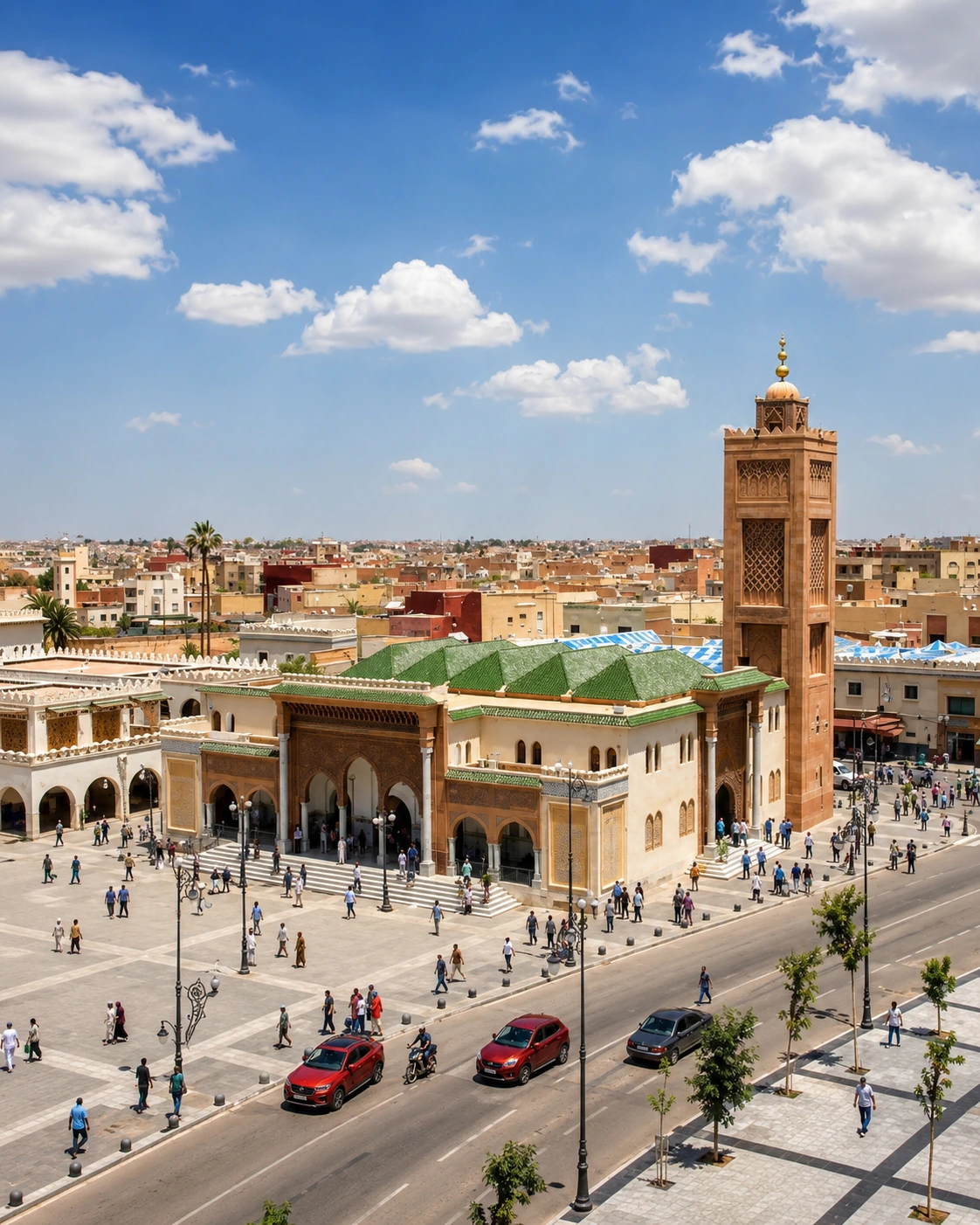
Taforalt Cave belongs naturally inside an eastern Morocco journey. Oujda gives visitors a stronger base for reading the region: city life, historic architecture, routes toward Berkane, mountain approaches and the broader Oriental identity of Morocco.
Use Oujda to widen the context after the cave itself. The contrast is useful: a living city on one side, a prehistoric mountain site on the other, and between them a regional map shaped by movement, trade, landscape and memory. That contrast gives the final guide section a real purpose instead of turning it into a generic city link.
Eastern Morocco orientationOujda city contextBeni Snassen mountain routesPrehistory and heritage readingPractical travel structureBerkane and Taforalt context
Read the cave slowly, then connect it to Oujda, Berkane, the Beni Snassen Mountains, archaeological memory, mountain routes and the wider heritage map of Morocco.