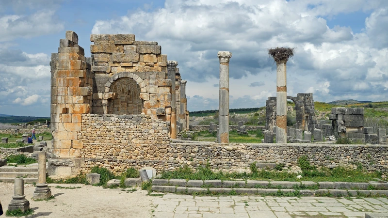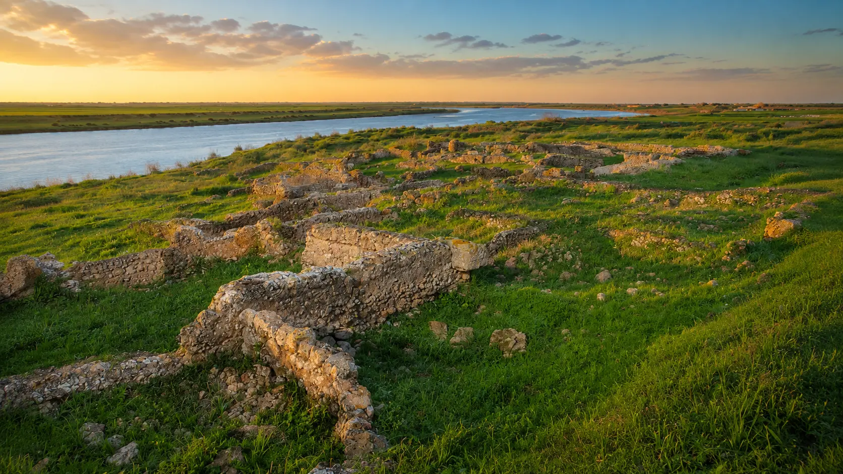
Thamusida archaeological ruins beside the Sebou River near Kenitra, Morocco

Visit / Place · Sebou River · Kenitra

Thamusida Ancient river ruins where the Sebou still explains the site

Thamusida is an archaeological site near Kenitra where Roman urban remains, river-port memory and the open Gharb landscape meet beside the Sebou.

Begin with the river before reading the stones. The ruins are low, quiet and easily overlooked, but their position makes the place powerful: settlement, movement, supply and defence all become clearer when the Sebou is kept in view.

Why Thamusida matters

A river city before it is a ruin.

Thamusida matters because it makes the Sebou visible as a historical engine. The site is not only a scatter of ancient walls near Kenitra; it is evidence of how river movement, agricultural land, Atlantic access and military caution could shape a settlement on Morocco's northern Atlantic plain.

Regional tourism material identifies Thamusida as one of the major archaeological sites of the Rabat-Salé-Kenitra region, with remains that help visitors read Roman urban planning through traces of ramparts, thermal baths, dwellings and public spaces. That description is important because it keeps the focus on the whole urban fabric, not on a single monument.

The site is also valuable because it resists a simple postcard reading. Its power is horizontal and archaeological: low wall lines, broken masonry, grass, river light and open ground. Visitors have to assemble the place patiently, moving from landscape to plan, from plan to material, and from material to the larger Roman and Moroccan heritage map.

Thamusida belongs naturally with nearby Kenitra, Mehdia, the Sebou estuary and the wider network of ancient sites in northern Morocco. It asks for the kind of attention that connects place to route: what arrived by river, what moved inland, what needed protection, and what remains legible after centuries of weather, research and partial excavation.

For visitors, the reward is not spectacle alone. It is the slower pleasure of seeing how an ancient city can still be read through position, water, wall traces and silence. The more carefully the site is approached, the more it becomes a lesson in geography, archaeology and restraint.

Core orientation is grounded in Visit Rabat & Region's Thamusida description and INSAP-listed archaeological publications on the site. Practical details such as access, signage, prices, opening arrangements and road conditions should be checked close to travel.
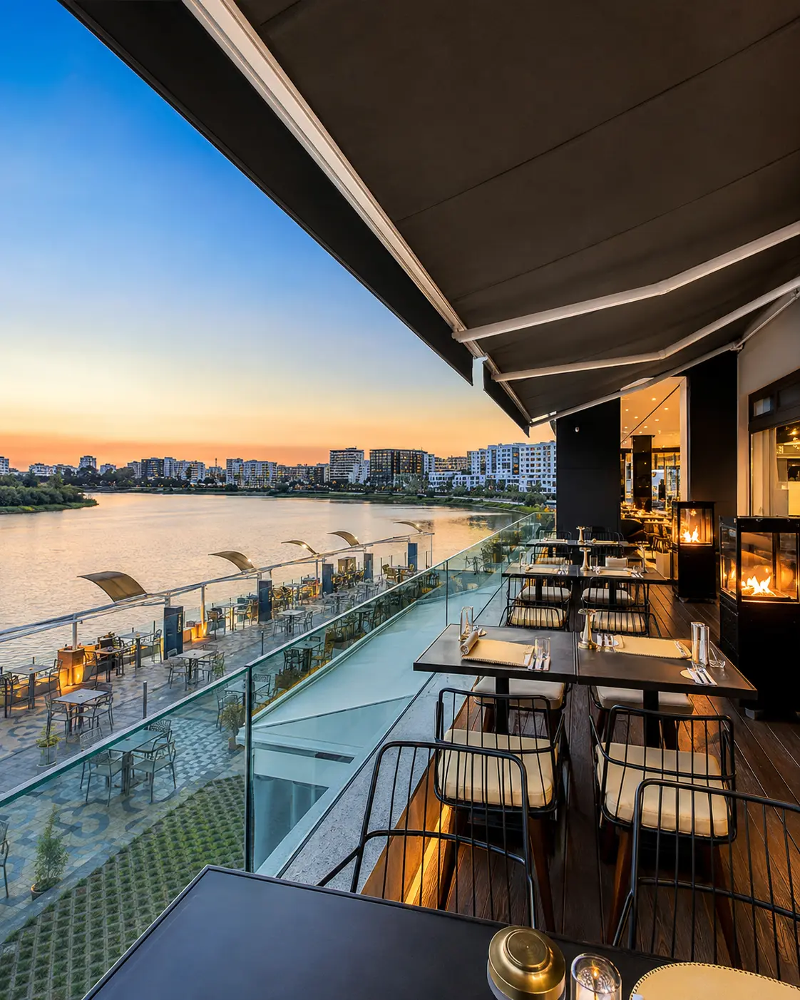
Kenitra riverside terrace at sunset, the city context for Thamusida

Map orientation

Use the map to place Thamusida on the Sebou edge near Kenitra, then read the ruins in relation to river, road and open plain.

Editorial reading

Its beauty is river logic, not monumentality.

Thamusida does not announce itself with a single vertical landmark. Its beauty sits lower: stone lines in grass, wall fragments catching light, the broad water of the Sebou and the quiet feeling that the city once depended on a river corridor more than on theatrical display.

That makes the site especially rewarding for visitors who enjoy reading rather than consuming a place. The first impression may feel calm, even spare. Look longer and the ground begins to organise itself into edges, rooms, circulation, public life and a strategic river position.

The visible remains should be read together: rampart traces suggest enclosure and protection; baths and public spaces point toward civic rhythm; domestic zones bring the scale back to daily life. None of these elements needs exaggeration to matter.

The Sebou is the essential clue. It explains why movement, supply and contact mattered here. It also explains the atmosphere of the visit today: open sky, water, vegetation, soft ground and ruins that feel embedded in landscape rather than isolated from it.

A careful visitor gives the site time. Thamusida is not a place to rush through while hunting for one famous frame. Its strongest memory comes from connecting fragments: river, walls, roads, material, silence and the patience required by archaeological heritage.

That restraint is also ethical. Low ruins are easy to damage by climbing, leaning, walking carelessly or treating stones as props. The better visit keeps curiosity sharp and the body light: observe closely, step carefully, and let the site remain readable for others.

At the end, return mentally to the map. Thamusida becomes clearer when linked to Kenitra, Banasa, Chellah, Lixus and the broader northern Moroccan heritage network. It is one chapter in a larger story of river cities, coastal routes and inland exchange.

Historical and heritage orientation

Read the site through river, road and urban remains.

Thamusida is best understood as an archaeological landscape rather than a single monument. Its identity depends on the meeting of the Sebou River, ancient urban organisation, visible Roman-era remains and the wider Rabat-Salé-Kenitra setting. What survives is partial, but the partial character is exactly why careful reading matters.

01Place type

Ancient river city

Thamusida is an archaeological site associated with ancient settlement on the Sebou. Visitors should read it as a city landscape: edges, movement, water, public space and domestic life rather than one isolated ruin.

02Urban remains

Walls, baths and dwellings

Regional descriptions highlight traces of ramparts, thermal baths, dwellings and public spaces. These remains allow visitors to recognise an urban fabric even where structures survive only as low masonry.

03River context

Sebou movement

The site's position near the river helps explain its historical role. The Sebou connected inland land, river navigation and Atlantic-facing routes, giving Thamusida a strategic geography that is still visible today.

04Archaeology

Read with care

Excavation history and research have made the site more legible, but many details remain specialist territory. A visitor-facing reading should be accurate, cautious and respectful of what the stones can and cannot prove.

A visual bridge

Three readings between river, stone and open land

Thamusida becomes richer when visitors move from landscape to detail. These three readings keep the site clear: first the Sebou, then the masonry, then the quiet spaces between them.

01

River

The Sebou as structure

The river is not a scenic extra. It is the line that explains why this place could matter: movement, supply, trade, defence and access all become easier to imagine when the water is treated as part of the site.

  • Begin by locating the river edge.
  • Read the ruins with water and route in mind.
  • Notice how open land changes the scale.
02

Material

Low masonry, large meaning

Thamusida asks visitors to value fragments. A wall line, a bath trace or a block of masonry can carry more meaning than a dramatic silhouette when it helps reconstruct the rhythm of an ancient town.

  • Look for alignments before decoration.
  • Connect stones to rooms and movement.
  • Keep fragile surfaces untouched.
03

Looking

Distance before detail

The strongest reading starts wide. Let the river, grass, horizon and ruin field settle first; then move closer to individual structures. The site becomes legible through patience rather than instant spectacle.

  • Start with the whole archaeological field.
  • Move slowly around edges and openings.
  • Use the map to connect place and region.

Quick orientation

Type of place

An archaeological site and ancient river-city landscape near Kenitra, best understood through Roman urban remains, Sebou River geography and careful ground-level observation.

Landscape context

The site sits in the Rabat-Salé-Kenitra region on the left-bank context of the Sebou, where river, plain, vegetation and low masonry shape the visitor's reading.

Best for

Archaeology, Roman urban history, quiet walking, heritage photography, river-landscape reading and connecting Kenitra with northern Morocco's ancient site network.

Closest city context

Kenitra is the strongest city context for travellers connecting Thamusida with the Sebou, Mehdia, Atlantic routes and nearby archaeological places such as Banasa.

What visitors experience here

A quiet site that becomes stronger as you read it.

Thamusida works in layers. First comes the river landscape: water, green ground, open sky and low ruins. Then come the archaeological clues: edges, wall lines, masonry, public spaces and the suggestion of an ancient town plan. The experience is subtle, but never empty.

Arrival

Ruins in open ground

The first view is broad and quiet. Instead of one monumental facade, visitors meet a field of remains beside the Sebou, where the whole setting must be understood before single details can speak.

Light

Green, stone and river colour

The atmosphere changes with light across grass, broken stone and water. Late sun can make the masonry warmer and clearer, while softer light helps the river and archaeological field read as one landscape.

Movement

Slow edges and alignments

The best walking rhythm is measured. Follow visible edges, pause where wall lines turn, and let the plan emerge gradually instead of forcing the site into one quick photograph.

Material

Masonry before ornament

Thamusida is not about decorative abundance. Its material reading comes from stone, mortar, low walls, gaps, erosion and the practical intelligence of building within a riverine landscape.

River

The Sebou as the clue

The river gives the ruins their logic. Keep it in view and the site shifts from scattered remains to a settlement connected to movement, supply, crossing, defence and wider regional exchange.

Pace

A visit for careful eyes

The site rewards visitors who enjoy archaeology without needing every answer simplified. A slower pace makes room for uncertainty, observation and respect for fragile remains.

Place details and orientation

Read Thamusida through six defining elements

No single fragment explains Thamusida. Its meaning comes from the relationship between river position, enclosure, public infrastructure, domestic traces, open ground and archaeological fragility.

1
Sebou riverbank

The river context is essential to understanding why the settlement mattered and why the site still feels connected to movement rather than isolated display.

2
Rampart traces

Visible defensive remains help visitors read enclosure, protection and the edge between city fabric and surrounding landscape.

3
Thermal baths

The baths are among the clearest clues that Thamusida was an organised urban place with public infrastructure, not just a small ruin field.

4
Domestic quarters

Traces of dwellings bring the site back to daily life and help balance the military or strategic reading with a human-scale urban one.

5
Public spaces

Open and civic areas help the visitor imagine circulation, gathering and the shared functions that made the settlement work.

6
Fragile surface

Low walls and exposed remains are vulnerable to careless walking, climbing and pressure. Respecting the surface is part of reading the site well.

River city, not scenery

The place asks for a disciplined eye.

Stand back before moving across the site. The first lesson is geographic: ruins gathered near the Sebou, open land spreading around them, and a position that once connected river movement with settlement, protection and exchange.

Then move closer. Wall lines, bath traces, domestic zones and public spaces become easier to understand when they are read as parts of one urban system. The visit becomes stronger when each fragment is allowed to point beyond itself.

Keep returning to the river. It gives Thamusida scale, mood and historical logic. Without the Sebou, the ruins risk becoming scattered stones; with it, they become the remains of a place built around movement.

Architecture and landscape intelligence

The river explains the urban plan.

Thamusida's architecture is best read through landscape. The site sits low and open, so the visitor has to connect masonry with river, soil, route and horizon. What looks modest at first can become precise when read as an urban field shaped by the Sebou.

Stone and mortar do not work here as decorative spectacle. They preserve traces of enclosure, infrastructure, rooms and movement. The intelligence of the place lies in how these remains help reconstruct a settlement that once depended on geography as much as on construction.

What to notice slowly

  • Locate the Sebou first, then read the ruins in relation to the water.
  • Look for wall alignments, corners and changes in level before seeking decoration.
  • Distinguish public infrastructure from domestic traces where the plan allows it.
  • Notice how vegetation, soil and stone make the site feel embedded in landscape.
  • Connect Thamusida with Kenitra, Mehdia and the wider northern heritage route.
  • Respect exposed remains by keeping weight, touch and photography setups off fragile surfaces.

Archaeological reading

Three urban languages to notice

River-edge planning

Thamusida speaks first through position. The Sebou clarifies access, supply and movement, turning the site from an isolated ruin into a river-facing urban landscape.

Public and private traces

Baths, dwellings, public areas and enclosure do different kinds of work. Reading them together helps visitors understand the site as a town with civic rhythm and daily life.

Material evidence

Low masonry, exposed stones and weathered edges record both construction and time. Their quietness is part of the experience, and their fragility demands restraint.

Visual atmosphere

Water, stone and quiet transitions

From river to stones

Start with the Sebou and let the ruins grow out of that context. The best visual memory is not only a wall or a view, but the relationship between water, settlement and open land.

From green to masonry

Grass and vegetation soften the archaeological field, while broken masonry gives it rhythm. The contrast helps visitors sense time without turning the site into romantic ruin scenery.

From visit to understanding

The deeper memory comes from the mental reconstruction: where people moved, where public life gathered, where the river mattered, and why a quiet site near Kenitra deserves careful attention.

Nearby places and onward links

Connect Thamusida to the northern Atlantic heritage map

Thamusida belongs to a wider Sebou and Atlantic-facing itinerary. Kenitra gives the nearest city context, while Banasa, Chellah, Lixus and the regional pages help visitors connect archaeological fragments across northern Morocco.

Kenitra

The closest city context for Thamusida. Use Kenitra to frame the Sebou, Mehdia, Atlantic access and the modern base around this archaeological landscape.

Open Kenitra city guide

Banasa

Another Sebou-region archaeological site that helps visitors compare river geography, Roman urban remains and the northern Moroccan heritage network.

Open Banasa place guide

Atlantic Coast & Historic Port Cities

The regional frame for Atlantic-facing routes, coastal memory, river mouths, historic ports and the wider movement between inland Morocco and the sea.

Explore the region

Architecture & Heritage

Thamusida fits a broader Moroccan heritage reading based on urban form, material evidence, preservation and the discipline of looking slowly.

Read the theme

Visit Morocco places

Continue through archaeological sites, monuments, landscapes, lagoons, valleys, caves and other place-based guides beyond the city pages.

Browse Visit places

Plan your journey

Treat Thamusida as part of a thoughtful northern route, connecting Kenitra with river sites, Atlantic edges and careful heritage travel.

Plan your journey

How to visit respectfully

Good behaviour keeps the site readable.

Thamusida's remains are exposed, low and easy to underestimate. Respect begins with moving lightly: do not climb on walls, shift stones, scratch surfaces, leave litter, lean into unstable edges or use ruins as props for photographs.

Respect also means accepting the site's quietness. Not every archaeological place needs loud explanation or dramatic staging. Give space to other visitors, ask before photographing people nearby, and check local access or guidance before travelling, because arrangements can change.

  • Keep to appropriate paths and avoid stepping on fragile wall tops or exposed masonry.
  • Use the river and map for orientation before moving into the ruin field.
  • Ask clearly before photographing people, workers, guides or private activity near the site.
  • Carry water and sun protection, especially when the open ground is exposed.
  • Verify current access, signage, road approach and local guidance close to travel.

A strong first visit

Begin with the map and the Sebou. Knowing where the river sits gives the visit a structure before the ruins compete for attention. The first view should connect water, open ground, wall traces and the wider Kenitra landscape.

Move slowly around the visible edges. Look for turns, alignments and changes in masonry; then connect those clues to the larger ideas of enclosure, public infrastructure, domestic space and river movement. The site becomes clearer when the visitor builds the plan gradually.

If signage or local guidance is available, use it to identify major features such as ramparts, baths, dwellings and public areas. Where interpretation is uncertain, stay cautious rather than inventing a story. Good archaeology accepts the limits of what can be seen.

Afterward, connect Thamusida back to Kenitra and the northern heritage map. Banasa, Chellah, Lixus and Atlantic-facing routes help the site feel less isolated and more like part of a network of river, road and coastal histories.

  • Start with the river context before focusing on individual fragments.
  • Read low walls as evidence of plan, movement and daily life.
  • Photograph from stable ground without climbing or moving stones.
  • Leave the site cleaner and quieter than you found it.
  • Finish by connecting Thamusida to Kenitra, Banasa and the Atlantic region.

Careful planning note: opening hours, prices, access arrangements and exact travel times can change. Verify practical details locally before travelling.

Kenitra riverside terrace at sunset, the city gateway context for Thamusida

Go deeper through the nearest city context

Kenitra — the city gateway to Thamusida

Kenitra gives Thamusida its most useful modern base. The city sits close to the Sebou and helps visitors connect the archaeological site with river geography, Mehdia, Atlantic access and the wider Rabat-Salé-Kenitra region.

Use Kenitra to widen the visit after the ruins: the river becomes clearer, the road context feels more practical, and nearby heritage places can be linked into one thoughtful northern Morocco route rather than a collection of isolated stops.

Nearest city contextSebou River orientation Mehdia and Atlantic accessArchaeology and heritage reading Practical travel structureNorthern Morocco connections

Continue the journey

Continue from Thamusida into river and Atlantic Morocco.

Read the ruins slowly, then connect them to Kenitra, the Sebou, Banasa, Atlantic routes and the wider heritage map of northern Morocco.